


Neuenrade, Germany
Neuenrade is a town of 12,602 people in North Rhine-Westphalia, Germany.
Why visit Neuenrade
Townapedia lists 57 museums and landmarks, 20 parks and trails, 64 places to eat, 8 places to stay and 70 attractions in and around town.
Highlights include Balve Cave, Ahlenberg, Schloss Brüninghausen and Stadtmuseum Werdohl.
Weather in Neuenrade
Forecast from MET Norway (CC BY 4.0). Full forecast
About Neuenrade
Neuenrade (German pronunciation: [nɔʏənˈʁaːdə] ) is a town in North Rhine-Westphalia, Germany, located in the hills of the Sauerland in the Märkischer Kreis.
From the Wikipedia article Neuenrade (this version), under CC BY-SA 4.0.
Things to do70


58 more on the map.
Museums and landmarks57

Schloss Brüninghausen
Monument and historic site · 4.9 km
1 Brüninghausen, Plettenberg





45 more on the map.
Parks, trails and playgrounds20




Reitanlage RFZV Neuenrade-Küntrop
Sports field and stadium · 2.6 km
30 Gevener Weg, Neuenrade
RFZV Neuenrade-Küntrop
Sports field and stadium · 2.6 km
30 Gevener Weg, Neuenrade


8 more on the map.
Restaurants and cafes64

Tiroler Stub'n
Restaurant · Austrian · 1.4 km
4 Kohlberg, Neuenrade
We-Mo 12:00-23:00

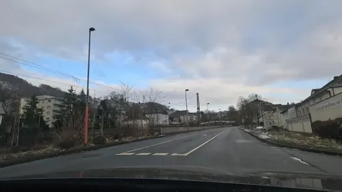
Dorfkrug - Thuns
Restaurant · Fine Dining · 5.3 km
7 Brauck, Werdohl
Tu-Sa 18:00-23:00
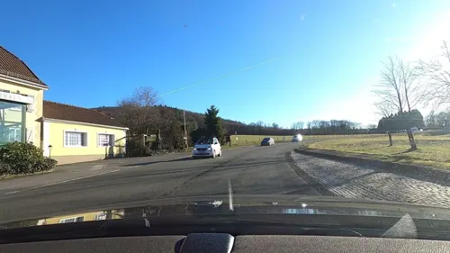

Goldbäckerei Grote
Bakery · 5.1 km
16 Märkische Straße, Balve
Mo-Fr 05:00-18:30; Sa 05:30-12:30; Su 06:30-11:30
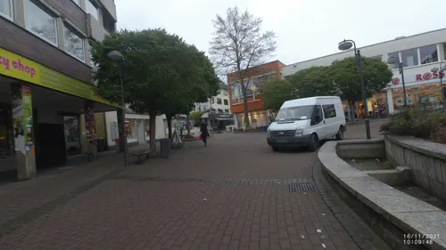


Jade
Restaurant · Chinese · 3.0 km
2 Freiheitstraße, Werdohl
Tu-Sa 12:00-15:00, 17:00-22:00; Su,PH 12:00-22:00
La Rosa
Restaurant · Pizza, Pasta, Salad · 3.1 km
11 Bahnhofstraße, Werdohl
Mo-Fr,Su 11:00-14:00, Mo-Sa,PH 17:30-22:00; Tu off; 2019 Aug...
52 more on the map.
History
Around 1220 the place was first mentioned in a document, then named Rode. The village consisted of about 12 farms. In 1353 the city was fortified. In 1355 it received the cityrights from count Engelbert III.
By 1890/91 the municipalities Werdohl and Ohle had grown so much that they left the Amt Neuenrade, the local administrative unit. The Amt thereafter was composed of only Neuenrade and Dahle.
The Amt Neuenrade was dissolved, effective on January 1, 1969. The municipality Dahle was incorporated into Altena, while the municipality Küntrop from the Amt Balve was incorporated into the city Neuenrade. In 1975 the city was further enlarged with the municipalities Affeln, Altenaffeln and Blintrop from the Amt Balve.
From the History section of Neuenrade on Wikipedia, under CC BY-SA 4.0.
Where to stay8
Gasthaus/Pension Sasse-Kuschert
Motel and hotel · 4.7 km
1 Kuschertstraße, Neuenrade
Churches and places of worship22
Shopping15
Gas and EV charging6
Schools, colleges and libraries12
Healthcare8
Map of Neuenrade
250 places. The map loads OpenStreetMap tiles when you open it.
Getting there and nearby towns
Dortmund Airport (DTM) is the nearest airport with scheduled flights listed in OpenStreetMap, 29 km away.
- Werdohl 3 km southwest, about 3 min by car
- Plettenberg 10 km southeast, about 10 min by car
- Schalksmühle 18 km west, about 18 min by car
- Hagen 23 km west, about 23 min by car
- Schwerte 23 km northwest, about 23 min by car
- Wickede 24 km north, about 24 min by car
- Unna 29 km north, about 29 min by car
- Olpe 29 km south, about 29 min by car
- Wetter 29 km northwest, about 29 min by car
- Dortmund 34 km northwest, about 34 min by car
Drive times are estimates from straight-line distance, not routes.
Local news
Headlines from INDB.
Reviews, tips and questions
Loading what members have shared...
Sources and licences
- GeoNames (CC BY 4.0): population, coordinates, regions and time zone
- Mapillary (see each image): photos
- OpenStreetMap contributors (ODbL 1.0): places, airports, map data
- Wikidata (CC0 1.0): elevation, founding date, time zone, website, landmarks and historic places
- Wikimedia Commons (see each image): photos
- Wikipedia (CC BY-SA 4.0): overview and history text
Photo credits
- Neuenrade-Panorama1-Bubo, Bubo, CC BY-SA 3.0
- 2020-08-16 Hinter der Stadt 6, Neuenrade (NRW), Yvonne Bentele, CC BY-SA 4.0
- Neuenrade-LindeAmWall-1-Asio, Asio otus, CC BY-SA 3.0
- Neuenrade-AmStadtgarten4-1-Asio, Asio otus, CC BY-SA 3.0
- Neuenrade Gewerbegebiet mit Hagebaumarkt FFSW-0230, Michael Kramer, CC BY-SA 3.0
- Neuenrade-Berentrop-FriedhofSchniewindt-3-Asio, Asio otus, CC BY-SA 3.0
- Neuenrade-Berentrop-FriedhofSchniewindt-2-Asio, Asio otus, CC BY-SA 3.0
- Neuenrade-Berentrop-FriedhofSchniewindt-1-Asio, Asio otus, CC BY-SA 3.0
- Neuenrade-Berentrop-FriedhofSchniewindt-5-Asio, Asio otus, CC BY-SA 3.0
- Neuenrade-Berentrop-FriedhofSchniewindt-4-Asio, Asio otus, CC BY-SA 3.0
- Sonnenuntergang Dämmerung Neuenrade, Steffen Flor, CC BY-SA 4.0
- Neuenrade, Blick Richtung Nordosten FFSW 3119, Petra Klawikowski, CC BY-SA 3.0
- Balve Balver Höhle FFSN-6201, Michael Kramer, CC BY-SA 3.0
- Hemer-IhmertKirche1-Asio, Asio otus, CC BY-SA 3.0
- Neuenrade-Kirche1-Bubo, Bubo, CC BY-SA 3.0
- Evangelische Kirche Ohle (06), Chris06, CC BY-SA 4.0
- Balve-Garbeck-Kirche1-Asio, Asio otus, CC BY-SA 3.0
- Plettenberg-SchlossBrüninghausen1-Asio, Asio otus, CC BY-SA 3.0
- Plettenberg-LennebrückeHilfringhausen2-Bubo, Bubo, CC BY-SA 3.0
- Neuenrade Berentrop - Rennofen 04 ies, Frank Vincentz, CC BY-SA 3.0
- Affeln-Kirche2-Bubo, Bubo, CC BY-SA 3.0
- Werdohl-StMichael1-Asio, Asio otus, CC BY-SA 3.0
- Werdohl Stadtmuseum, Arnoldius, CC BY-SA 3.0
- Neuenrade Küntrop - Wasserburg Gevern 06 ies, Frank Vincentz, CC BY-SA 3.0
- NSG MK-008 Eschmecke-Hückenstein in Werdohl, René Kirchhoff, CC BY-SA 4.0
- Neuenrade - Niederheide - Stadtbücherei 01 ies, Frank Vincentz, CC BY-SA 3.0
- Werdohl-Deitenbecke1-Asio, Asio otus, CC BY-SA 3.0
- Werdohl-Christuskirche1-Asio, Asio otus, CC BY-SA 3.0
- Plettenberg-AmSchlehenNSG1-Asio, Asio otus, CC BY-SA 3.0
- Naturschutzgebiet Auf dem Giebel Photo-04, Velopilger, CC0
- Evangelische Kirche Ohle (01), Chris06, CC BY-SA 4.0
- Werdohl - Christuskirche 09 ies, Frank Vincentz, CC BY-SA 3.0
- Kohlberg, J. Braukmann Milseburg, CC BY-SA 3.0 de
- Traditionell gezeichneter Showa, KoiKarl, CC BY-SA 4.0
- Red Sky, Tobias Brinkhoff, CC BY-SA 3.0
- Panorama vom Quitmannsturm 2019, Jörg Braukmann, CC BY-SA 4.0
- Ballonfahrt 2017-063 (38327973752), Markus Trienke, CC BY-SA 2.0
- Ballonfahrt 2017-059 (26583443429), Markus Trienke, CC BY-SA 2.0
- Drahtrolle „Am Hurk“, Dr.G.Schmitz, CC BY-SA 4.0
- Street-level photo, tasmaniadevil, CC BY-SA 4.0
- Street-level photo, tasmaniadevil, CC BY-SA 4.0
- Street-level photo, tasmaniadevil, CC BY-SA 4.0
- Street-level photo, VIA_DT, CC BY-SA 4.0
- Street-level photo, uwekoch, CC BY-SA 4.0
- Street-level photo, dilara2001, CC BY-SA 4.0
- Street-level photo, dilara2001, CC BY-SA 4.0
- Street-level photo, tasmaniadevil, CC BY-SA 4.0
- Street-level photo, uwekoch, CC BY-SA 4.0
- Street-level photo, VIA_DT, CC BY-SA 4.0
- Street-level photo, VIA_DT, CC BY-SA 4.0
- Street-level photo, uwekoch, CC BY-SA 4.0
- Street-level photo, derlipper, CC BY-SA 4.0
- Street-level photo, derlipper, CC BY-SA 4.0
- Street-level photo, dilara2001, CC BY-SA 4.0
- Street-level photo, dilara2001, CC BY-SA 4.0
- Street-level photo, VIA_DT, CC BY-SA 4.0


Page built November 8, 2026. Spotted a mistake? Tell us or suggest a place.