


Schalksmühle, Germany
Schalksmühle is a town of 11,753 people in North Rhine-Westphalia, Germany.
Why visit Schalksmühle
Townapedia lists 19 museums and landmarks, 21 parks and trails, 38 places to eat, 7 places to stay and 29 attractions in and around town.
Highlights include Kulturhaus Lüdenscheid, MuhToGo - Huxhardter Milchhäusel, Historische Schule Winkhausen and Schloss Oedenthal.
Weather in Schalksmühle
Forecast from MET Norway (CC BY 4.0). Full forecast
About Schalksmühle
Schalksmühle (German pronunciation: [ˈʃalksˌmyːlə]; Westphalian: Schalksmüehle) is a municipality in district Märkischer Kreis, in North Rhine-Westphalia, Germany. It is the town with the highest rate of millionaires relating to the population in North Rhine-Westphalia (2004).
From the Wikipedia article Schalksmühle (this version), under CC BY-SA 4.0.
Things to do29


MuhToGo - Huxhardter Milchhäusel
Farm and orchard · 2.1 km
24/7


17 more on the map.
Museums and landmarks19
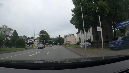
Historische Schule Winkhausen
Monument and historic site · 4.0 km
Das Gebäude steht zum Verkauf.
141 Volmestraße, Lüdenscheid

Schloss Oedenthal
Monument and historic site · 4.0 km
105 Oedenthaler Straße, Lüdenscheid

Bauernhaus Wippekühl
Monument and historic site · 0.7 km
4 Wippekühl, Schalksmühle
ehem. Empfangsgebäude Bf Breckerfeld (Kleinbahn Haspe-Voerde-Breckerfeld)
Monument and historic site · 4.9 km
1 Langscheider Straße, Breckerfeld
Hansaschanze
Monument and historic site · 5.4 km
Http://www.skisprungschanzen.com/DE/Schanzen/GER-Deutschland/NW-Nordrhein-Westfalen/Breckerfeld/2098/
Priorlinde
Monument and historic site · 5.3 km
1000 Jahre alt, 1 Hauptstamm,7 Nebenstämme, Umfang 6m, ehemals Höhe 25 m, Naturdenkmal, mittlerweile oben abgesägt, nur der Stumpf ist...
Scheuerpfahl "Stille"
Monument and historic site · 1.4 km
Glörstraße, Schalksmühle
7 more on the map.
Parks, trails and playgrounds21




9 more on the map.
Restaurants and cafes38

Zum Nöckel
Restaurant · Regional · 1.6 km
37 Rotthauser Straße, Schalksmühle
We-Fr 16:00-22:00; Sa 11:30-14:00,16:00-22:00; Su 11:30-14:00,16:00-22:00

Landbäckerei Sommer
Bakery · 4.1 km
2 Alte Hülscheider Straße, Schalksmühle
Mo-Fr 05:00-18:30; Sa 05:00-17:00; Su 08:00-11:00
Restaurant International
Restaurant · 3.3 km
73 Rummenohler Straße, Hagen
Mo-Sa 11:30-14:30, 17:30-23:00; Su,PH 11:30-23:00
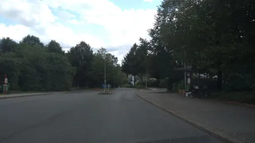
Bäckerei Hesse im Edeka Preller
Bakery · 5.5 km
1 Unterm Freihof, Lüdenscheid
Mo-Sa 07:00-21:00; Su off
Bäckerei Hosselmann
Bakery · 5.3 km
Bäckerei
2 Am Wasserturm, Lüdenscheid
Mo-Sa 07:00-18:00; Su 08:00-12:00
Haus Glörtal
Restaurant · 2.0 km
1 Glörtalsperre, Breckerfeld
We-Fr 12:00-22:00; Sa 10:00-22:00; Su 10:00-20:00
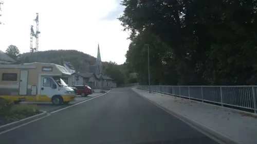
Hotel Restaurant Passmann Lüdenscheid
Restaurant · 4.7 km
Hotelgebäude mit Restaurant.
83 Volmestraße, Lüdenscheid
Sondermann-Brot
Bakery
3 Bahnhofstraße, Schalksmühle
Mo-Fr 06:00-18:00; Sa 06:00-17:00; Su 08:00-17:00
Asia Restaurant Viet Thai Express
Restaurant · Chinese · 4.8 km
8 Denkmalstraße, Breckerfeld
Tu-Fr 11:00-14:30,17:00-21:30; Sa,Su,PH 12:30-21:30
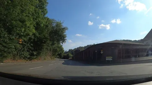


Bei Tony zur Ecke
Restaurant · Pizza · 5.2 km
84 Prioreier Straße, Hagen
Mo-We 17:00-22:30; Fr-Su 11:00-14:00, 17:00-22:30
26 more on the map.
History
The oldest written documents on the municipality date back to 1350, when the farmers of Hülscheid formed a free duchy. The largest extent of the Freigrafschaft Hülscheid was in 1478, when it contained not only the Kirchspiel Hülscheid, but also the northwestern part of the Kirchspiel Lüdenscheid.
Schalksmühle itself was first mentioned on May 1, 1407 in a document by archbishop Friedrich of Cologne, when Gerwin of Altenbreckerfeld, a merchant, donated an altar to the church of Breckerfeld. One of the villages leased by Gerwin was Schalksmollen in parrochia Halvere (Schalksmühle in the parish Halver).
The municipality in its modern boundaries was created during the communal reforms of 1969/70. Becoming effective on January 1, 1969 the municipality Schalksmühle was merged with the municipality Hülscheid (previously in the Amt Lüdenscheid). On January 1, 1970 the municipality Dahlerbrück (previously in the Amt Breckerfeld, district Ennepe-Ruhr) was also added to it.
From the History section of Schalksmühle on Wikipedia, under CC BY-SA 4.0.
Where to stay7
Churches and places of worship21
Evangelische Freikirche Gemeinde Gottes Beethovenstraße
Church · Protestant · 5.2 km
4 Beethovenstraße, Lüdenscheid
Shopping16
Gas and EV charging8
Schools, colleges and libraries8
Eugen-Schmalenbach-Berufskolleg
School · 4.1 km
3-5 Eugen-Schmalenbach-Straße, Halver
Healthcare3
Map of Schalksmühle
170 places. The map loads OpenStreetMap tiles when you open it.
Getting there and nearby towns
Dortmund Airport (DTM) is the nearest airport with scheduled flights listed in OpenStreetMap, 31 km away.
- Hagen 14 km north, about 14 min by car
- Wipperfürth 17 km southwest, about 17 min by car
- Werdohl 17 km east, about 17 min by car
- Schwelm 17 km west, about 17 min by car
- Wetter 19 km northwest, about 19 min by car
- Schwerte 23 km north, about 23 min by car
- Sprockhövel 23 km northwest, about 23 min by car
- Remscheid 24 km west, about 24 min by car
- Wuppertal 26 km west, about 26 min by car
- Witten 26 km northwest, about 26 min by car
Drive times are estimates from straight-line distance, not routes.
Local news
Headlines from INDB.
Reviews, tips and questions
Loading what members have shared...
Sources and licences
- GeoNames (CC BY 4.0): population, coordinates, regions and time zone
- Mapillary (see each image): photos
- OpenStreetMap contributors (ODbL 1.0): places, airports, map data
- Wikidata (CC0 1.0): elevation, founding date, time zone, website, landmarks and historic places
- Wikimedia Commons (see each image): photos
- Wikipedia (CC BY-SA 4.0): overview and history text
Photo credits
- Schalksmühle-Rathaus-1-Bubo, Bubo bubo, CC BY-SA 3.0
- 20200215-Über den Dächern von Schalksmühle, (nob), CC BY-SA 4.0
- Erlöserkirche Schalksmühle, Dat doris, CC BY-SA 4.0
- Blick Kirchenschiff Erlöserkirche Schalksmühle und, Aholtman, CC BY-SA 4.0
- Empore Erlöserkirche Schalksmühle, Aholtman, CC BY-SA 4.0
- Empore Erlöserkirche Schalksmühle - Südseite, Aholtman, CC BY-SA 4.0
- Nature of Schalksmühle (51372947787), Markus Trienke, CC BY-SA 2.0
- Nature of Schalksmühle (51373938273), Markus Trienke, CC BY-SA 2.0
- Schalksmühle-SchnurrenplatzWinterfest-1-Bubo, Bubo bubo, CC BY-SA 3.0
- Panorama Bahnhof Schalksmühle, Aholtman, CC BY-SA 4.0
- Erlöserkirche in Schalksmühle, Aholtman, CC BY-SA 4.0
- Blood Moon over Schalksmühle (45927317505), Markus Trienke, CC BY-SA 2.0
- Jagdmuseum Schalksmühle, Dat doris, CC BY-SA 4.0
- Jagdmuseum Schalksmühle - Wisent, Deejott, CC BY-SA 4.0
- Jagdmuseum Schalksmühle - Jagdzimmer, Deejott, CC BY-SA 4.0
- Jagdmuseum Schalksmühle - Präparierter Eber, Deejott, CC BY-SA 4.0
- Lüdenscheid-Kulturhaus-01 new, derivative work: Pro2 ( talk ) Lüdenscheid-Kulturhaus-01.jpg : Silvercork The original uploader was Silvercork at German Wikipedia ., CC BY-SA 3.0
- Lüdenscheid Schloss Oedenthal FFSW PK 5862, Petra Klawikowski, CC BY-SA 3.0
- Wengeberg im Dezember, Moonbarker, CC0
- Evangelische Jakobus-Kirche (Breckerfeld) (1), Chris06, CC BY-SA 4.0
- Breckerfeld - Sankt Jakobus 05 ies, Frank Vincentz, CC BY-SA 3.0
- NSG Saure Epscheid Breckerfeld 1, Klaus Ehlers, CC BY-SA 4.0
- Hagen NSG-Bachtal Saure Epscheid, Bärwinkel,Klaus, CC BY 3.0
- Schalksmuehle-Erloeserkirche1-Bubo, Bubo, CC BY-SA 3.0
- Kath Kirche Brügge, PeLei, CC BY 3.0
- Schalksmuehle-KatholischeKirche1-Bubo, Bubo, CC BY-SA 3.0
- Evangelische Pfarrkirche (Breckerfeld), DiAuras, CC BY-SA 4.0
- Lüdenscheid Schloss Oedenthal FFSW-0991, Michael Kramer, CC BY-SA 3.0
- Wengeberg, DooFi, CC0
- Katholische PFarrkirche St. Jakobus (Breckerfeld), DiAuras, CC BY-SA 4.0
- NSG Saure Epscheid Breckerfeld 2, Klaus Ehlers, CC BY-SA 4.0
- Hälver, Marvo, CC BY-SA 4.0
- 20200215-Grabstein von Pfarrer Heinrich Stein, (nob), CC BY-SA 4.0
- 20200215-Das Lamm Gottes auf Kirchentür, (nob), CC BY-SA 4.0
- Bee happy ) (9877585365), Markus Trienke, CC BY-SA 2.0
- Evening Rain (28610961040), Markus Trienke, CC BY-SA 2.0
- Dark Sunrise (45023948035), Markus Trienke, CC BY-SA 2.0
- Blood Moon over Erlöserkirche (46841740131), Markus Trienke, CC BY-SA 2.0
- Дятел (51374439944), Markus Trienke, CC BY-SA 2.0
- Bloody Cross (32954294748), Markus Trienke, CC BY-SA 2.0
- Street-level photo, poxonline, CC BY-SA 4.0
- Street-level photo, baldur80, CC BY-SA 4.0
- Street-level photo, uwekoch, CC BY-SA 4.0
- Street-level photo, uwekoch, CC BY-SA 4.0
- Street-level photo, uwekoch, CC BY-SA 4.0
- Street-level photo, uwekoch, CC BY-SA 4.0
- Street-level photo, uwekoch, CC BY-SA 4.0
- Street-level photo, uwekoch, CC BY-SA 4.0
- Street-level photo, uwekoch, CC BY-SA 4.0
- Street-level photo, thoschi, CC BY-SA 4.0
- Street-level photo, uwekoch, CC BY-SA 4.0
- Street-level photo, uwekoch, CC BY-SA 4.0
- Street-level photo, VIA_DT, CC BY-SA 4.0
- Street-level photo, uwekoch, CC BY-SA 4.0
- Street-level photo, thoschi, CC BY-SA 4.0
- Street-level photo, poxonline, CC BY-SA 4.0
- Street-level photo, uwekoch, CC BY-SA 4.0
- Street-level photo, uwekoch, CC BY-SA 4.0
- Street-level photo, uwekoch, CC BY-SA 4.0


_(9877585365).jpg)


Page built November 8, 2026. Spotted a mistake? Tell us or suggest a place.