


Plettenberg, Germany
Plettenberg is a town of 28,206 people in North Rhine-Westphalia, Germany.
Why visit Plettenberg
Townapedia lists 75 museums and landmarks, 35 parks and trails, 64 places to eat, 15 places to stay and 145 attractions in and around town.
Highlights include Weidenhof Kino, Atta Cave, Lennebrücke Ohle and Bahnhof Hüinghausen.
Weather in Plettenberg
Forecast from MET Norway (CC BY 4.0). Full forecast
About Plettenberg
Plettenberg (German: [ˈplɛtn̩ˌbɛʁk] ; Westphalian: Plettmert) is a town in the Märkischer Kreis, in North Rhine-Westphalia, Germany.
From the Wikipedia article Plettenberg (this version), under CC BY-SA 4.0.
Things to do145
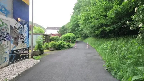
Weidenhof Kino
Cinema and theater · 1.4 km
31 Auf der Weide, Plettenberg
"30 Minuten vor Beginn der ersten Vorstellung"

Atta Cave
Monument and historic site · 9.9 km
Dripstone cave in Germany

Schomberg Observation Tower
Monument and historic site · 9.7 km
German observation tower

133 more on the map.
Museums and landmarks75


Schloss Brüninghausen
Monument and historic site · 5.4 km
1 Brüninghausen, Plettenberg



Wasserschloss Lenhausen
Monument and historic site · 6.8 km
9 Westfalenstraße, Finnentrop



63 more on the map.
Parks, trails and playgrounds35






23 more on the map.
Restaurants and cafes64

Cafe - Restaurant Haltepunkt
Restaurant · 0.6 km
1, Plettenberg
Mo-Sa 09:00-14:30; 17:00-21:00

Zur Oestertalsperre
Restaurant · 6.0 km
1 An der Oestertalsperre, Plettenberg
Tu-Fr 11:30-17:30; Sa 11:00-17:30
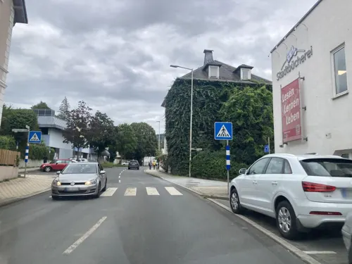


Akropolis
Restaurant · Greek · 0.6 km
51 Grünestraße, Plettenberg
Tu-Fr 16:00-22:00, Sa,Su 11:30-14:00,17:00-22:00
Grill Haus
Restaurant · 0.6 km
Steinofen • Holzkohlegrill
Mo-Th 11:00-23:00; Fr, Sa 11:00-02:00; Su 11:00-23:00
Lakshmy
Restaurant · Indian · 7.8 km
210 Bamenohler Straße, Finnentrop
Tu-Fr 14:00-23:00; Sa,Su 12:00-23:00
Pizzeria Thusy
Restaurant · Italian · 7.6 km
Tu-Su,PH 11:00-22:00
52 more on the map.
History
Probably the first written proof of Plettenberg was made in a document from Grafschaft Abbey of Anno II, archbishop of Cologne, at that time named Heslipho. The name was later changed to Plettenberg, as the name of the noble family von Plettenberg, who owned virtually all of the town and surrounding lands.
The Dukes of the Mark bought the town from Cologne, who in 1301 built the castle Schwarzenberg (which was destroyed by fire in 1864). In 1387, Count Engelbert III granted the town some privileges, it received full town rights in 1397 from Count Dietrich von der Mark. At the same time, the town was fortified. The town blossomed in the following centuries thanks to mining and iron casting, as well as trading with the Hanseatic League.
In 1941, the town was enlarged to its current size, when the former town and the surrounding Amt were merged.
From the History section of Plettenberg on Wikipedia, under CC BY-SA 4.0.
Where to stay15
Churches and places of worship35
St. Antonius von Padua
Church · Roman Catholic · 7.1 km
4 Antoniusstraße, Attendorn
Shopping25
Gas and EV charging6
Schools, colleges and libraries16
Geschwister-Scholl-Realschule
School · 2.8 km
4 Albert-Schweitzer-Straße, Plettenberg
Healthcare4
Map of Plettenberg
250 places. The map loads OpenStreetMap tiles when you open it.
Getting there and nearby towns
Dortmund Airport (DTM) is the nearest airport with scheduled flights listed in OpenStreetMap, 39 km away.
- Werdohl 9 km northwest, about 9 min by car
- Schalksmühle 24 km west, about 24 min by car
- Schmallenberg 29 km east, about 29 min by car
- Hagen 33 km northwest, about 33 min by car
- Wickede 32 km north, about 32 min by car
- Schwerte 34 km northwest, about 34 min by car
- Wipperfürth 35 km west, about 35 min by car
- Radevormwald 36 km west, about 36 min by car
- Siegen 39 km south, about 39 min by car
- Unna 39 km north, about 39 min by car
Drive times are estimates from straight-line distance, not routes.
Local news
Headlines from INDB.
Reviews, tips and questions
Loading what members have shared...
Sources and licences
- GeoNames (CC BY 4.0): population, coordinates, regions and time zone
- Mapillary (see each image): photos
- OpenStreetMap contributors (ODbL 1.0): places, airports, map data
- Wikidata (CC0 1.0): elevation, founding date, time zone, website, landmarks and historic places
- Wikimedia Commons (see each image): photos
- Wikipedia (CC BY-SA 4.0): overview and history text
Photo credits
- Plettenberg 01 ies, Frank Vincentz, CC BY-SA 3.0
- Atta-Höhle, Rainer Lippert, Public domain
- Schombergturm, Jörg Braukmann, CC BY-SA 4.0
- Burg Schwarzenberg-1, Wolfgang Poguntke, CC BY-SA 2.0 de
- Plettenberg - Christuskirche 04 ies, Frank Vincentz, CC BY-SA 3.0
- Lenhausen Ortsdurchfahrt, Dr. Hans Wiechers, CC BY-SA 3.0
- Evangelische Kirche Ohle (06), Chris06, CC BY-SA 4.0
- Schloss Lenhausen 2014, Stefan Didam - Schmallenberg, CC BY-SA 3.0
- Plettenberg-SchlossBrüninghausen1-Asio, Asio otus, CC BY-SA 3.0
- Finnentrop-Lenhausen-Laufwasserkraftwerk1-Asio, Asio otus, CC BY-SA 3.0
- Plettenberg-LennebrückeHilfringhausen2-Bubo, Bubo, CC BY-SA 3.0
- Lenne - WKA Ohle - Wehr bei Hochwasser, Patrick Kibies, CC BY-SA 3.0
- MME-Museumszug, User:Stefan Kunzmann, CC BY-SA 3.0
- Affeln-Kirche2-Bubo, Bubo, CC BY-SA 3.0
- Naturschutzgebiet Krähetal östlich der Grube Hermann, Annika Eickelmann, CC BY-SA 4.0
- Plettenberg Aqua Magis FFSN-5524 (cropped), Petra Klawikowski, CC BY-SA 3.0
- Plettenberg-BöhlerKapelle1-Asio, Asio otus, CC BY-SA 3.0
- St. Johann Baptist (Plettenberg-Eiringhausen) (01), Chris06, CC BY-SA 4.0
- Kirche St. Jakobus d. Ä. Lichtringhausen, Bärwinkel,Klaus, CC BY-SA 4.0
- Plettenberg-LettmeckeErloeserkirche1-Bubo, Bubo, CC BY-SA 3.0
- Plettenberg-AmSchlehenNSG1-Asio, Asio otus, CC BY-SA 3.0
- Naturschutzgebiet Auf dem Saal, Falkmart, CC BY-SA 4.0
- NSG Grünlandbrache Hagen, Martin Lindner, CC BY-SA 3.0
- Naturschutzgebiet Krähetal östlich der Grube Hermann 2, Annika Eickelmann, CC BY-SA 4.0
- Wasserschloss Lenhausen (7648999282), Heribert Pohl --- Thanks for half a million clicks! from Germering bei München, Bayern, CC BY-SA 2.0
- Evangelische Kirche Ohle (01), Chris06, CC BY-SA 4.0
- NSG Extensivgrünland südlich Hagen 4, Martin Lindner, CC BY-SA 4.0
- NSG Bommecketal, Martin Lindner, CC BY-SA 4.0
- Plettenberg-BöhlerKapelle1-Asio (bearb Sp), Asio otus, CC BY-SA 3.0
- Street-level photo, baldur80, CC BY-SA 4.0
- Street-level photo, uwekoch, CC BY-SA 4.0
- Street-level photo, uwekoch, CC BY-SA 4.0
- Street-level photo, uwekoch, CC BY-SA 4.0
- Street-level photo, uwekoch, CC BY-SA 4.0
- Street-level photo, tasmaniadevil, CC BY-SA 4.0
- Street-level photo, tasmaniadevil, CC BY-SA 4.0
- Street-level photo, uwekoch, CC BY-SA 4.0
- Street-level photo, derlipper, CC BY-SA 4.0
- Street-level photo, uwekoch, CC BY-SA 4.0
- Street-level photo, uwekoch, CC BY-SA 4.0
- Street-level photo, dilara2001, CC BY-SA 4.0
- Street-level photo, uwekoch, CC BY-SA 4.0


Page built November 8, 2026. Spotted a mistake? Tell us or suggest a place.