


Why visit Oberthulba
Townapedia lists 20 museums and landmarks, 17 parks and trails, 17 places to eat, 4 places to stay and 6 attractions in and around town.
Highlights include Kurtheater, Ludwigs-Tower, Burgruine and Denkmal.
Weather in Oberthulba
Forecast from MET Norway (CC BY 4.0). Full forecast
About Oberthulba
Oberthulba is a municipality in the district of Bad Kissingen in Bavaria in Germany.
From the Wikipedia article Oberthulba (this version), under CC BY-SA 4.0.
Things to do6

Kurtheater
Cinema and theater · 8.6 km
Cultural heritage monument D-6-72-114-98 (0) in Bad Kissingen, Bavaria

Ludwigs-Tower
Monument and historic site · 7.1 km
Cultural heritage monument D-6-72-114-21 (0) in Bad Kissingen, Bavaria


Museums and landmarks20

Burgruine
Monument and historic site · 9.2 km
Cultural heritage monument D-6-72-114-393 (0) in Bad Kissingen, Bavaria

Denkmal
Monument and historic site · 7.9 km
Cultural heritage monument D-6-72-114-127 (0) in Bad Kissingen, Bavaria

Denkmal
Monument and historic site · 8.2 km
Cultural heritage monument D-6-72-114-194 (0) in Bad Kissingen, Bavaria




8 more on the map.
Parks, trails and playgrounds17




5 more on the map.
Restaurants and cafes17

Gasthof und Pension Schultheis
Restaurant · Regional · 6.2 km
30 Zum Riedbrunnen, Hammelburg
Mo 17:00-22:00; We-Sa 12:00-22:00; Su 11:00-17:30
Zur Alten Brauerei
Restaurant · Regional · 5.0 km
151 Am Rasen, Aura an der Saale
Tu-Fr 11:30-14:30, 16:00-21:00; Sa-Su 11:30-22:00

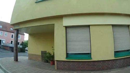
Pappert
Bakery
17a Hammelburger Straße, Oberthulba
Mo-Sa 07:00-20:00
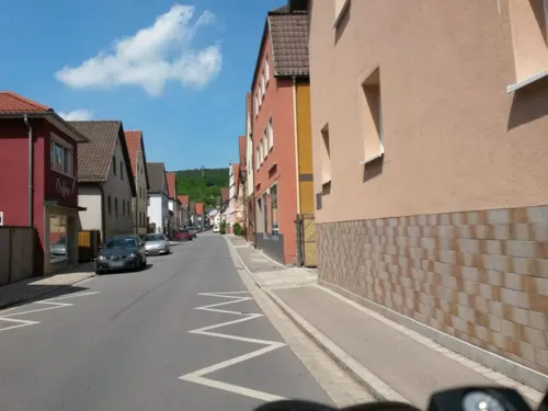
Pizzeria Europa
Restaurant · Pizza · 4.6 km
2 Poppenrother Straße, Bad Kissingen



5 more on the map.
History
With secularization of the government in 1803, the territory of the present municipality became part of Bavaria. In the Treaty of Pressburg between France and Austria in 1805, the lands of the Bishop of Würzburg were given to Ferdinand III, Grand Duke of Tuscany, and he was made Grand Duke of Würzburg, a new state, as a reward for his support of Napoleon. These lands then again became part of Bavaria in 1814 (this time permanently) at the defeat of Napoleon.
From the History section of Oberthulba on Wikipedia, under CC BY-SA 4.0.
Where to stay4
Churches and places of worship14
St. Michael
Church · Catholic · 2.3 km
1 St.-Michael-Straße, Bad Kissingen
Shopping3
Gas and EV charging2
Schools, colleges and libraries5
Healthcare1
Map of Oberthulba
89 places. The map loads OpenStreetMap tiles when you open it.
Getting there and nearby towns
Sonderlandeplatz Kitzingen (KZG) is the nearest airport with scheduled flights listed in OpenStreetMap, 54 km away.
- Bad Kissingen 8 km east, about 8 min by car
- Hammelburg 10 km southwest, about 10 min by car
- Oerlenbach 14 km southeast, about 14 min by car
- Bad Neustadt an der Saale 22 km northeast, about 22 min by car
- Gemünden am Main 25 km southwest, about 25 min by car
- Schweinfurt 25 km southeast, about 25 min by car
- Werneck 26 km southeast, about 26 min by car
- Karlstadt 30 km southwest, about 30 min by car
- Schlüchtern 35 km northwest, about 35 min by car
- Lohr am Main 36 km southwest, about 36 min by car
Drive times are estimates from straight-line distance, not routes.
Local news
Headlines from INDB.
Reviews, tips and questions
Loading what members have shared...
Sources and licences
- GeoNames (CC BY 4.0): population, coordinates, regions and time zone
- Mapillary (see each image): photos
- OpenStreetMap contributors (ODbL 1.0): places, airports, map data
- Wikidata (CC0 1.0): elevation, founding date, time zone, website, landmarks and historic places
- Wikimedia Commons (see each image): photos
- Wikipedia (CC BY-SA 4.0): overview and history text
Photo credits
- Oberthulba 01, Jan-Herm Janßen, CC BY-SA 3.0
- Oberthulba Infotafel Rhönkäppchenradweg, Surveyor54, CC BY-SA 4.0
- 97723 Oberthulba, Germany - panoramio (1), Foto Fitti, CC BY-SA 3.0
- Oberthulba, St. Johannes d.T. (11), Subbass1, CC BY-SA 4.0
- Oberthulba, St. Johannes d.T. (19), Subbass1, CC BY-SA 4.0
- Oberthulba, St. Johannes d.T. (17), Subbass1, CC BY-SA 4.0
- Oberthulba, St. Johannes d.T. (20), Subbass1, CC BY-SA 4.0
- Oberthulba, St. Johannes d.T. (21), Subbass1, CC BY-SA 4.0
- Oberthulba, St. Johannes d.T. (09), Subbass1, CC BY-SA 4.0
- Oberthulba, St. Johannes d.T. (10), Subbass1, CC BY-SA 4.0
- Oberthulba, St. Johannes d.T. (08), Subbass1, CC BY-SA 4.0
- Oberthulba, St. Johannes d.T. (13), Subbass1, CC BY-SA 4.0
- Oberthulba, St. Johannes d.T. (03), Subbass1, CC BY-SA 4.0
- Oberthulba, St. Johannes d.T. (07), Subbass1, CC BY-SA 4.0
- Oberthulba, St. Johannes d.T. (04), Subbass1, CC BY-SA 4.0
- Oberthulba, St. Johannes d.T. (23), Subbass1, CC BY-SA 4.0
- Oberthulba, St. Johannes d.T. (16), Subbass1, CC BY-SA 4.0
- Oberthulba, St. Johannes d.T. (02), Subbass1, CC BY-SA 4.0
- Oberthulba, St. Johannes d.T. (15), Subbass1, CC BY-SA 4.0
- Oberthulba, St. Johannes d.T. (18), Subbass1, CC BY-SA 4.0
- Oberthulba, St. Johannes d.T. (14), Subbass1, CC BY-SA 4.0
- Oberthulba, St. Johannes d.T. (05), Subbass1, CC BY-SA 4.0
- Oberthulba, St. Johannes d.T. (06), Subbass1, CC BY-SA 4.0
- Oberthulba, St. Johannes d.T. (12), Subbass1, CC BY-SA 4.0
- Oberthulba, St. Johannes d.T. (01), Subbass1, CC BY-SA 4.0
- Oberthulba, St. Johannes d.T. (22), Subbass1, CC BY-SA 4.0
- Oberthulba, St. Johannes d.T. (25), Subbass1, CC BY-SA 4.0
- Oberthulba, St. Johannes d.T. (32), Subbass1, CC BY-SA 4.0
- Oberthulba, St. Johannes d.T. (24), Subbass1, CC BY-SA 4.0
- Oberthulba, St. Johannes d.T. (28), Subbass1, CC BY-SA 4.0
- Oberthulba, St. Johannes d.T. (31), Subbass1, CC BY-SA 4.0
- Oberthulba, St. Johannes d.T. (29), Subbass1, CC BY-SA 4.0
- Oberthulba, St. Johannes d.T. (26), Subbass1, CC BY-SA 4.0
- Oberthulba, St. Johannes d.T. (27), Subbass1, CC BY-SA 4.0
- 97723 Oberthulba, Germany - panoramio, Foto Fitti, CC BY-SA 3.0
- Oberthulba, St. Johannes d.T. (34), Subbass1, CC BY-SA 4.0
- Oberthulba, St. Johannes d.T. (33), Subbass1, CC BY-SA 4.0
- Бад Киссинген.Городской театр, Витольд Муратов, CC BY-SA 3.0
- Ludwigsturm (Bad Kissingen) – B106, Darev, CC BY-SA 3.0
- Burg Botenlauben-Juni2007, Sigismund von Dobschütz, CC BY-SA 3.0
- Sisi-Monument on the Altenberg (Bad Kissingen, Germany) – E714, Darev, CC BY-SA 3.0
- Bismarck-Denkmal-02, Sigismund von Dobschütz, Public domain
- Aura an der Saale, Kirchenruine, 014, Tilman2007, CC BY-SA 3.0
- Kirche Lauter, Langholzinger, CC BY-SA 4.0
- Kirche Katzenbach, Langholzinger, CC BY-SA 4.0
- Michaelskapelle (8), Ginkgo2g, CC BY-SA 3.0
- Elfershausen, Schloß-003, Tilman2007, CC BY-SA 3.0
- Thulba St. Lambertus (0), Ginkgo2g, CC BY-SA 3.0
- Kirche Oberthulba, Langholzinger, CC BY-SA 4.0
- St.Ullrich Church in Bad Kissingen (Germany) – C896, Darev, CC BY-SA 3.0
- Hassenbach, Kath. Kuratiekirche St. Johannes d. Täufer Oberthulba 20220106 0183, Tilman2007, CC BY-SA 4.0
- D-6-72-139-3, Friedhofskapelle St. Agatha und Brigitta, sog. Freydenkapelle Oberthulba 20220106 0137, Tilman2007, CC BY-SA 4.0
- St.Michael Church in Bad Kissingen (Germany) – C953, Darev, CC BY-SA 3.0
- Fischotter im Wildpark Klaushof 3, Stephan van Helden, CC BY-SA 4.0
- Street-level photo, rausk, CC BY-SA 4.0
- Street-level photo, rausk, CC BY-SA 4.0
- Street-level photo, Hightower-, CC BY-SA 4.0
- Street-level photo, rausk, CC BY-SA 4.0
- Street-level photo, Hightower-, CC BY-SA 4.0
- Street-level photo, ramap, CC BY-SA 4.0
- Street-level photo, Hightower-, CC BY-SA 4.0
- Street-level photo, rausk, CC BY-SA 4.0
- Street-level photo, thetornado76, CC BY-SA 4.0
- Street-level photo, ramap, CC BY-SA 4.0
- Street-level photo, thetornado76, CC BY-SA 4.0
- Street-level photo, svhelden, CC BY-SA 4.0
- Street-level photo, svhelden, CC BY-SA 4.0
- Street-level photo, svhelden, CC BY-SA 4.0
- Street-level photo, svhelden, CC BY-SA 4.0
- Street-level photo, svhelden, CC BY-SA 4.0
- Street-level photo, svhelden, CC BY-SA 4.0


Page built November 9, 2026. Spotted a mistake? Tell us or suggest a place.