


Stadtlohn, Germany
Stadtlohn is a town of 20,602 people in North Rhine-Westphalia, Germany.
Why visit Stadtlohn
Townapedia lists 52 museums and landmarks, 20 parks and trails, 93 places to eat, 10 places to stay and 2 attractions in and around town.
Highlights include Westfälisches Glockenmuseum, 1623 - 400 Jahre Schlacht im Lohner Bruch, Berkelaue and Berkelaue II.
Weather in Stadtlohn
Forecast from MET Norway (CC BY 4.0). Full forecast
About Stadtlohn
Stadtlohn (German pronunciation: [ˈʃtatloːn] ; Low German: Stadlaun) is a city in western Münsterland in the northwest of North Rhine-Westphalia, and is a district town of the Borken administrative district. The city had 20,856 inhabitants as of 2025. The River Berkel flows through the city on its way to the Netherlands.
From the Wikipedia article Stadtlohn (this version), under CC BY-SA 4.0.
Things to do2

Theater- und Konzertsaal Gescher
Cinema and theater · 6.9 km
48 Borkener Damm, Gescher

Museums and landmarks52


1623 - 400 Jahre Schlacht im Lohner Bruch
Museum
Diorama der Schlacht im Lohner Bruch 1623
14 Dufkampstraße, Stadtlohn
nach Anmeldung beim Heimatverein oder Stadtarchiv
Westfälisch-Niederländisches Imkereimuseum
Museum · 7.0 km
2 Lindenstraße, Gescher
"Führungen jederzeit nach Vereinbarung"

Schlacht bei Stadtlohn
Monument and historic site · 2.4 km
Westliches Schlachtfeld, Graf von Pappenheim, Graf von Limburg-Styrum, Kavallerie
Schlacht bei Stadtlohn
Monument and historic site · 2.6 km
Östliches Schlachtfeld, Dodo zu Inn- und Knyphausen, Graf von Anholt, Artillerie
Schlacht bei Stadtlohn
Monument and historic site · 3.4 km
Blotkamp / Blotfeld: Zentrum der Schlacht, Pulverkuhlen, Musketiere und Pikeniere



40 more on the map.
Parks, trails and playgrounds20






8 more on the map.
Restaurants and cafes93
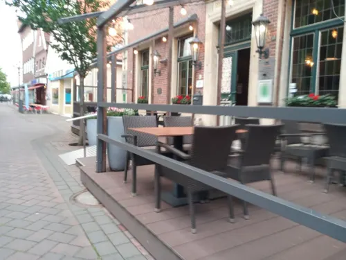
Zur Krone
Restaurant · German · 7.3 km
39 Hauptstraße, Gescher
Mo 18:00-21:30; Tu-Sa 12:00-14:00,18:00-21:30; Su 12:00-14:00
Hong Fu
Restaurant · Asian · 7.0 km
83 Ahauser Damm, Gescher
Tu-Th 17:30-21:30, Fr,Sa 11:30-14:30,17:30-21:30, Su,PH 12:00-21:30
Ristorante da Fabio
Restaurant · Italian · 6.5 km
3 Kirchstraße, Südlohn
Mo,Tu,Th,Fr 17:00-21:30; Sa,Su 12:00-14:00, 17:30-21:30; We off

Spezialbäckerei & Conditorei Zumbusch
Bakery · 0.6 km
55 Mühlenstraße, Stadtlohn
Mo-Fr 06:00-18:00, Sa 06:00-13:00, Su 07:00-11:00

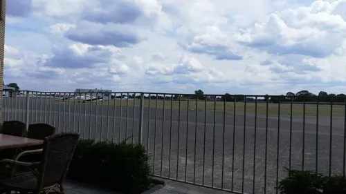
Flugplatz Restaurant
Restaurant · International · 5.0 km
41 Wenningfeld, Stadtlohn
Tu-Su 10:00-23:00

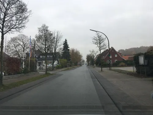


Pizzeria Florentina
Restaurant · Pizza · 6.6 km
13 Kirchstraße, Südlohn
Mo-Fr 11:30-14:00,17:00-21:00; Sa,Su,PH 17:00-21:00
Eiscafe Bäing
Cafe · Ice Cream, Cake · 7.4 km
4 Inselstraße, Gescher
We-Mo 11:00-21:00
81 more on the map.
History
The town was founded as Lohn by Liudger, the first Bishop of Münster about the year 800. About 985 Gescher was split from Lohn, which in turn (1231) split into Südlohn (literally "South-Lohn") and Nordlohn (literally "North-Lohn"). The name Stadtlohn (literally "Town-Lohn") is first mentioned in 1389 after the small town Nordlohn was secured by a moat, a defensive wall and gates and gained the town rights. About 1406 Stadtlohn was burned down by Count Heinrich I of Solms-Ottenstein because he feuded with the bishop of Münster. Bishop Heinrich III of Münster verified its town rights in 1491.
In 1584 Stadtlohn was pillaged by the troops of Duke Ernest of Bavaria and again in 1588 by Dutch soldiers. In 1591 Spanish soldiers attacked the town. For a few months of 1598 Spanish troops were stationed in the town during the Eighty Years' War. In 1611 a serious fire destroyed 225 of 235 houses.
On August 6, 1623 during the Thirty Years' War the Battle of Stadtlohn (German: Schlacht im Lohner Brook) saw Johan Tzerclaes, Count of Tilly's imperial troops victorious over Duke Christian of Brunswick's men. About 6.000 soldiers died that day. In 1742 regular pilgrimages started to a statue of Mary in a small chapel in Stadtlohn from various towns in the Münsterland. The adoration of the Virgin Mary ended in 1886 when the statue was stolen from the Hilgenbergchapel.
From the History section of Stadtlohn on Wikipedia, under CC BY-SA 4.0.
Where to stay10
Churches and places of worship11
Shopping33
Gas and EV charging18
Schools, colleges and libraries20
Healthcare8
Medizinisches Versorgungszentrum (MVZ) Stadtlohn
Clinic and pharmacy · 0.8 km
58 Vredener Straße, Stadtlohn
Map of Stadtlohn
250 places. The map loads OpenStreetMap tiles when you open it.
Getting there and nearby towns
Münster Osnabrück Airport (FMO) is the nearest airport with scheduled flights listed in OpenStreetMap, 55 km away.
- Vreden 8 km northwest, about 8 min by car
- Velen 12 km southeast, about 12 min by car
- Wesel 42 km southwest, about 42 min by car
- Recklinghausen 46 km southeast, about 46 min by car
- Voerde 47 km south, about 47 min by car
- Münster 49 km east, about 49 min by car
- Xanten 49 km southwest, about 49 min by car
- Bottrop 52 km south, about 52 min by car
- Herne 55 km southeast, about 55 min by car
- Gelsenkirchen 56 km south, about 56 min by car
Drive times are estimates from straight-line distance, not routes.
Local news
Headlines from INDB.
Reviews, tips and questions
Loading what members have shared...
Sources and licences
- GeoNames (CC BY 4.0): population, coordinates, regions and time zone
- Mapillary (see each image): photos
- OpenStreetMap contributors (ODbL 1.0): places, airports, map data
- Wikidata (CC0 1.0): elevation, founding date, time zone, website
- Wikimedia Commons (see each image): photos
- Wikipedia (CC BY-SA 4.0): overview and history text
Photo credits
- Mühlenstraße Stadtlohn, Stadtlohn, CC BY-SA 3.0
- Bücherei Stadtlohn St. Otger, Tetzemann, CC0
- Stadtlohn - Der Figurenbrunnen von 1984 vor der "Alten Krone" - panoramio, giggel, CC BY 3.0
- St. Otker in Stadtlohn - panoramio (1), giggel, CC BY 3.0
- Schneeeule Losbergpark Stadtlohn, Tetzemann, CC0
- Eulenvoliere Losbergpark Stadtlohn, Tetzemann, CC0
- Vogelkäfig Losbergpark Stadtlohn(1), Tetzemann, CC0
- Teich Losbergpark Stadtlohn, Tetzemann, CC0
- Bewegungspark Losbergpark Stadtlohn, Tetzemann, CC0
- Stolperstein Brookstraße 10 Stadtlohn Paulina Kleffmann, Tetzemann, CC0
- Stolperstein Brookstraße 10 Stadtlohn Albert Kleffmann, Tetzemann, CC0
- Minigolfanlage Losbergpark Stadtlohn, Tetzemann, CC0
- Rodelberg Losbergpark Stadtlohn, Tetzemann, CC0
- Tischetennis Losbergpark Stadtlohn, Tetzemann, CC0
- Skatepark Losbergpark Stadtlohn(1), Tetzemann, CC0
- St. Otker in Stadtlohn - panoramio, Edgar El, CC BY 3.0
- Trialgelände Stadtlohn, Tetzemann, CC0
- Schlacht bei Stadtlohn, Unknown author, Public domain
- VredenKapelleMaria-Brunn6, Netzhering, CC BY-SA 3.0
- Hünenburg - äußerer Wall, Günter Seggebäing, CC BY-SA 3.0
- Gescher, St. Pankratius, Duhon, CC BY-SA 3.0
- Südlohn, Katholische Pfarrkirche Sankt Vitus Dm1 in straatzicht foto9 2016-04-02 10.00, Michielverbeek, CC BY-SA 4.0
- Hilgenbergkapelle, Stadtlohn, CC BY-SA 3.0
- Stadtlohn, kerk foto6 2012-04-30 10.19, Michielverbeek, CC BY-SA 3.0
- Stadtbücherei St. Pankratius Gescher, Tetzemann, CC0
- Teufelsschlucht 2024, Muehlenbernd, CC BY-SA 4.0
- Gescher, Domhotel, Rwgwiki, CC BY-SA 4.0
- Von-Galen Grundschule Gescher, Tetzemann, CC BY-SA 4.0
- St. Karl Borromäus Kirche Büren Stadtlohn, Tubantia, CC BY-SA 3.0
- Josefkirche Stadtlohn, Stadtlohn, CC BY-SA 3.0
- Glockenmuseum Gescher, Tetzemann, CC0
- Haus Lohn, Südlohn (DSC00595), Günter Seggebäing, Coesfeld, CC BY-SA 3.0
- Denkmalliste Südlohn Nr. 32 Haus Wilmers, Rwgwiki, CC BY-SA 4.0
- Liesner Wald, Tetzemann, CC0
- Museumshof Gescher - Panorama Bauerngarten, Tetzemann, CC0
- Gescher St Pankratius, Unknown author, CC BY-SA 3.0
- Stadtlohn, Hilgenbergkapelle, Stadtlohn ; cropped by Rabanus Flavus, CC BY-SA 3.0
- St. Otger Stadtlon außen, Jochen17, CC BY-SA 4.0
- Springplatz ZRFV St.Martin, Tetzemann, CC0
- Exzey (2022), Exzey, CC BY-SA 4.0
- Street-level photo, Tetzemann82, CC BY-SA 4.0
- Street-level photo, poxonline, CC BY-SA 4.0
- Street-level photo, poxonline, CC BY-SA 4.0
- Street-level photo, geogladbecker, CC BY-SA 4.0
- Street-level photo, gdm, CC BY-SA 4.0
- Street-level photo, geogladbecker, CC BY-SA 4.0
- Street-level photo, poxonline, CC BY-SA 4.0
- Street-level photo, gdm, CC BY-SA 4.0
- Street-level photo, poxonline, CC BY-SA 4.0
- Street-level photo, technick, CC BY-SA 4.0
- Street-level photo, jockel76, CC BY-SA 4.0
- Street-level photo, gdm, CC BY-SA 4.0
- Street-level photo, jockel76, CC BY-SA 4.0
- Street-level photo, Tetzemann82, CC BY-SA 4.0
- Street-level photo, Tetzemann82, CC BY-SA 4.0
- Street-level photo, poxonline, CC BY-SA 4.0
- Street-level photo, jockel76, CC BY-SA 4.0
- Street-level photo, gdm, CC BY-SA 4.0


Page built November 8, 2026. Spotted a mistake? Tell us or suggest a place.