


Why visit Orscholz
Townapedia lists 16 museums and landmarks, 6 parks and trails, 26 places to eat, 3 places to stay and 11 attractions in and around town.
Highlights include Treetop path Saarschleife, Aussichtsturm, Baumwipfelpfad Saarschleife and Burg Montclair.
Weather in Orscholz
Forecast from MET Norway (CC BY 4.0). Full forecast
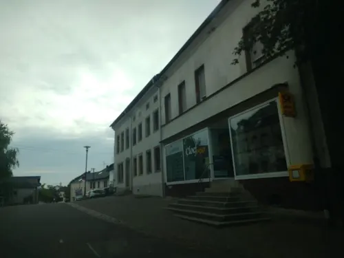
Photos of Orscholz


Things to do11

Treetop path Saarschleife
Monument and historic site · 1.2 km
Canopy walkway in Mettlach, Germany



Museums and landmarks16
Baumwipfelpfad Saarschleife
Monument and historic site · 1.0 km
Jan-Mar,Nov-Dec 09:30-16:00; Apr,Oct 09:30-18:00; May-Sep 09:30-19:00


Saarschleife
Monument and historic site · 1.6 km
Die Saarschleife ist gewissermaßen das Wahrzeichen des Saarlandes. Die beste Sicht auf die Saarschleife bietet die Cloef bei Orscholz


Höckerlinie
Monument and historic site · 1.3 km
Panzersperre aus Betonpyramiden im Zuge des Westwalls - hier Orscholzriegel
Höckerlinie
Monument and historic site · 1.9 km
Panzersperre aus Betonpyramiden im Zuge des Westwalls - hier Orscholzriegel
Schlacht am Orscholzriegel 44/45
Monument and historic site · 1.2 km
Kämpfe vom 17.11.1945 bis 23.2.1945
4 more on the map.
Parks, trails and playgrounds6



Restaurants and cafes26

Vesperstübchen Wiesenhof
Restaurant · 1.4 km
1 Wiesenhof
We-Sa 16:00-22:00; Su 11:30-13:30, 16:00-22:00

14 more on the map.
Where to stay3
Churches and places of worship6
Shopping2
Schools, colleges and libraries2
Healthcare1
Map of Orscholz
73 places. The map loads OpenStreetMap tiles when you open it.
Getting there and nearby towns
Flugplatz Bitburg (BBJ) is the nearest airport with scheduled flights listed in OpenStreetMap, 50 km away.
- Saarhölzbach 6 km east, about 6 min by car
- Merzig 11 km southeast, about 11 min by car
- Saarburg 11 km north, about 11 min by car
- Beckingen 17 km southeast, about 17 min by car
- Weiskirchen 22 km east, about 22 min by car
- Konz 22 km north, about 22 min by car
- Dillingen 22 km southeast, about 22 min by car
- Schmelz 25 km east, about 25 min by car
- Wallerfangen 24 km southeast, about 24 min by car
- Saarlouis 27 km southeast, about 27 min by car
Drive times are estimates from straight-line distance, not routes.
Towns near Orscholz


Local news
Headlines from INDB.
Reviews, tips and questions
Loading what members have shared...
Sources and licences
- GeoNames (CC BY 4.0): population, coordinates, regions and time zone
- Mapillary (see each image): photos
- OpenStreetMap contributors (ODbL 1.0): places, airports, map data
- Wikidata (CC0 1.0): elevation, founding date, time zone, website, landmarks and historic places
- Wikimedia Commons (see each image): photos
Photo credits
- Orscholz, Saarburger Straße 20160717 (2), teddy73, CC BY-SA 4.0
- Orscholz, Saarburger Straße 20160717 (1), teddy73, CC BY-SA 4.0
- Orscholz, Moselstraße 20160225, P170, CC BY-SA 4.0
- Orscholz, Saarburger Straße, Blick zum Restaurant Bauernstube 20160717, teddy73, CC BY-SA 4.0
- Kapelle Orscholz 2, LoKiLeCh, CC BY-SA 4.0
- Kapelle Orscholz, LoKiLeCh, CC BY-SA 4.0
- Orscholz, Kirche St. Nikolaus 20161103, P170, CC BY-SA 4.0
- Orscholz, Nikolausstraße-Zum Orkelsfels 20161103, P170, CC BY-SA 4.0
- Evangelische Kirche Orscholz, LoKiLeCh, CC BY-SA 4.0
- Wege Kreuz Orscholz 2, LoKiLeCh, CC BY-SA 4.0
- Orscholz, Am Waldfriedhof 20160317, P170, CC BY-SA 4.0
- Waldweg bei Orscholz 20160317, P170, CC BY-SA 4.0
- Baumwipfelpfad Saarschleife-05-Aussichtsturm, Muck, CC BY-SA 4.0
- La Sarre, Wolfgang Staudt, CC BY 2.0
- Montclair neu, LoKiLeCh, CC BY-SA 3.0
- Kesslingen kirche, Johannes Simon, Public domain
- Saar-Steilhänge Lutwinuswald-04, Thomas Johannes, CC BY-SA 4.0
- Orscholz, Evangelische Kirche (10), Cmcmcm1, CC BY-SA 3.0
- Weiten, St. Hubertus (19), Cmcmcm1, CC BY-SA 3.0
- Aussichtsturm Baumwipfelpfad Saarschleife, Pascal Dihé, CC BY-SA 4.0
- 2021.07 - Saarschleife, Akveniam, CC0
- Cloef und Aussichtsturm Saarschleife, Pascal Dihé, CC BY-SA 4.0
- Clouds (2495428352), Wolfgang Staudt from Saarbruecken, Germany, CC BY 2.0
- Alter Friedhof Nohn 2, LoKiLeCh, CC BY-SA 4.0
- Alter Friedhof Nohn 4, LoKiLeCh, CC BY-SA 4.0
- Alter Friedhof Nohn 5, LoKiLeCh, CC BY-SA 4.0
- Alter Friedhof Nohn 6, LoKiLeCh, CC BY-SA 4.0
- Alter Friedhof Nohn, LoKiLeCh, CC BY-SA 4.0
- Alter Friedhof Nohn 3, LoKiLeCh, CC BY-SA 4.0
- St. Nikolaus 4, LoKiLeCh, CC BY-SA 4.0
- Architecture fantasy (5675101164), Bert Kaufmann from Roermond, Netherlands, CC BY 2.0
- Together alone (5673115721), Bert Kaufmann from Roermond, Netherlands, CC BY 2.0
- Baumwipfelpfad Saarschleife-02-Eingang, Muck, CC BY-SA 4.0
- Baumwipfelpfad Saarschleife-01-Tafel, Muck, CC BY-SA 4.0
- Aerial image of the Saarschleife (view from the northwest), Carsten Steger, CC BY-SA 4.0
- 20200316 Cloef Baumwipfelpfad 161, Jacquesverlaeken, CC BY-SA 4.0
- Baumwipfelpfad Saarschleife-03-Rialtobrücke, Muck, CC BY-SA 4.0
- Cloef Atrium, Pascal Dihé, CC BY-SA 4.0
- Weg oberhalb der Saarschleife zwischen den Aussichtspunkten Kleine Cloef und Cloef 20150510, P170, CC BY-SA 4.0
- Street-level photo, chuck, CC BY-SA 4.0
- Street-level photo, ma_rt_in, CC BY-SA 4.0
- Street-level photo, teddy73, CC BY-SA 4.0
- Street-level photo, foxandpotatoes, CC BY-SA 4.0
- Street-level photo, 5rmft, CC BY-SA 4.0
- Street-level photo, teddy73, CC BY-SA 4.0
- Street-level photo, teddy73, CC BY-SA 4.0
- Street-level photo, chuck, CC BY-SA 4.0
- Street-level photo, igdb, CC BY-SA 4.0
- Street-level photo, igdb, CC BY-SA 4.0
- Street-level photo, chuck, CC BY-SA 4.0
- Street-level photo, igdb, CC BY-SA 4.0
- Street-level photo, peewee32, CC BY-SA 4.0
- Street-level photo, chuck, CC BY-SA 4.0
- Street-level photo, teddy73, CC BY-SA 4.0
- Street-level photo, chuck, CC BY-SA 4.0
- Street-level photo, deleted_user, CC BY-SA 4.0


Page built November 9, 2026. Spotted a mistake? Tell us or suggest a place.