


Why visit Saarhölzbach
Townapedia lists 32 museums and landmarks, 7 parks and trails, 18 places to eat, 6 places to stay and 17 attractions in and around town.
Highlights include Treetop path Saarschleife, Eisenkopf, Villeroy & Boch and Villeroy&Boch Welt.
Weather in Saarhölzbach
Forecast from MET Norway (CC BY 4.0). Full forecast
Things to do17

Treetop path Saarschleife
Monument and historic site · 5.1 km
Canopy walkway in Mettlach, Germany


5 more on the map.
Museums and landmarks32


Villeroy&Boch Welt
Museum · 2.5 km
1-3 Saaruferstraße, Mettlach
Mo-Sa 09:30-18:00; Su 14:00-18:00; PH 14:00-18:00

Schloss Saareck
Monument and historic site · 2.4 km
34 Saareckstraße, Mettlach


Museumsbunker
Museum · 2.1 km
Regelbau B1-7a, Doppel MG-Schartenstand mit Kleinstglocke, 12 Mann, WH 379

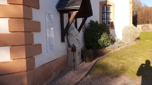
Ehemaliges Kapuzinerkloster
Monument and historic site · Roman Catholic · 3.7 km
20 more on the map.
Parks, trails and playgrounds7





Restaurants and cafes18
Mettlacher Abtei-Bräu
Restaurant · Regional · 2.2 km
Regionale Produkte, Hausbrauerei, gute Küche Mitglied der Viezstraße / Route du Cidre
32 Bahnhofstraße, Mettlach
Tu-Su 12:00-22:00

Hotel-Restaurant Saarblick
Restaurant · Regional · 2.9 km
14 Freiherr-vom-Stein-Straße, Mettlach
Mo,Tu off; We-Su 11:00-14:30,17:30-21:00

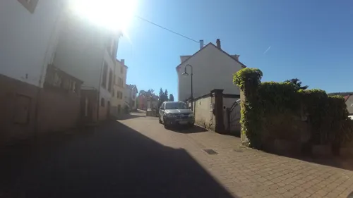
Zum Schwan
Restaurant · German · 2.9 km
34a Freiherr-vom-Stein-Straße, Mettlach
Mo-We, Fr 11:00-15:00,17:00-21:00; PH,Sa,Su 11:00-21:00
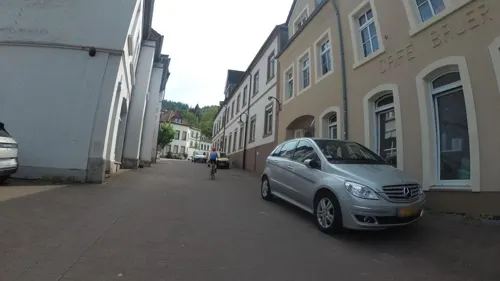


6 more on the map.
Where to stay6
Churches and places of worship10
Shopping3
Gas and EV charging1
Schools, colleges and libraries2
Healthcare3
DRK Klinik Mettlach für Geriatrie und Rehabilitation
Clinic and pharmacy · 2.4 km
10 Saaruferstraße, Mettlach
Map of Saarhölzbach
99 places. The map loads OpenStreetMap tiles when you open it.
Getting there and nearby towns
Flugplatz Bitburg (BBJ) is the nearest airport with scheduled flights listed in OpenStreetMap, 48 km away.
- Merzig 8 km south, about 8 min by car
- Beckingen 15 km southeast, about 15 min by car
- Weiskirchen 16 km east, about 16 min by car
- Dillingen 20 km southeast, about 20 min by car
- Schmelz 20 km southeast, about 20 min by car
- Wadern 20 km east, about 20 min by car
- Konz 21 km north, about 21 min by car
- Wallerfangen 22 km south, about 22 min by car
- Saarwellingen 23 km southeast, about 23 min by car
- Saarlouis 25 km southeast, about 25 min by car
Drive times are estimates from straight-line distance, not routes.
Local news
Headlines from INDB.
Reviews, tips and questions
Loading what members have shared...
Sources and licences
- GeoNames (CC BY 4.0): population, coordinates, regions and time zone
- Mapillary (see each image): photos
- OpenStreetMap contributors (ODbL 1.0): places, airports, map data
- Wikidata (CC0 1.0): elevation, founding date, time zone, website, landmarks and historic places
- Wikimedia Commons (see each image): photos
Photo credits
- Saarhoelzbach, Thomas Johannes, CC BY-SA 3.0
- Saarhölzbach 9, LoKiLeCh, CC BY-SA 4.0
- Saarhölzbach 16, LoKiLeCh, CC BY-SA 4.0
- Saarhölzbach 14, LoKiLeCh, CC BY-SA 4.0
- Saarhölzbach 11, LoKiLeCh, CC BY-SA 4.0
- Saarhölzbach 12, LoKiLeCh, CC BY-SA 4.0
- Saarhölzbach 8, LoKiLeCh, CC BY-SA 4.0
- Saarhölzbach 15, LoKiLeCh, CC BY-SA 4.0
- Saarhölzbach 13, LoKiLeCh, CC BY-SA 4.0
- Saarhölzbach 19, LoKiLeCh, CC BY-SA 4.0
- Saarhölzbach 20, LoKiLeCh, CC BY-SA 4.0
- Saarhölzbach 21, LoKiLeCh, CC BY-SA 4.0
- Saarhölzbach 4, LoKiLeCh, CC BY-SA 4.0
- Saarhölzbach 2, LoKiLeCh, CC BY-SA 4.0
- Saarhölzbach 23, LoKiLeCh, CC BY-SA 4.0
- Saarhölzbach 22, LoKiLeCh, CC BY-SA 4.0
- Saarhölzbach 3, LoKiLeCh, CC BY-SA 4.0
- Saarhölzbach 5, LoKiLeCh, CC BY-SA 4.0
- Saarhölzbach 6, LoKiLeCh, CC BY-SA 4.0
- Saarhölzbach 7, LoKiLeCh, CC BY-SA 4.0
- 20211010 Fußgängerbrücke Saarhölzbach 01, Flocci Nivis, CC BY 4.0
- Baumwipfelpfad Saarschleife-05-Aussichtsturm, Muck, CC BY-SA 4.0
- MettlachAlterTurm, Lokilech, CC BY-SA 3.0
- Kirche Mettlach 2011, Felix König, CC BY 3.0
- Saarhölzbach St. Antonius 01, atreyu, CC BY-SA 3.0
- St. Gangolf Kirche 03, atreyu, CC BY-SA 3.0
- Kirche Westansicht CIMG5069, Bernd Heinz, Taben-Rodt, CC BY-SA 4.0
- Michaelskapelle Taben-Rodt-Westansicht, Hz310905, CC BY-SA 4.0
- Saar-Steilhänge Lutwinuswald-04, Thomas Johannes, CC BY-SA 4.0
- LutwinuskapelleMettlachL1150718, Sol Octobris, CC BY-SA 4.0
- 20210320 Evangelische Kirche Mettlach, Flocci Nivis, CC BY 4.0
- Gaestehaus Saareck, Bernd.hildebrand, CC BY 3.0
- Mettlach Villeroy and Boch Ceramics factory along the Saarriver - panoramio, Henk Monster, CC BY 3.0
- Mettlach VuB-Gästehaus 2012-8 1, EPei ( Diskussion ), CC BY-SA 3.0
- Saarhölzbach Langenbergkreuz, Wambe78, CC BY-SA 4.0
- Westwall Bunker Mettlach, PiCri, Public domain
- 20170502 tabener Urwald baum2 (2), Hz310905, CC BY-SA 4.0
- Michaelskapelle Taben-Rodt, AndHa, CC BY-SA 4.0
- Lutwinuskapelle Weiten (Mettlach), Andy Dufresne & Red, CC BY-SA 4.0
- Alter Turm Mettlach (pol), Kondephy, CC BY-SA 4.0
- Mettlach VuB-Kapelle St.Joseph 2, EPei ( Diskussion ), CC BY-SA 3.0
- Unterstand am Herrgottstein, Werner Wanderfreund, CC0
- Street-level photo, chuck, CC BY-SA 4.0
- Street-level photo, teddy73, CC BY-SA 4.0
- Street-level photo, teddy73, CC BY-SA 4.0
- Street-level photo, teddy73, CC BY-SA 4.0
- Street-level photo, teddy73, CC BY-SA 4.0
- Street-level photo, teddy73, CC BY-SA 4.0
- Street-level photo, teddy73, CC BY-SA 4.0
- Street-level photo, chuck, CC BY-SA 4.0
- Street-level photo, chuck, CC BY-SA 4.0
- Street-level photo, teddy73, CC BY-SA 4.0
- Street-level photo, chuck, CC BY-SA 4.0
- Street-level photo, teddy73, CC BY-SA 4.0
- Street-level photo, mfa, CC BY-SA 4.0
- Street-level photo, changchun1, CC BY-SA 4.0
- Street-level photo, teddy73, CC BY-SA 4.0
- Street-level photo, gbabmap, CC BY-SA 4.0
- Street-level photo, marczoutendijk, CC BY-SA 4.0
- Street-level photo, marczoutendijk, CC BY-SA 4.0
- Street-level photo, gbabmap, CC BY-SA 4.0
- Street-level photo, gbabmap, CC BY-SA 4.0


Page built November 9, 2026. Spotted a mistake? Tell us or suggest a place.