


Why visit Wallerfangen
Townapedia lists 159 museums and landmarks, 30 parks and trails, 234 places to eat, 20 places to stay and 8 attractions in and around town.
Highlights include Theater am Ring, Capitol Movie World, Städtisches Museum und Ludwig Galerie and Alter Friedhof.
Weather in Wallerfangen
Forecast from MET Norway (CC BY 4.0). Full forecast
About Wallerfangen
Wallerfangen (German pronunciation: [ˈvalɐfaŋən]; French: Vaudrevange, pronounced [vodʁəvɑ̃ʒ]) is a municipality of Saarlouis district, Saarland, Germany. Located west of Saarlouis and along the French border, it is the seat of the villages of Ittersdorf, Ihn, Leidingen, St. Barbara, Kerlingen, Gisingen, Rammelfangen, Oberlimberg, Bedersdorf, and Düren.
From the Wikipedia article Wallerfangen (this version), under CC BY-SA 4.0.
Things to do8





Museums and landmarks159

Städtisches Museum und Ludwig Galerie
Museum · 3.2 km
1 Alte-Brauerei-Straße, Saarlouis
Tu-Fr 10:00-10:00, 13:00-17:00; Sa-Su 13:00-17:00


Bodinets-kreuz
Monument and historic site · 2.8 km
Barockes helles Sandsteinkreuz mit Steinkruzifix auf Steinsockel

Oberer Emilianusstollen
Monument and historic site · 2.3 km
Der Emilianusstollen ist Teil eines römischen Kupferbergwerks. Der antike Stollen ist mit seiner in Stein gehauenen Inschrift das...


Contiomagus
Monument and historic site · 3.2 km
Archaeological site in Dillingen/Saar, Germany


147 more on the map.
Parks, trails and playgrounds30








18 more on the map.
Restaurants and cafes234

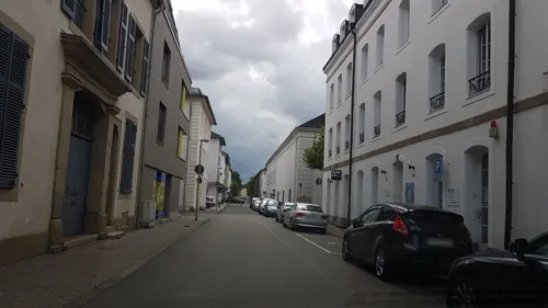
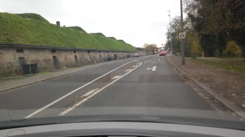
Choa 37
Restaurant · Sushi · 3.1 km
5 Schlächterstraße, Saarlouis
Mo-Fr 11:00-22:00; Sa,Su,PH 12:00-22:00
Davy's Pinsa
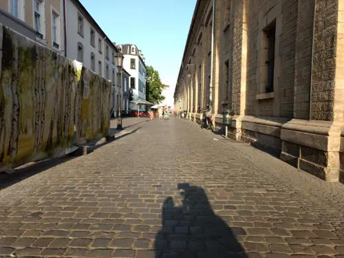
Restaurant · Italian · 3.0 km
36 Kasemattenhof, Saarlouis
Mo off; Tu-Th,Su 17:00-22:00; Fr,Sa 17:00-23:00
Hans im Glück
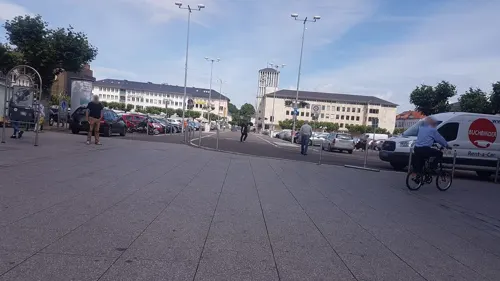
Restaurant · Burger · 3.2 km
16 Alte-Brauerei-Straße, Saarlouis
Su-Th 12:00-22:00; Fr,Sa 12:00-23:00
Bäckerei Welling
Bakery · 3.3 km
7 Französische Straße, Saarlouis
Mo-Fr 06:30-18:00; Sa 07:00-18:00; PH,Su 08:30-18:00
Capizzi Napoletana
Restaurant · Pizza · 3.3 km
We, Th 17:30-22:00; Fr 17:30-23:00; Sa 14:30-23:00; Su 12:00-22:00



Delphi - Bastion VI
Restaurant · 2.9 km
6 Anton-Merziger-Ring, Saarlouis
Mo,We-Su 12:00-14:30,18:00-23:00; Tu closed

Hai Ly
Restaurant · Asian · 3.4 km
5 Überherrner Straße, Saarlouis
Mo-Fr 11:30-14:30; Mo-Su 17:00-21:30; Tu,PH off
222 more on the map.
History
Formerly called Walderfinga, it was established by the Duchy of Lorraine, and belonged to the Duchy until the Napoleonic Wars in the late 18th century, at which time it came under French control. Up until 1687, Wallerfangen possessed town privileges. In that year, the fortifications and most of the buildings were destroyed and the inhabitants were moved to the newly found town-fortress of Saarlouis.
In 1815, under the Treaty of Paris, Prussia assumed control of the area. For all intents and purposes, it remained in the possession of the German Federation of States until 1919. The Treaty of Versailles created an independent and autonomous territory of Saargebiet, administered by France and the League of Nations until 1935. Under the terms of Versailles, the citizens of the Saargebiet voted to become part of Germany, doing so in spite of Adolf Hitler having assumed power in 1933.
World War II brought much despair and bloodshed for Wallerfangen and its citizens. Being the western border of the German Reich, the area became a battleground in 1944/45, and the area was evacuated en masse twice. After World War II, Wallerfangen belonged to the newly independent, but French-controlled, Saarland.
From the History section of Wallerfangen on Wikipedia, under CC BY-SA 4.0.
Where to stay20
Churches and places of worship23
Katholische Pfarrkirche Heilig Sakrament
Church · Roman Catholic · 3.4 km
Shopping37
Gas and EV charging17
bike-energy Ladestation
EV charging · 2.1 km
14 Wallerfanger Straße, Dillingen/Saar
Schools, colleges and libraries34
Healthcare26
Map of Wallerfangen
250 places. The map loads OpenStreetMap tiles when you open it.
Getting there and nearby towns
Saarbrücken Airport (SCN) is the nearest airport with scheduled flights listed in OpenStreetMap, 31 km away.
- Saarlouis 3 km southeast, about 3 min by car
- Dillingen 3 km north, about 3 min by car
- Saarwellingen 7 km northeast, about 7 min by car
- Beckingen 8 km north, about 8 min by car
- Schwalbach 8 km east, about 8 min by car
- Wadgassen 9 km southeast, about 9 min by car
- Überherrn 10 km south, about 10 min by car
- Völklingen 14 km southeast, about 14 min by car
- Püttlingen 14 km east, about 14 min by car
- Merzig 14 km north, about 14 min by car
Drive times are estimates from straight-line distance, not routes.
Local news
Headlines from INDB.
Reviews, tips and questions
Loading what members have shared...
Sources and licences
- GeoNames (CC BY 4.0): population, coordinates, regions and time zone
- Mapillary (see each image): photos
- OpenStreetMap contributors (ODbL 1.0): places, airports, map data
- Wikidata (CC0 1.0): elevation, founding date, time zone, website, landmarks and historic places
- Wikimedia Commons (see each image): photos
- Wikipedia (CC BY-SA 4.0): overview and history text
Photo credits
- WallerfangenAltesRathaus, Lokilech, CC BY-SA 3.0
- Fachklinik für Psychotherapie (Wallerfangen), LoKiLeCh, CC BY-SA 4.0
- Krankenhauskapelle Wallerfangen (71889), LoKiLeCh, CC BY-SA 4.0
- Krankenhauskapelle Wallerfangen (81816), LoKiLeCh, CC BY-SA 4.0
- Krankenhauskapelle Wallerfangen (77825), LoKiLeCh, CC BY-SA 4.0
- Krankenhauskapelle Wallerfangen (65128), LoKiLeCh, CC BY-SA 4.0
- Krankenhauskapelle Wallerfangen (25152), LoKiLeCh, CC BY-SA 4.0
- Krankenhauskapelle Wallerfangen (18747), LoKiLeCh, CC BY-SA 4.0
- Krankenhauskapelle Wallerfangen (57008), LoKiLeCh, CC BY-SA 4.0
- Krankenhauskapelle Wallerfangen (35899), LoKiLeCh, CC BY-SA 4.0
- Krankenhauskapelle Wallerfangen (68991), LoKiLeCh, CC BY-SA 4.0
- Krankenhauskapelle Wallerfangen (24427), LoKiLeCh, CC BY-SA 4.0
- Krankenhauskapelle Wallerfangen (85948), LoKiLeCh, CC BY-SA 4.0
- Krankenhauskapelle Wallerfangen, LoKiLeCh, CC BY-SA 4.0
- Fachklinik für Psychotherapie (Wallerfangen) (44398), LoKiLeCh, CC BY-SA 4.0
- St. Katharina (Wallerfangen) (57775), LoKiLeCh, CC BY-SA 4.0
- St. Katharina (Wallerfangen), LoKiLeCh, CC BY-SA 4.0
- AltesSchlossWallerfangen, Fjrei F.J. Reichert, CC BY 3.0
- WallerfangenFriedhof 20090601 Papen01 resized, Phrontis, CC BY-SA 3.0
- Wallerfangen Grabstein von Papen, Lokilech, CC BY-SA 3.0
- Grab von Louis Villeroy Wallerfangen, LoKiLeCh, CC BY-SA 4.0
- Schloss Fabvier Wallerfangen, LoKiLeCh, CC BY-SA 4.0
- Schloss Boch Wallerfangen 2, LoKiLeCh, CC BY-SA 4.0
- Kreuzweg Limberg Wallerfangen 7, LoKiLeCh, CC BY-SA 4.0
- Schloss Boch Wallerfangen, LoKiLeCh, CC BY-SA 4.0
- Wallerfangen Sandsteinhöhlen (2), LoKiLeCh, CC BY-SA 3.0
- WallerfangenAmtschildVaudrvangeP1000415 (2), Oktobersonne, CC BY-SA 4.0
- WallerfangenmittelalterlicheStadtP1000424 (2), Oktobersonne, CC BY-SA 4.0
- Wallerfangen Sandsteinhöhle von Landstraße, LoKiLeCh, CC BY-SA 3.0
- Wallerfangen Sandsteinhöhlen (8), LoKiLeCh, CC BY-SA 3.0
- Wallerfangen Sandsteinhöhlen (4), LoKiLeCh, CC BY-SA 3.0
- Saarlouis Haus Ludwig, -- Xocolatl ( talk ) 14:14, 11 April 2010 (UTC), Public domain
- DillingenSaarL1100566 (2), Oktobersonne, CC BY-SA 4.0
- Saarlouis Alter Friedhof (8), LoKiLeCh, CC BY-SA 3.0
- Dillingen Altes Schloss1, User Kolling on de.wikipedia, CC BY-SA 3.0
- Saarlouis, the church of the Peter brotherhood society, Dguendel, CC BY 3.0
- Emilianusstollen, LoKiLeCh, CC BY-SA 3.0
- DillingenSchwedenkreuz-2, Lokilech, CC BY-SA 3.0
- Saarlouis Evangelische Kirche Innen 01, atreyu, CC BY-SA 3.0
- SLS RobertSchumanGymnasium, Phrontis, CC BY-SA 3.0
- Dillingen St. Johann 01, atreyu, CC BY-SA 3.0
- GymnasiumamStadtgarten(Saarlouis)L1030562 (2), Oktobersonne, CC BY-SA 4.0
- SLS MaxPlanckGymnasium, Phrontis, CC BY-SA 3.0
- WallerfangenKircheAussen, Lokilech, CC BY-SA 3.0
- Pachten Kirche ohne Baum, Lokilech, CC BY-SA 3.0
- Fraulautern Friedhofskapelle (11), LoKiLeCh, CC BY-SA 3.0
- MariaHimmelfahrtRodenL1020676 (3), Oktobersonne, CC BY-SA 4.0
- Dillingen Evangelische Kirche1, Lokilech, CC BY-SA 3.0
- Beaumarais Baudenkmal (13), LoKiLeCh, CC BY-SA 3.0
- Wallerfangen Louisenstraße 3, LoKiLeCh, CC BY-SA 3.0
- 20200820 Dillinger See 02, Flocci Nivis, CC BY 4.0
- SaarlouisTheateramRingDSCF7436, Oktobersonne, CC BY-SA 4.0
- Taffingstal 2 40 Fl, Biadopia, CC0
- BastionVI albrecht saarlouis 2018-08-21 (4), Z thomas, CC BY-SA 4.0
- Oberer Emilianusstollen, Zecke64, CC BY-SA 4.0
- PachtenWestwallbunkerAnnastr, Lokilech, CC BY-SA 3.0
- DillingenGrabmalDefrance, Lokilech, CC BY-SA 3.0
- DillingenKreuzPeterHillen, Lokilech, CC BY-SA 3.0
- Dillingen Jakob Burger Platz, LoKiLeCh, CC BY-SA 3.0
- SanktLudwigSaarlouis, Fjrei F.J. Reichert, CC BY-SA 3.0
- Hoesberg (Siersburg), LoKiLeCh, CC BY 3.0
- Römerkastell Contiomagus Pachten Dillingen Saarland, Amber16, CC BY-SA 4.0
- Öffentliche Toiletten am Stadtpark Dillingen-Saar, LoKiLeCh, CC BY-SA 3.0
- Street-level photo, teddy73, CC BY-SA 4.0
- Street-level photo, locus57, CC BY-SA 4.0
- Street-level photo, lokilech, CC BY-SA 4.0
- Street-level photo, zors1843, CC BY-SA 4.0
- Street-level photo, teddy73, CC BY-SA 4.0
- Street-level photo, elton4711, CC BY-SA 4.0
- Street-level photo, lokilech, CC BY-SA 4.0
- Street-level photo, changchun1, CC BY-SA 4.0
- Street-level photo, teddy73, CC BY-SA 4.0
- Street-level photo, teddy73, CC BY-SA 4.0
- Street-level photo, elton4711, CC BY-SA 4.0
- Street-level photo, miguel_andrade, CC BY-SA 4.0
- Street-level photo, teddy73, CC BY-SA 4.0
- Street-level photo, lokilech, CC BY-SA 4.0
- Street-level photo, miguel_andrade, CC BY-SA 4.0
- Street-level photo, lokilech, CC BY-SA 4.0
- Street-level photo, lokilech, CC BY-SA 4.0
- Street-level photo, lokilech, CC BY-SA 4.0
- Street-level photo, lokilech, CC BY-SA 4.0
- Street-level photo, lokilech, CC BY-SA 4.0
- Street-level photo, lokilech, CC BY-SA 4.0
- Street-level photo, miguel_andrade, CC BY-SA 4.0
- Street-level photo, lokilech, CC BY-SA 4.0
- Street-level photo, lokilech, CC BY-SA 4.0
- Street-level photo, lokilech, CC BY-SA 4.0


Page built November 9, 2026. Spotted a mistake? Tell us or suggest a place.