


Why visit Passau
Townapedia lists 74 museums and landmarks, 23 parks and trails, 252 places to eat, 34 places to stay and 14 attractions in and around town.
Highlights include Film Theater Metropolis, Stadttheater Passau, Museum Moderner Kunst and Schloss Freudenhain.
Weather in Passau
Forecast from MET Norway (CC BY 4.0). Full forecast
About Passau
Passau ( PASS-ow; German: [ˈpasaʊ] ; Central Bavarian: Båssa(u)) is a city in Lower Bavaria, Germany. It is also known as the Dreiflüssestadt (lit. 'City of Three Rivers'), as the river Danube is joined by the Inn from the south and the Ilz from the north.
From the Wikipedia article Passau (this version), under CC BY-SA 4.0.
Travel tips from other travellers: Passau on Wikivoyage (CC BY-SA 4.0).
Things to do14
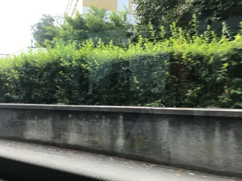

Stadttheater Passau
Cinema and theater · 2.6 km
Theatre in Passau, Germany
2-4 Gottfried-Schäffer-Straße, Passau

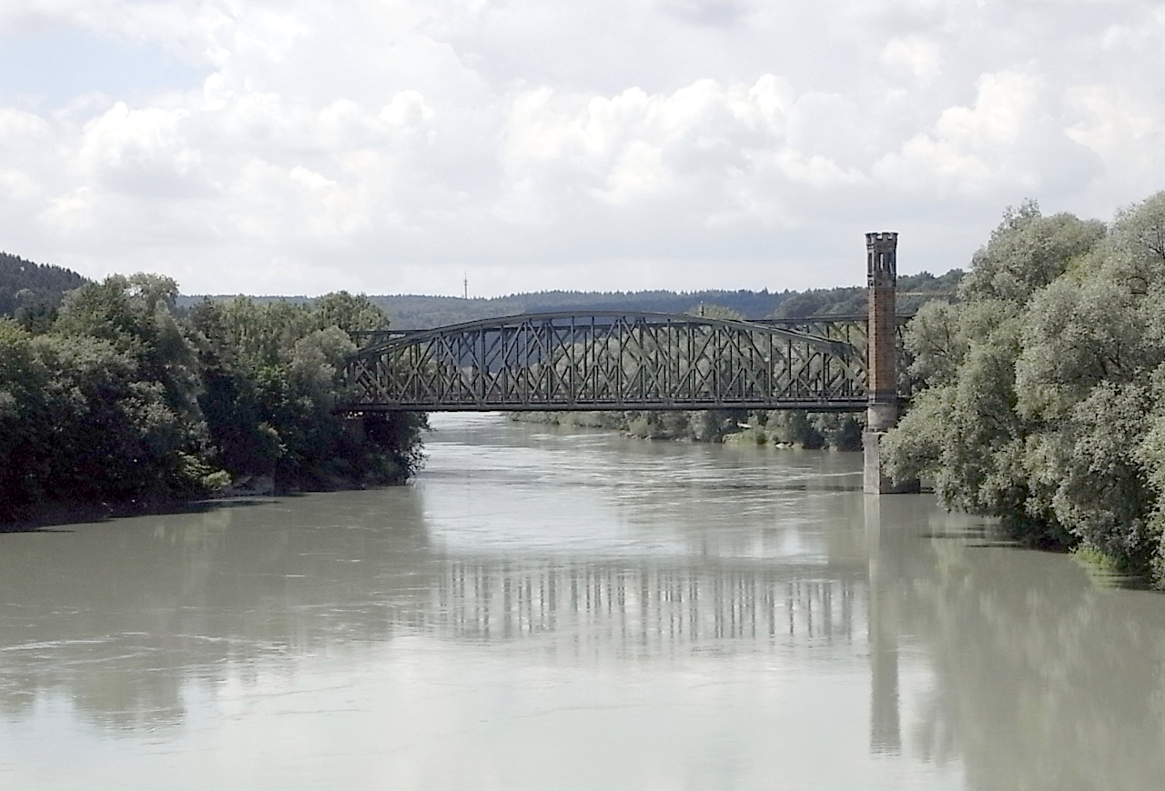
Kaiserin-Elisabeth-Brücke
Bridge · 1.8 km
Kaiserin-Elisabeth-Brücke in Passau


Beppo‘s Chicks
Farm and orchard · 0.7 km
Eier vom eignen Hof, Nudel & Pesto-Spezialitäten, Holzkunst
17 Schönleitnerweg, Passau
Eier-Häusl - Selbstbedienung
Farm and orchard · 3.6 km
Eierverkauf, nudeln, honig
14 Carossastraße, Passau


2 more on the map.
Museums and landmarks74

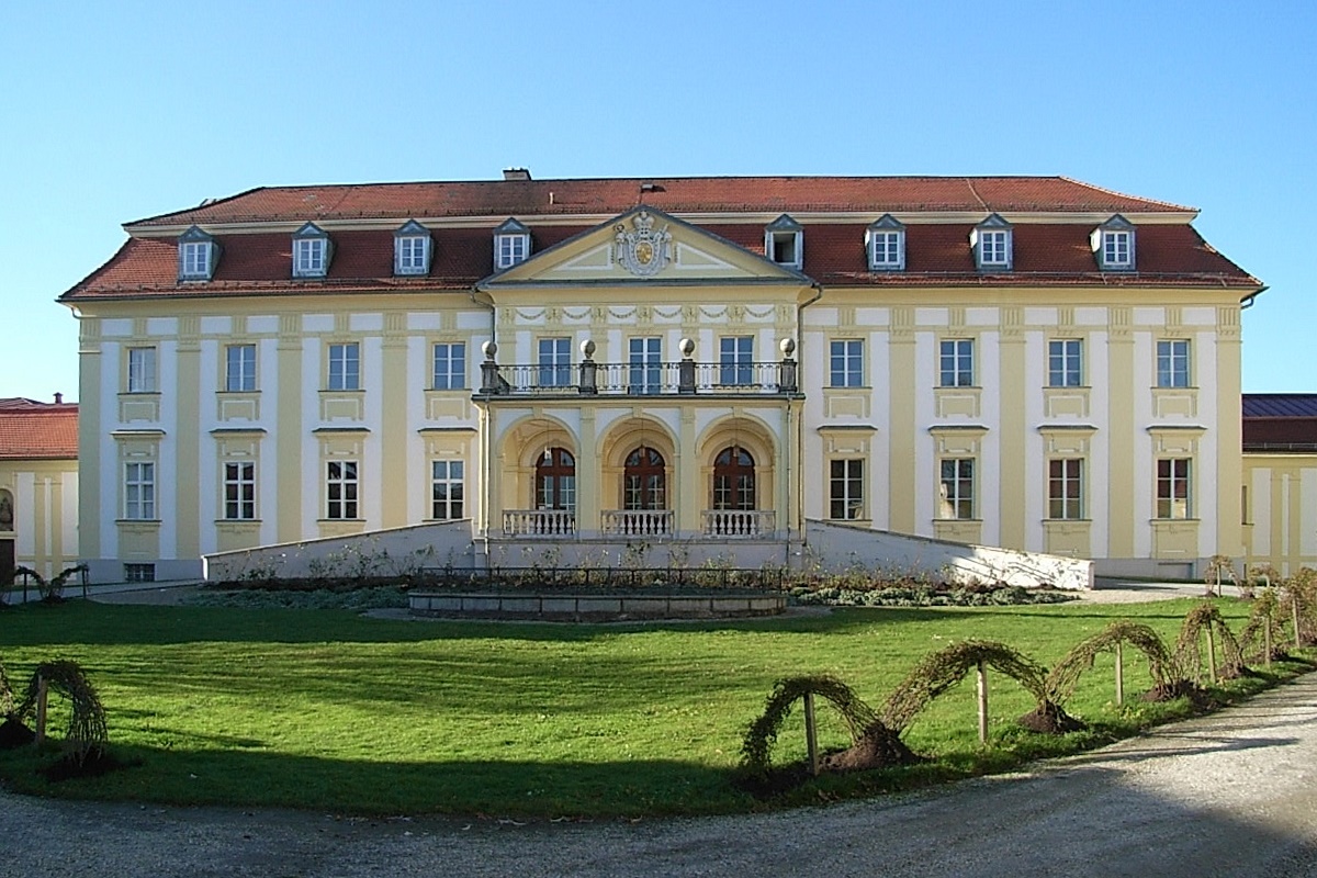

Broken Glass Villa
Monument and historic site · 1.1 km
Glasscherbenvilla, Ostuzzistraße 5 in Passau OT Haidenhof
5 Ostuzzistraße, Passau


Oberhausmuseum
Museum · 3.2 km
125 Oberhaus, Passau
Mar 03 - Nov 15: Mo-Fr 09:00-17:00; Sa-Su 10:00-18:00; PH...

Severinstor
Monument and historic site · 2.3 km
Severinstor, Am Severinstor in Passau



Scharfrichterhaus "Theater"
Museum · 3.0 km
Veranstaltungsräume im Scharfrichterhaus
2 Milchgasse, Passau

62 more on the map.
Parks, trails and playgrounds23

Babalu Funpark Passau
Sports field and stadium · 3.7 km
1 Schaldinger Straße, Passau
Mo-Fr 14:00-19:00; Sa-Su 10:00-19:00

EisArena Passau
Sports field and stadium · 1.7 km
6 Dr.-Ernst-Derra-Straße, Passau
Liegeplatz für Sportboote
Marina and boat launch · 2.0 km
Warteplatz für Sportboote die Schleußen möchten. Telefon am Steg.
Pumperhölzl
Park · 0.8 km
Flächenhaftes Naturdenkmal, naturnaher Eichen- u. Hainbuchenwald

11 more on the map.
Restaurants and cafes252

Café Kowalski
Cafe · Breakfast, Burger, Coffee Shop, Pasta, Sandwich · 2.4 km
1 Oberer Sand, Passau
Su-Mo, We-Th 10:00-23:00; Tu, Fr-Sa 10:00-00:00


Kranabith im Hoffragner
Restaurant · Bavarian, Syrisch · 2.7 km
8 Große Messergasse, Passau
Tu-Su 11:30-22:00

Bouillabaisse
Restaurant · French · 2.3 km
1 Rosengasse, Passau
Tu-Sa 11:00-23:00; Su 18:00-22:00

KaffeeWerk
Cafe · Snack, Cake · 2.6 km
Leitungswasser kostenlos für Kunden, auch Trinkflaschen Füllung
3 Kirchenplatz, Passau
Mo-Sa 10:00-20:00; Su,PH 13:00-18:00

Peschl-Terrasse
Restaurant · 2.4 km
Peschl-Bräu (auch Brauerei E. F. Peschl), Roßtränke 6 in Passau (War die älteste Brauerei Passaus, Produktion 2008 eingestellt)
4 Roßtränke, Passau
Mo-Su 09:00-24:00
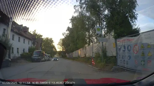

Bayerischer Löwe
Restaurant · Regional · 2.0 km
3 Dr.-Hans-Kapfinger-Straße, Passau
Mo-Su 09:30-24:00; Dec 24 off;Jan 01 off
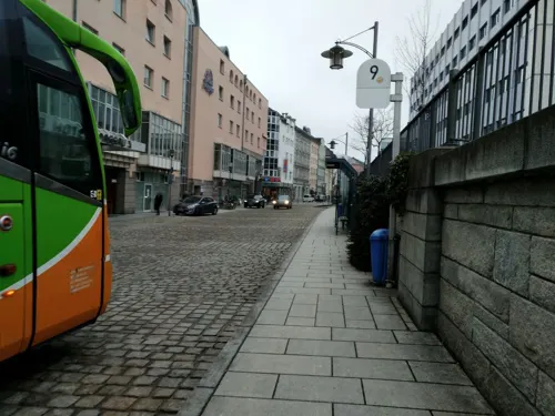


Big Daddy´s American Diner Passau
Restaurant · Burger, American · 1.8 km
24 Bahnhofstraße, Passau
Mo off; Tu 17:30-21:30; We-Su 11:30-15:00,17:30-21:30
240 more on the map.
History
In the 2nd century BC, many of the Boii tribe were pushed north across the Alps out of northern Italy by the Romans. They established a new capital called Boiodurum by the Romans (from Gaulish Boioduron), now within the Innstadt district of Passau.
Passau was an ancient Roman colony called Batavis, Latin for "for the Batavi". The Batavi were an ancient Germanic tribe from area of the Rhine delta who frequently served in the Roman army as auxiliary troops. Batavis (Passau-Altstadt) was a Roman castrum in the province of Raetia, while another late Roman castrum, Boiotro (Passau-Innstadt), was in the province of Noricum.
During the second half of the 5th century, St. Severinus established a monastery here. The site was subject to repeated raids by the Alemanni. In 739, the recently consecrated English archbishop Boniface founded the diocese of Passau, which for many years was the largest diocese of the German Kingdom/Holy Roman Empire, covering territory in southern Bavaria and most of what is now Upper and Lower Austria. From the 10th century the bishops of Passau also exercised secular authority as Prince-Bishops in the immediate area around Passau (see Prince-Bishopric of Passau).
Before the Holocaust, there was a small Jewish community present in Passau, with Jews being mentioned as early as the 10th century.
From the History section of Passau on Wikipedia, under CC BY-SA 4.0.
Where to stay34
Churches and places of worship38
Spitalkirche "St. Johann"
Church · Roman Catholic · 2.5 km
Rindermarkt, Passau
Pfarrkirche Sankt Paul
Church · Roman Catholic · 2.5 km
1 Rindermarkt, Passau
St. Michael
Church · Roman Catholic · 3.0 km
14 Schustergasse, Passau
Sankt Gertraud
Church · Roman Catholic · 2.6 km
5 Kirchenplatz, Passau
Shopping95
Gas and EV charging8
Schools, colleges and libraries24
Auersperg-Gymnasium Passau Freudenhain
School · Roman Catholic · 1.9 km
Staatliche Bibliothek Passau
Library · 3.0 km
11 Michaeligasse, Passau
Healthcare19
Map of Passau
250 places. The map loads OpenStreetMap tiles when you open it.
Getting there and nearby towns
Flugplatz Straubing-Wallmühle (RBM) is the nearest airport with scheduled flights listed in OpenStreetMap, 77 km away.
- Salzweg 7 km northeast, about 7 min by car
- Pocking 20 km southwest, about 20 min by car
- Waldkirchen 22 km northeast, about 22 min by car
- Pfarrkirchen 39 km west, about 39 min by car
- Plattling 47 km northwest, about 47 min by car
- Regen 50 km northwest, about 50 min by car
- Zwiesel 52 km north, about 52 min by car
- Straubing 72 km northwest, about 1 h 15 min by car
- Vilsbiburg 80 km west, about 1 h 15 min by car
- Waldkraiburg 86 km southwest, about 1 h 30 min by car
Drive times are estimates from straight-line distance, not routes.
Local news
Headlines from INDB.
Reviews, tips and questions
Loading what members have shared...
Sources and licences
- GeoNames (CC BY 4.0): population, coordinates, regions and time zone
- Mapillary (see each image): photos
- OpenStreetMap contributors (ODbL 1.0): places, airports, map data
- Wikidata (CC0 1.0): elevation, founding date, time zone, website, landmarks and historic places
- Wikimedia Commons (see each image): photos
- Wikipedia (CC BY-SA 4.0): overview and history text
Photo credits
- Passau - Dom (1), C.Stadler/Bwag, CC BY-SA 4.0
- Fernmeldeturm Passau 1, Aconcagua, CC BY-SA 3.0
- Fernmeldeturm Passau 2, Aconcagua, CC BY-SA 3.0
- Leberbluemchen Passau, Konrad Lackerbeck, CC0
- Nickendes Leimkraut Passau, Konrad Lackerbeck, CC0
- Friedenskirche Passau, MoatlNdb, CC BY 3.0
- Donau in Passau, MoatlNdb, CC BY 3.0
- Christ Himmelfahrt (Passau), MoatlNdb, CC BY 3.0
- Wald-Storchschnabel Passau, Konrad Lackerbeck, CC0
- Passauer Eisenbahnfreunde Feldbahnlok, Simon Legner ( User:simon04 ), CC BY-SA 4.0
- Passauer Eisenbahnfreunde Klima-Schneepflug, Simon Legner ( User:simon04 ), CC BY-SA 4.0
- Passauer Eisenbahnfreunde Dampflokomotive 64 344, Simon Legner ( User:simon04 ), CC BY-SA 4.0
- Remise Passauer Eisenbahnfreunde, Simon Legner ( User:simon04 ), CC BY-SA 4.0
- Passauer Eisenbahnfreunde Schienenbusse, Simon Legner ( User:simon04 ), CC BY-SA 4.0
- Crane in the harbour (Racklau Passau) - panoramio, Dorfseppel, CC BY 3.0
- Passau from the Georgsberg mountain, Hawksei, CC BY 4.0
- Grosser Ehrenpreis Passau, Konrad Lackerbeck, CC0
- Grossbluetige Braunelle Passau, Konrad Lackerbeck, CC0
- Hufeisenklee Passau, Konrad Lackerbeck, CC0
- Karthaeuser-Nelke Passau, Konrad Lackerbeck, CC0
- Passau Racklau harbour - panoramio, Dorfseppel, CC BY 3.0
- Gamander Passau, Konrad Lackerbeck, CC0
- Passauer Stadttheater 3, Aconcagua, CC BY-SA 3.0
- Glasmuseum Passau, Konrad Lackerbeck, CC BY-SA 3.0
- St Nikolakloster Passau, Kurt Seebauer at de.wikipedia, CC BY-SA 3.0
- Passauer Dom, Aconcagua, CC BY-SA 3.0
- Adalbert Stifter Gymnasium Passau Panorama, Aconcagua, CC BY-SA 3.0
- Pfarrkirche St. Anton, Passau, Konrad Lackerbeck, CC BY-SA 2.5
- Museum Moderner Kunst, Passau, Konrad Lackerbeck, CC BY-SA 2.5
- Die Glasscherbenvilla, Konrad Lackerbeck, CC BY-SA 2.5
- Gymnasium Leopoldinum Passau, Aconcagua, CC BY-SA 3.0
- Severinstor Passau, Konrad Lackerbeck, CC BY-SA 2.5
- Veste Oberhaus GO-2, Gras-Ober, CC BY-SA 3.0
- Passau, 15. November 002, Konrad Lackerbeck, CC BY-SA 2.5
- St. Gertraud und Mariahilf, Aconcagua, CC BY-SA 3.0
- Kirche Passau 02, Immanuel Giel, Public domain
- Kirche St. Michael samt Inn, Passau, 07.07.2018, Liberaler Humanist, CC BY-SA 3.0
- StaBi Passau 01, MoatlNdb, CC BY 3.0
- Klinikum Passau, Aconcagua, CC BY-SA 3.0
- Große Messergasse 8 Passau, Konrad Lackerbeck, CC0
- Fachoberschule Passau, Konrad Lackerbeck, CC BY-SA 3.0
- Kleine Messergasse 12 Passau, Konrad Lackerbeck, CC0
- Wohn- und Geschäftshaus Ludwigstraße 20 (Passau) a, Michael Kranewitter, CC BY-SA 4.0
- Oberer Sand 1 Passau, Konrad Lackerbeck, CC0
- Wohnhaus und Gaststätte Rosengasse 1 (Passau) a, Michael Kranewitter, CC BY-SA 4.0
- Hotel Wilder Mann, Demonwhip, CC BY-SA 3.0
- Evangelische Pfarrkirche St. Matthäus (Passau) c, Michael Kranewitter, CC BY-SA 4.0
- Passau, Bahnbrücke vom Innsteg aus, Aisano, CC BY-SA 4.0
- Passau Fuenferlsteg, Aconcagua, CC BY-SA 3.0
- Auferstehungskirche - Passau -01, High Contrast, CC BY 3.0 de
- Mariahilfstraße 8 Passau, Konrad Lackerbeck, CC0
- Passau Cineplex, Photo: Andreas Praefcke, CC BY 3.0
- Passau Schaiblingsturm 752, GFreihalter, CC BY-SA 4.0
- Passau Glasscherbenvilla-01, Radler59 ( talk ), CC BY-SA 4.0
- Passau Severinstor-01, Radler59 ( talk ), CC BY-SA 4.0
- Passau Peichterturm-01, Radler59 ( talk ), CC BY-SA 4.0
- Passau Wittelsbacherbrunnen, Radler59 ( talk ), CC BY-SA 4.0
- Passau Rosstraenke 6, Radler59 ( talk ), CC BY-SA 4.0
- Kirche Passau-Auerbach 8. Nov. 2006 001, Konrad Lackerbeck, CC BY-SA 2.5
- Roemermuseum Kastell Boiotro, Aconcagua, CC BY-SA 3.0
- Sankt Paul, Passau, 360°-Panorama, 2018, Maximilian Schönherr, CC BY-SA 4.0
- Kloster Niedernburg Passau 01, H.Helmlechner, CC BY-SA 4.0
- Dreiflüsseeck, Gargolla, CC BY-SA 3.0
- Street-level photo, miguel_andrade, CC BY-SA 4.0
- Street-level photo, AR88, CC BY-SA 4.0
- Street-level photo, peda, CC BY-SA 4.0
- Street-level photo, peda, CC BY-SA 4.0
- Street-level photo, AR88, CC BY-SA 4.0
- Street-level photo, peda, CC BY-SA 4.0
- Street-level photo, peda, CC BY-SA 4.0
- Street-level photo, peda, CC BY-SA 4.0
- Street-level photo, aceini, CC BY-SA 4.0
- Street-level photo, aceini, CC BY-SA 4.0
- Street-level photo, peda, CC BY-SA 4.0
- Street-level photo, aceini, CC BY-SA 4.0
- Street-level photo, peda, CC BY-SA 4.0
- Street-level photo, aceini, CC BY-SA 4.0
- Street-level photo, aceini, CC BY-SA 4.0
- Street-level photo, peda, CC BY-SA 4.0
- Street-level photo, aceini, CC BY-SA 4.0
- Street-level photo, aceini, CC BY-SA 4.0
- Street-level photo, txllxt, CC BY-SA 4.0
- Street-level photo, aceini, CC BY-SA 4.0


Page built November 8, 2026. Spotted a mistake? Tell us or suggest a place.