


Why visit Rees
Townapedia lists 207 museums and landmarks, 66 parks and trails, 119 places to eat, 37 places to stay and 18 attractions in and around town.
Highlights include Tannen-Karl Kalkar, Garten- und Landschaftsbau Rottmann, Vriendshof, Burg Boetzelaer and Städtisches Museum.
Weather in Rees
Forecast from MET Norway (CC BY 4.0). Full forecast
About Rees
Rees (German pronunciation: [ʁeːs] ) is a town in the district of Kleve in the state of North Rhine-Westphalia, Germany. It is located on the right bank of the Rhine, approximately 20 km east of Kleve. The population in 2025 was 21,446. Founded in 1228, Rees is the oldest town in the lower Rhine area.
From the Wikipedia article Rees, Germany (this version), under CC BY-SA 4.0.
Things to do18

Tannen-Karl Kalkar, Garten- und Landschaftsbau Rottmann
Farm and orchard · 8.7 km
Weihnachtsbäume
2b Gocher Feld, Kalkar
Saisonale Öffnungszeiten

Vriendshof
Farm and orchard · 5.0 km
Äpfel, Birnen, Marmelade
7 Grietherbusch, Rees
Th-Sa 09:00-12:30,14:00-18:00, Su 11:00-12:30
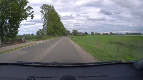
Der Milchmann
Farm and orchard · 8.2 km
22 Wertherbrucher Straße, Hamminkeln
Mo-Fr 09:00-12:00,13:30-18:00; Sa 09:00-16:00
Edelobst Raadts
Farm and orchard · 5.5 km
189 Griether Straße, Kalkar
Mo-Fr 08:00-18:00; Sa 08:00-13:00
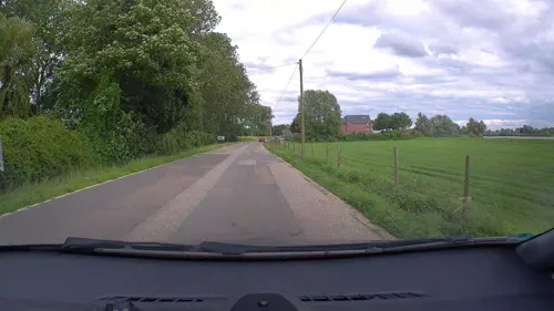
Reeserwarder Obstanlagen
Farm and orchard · 0.9 km
2 Wardstraße, Rees
Aug-May; Mo-Fr 09:00-12:30,14:00-18:00, Sa 09:00-12:30, Su 14:00-18:00
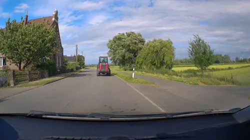
Rosenhof
Farm and orchard · 5.0 km
10 Grietherbusch, Rees
"nur nach vorheriger Absprache, telefonisch oder per WhatsApp"
Kalfhovenhof (Dornenhof)
Farm and orchard · 6.5 km
Verkaufshütte am Hof
29 Lohstraße, Rees
24/7
Ortscher Hof, Marcel Müller
Farm and orchard · 6.7 km
55 Waysche Straße, Kalkar
Saisonale Öffnungszeiten
6 more on the map.
Museums and landmarks207

Burg Boetzelaer
Monument and historic site · 5.1 km
Dreigeschossiger, hell verputzter Backsteinbau, drei Stockwerke auf hohem Kellergeschoss; viergeschossiger Rundturm mit Burgkapelle;...
247 Reeser Straße, Kalkar


Battenbergturm
Monument and historic site · 5.2 km
Seltenes Beispiel für leicht geschützten Wohnturm (steinerner Berfes); Turm aus Backsteinen, zweigeschossig über niedrigen...

Haus Balken
Monument and historic site · 7.8 km
1419 wasserumwehrtes festes Haus an Grenze Kleve/Xanten; ab 1770 Herrenhaus mit Park; zweigeschossiger Putzbau mit Walmdach, 5 zu 2...

Mühle Rosau
Monument and historic site · 4.1 km
Viergeschossig aus Ziegelsteinen, weiß gekälkt; gradlinig und zylindrisch; errichtet als Wehrturm der Burg Rosau, von 1500-1850 Windmühle

Scholten Mühle
Monument and historic site · 1.2 km
Wallholländermühle mit „Bilauschen Ventikanten“ in Ziegelbauweise; 1885 Dampfmaschine, 1914 Gasmotor. 1963 stillgelegt

Archaeological Park of Xanten
Monument and historic site · 11.2 km
Archaeological ancient Roman site in Xanten, Germany, with reconstructed buildings


Colonia Ulpia Traiana
Monument and historic site · 11.3 km
Ancient Roman city



195 more on the map.
Parks, trails and playgrounds66

Wunderland Kalkar
Sports field and stadium · 4.9 km
Amusement park in Germany
110-120 Griether Straße, Kalkar



Bienener Altrhein, Millinger Meer und Hurler Meer
Hiking and trails · 4.2 km


54 more on the map.
Restaurants and cafes119

Brauhaus Kalkarer Mühle
Restaurant · Regional · 7.5 km
8 Mühlenstege, Kalkar
Tu-Fr 11:00-14:00,17:00-23:00; Sa,Su 10:00-23:00
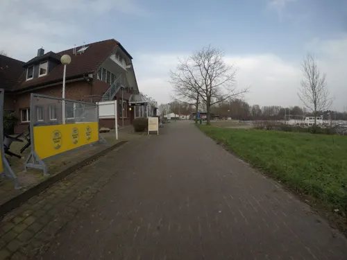
Hido Café
Restaurant · Asian · 6.8 km
7 Alt-Vynscher-Weg, Xanten
Mo-Fr 11:30-15:00,17:00-23:00; Sa,Su,PH 11:30-23:00
La Roma - Pizzeria - Eiscafe - Döner
Restaurant · Pizza · 4.5 km
2 Isselburger Straße, Rees
Mo off;Tu-Fr 11:00-22:30;PH, Sa, Su 12:00-22:30
Zum Schwan
Restaurant · Regional · 7.6 km
17 Dorfstraße, Kalkar
Mo,Th off; Tu-We 16:00-23:00; Fr-Sa 16:00-23:00; Su,PH...




Bäckerei Gerads
Bakery · 7.5 km
17 Kalkarer Straße, Xanten
Mo-Th 07:00-19:00; Fr-Sa 07:00-18:00; Su 07:00-12:00

Haldern Pop Bar
Bar and pub · 4.4 km
1b Lindenstraße, Rees
Th 19:00-24:00, Fr 19:00-02:00, Sa 15:00-02:00, Su 11:00-14:00
107 more on the map.
History
The origin of the town is a Frankish settlement established between 500-800 AD. The name Rees most probably goes back to the Kleverlandish term "Rys", which means "willow grove".
The Lower Rhine area was Christianized by the Irish missionary Willibrord between 657-739. Around 1000 the nearby monastery of Aspel was first mentioned.
On 14 July 1228 Rees was granted municipal rights by Heinrich I von Müllenark, Archbishop of Cologne. At that time it had about 600 inhabitants. In 1289/90 the works on a fortified city wall began, which was completed in 1350. In 1392 Rees and the monastery of Aspel became parts of the County of Cleves.
During the Eighty Years War, the town was captured by Spanish troops in 1598. After the death of the last duke of Cleves in 1609 the town belonged to the Margraviate of Brandenburg. Between 1616 and 1625 Rees was occupied by Dutch troops who transformed the town into a huge fortress. In 1701 Rees became a part of the Kingdom of Prussia.
In 1816 Rees became capital of the newly founded Rees District within Regierungsbezirk Kleve. The railway line from Oberhausen to Arnhem was inaugurated in 1856 and a railway station was built near Rees.
At the beginning of the 20th century Rees had 4,096 inhabitants of whom 330 were Protestants and 52 were Jews.
From the History section of Rees, Germany on Wikipedia, under CC BY-SA 4.0.
Where to stay37
Churches and places of worship41
Shopping32
Gas and EV charging28
Schools, colleges and libraries24
Heinrich-Eger-Schule, katholische Grundschule Appeldorn
School · Catholic · 5.3 km
10 Heinrich-Eger-Straße, Kalkar
St. Luthard-Schule, katholische Grundschule Wissel
School · Catholic · 7.6 km
29 Dorfstraße, Kalkar
St. Quirinus - Schule, katholische Grundschule Millingen
School · Catholic · 5.3 km
31a Hauptstraße, Rees
Healthcare9
DoctoRees Facharztpraxis für Innere und Allgemeinmedizin
Clinic and pharmacy
5 Florastraße, Rees
Dr. med. Christine Monser und Dr. med. Winfried Vierke
Clinic and pharmacy · 0.6 km
12 Markt, Rees
Map of Rees
250 places. The map loads OpenStreetMap tiles when you open it.
Getting there and nearby towns
Airport Weeze (NRN) is the nearest airport with scheduled flights listed in OpenStreetMap, 25 km away.
- Xanten 12 km south, about 12 min by car
- Wesel 19 km southeast, about 19 min by car
- Weeze 20 km southwest, about 20 min by car
- Rhede 22 km east, about 22 min by car
- Voerde 27 km southeast, about 27 min by car
- Rheinberg 28 km southeast, about 28 min by car
- Schermbeck 33 km east, about 33 min by car
- Straelen 37 km south, about 37 min by car
- Moers 38 km southeast, about 38 min by car
- Duisburg 45 km southeast, about 45 min by car
Drive times are estimates from straight-line distance, not routes.
Local news
Headlines from INDB.
Reviews, tips and questions
Loading what members have shared...
Sources and licences
- GeoNames (CC BY 4.0): population, coordinates, regions and time zone
- Mapillary (see each image): photos
- OpenStreetMap contributors (ODbL 1.0): places, airports, map data
- Wikidata (CC0 1.0): elevation, founding date, time zone, website, landmarks and historic places
- Wikimedia Commons (see each image): photos
- Wikipedia (CC BY-SA 4.0): overview and history text
Photo credits
- Rees, bij de voormalige stadsmuur foto4 2011-04-11 15.19, Michielverbeek, CC BY-SA 3.0
- Ehemaliges Amtsgericht Rees PM23-05-07, Pieter Delicaat, CC BY-SA 4.0
- Ehemaliges Amtsgericht Rees PM23-05-21, Pieter Delicaat, CC BY-SA 4.0
- Ehemaliges Amtsgericht Rees PM23-05-19, Pieter Delicaat, CC BY-SA 4.0
- Ehemaliges Amtsgericht Rees PM23-05-10, Pieter Delicaat, CC BY-SA 4.0
- Ehemaliges Amtsgericht Rees PM23-05-13, Pieter Delicaat, CC BY-SA 4.0
- Ehemaliges Amtsgericht Rees PM23-05-09, Pieter Delicaat, CC BY-SA 4.0
- Ehemaliges Amtsgericht Rees PM23-05-14, Pieter Delicaat, CC BY-SA 4.0
- Ehemaliges Amtsgericht Rees PM23-05-16, Pieter Delicaat, CC BY-SA 4.0
- Ehemaliges Amtsgericht Rees PM23-05-15, Pieter Delicaat, CC BY-SA 4.0
- Ehemaliges Amtsgericht Rees PM23-05-08, Pieter Delicaat, CC BY-SA 4.0
- Ehemaliges Amtsgericht Rees PM23-05-20, Pieter Delicaat, CC BY-SA 4.0
- Ehemaliges Amtsgericht Rees PM23-05-17, Pieter Delicaat, CC BY-SA 4.0
- Ehemaliges Amtsgericht Rees PM23-05-11, Pieter Delicaat, CC BY-SA 4.0
- Ehemaliges Amtsgericht Rees PM23-05-12, Pieter Delicaat, CC BY-SA 4.0
- Ehemaliges Amtsgericht Rees PM23-05-22, Pieter Delicaat, CC BY-SA 4.0
- Ehemaliges Amtsgericht Rees PM23-05-18, Pieter Delicaat, CC BY-SA 4.0
- Rees Stadtgarten PM16-00, Pieter Delicaat, CC BY-SA 4.0
- Rees Stadtgarten PM16-01, Pieter Delicaat, CC BY-SA 4.0
- Rees Stadtgarten PM16-00A, Pieter Delicaat, CC BY-SA 4.0
- Kiepenkerl Rees, Gmbo 2013, CC0
- Mahnmahl Rees 2023-002, Gmbo 2013, CC0
- Mahnmahl Rees 2023-008, Gmbo 2013, CC0
- Mahnmahl Rees 2023-005, Gmbo 2013, CC0
- Mahnmahl Rees 2023-004, Gmbo 2013, CC0
- Mahnmahl Rees 2023-007, Gmbo 2013, CC0
- Mahnmahl Rees 2023-001, Gmbo 2013, CC0
- Mahnmahl Rees 2023-006, Gmbo 2013, CC0
- Mahnmahl Rees 2023-003, Gmbo 2013, CC0
- Rees Stadtgarten Denkmal PM16-04, Pieter Delicaat, CC BY-SA 4.0
- Rees Stadtgarten Denkmal PM16-03, Pieter Delicaat, CC BY-SA 4.0
- Rees Stadtgarten Denkmal PM16-02, Pieter Delicaat, CC BY-SA 4.0
- Rees Stadtgarten Denkmal PM16-01, Pieter Delicaat, CC BY-SA 4.0
- Rob Logister, Koeienkoppen, Rees PM16-1, Pieter Delicaat, CC BY-SA 4.0
- Relief am Friedhof Westring, Rees-093259, Raimond Spekking, CC BY-SA 4.0
- Rees Postamt PM16-01, Pieter Delicaat, CC BY-SA 4.0
- Infotafel neuer jüdischer Friedhof Weseler Straße Stadt Rees 2016- 5777, Gmbo 2013, CC0
- Neuer jüdischer Friedhof Weseler Straße Rees, Gmbo 2013, CC0
- Neuer jüdischer Friedhof Rees, Gmbo 2013, CC0
- Colonia Ulpia Traiana - Aerial views -0102, Raimond Spekking, CC BY-SA 4.0
- Harbor temple (1) (archaeological park Xanten, Germany, 2005-04-23), Magnus Manske, CC BY-SA 3.0
- Wunderland Kalkar - panoramio (5), alpenzoo, CC BY-SA 3.0
- Kalkar Nicolai, Unknown author, CC BY-SA 3.0
- Isselburg Anholt - Anholter Schweiz 12 ies, Frank Vincentz, CC BY-SA 3.0
- Rees-Empel Haus Empel PM20-05, Pieter Delicaat, CC BY-SA 4.0
- St. Lambertus Kalkar-Appeldorn PM21-01, Pieter Delicaat, CC BY-SA 4.0
- St. Georg, Haldern-3784, Raimond Spekking, CC BY-SA 4.0
- Kalkar Grieth - Sankt Peter und Paul 01 ies, Frank Vincentz, CC BY-SA 3.0
- Gebäude der Stadtbücherei Rees, TeleD, CC BY-SA 3.0
- 2024-09-08 Scholten-Mühle Rees ZvD 05, Ziko, CC BY-SA 4.0
- Mehr, kerk foto2 2011-04-11 14.17, Michielverbeek, CC BY-SA 3.0
- St. Mariä Himmelfahrt Rees, Volker1978 (shifted & cropped by Rabanus Flavus ), CC BY-SA 3.0
- Kalkar 12 ies, Frank Vincentz, CC BY-SA 3.0
- Emmerich-Praest Bienener Altrhein PM18-02, Pieter Delicaat, CC BY-SA 4.0
- NSG Grietherorter Altrhein PM18-020, Pieter Delicaat, CC BY-SA 4.0
- 20190319 181227 Sonne, AlexLenny, CC BY-SA 4.0
- Rees-Bienen Mühle Rosau PM18-04, Pieter Delicaat, CC BY-SA 4.0
- St. Quirinus Rees-Millingen PM21-02, Pieter Delicaat, CC BY-SA 4.0
- Rees, der Mühlenturm DmA8 foto3 2017-10-18 15.58, Michielverbeek, CC BY-SA 4.0
- BurgBoetzelaer07, Maarten Takens, CC BY-SA 2.0
- Battenbergturm Haldern, Volker1978, CC BY-SA 3.0
- Haus Balken in Marienbaum, Udo und Joan Fugel, CC BY-SA 2.0
- Appeldorn Burg Boetselaer NW PM21-03, Pieter Delicaat, CC BY-SA 4.0
- Rees-Empel Haus Empel PM20-09, Pieter Delicaat, CC BY-SA 4.0
- Sankt Mariä Himmelfahrt Marienbaum, Hans-Martin Scheibner, CC BY-SA 3.0
- Kirche St. Willibrordus in Wardt - hms(1), Hans-Martin Scheibner, CC BY-SA 3.0
- Kalkar-Hanselaer Spickstraße 83 PM18-05, Pieter Delicaat, CC BY-SA 4.0
- Rees-Bienen 07, Pieter Delicaat, CC BY-SA 4.0
- 46459 Rees, Germany - panoramio (23), Ben Bender, CC BY-SA 3.0
- Rees Grietherbusch 7 Vriendshof PM18-01, Pieter Delicaat, CC BY-SA 4.0
- Street-level photo, sirix, CC BY-SA 4.0
- Street-level photo, poxonline, CC BY-SA 4.0
- Street-level photo, poxonline, CC BY-SA 4.0
- Street-level photo, poxonline, CC BY-SA 4.0
- Street-level photo, poxonline, CC BY-SA 4.0
- Street-level photo, poxonline, CC BY-SA 4.0
- Street-level photo, poxonline, CC BY-SA 4.0
- Street-level photo, poxonline, CC BY-SA 4.0
- Street-level photo, poxonline, CC BY-SA 4.0
- Street-level photo, poxonline, CC BY-SA 4.0
- Street-level photo, poxonline, CC BY-SA 4.0
- Street-level photo, poxonline, CC BY-SA 4.0
- Street-level photo, poxonline, CC BY-SA 4.0
- Street-level photo, littlefool, CC BY-SA 4.0
- Street-level photo, sirix, CC BY-SA 4.0
- Street-level photo, poxonline, CC BY-SA 4.0


Page built November 8, 2026. Spotted a mistake? Tell us or suggest a place.