


Why visit Rodenberg
Townapedia lists 40 museums and landmarks, 20 parks and trails, 64 places to eat, 5 places to stay and 8 attractions in and around town.
Highlights include Obst und Gemüsediele Steege, Belvedereturm, Agnes-Miegel-Haus and Ernst Blumenberg.
Weather in Rodenberg
Forecast from MET Norway (CC BY 4.0). Full forecast
About Rodenberg
Rodenberg (German: [ˈʁoːdn̩ˌbɛʁk] ) is a town in the district of Schaumburg, in Lower Saxony, Germany. It is situated on the northwestern edge of the Deister hills, approx. 10 km east of Stadthagen, and 27 km west of Hanover.
From the Wikipedia article Rodenberg (this version), under CC BY-SA 4.0.
Things to do8

Obst und Gemüsediele Steege
Farm and orchard · 2.2 km
60 Hauptstraße, Rodenberg
Mo-Fr 09:00-18:00; Sa 09:00-13:00

Belvedereturm
Scenic view · 2.6 km
Leider sind die Bäume d'rumherum mittlerweile höher als der Turm :-(


Museums and landmarks40


Densinghauser Quelle
Monument and historic site · 2.9 km
Ehemalige Quellanlage, jetziges Fledermausquartier


28 more on the map.
Parks, trails and playgrounds20



8 more on the map.
Restaurants and cafes64

Mooshütte
Restaurant · German · 3.1 km
1, Bad Nenndorf
Tu-Sa 11:00-19:00; Su 10:00-19:00; Mo off; PH 10:00-19:00

Bäckerei Frenzel
Bakery · 3.7 km
Namensähnlich: Konditorei Frenkel in der Bahnhofstraße mit vormaligem Central-Cafe in Hauptstraße
1 Haster Straße, Bad Nenndorf
Mo-Fr 06:00-18:00; Sa 06:00-13:00
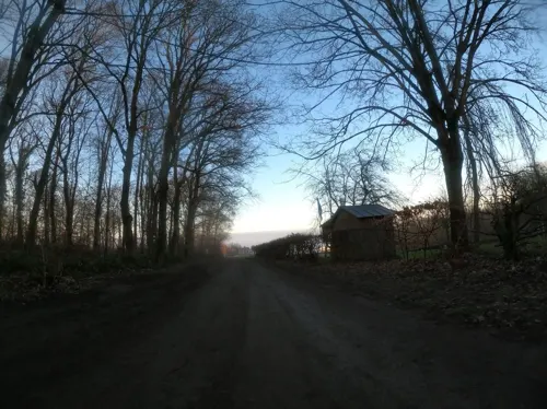
Deister Alm
Restaurant · German, Regional, Bavarian · 3.8 km
50 Luttringhäuser Weg, Barsinghausen
Mo off; Tu-Th 11:00-17:00; Fr-Su 11:00-20:00
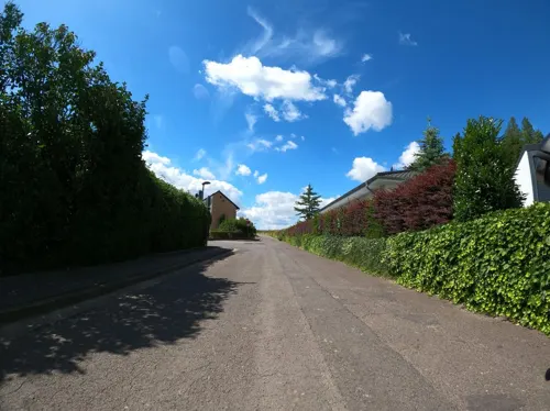


Hotel & Restaurant Buchenfürst
Restaurant · 3.8 km
44 Buchenallee, Bad Nenndorf
Tu-Th 17:30-21:00; Fr-Su 11:30-14:00,17:30-21:00

Konditorei Frenkel
Cafe · 3.0 km
Central-Cafe Frenkel in Hauptstraße 10 war eine Zweigstelle. Namensähnlich: Bäckerei Frenzel in Haster Straße und in Waltringhausen
11 Bahnhofstraße
Fr-Sa 09:00-17:00; Su 10:00-17:00
La Viletta
Restaurant · Italian, Pizza, Pasta · 3.1 km
4D Kurhausstraße, Bad Nenndorf
Tu-Su 12:00-14:30,18:00-22:30
Ratskeller
Restaurant · German
42 Lange Straße, Rodenberg
We, Fr-Sa 17:00-23:00; Su 11:30-14:30, 17:00-23:00; Th...
Restaurant Sokrates
Restaurant · Greek · 2.1 km
31 Rodenberger Allee
Tu-Fr 17:00-23:00; Sa, Su 11:30-14:30, 17:00-23:00
Waldgaststätte Teufelsbrücke
Restaurant · German · 3.4 km
1 Heisterburg, Rodenberg
Mo-Tu off; We-Fr 11:00-18:00; Sa-Su, PH 10:00-18:00
Wirtshaus zum Bayern Stadl
Restaurant · Bavarian · 3.3 km
32 Hauptstraße, Bad Nenndorf
Mo-Th,Su,PH 11:00-22:00; Fr,Sa 11:00-23:00
Balkan Restaurant
Restaurant · 1.0 km
61 Grover Straße, Rodenberg
Tu-Sa 17:00-22:30; Su,PH 12:00-14:30, 17:00-22:30
52 more on the map.
History
The Rodenberg area was already inhabited in prehistoric times, among others by the Celts and Saxons. A number of burial mounds in the area also bear witness to this. The name Rodenberg refers to a hill in the west of the city, but the name is not a reference to the clearing, but to the color of the mountain - "red mountain". The first documented mention (as "Castrum Rodenbergum") dates back to the year 930, when the predecessors of the Counts of Schaumburg built a castle or a fortified tower here. It was said to be on the so-called "old Rodenberg" in the west of the town, although more details are not known. The Heisterburg in the Deister, which is assigned to Rodenberg, dates from the 10th/11th Century. The few remains of Rodenberg Castle were probably built as a moated castle by Count Adolf IV of Schaumburg between 1228 and 1240. Today's spelling "Rodenberg" was first used in 1632.
From the History section of Rodenberg on Wikipedia, under CC BY-SA 4.0.
Where to stay5
Churches and places of worship9
Maria vom heiligen Rosenkranz
Church · Catholic · 2.8 km
11 Wilhelmstraße, Bad Nenndorf
Shopping11
Gas and EV charging9
Schools, colleges and libraries10
Gymnasium Bad Nenndorf
School · 3.4 km
42 Horster Straße, Bad Nenndorf
Schule Schlaffhorst-Andersen für Atem-, Sprech- und Stimmlehre
School · 3.7 km
20 Bornstraße, Bad Nenndorf
Healthcare5
Map of Rodenberg
181 places. The map loads OpenStreetMap tiles when you open it.
Getting there and nearby towns
Hannover Airport (HAJ) is the nearest airport with scheduled flights listed in OpenStreetMap, 28 km away.
- Bad Nenndorf 3 km northeast, about 3 min by car
- Barsinghausen 6 km east, about 6 min by car
- Stadthagen 11 km west, about 11 min by car
- Wunstorf 14 km northeast, about 14 min by car
- Bad Münder am Deister 15 km southeast, about 15 min by car
- Wennigsen 15 km east, about 15 min by car
- Obernkirchen 16 km west, about 16 min by car
- Gehrden 17 km east, about 17 min by car
- Hessisch Oldendorf 17 km southwest, about 17 min by car
- Springe 18 km southeast, about 18 min by car
Drive times are estimates from straight-line distance, not routes.
Local news
Headlines from INDB.
Reviews, tips and questions
Loading what members have shared...
Sources and licences
- GeoNames (CC BY 4.0): population, coordinates, regions and time zone
- Mapillary (see each image): photos
- OpenStreetMap contributors (ODbL 1.0): places, airports, map data
- Wikidata (CC0 1.0): elevation, founding date, time zone, website
- Wikimedia Commons (see each image): photos
- Wikipedia (CC BY-SA 4.0): overview and history text
Photo credits
- RathausRodenberg, Tortuosa, CC BY-SA 3.0
- Stolperstein Rodenberg Echternstraße 19 Paul Jost, Tomtom10, CC BY-SA 4.0
- Rodenberger Windmühle, Den man tau, CC BY-SA 4.0
- Stolpersteinlage Rodenberg Echternstraße 19, Tomtom10, CC BY-SA 4.0
- Stolpersteinlage Rodenberg Lange Straße 23, Tomtom10, CC BY-SA 4.0
- Stolperstein Rodenberg Lange Straße 23 Gustav Windmüller, Tomtom10, CC BY-SA 4.0
- Stolperstein Rodenberg Lange Straße 23 Else Windmüller, Tomtom10, CC BY-SA 4.0
- Stolperstein Rodenberg Lange Straße 23 Oskar Windmüller, Tomtom10, CC BY-SA 4.0
- Stolpersteine Rodenberg Lange Straße 23, Tomtom10, CC BY-SA 4.0
- Rodenberg, Gefallenen-Denkmal, Gerd Fahrenhorst, CC BY 3.0
- Windmühle in Rodenberg, Varus111, CC BY-SA 4.0
- 31552 Rodenberg, Germany - panoramio, Foto Fitti, CC BY-SA 3.0
- Rodenberger Allee, 1, Bad Nenndorf, Landkreis Schaumburg, GeorgDerReisende, CC BY-SA 4.0
- Agnes-Miegel-Haus Bad Nenndorf IMG 6791 retouched, losch, Attribution
- Gymnasium Bad Nenndorf, Lutz Lange, CC BY-SA 4.0
- Heisterburg Tor heute, de:Benutzer:Axel Hindemith Original uploader was Axel Hindemith at de.wikipedia, Public domain
- Kirche in Apelern IMG 6035, losch, Attribution
- Bad Nenndorf St. Maria vom hl. Rosenkranz, Rabanus Flavus, CC0
- Rodenberg St. Mariä Himmelfahrt 1, Rabanus Flavus, CC0
- Schloss Rodenberg Ständehaus Burggraben, Axel Hindemith, CC BY 3.0
- Rodenberg - St. Jacobi - Außenansicht, Misburg3014, CC BY-SA 3.0
- Strutzbergstollen-Mundloch, Den man tau, CC BY-SA 4.0
- Mooshüttestollen (2), Den man tau, CC BY-SA 4.0
- Belvedereturm Deister, AxelHH, CC BY 3.0
- Stolperstein Bad Nenndorf Hauptstraße 14 Ernst Blumenberg, Tomtom10, CC BY-SA 4.0
- Bad Nenndorf, view to the little palace, Dguendel, CC BY 4.0
- Bad Nenndorf 08-13 img03 StGodehardi, A.Savin, CC BY-SA 3.0
- Bad Nenndorf Grandhotel Esplanade - ehemaliges Schwefelbadehaus, Rabanus Flavus, CC0
- Mooshüttestollen (1), Den man tau, CC BY-SA 4.0
- Rodenberg Staendehaus, No machine-readable author provided. Warrior071~commonswiki assumed (based on copyright claims)., Public domain
- Podbielski Denkmal-Bad Nenndorf (1), Lutz Lange ( talk ), CC BY-SA 4.0
- Densinghäuser Quelle, Raugeier, CC BY-SA 3.0
- St. Godehardi-Kirche Bad Nenndorf, Lutzto, CC BY-SA 4.0
- Agnes Miegel Haus mit Denkmal, Nifoto, CC BY-SA 4.0
- Strutzbergturm, Raugeier, CC BY-SA 4.0
- 31542 Bad Nenndorf Godehardi-Kirche 20230506, Uwe Barghaan, CC BY-SA 3.0
- NeuerLandesbischofSchuegraf, NadineJuliana, CC BY-SA 4.0
- Bach, 5, Bad Nenndorf, Landkreis Schaumburg, GeorgDerReisende, CC BY-SA 4.0
- Street-level photo, Langfahrer, CC BY-SA 4.0
- Street-level photo, Langfahrer, CC BY-SA 4.0
- Street-level photo, Langfahrer, CC BY-SA 4.0
- Street-level photo, Langfahrer, CC BY-SA 4.0
- Street-level photo, Langfahrer, CC BY-SA 4.0
- Street-level photo, Langfahrer, CC BY-SA 4.0
- Street-level photo, jom, CC BY-SA 4.0
- Street-level photo, hotteliene, CC BY-SA 4.0


Page built November 9, 2026. Spotted a mistake? Tell us or suggest a place.