


Why visit Bodenheim
Townapedia lists 23 museums and landmarks, 20 parks and trails, 78 places to eat, 7 places to stay and 5 attractions in and around town.
Highlights include Südbrücke, Gauberg, Pfarrei St. Gereon and Heimatmuseum.
Weather in Bodenheim
Forecast from MET Norway (CC BY 4.0). Full forecast
About Bodenheim
Bodenheim (German pronunciation: [ˈboːdn̩ˌhaɪ̯m] ) is a state-recognized tourism municipality (Fremdenverkehrsgemeinde) in the Mainz-Bingen district in Rhineland-Palatinate, Germany
From the Wikipedia article Bodenheim (this version), under CC BY-SA 4.0.
Photos of Bodenheim


Things to do5


Bodenheimer Hoch
Scenic view · 2.0 km
Schutzhütte mit Aussichtsplattform auf dem Dach; Aussichtsplattform nicht zugänglich (2024-02-18)


Museums and landmarks23
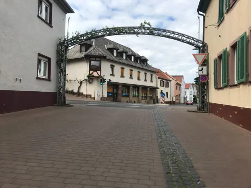


ehem. Generator-/Pumpenhaus
Monument and historic site · 2.6 km
Das Bauwerk gehörte zum Hofgut Hohenaue und wurde um 1900 erbaut. Es beinhaltete eine Dampfmaschine und einen Stromgenerator zum Antrieb...
11 more on the map.
Parks, trails and playgrounds20

Erweiterung Laubenheimer - Bodenheimer Ried
Hiking and trails · 0.9 km




Maria-Oberndorf-Spielplatz
Playground · 1.4 km
Mo-Sa 08:00-19:00; Su,PH 08:00-13:00,15:00-19:00

Grillplatz
Park · 2.0 km
Grillen nur in der Grillstelle. Lautsprecheranlagen und Notstromaggregate verboten.

8 more on the map.
Restaurants and cafes78
Weinstube Potsdamer Hof
Restaurant · Regional · 1.6 km
1 Plattenhohl, Bodenheim
We-Sa 16:00+; Su 15:00+
Wok Sushi Express Bodenheim
Restaurant · Asian · 1.0 km
5 Am Kuemmerling, Bodenheim
Mo-Fr 11:00-14:30,17:00-21:30; Su 12:00-21:30
Bootshaus Haupt
Restaurant · 3.5 km
5 An der Fähre, Ginsheim-Gustavsburg
Tu-Sa 17:00-22:00, Su 12:00-16:00

Athena
Restaurant · Greek · 3.0 km
1 Möhnstraße, Mainz
Mo,We-Sa 17:00-23:00; Su,PH 17:00-23:00,11:00-14:30
Rice Fusion 1990
Restaurant · Japanese, Vietnamese · 2.1 km
19 Pommardstraße, Nackenheim
Tu-Fr 11:00-15:00; Mo-Sa 17:00-23:00; Su 12:00-23:00
Weinhaus May
Restaurant · Regional · 1.4 km
13 Hellmerichstraße, Bodenheim
Jul-Sep: Su 13:00-22:00, Mo-Tu 16:00-22:00
66 more on the map.
History
Bodenheim's first documented mention was in 754, and it marked its 1,250-year jubilee in 2004.
On 29 June 1988, two US F-16C combat aircraft collided near the municipality and fell over an uninhabited area. One of the pilots managed to save himself with his ejection seat, while the other, Captain Mike Crandall, was killed.
From the History section of Bodenheim on Wikipedia, under CC BY-SA 4.0.
More about Bodenheim
Geography
The municipality lies roughly 12 km south of downtown Mainz on the edge of the Frankfurt Rhine Main Region. The municipality is strongly characterized by winegrowing. The many wineries and Straußwirtschaften invite visitors to come and enjoy the wine. Since 1972, Bodenheim has been the seat of the Verbandsgemeinde of Bodenheim, a kind of collective municipality.
Economy
Herdt-Verlag für Bildungsmedien GmbH, publishing house for educational media
In Bodenheim, there is winegrowing on 426 ha shared among vineyards owned by Kapelle, Kreuzberg, Silberberg, Hoch, Leidhecke, Westrum, Heitersbrünnchen, Ebersberg, Burgweg, Mönchspfad and Reichsritterstift. All together, there are currently (as of 2003) 79 active winegrowing operations with a working area greater than 3 000 m². The winegrowing lands are divided into 315 ha of white wine varieties and 112 ha of red wine varieties. Of white wine varieties, 72 ha are taken up by Silvaner vines and 71 ha by Müller-Thurgau. Dornfelder, at 47 ha is currently the most strongly represented red wine variety.
A vine theme park guides the tourist through the vineyards explaining the most sought vines at the sites where they are planted.
The Weingut Oberstleutnant Liebrecht'sche Gutsverwaltung (winery) goes back to the estate built by the nuns from Altmünster Abbey in 1754 between the parish estate and the municipality of Weed. The career officer Friedrich Wilhelm Liebrecht realigned the vineyards’ boundaries and is counted among the founders of the Verband Deutscher Naturwein Versteigerer, the forerunner of the Verband Deutscher Prädikatsweingüter (VDP). The winery was led until 2010 by a fourth-generation descendant, Mr. Fritz Nacke.
Arts and culture
The Catholic parish church was built about 1830. It is a hall church with barrel vaulting with a west tower, square quire and apse. The painting and stucco date from 1910.
The foundation stone for the Evangelical Church in Bodenheim was laid on 16 May 1887. Master builder Baron von Schmitt, who was also given the job of restoring Saint Catherine’s Church (Katharinenkirche) in Oppenheim, drew up plans for the church while master church builder Otto Schwarze took on the job of overseeing the building work. In the Gothic Revival style there arose a house of worship built out of quarried limestone blocks with a slated hip roof and a decorative flèche. Inside the building are found, among other things, three stained-glass windows in the quire showing Christ’s birth, Crucifixion and Resurrection, and the artistically carved pulpit, which is borne by the Four Evangelists. On 26 September 1888 came the church’s festive consecration. Today the Evangelical Church is open all week from 8:00 to 19:00 for devotions and sightseeing.
From the Wikipedia article Bodenheim, under CC BY-SA 4.0.
Where to stay7
Churches and places of worship13
Kapelle Maria-Oberndorf
Church · Roman Catholic · 1.3 km
Kapellenstraße, Bodenheim
St. Alban
Church · Roman Catholic · 1.2 km
16 Kirchbergstraße, Bodenheim
Evangelisches Gemeindezentrum
Church · Protestant · 2.3 km
2 In den Haferwiesen, Nackenheim
Shopping13
Gas and EV charging5
Schools, colleges and libraries6
Healthcare5
Map of Bodenheim
175 places. The map loads OpenStreetMap tiles when you open it.
Getting there and nearby towns
Wiesbaden Army Airfield (WIE) is the nearest airport with scheduled flights listed in OpenStreetMap, 13 km away.
- Nackenheim 3 km southeast, about 3 min by car
- Ginsheim-Gustavsburg 4 km northeast, about 4 min by car
- Mainz 6 km northwest, about 6 min by car
- Trebur 6 km east, about 6 min by car
- Bischofsheim 7 km northeast, about 7 min by car
- Nierstein 7 km south, about 7 min by car
- Nieder-Olm 9 km west, about 9 min by car
- Rüsselsheim am Main 9 km northeast, about 9 min by car
- Hochheim am Main 9 km north, about 9 min by car
- Oppenheim 9 km south, about 9 min by car
Drive times are estimates from straight-line distance, not routes.
Towns near Bodenheim


Keep exploring
Local news
Headlines from INDB.
Reviews, tips and questions
Loading what members have shared...
Sources and licences
- GeoNames (CC BY 4.0): population, coordinates, regions and time zone
- Mapillary (see each image): photos
- OpenStreetMap contributors (ODbL 1.0): places, airports, map data
- Wikidata (CC0 1.0): elevation, founding date, time zone, website, landmarks and historic places
- Wikimedia Commons (see each image): photos
- Wikipedia (CC BY-SA 4.0): overview and history text
Photo credits
- 2009-10-30 1 Bodenheim, Vera Buhl, CC BY-SA 3.0
- Bodenheim - Kirschpflaume als Fallobst (Details), ManuelB701, CC0
- Bodenheim - Kirschpflaume als Fallobst, ManuelB701, CC0
- Bodenheim - Schleuse eines Wassergrabens an der Seurreallee, ManuelB701, CC0
- Wilde Kirsche in Bodenheim, ManuelB701, CC0
- Bushalt Bodenheim, Langwiese (Südrichtung), ManuelB701, CC0
- Wilde Wallnüsse in Bodenheim, ManuelB701, CC0
- Bodenheim - Weizenfeld an der Suerreallee, ManuelB701, CC0
- Wilde Himbeeren in Bodenheim, ManuelB701, CC0
- Bushalt Bodenheim, Eichweg (Südrichtung), ManuelB701, CC0
- Bodenheim - Samen eines Mandelbaums, ManuelB701, CC0
- Bodenheim - Blüte eines Mandelbaums, ManuelB701, CC0
- Bodenheim - Baustelle Eichweg Nord, ManuelB701, CC0
- Bodenheim Deutsches Pumpen-Museum, Wleiter, CC BY-SA 4.0
- Bahnhof Bodenheim - Mireo der S 6, ManuelB701, CC0
- Bahnhof Bodenheim - RB 33 in Bodenheim, ManuelB701, CC0
- Bodenheim - Ärztzehaus Vitanum, ManuelB701, CC0
- Bodenheim - Umgestaltete Fußwegsquerung an der Hilgestraße, ManuelB701, CC0
- Bodenheim - Baustelle am Eichweg, ManuelB701, CC0
- Bodenheim - Vitanum, Fidus Apotheke, ManuelB701, CC0
- Bodenheim Bahnhof 2017, Nixus Minimax, CC BY-SA 4.0
- Bodenheim - Kaiserliches Postamt, ManuelB701, CC0
- Bodenheim - Lange Ruthe, Abzweige Am Bürgel und Uwe-Zeidler-Ring, ManuelB701, CC0
- Bodenheim Rathaus 20100701, Rudolf Stricker, Attribution
- Bodenheim Fachwerkhaus 20100701, Rudolf Stricker, Attribution
- Suedbruecke Mainz, Felix.matheis, Public domain
- Mariae Heimsuchung MZ Laubenheim, Drewitz, CC BY-SA 3.0
- Nackenheim Kirche St. Gereon 2016-02-18-15-57-05, Alexander Hoernigk, CC BY-SA 4.0
- Katholische Pfarrkirche St. Alban, Enbodenumer, CC BY-SA 3.0
- Ev. Kirche Bodenheim, Enbodenumer, CC BY-SA 3.0 de
- Evangelische Pfarrkirche Mainz-Laubenheim, Stefan Christ, CC BY-SA 3.0
- Katholische Wallfahrtskapelle St. Maria im Oberdorf, Enbodenumer, CC BY-SA 3.0
- Nackenheimer Bergkapelle 2, Stefan Bauer, CC BY-SA 4.0
- Glockenberghütte, Wiemaha, CC BY-SA 4.0
- Erweiterung Laubenheimer-Bodenheimer Ried, Joho345, CC BY-SA 3.0
- 2017-10-17-Laubenheimer-Ried- 165-k-r-a-2, Bodow, CC BY-SA 4.0
- Naturschutzgebiet Rothenberg, Karsten Ratzke, CC0
- Rewemarkt, joho345, Public domain
- Insel Sändchen - Nackenheim, PM3, CC BY-SA 4.0
- Naturschutzgebiet Rothenberg 2, PM3, CC BY-SA 4.0
- Weinbergsturm Bodenheimer Hoch, Muck, CC BY-SA 4.0
- Street-level photo, miguel_andrade, CC BY-SA 4.0
- Street-level photo, chuck, CC BY-SA 4.0
- Street-level photo, miguel_andrade, CC BY-SA 4.0
- Street-level photo, miguel_andrade, CC BY-SA 4.0
- Street-level photo, miguel_andrade, CC BY-SA 4.0
- Street-level photo, miguel_andrade, CC BY-SA 4.0
- Street-level photo, chuck, CC BY-SA 4.0
- Street-level photo, chuck, CC BY-SA 4.0
- Street-level photo, changchun1, CC BY-SA 4.0
- Street-level photo, miguel_andrade, CC BY-SA 4.0
- Street-level photo, miguel_andrade, CC BY-SA 4.0
- Street-level photo, tasmaniadevil, CC BY-SA 4.0
- Street-level photo, miguel_andrade, CC BY-SA 4.0
- Street-level photo, miguel_andrade, CC BY-SA 4.0
- Street-level photo, miguel_andrade, CC BY-SA 4.0
- Street-level photo, tasmaniadevil, CC BY-SA 4.0
- Street-level photo, miguel_andrade, CC BY-SA 4.0
- Street-level photo, miguel_andrade, CC BY-SA 4.0
- Street-level photo, chuck, CC BY-SA 4.0
- Street-level photo, chuck, CC BY-SA 4.0
- Street-level photo, miguel_andrade, CC BY-SA 4.0
- Street-level photo, miguel_andrade, CC BY-SA 4.0
- Street-level photo, tasmaniadevil, CC BY-SA 4.0
- Street-level photo, miguel_andrade, CC BY-SA 4.0
- Street-level photo, miguel_andrade, CC BY-SA 4.0


Page built November 9, 2026. Spotted a mistake? Tell us or suggest a place.