


Why visit Werl
Townapedia lists 71 museums and landmarks, 40 parks and trails, 87 places to eat, 11 places to stay and 9 attractions in and around town.
Highlights include Hofladen Wilhelm Bieling, hofladen landverliebt, Haus Borg and Haus Rykenberg.
Weather in Werl
Forecast from MET Norway (CC BY 4.0). Full forecast
About Werl
Werl (German pronunciation: [vɛʁl] ; Westphalian: Wiärl) is a town in North Rhine-Westphalia and belongs to the Soest district in the Arnsberg administrative district. Werl is one of the largest and most important pilgrimage sites in Germany.
From the Wikipedia article Werl (this version), under CC BY-SA 4.0.
Photos of Werl


Things to do9

Hofladen Wilhelm Bieling
Farm and orchard · 7.1 km
16 Kühlstraße, Unna
Mo-Fr 09:30-12:00,15:00-18:00; Sa 08:00-12:00
Scheer und mehr
Farm and orchard · 3.9 km
1 Am Jüdischen Friedhof, Werl
We-Su 10:00-17:00; Mo-Tu off
Oevel's Milchtankstelle
Farm and orchard · 6.6 km
Milchtankstelle und Automat für Grillfleisch usw.
66 Lindweg, Soest
Museums and landmarks71


Franziskanerkloster Werl
Monument and historic site · Roman Catholic
17 Klosterstraße, Werl


Haus Echthausen
Monument and historic site · 6.6 km
87 Ruhrstraße, Wickede (Ruhr)


Rittergut Schafhausen
Monument and historic site · 6.2 km
28 Schafhauser Weg, Wickede (Ruhr)




59 more on the map.
Parks, trails and playgrounds40




28 more on the map.
Restaurants and cafes87
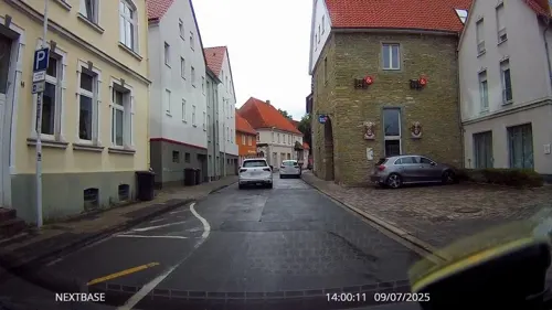
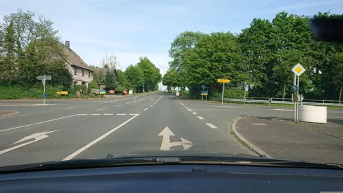
Das Fischlokal
Restaurant · Fish, Seafood · 3.5 km
36 Westönner Bundesstraße, Werl
We-Sa 17:00-22:30; Su,PH 11:30-14:30,16:30-22:00
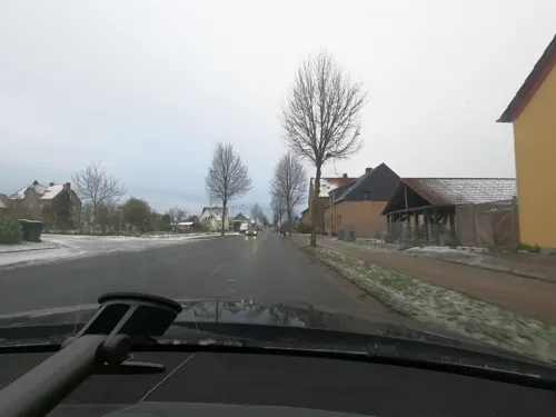
Haus Gerbens
Restaurant · International · 5.8 km
Tu-Fr 12:00-14:00,18:00-22:00, Sa 18:00-22:00, Su 17:30-20:30

Zur Post
Restaurant · Balkan · 7.1 km
76 Hemmerder Dorfstraße, Unna
Tu-Su 17:00-24:00; We-Su 11:30-14:30

Bäckerei Stricker
Bakery · 7.1 km
14 Kühlstraße, Unna
Mo-Fr 07:30-12:30,14:30-18:30; Sa 06:30-13:00; Su 08:00-11:00
75 more on the map.
History
Werl was a member of the Hanseatic League in the Middle Ages and since 1661 has had a statue of the Virgin Mary, making it a place of pilgrimage. Today this relic is in the Wallfahrtsbasilika and is looked after by the Franciscan religious order. Werl Prison is the third largest in North Rhine-Westphalia, Werl Prison.
From 1953 to 1970, Werl was one of three garrison towns — alongside Soest and Hemer — used by the Canadian Army as part of Canada's NATO commitment under the British Army of the Rhine. Three purpose-built single-storey barracks were constructed on the edge of the town: Fort Victoria, Fort St Anne and Fort St Louis, accommodating an engineer regiment, a field ambulance and an infantry battalion of 4 Canadian Infantry Brigade Group (renamed 4 Canadian Mechanized Brigade Group in May 1968).
Married soldiers and their families lived in a dedicated Canadian residential settlement inside Werl. The site also housed Radio Canadian Army Europe (CAE), the first Canadian military FM radio station on German soil, which broadcast from Fort Victoria until 18 October 1970.
When 4 CMBG relocated to CFB Lahr in 1970–71, the barracks were transferred to the British Army of the Rhine. Fort Victoria was renamed Vittoria Barracks, and Forts St Louis and Anne were combined as Albuhera Barracks.
Read more of the history
Successive British infantry battalions were stationed there: 2nd Queen's Regiment (1971–1975), 1st Queen's (1975–1980), 1st Black Watch (1980–1985), 1st Royal Scots (1985–1991), and 1st Devonshire and Dorset Regiment (August 1991 – June 1994). British forces vacated the site in June 1994, and the barracks have stood abandoned since.
A total of 474 Canadians — 124 post-war military personnel and 350 dependants — are buried in Werl Central Cemetery, the largest concentration of Canadian post-war graves in either Germany or France.
The 4th United States Army Field Artillery Detachment was stationed in Werl until 1992.
From the History section of Werl on Wikipedia, under CC BY-SA 4.0.
More about Werl
Geography
Werl lies between the Sauerland, the Münsterland, Ruhr area and Hellweg in the fertile Börde landscape of the Werl-Unnaer Börde. At the end of 2018, Werl had 32,994 inhabitants on an area of 76.35 square kilometers; this corresponds to a population density of 432 people/km2. The highest point in the city is at 228.4 m above sea level. NN in the city forest to the south. The deepest point is 73.1 m above sea level. NN in the northern part of the city on the Flerke farm. The city of Werl lies on the southern edge of the Westphalian Bay. Therefore, the terrain profile in the urban area is predominantly flat. In the southern area the terrain rises sharply towards the Haarstrang. It separates the lowlands from the mountainous Sauerland. In the south, the Werl city forest stretches across the hair strand. This is the only area in the city that is densely covered with trees. The Werler part of the lowlands is, in terms of landscape and economy, more dominated by agriculture.
From the Wikipedia article Werl, under CC BY-SA 4.0.
Notable people from Werl
 Franz von PapenGerman general staff officer, politician, diplomat, nobleman and Chancellor of Germany (1879–1969)Photo: Unknown Unknown, CC BY-SA 3.0 de
 Ulla WiesnerGerman singerPhoto: RAI, Public domain
 Andreas EnglischGerman journalistPhoto: J.-H. Janßen, CC BY-SA 4.0
 Dimitri HegemannGerman nightclub ownerPhoto: DjSchool ChileTv, CC BY 3.0
- Heinrich von RustigeGerman painter and poet (1810–1900)
- Dan LacksmanBelgian musician and audio engineer
- Theodor RedderGerman football player (born 1941)
- Philipp RosenthalGerman entrepreneur (1855-1937)
- Steve CyrOlympic biathlete
- Josef FoschepothGerman historian of modern age
- Walter SalmenGerman musicologist
- Heinrich von WerlGerman Scotist philosopher
Born in Werl, according to Wikidata (CC0). Each name links to its Wikipedia article.
Where to stay11
Gut Kump - Gastronomie und Hotel
Motel and hotel · 6.3 km
5 Kumper Landstraße, Hamm
Churches and places of worship36
Maria Magdalena
Church · Roman Catholic · 5.0 km
20 Kapellenstraße, Werl
Pfarrkirche St. Cäcilia
Church · Roman Catholic · 3.3 km
26 Westönner Kirchstraße, Werl
St. Peter und Paul
Church · Roman Catholic · 7.2 km
1 Friedhofsweg, Unna
Shopping22
Gas and EV charging16
AGRAVIS Raiffeisen AG, Tankstelle Soest-Ostönnen
Gas station · 5.9 km
319 Werler Landstraße, Soest
Theodor Rubart Mineralöle und Schmierstoffe GmbH & Co.
Gas station
24 Hammer Straße, Werl
Schools, colleges and libraries23
Healthcare8
Map of Werl
250 places. The map loads OpenStreetMap tiles when you open it.
Getting there and nearby towns
Dortmund Airport (DTM) is the nearest airport with scheduled flights listed in OpenStreetMap, 21 km away.
- Wickede 7 km southwest, about 7 min by car
- Welver 8 km northeast, about 8 min by car
- Bönen 11 km northwest, about 11 min by car
- Soest 13 km east, about 13 min by car
- Fröndenberg 13 km southwest, about 13 min by car
- Hamm 15 km northwest, about 15 min by car
- Unna 16 km west, about 16 min by car
- Möhnesee 16 km east, about 16 min by car
- Kamen 18 km west, about 18 min by car
- Bad Sassendorf 18 km east, about 18 min by car
Drive times are estimates from straight-line distance, not routes.
Towns near Werl


Keep exploring
Local news
Headlines from INDB.
Reviews, tips and questions
Loading what members have shared...
Sources and licences
- GeoNames (CC BY 4.0): population, coordinates, regions and time zone
- Mapillary (see each image): photos
- OpenStreetMap contributors (ODbL 1.0): places, airports, map data
- Wikidata (CC0 1.0): elevation, founding date, time zone, website, landmarks and historic places
- Wikimedia Commons (see each image): photos
- Wikipedia (CC BY-SA 4.0): overview and history text
Photo credits
- Werl Innenstadt FFSN-233, Michael Kramer, CC BY-SA 3.0
- Werl, Forum der Völker, Missionsmuseum, Malchen53, CC BY-SA 3.0
- Werl Basilika Westportal IMGP7135, Smial, CC BY-SA 2.0 de
- Mariä Heimsuchung (Werl) Ansicht vom Vorplatz aus., Malchen53, CC BY-SA 3.0
- Werl, die Walburgisstraße, Dguendel, CC BY 4.0
- Werl, die Salzstraße, Dguendel, CC BY 4.0
- Klosterstraße 2, 1, Werl, Landkreis Soest, GeorgDerReisende, CC BY-SA 4.0
- Werl, denkmalgeschütztes Haus mit Freitreppe, Melsterstraße 14, Malchen53, CC BY-SA 3.0
- Melstergraben 47, 1, Werl, Landkreis Soest, GeorgDerReisende, CC BY-SA 4.0
- Klosterstraße 4, 1, Werl, Landkreis Soest, GeorgDerReisende, CC BY-SA 4.0
- Steinergraben 92, 1, Werl, Landkreis Soest, GeorgDerReisende, CC BY-SA 4.0
- Melstergraben 38, 1, Werl, Landkreis Soest, GeorgDerReisende, CC BY-SA 4.0
- Werl, Skulptur von Joseph Wäscher, der Schweinehirt, Malchen53, CC BY-SA 3.0
- Werl, Skulptur von Joseph Wäscher, der Schweinehirt (1), Malchen53, CC BY-SA 3.0
- Melsterstraße 20, 1, Werl, Landkreis Soest, GeorgDerReisende, CC BY-SA 4.0
- Werl - Jüdischer Friedhof 02, Dat doris, CC BY-SA 3.0 de
- Werl, Franziskanerkloster, Teilansicht, Malchen53, CC BY-SA 3.0
- Werl - Jüdischer Friedhof 01, Dat doris, CC BY-SA 3.0 de
- Mariä Heimsuchung (Werl), Gedenktafel anlässlich der Erhebung zur Basilika minor, mit drei Wappen, Malchen53, CC BY-SA 3.0
- Werl, Franziskanerkloster, Forderansicht, Malchen53, CC BY-SA 3.0
- Werl, Franziskanerkloster, Eingang, Malchen53, CC BY-SA 3.0
- Bollergasse, 1, Werl, Landkreis Soest, GeorgDerReisende, CC BY-SA 4.0
- Bollergasse, 2, Werl, Landkreis Soest, GeorgDerReisende, CC BY-SA 4.0
- Klosterstraße 17, 1, Werl, Landkreis Soest, GeorgDerReisende, CC BY-SA 4.0
- Klosterstraße 7, 1, Werl, Landkreis Soest, GeorgDerReisende, CC BY-SA 4.0
- Werl, Blick zur Steinerstraße, Dguendel, CC BY 4.0
- Werl - Jüdischer Friedhof 07, Dat doris, CC BY-SA 3.0 de
- Werl - Jüdischer Friedhof 09, Dat doris, CC BY-SA 3.0 de
- Werl - Jüdischer Friedhof 06, Dat doris, CC BY-SA 3.0 de
- Werl - Jüdischer Friedhof 05, Dat doris, CC BY-SA 3.0 de
- Werl - Jüdischer Friedhof 08, Dat doris, CC BY-SA 3.0 de
- Werl - Jüdischer Friedhof 04, Dat doris, CC BY-SA 3.0 de
- Werl - Jüdischer Friedhof 03, Dat doris, CC BY-SA 3.0 de
- Schützenstraße 2, 1, Werl, Landkreis Soest, GeorgDerReisende, CC BY-SA 4.0
- Werl - Jüdischer Friedhof 10, Dat doris, CC BY 4.0
- Werl, Wallfahrtsbasilika Mariä Heimsuchung, Dguendel, CC BY 4.0
- Werl, Basilika, Kreuz unter dem li. Bogengang auf dem Vorhof, Malchen53, CC BY-SA 3.0
- Werl, Blick zur Kirche St.Walburga, Dguendel, CC BY 4.0
- Mariä Heimsuchung (Werl), Wappen von Papst Franziskus oberhalb der Eingangsportale, Malchen53, CC BY-SA 3.0
- Alte Wallfahrtskirche Werl 20220609 0260, Tilman2007, CC BY-SA 4.0
- Werl-Kloster1-Bubo, Bubo, CC BY-SA 3.0
- Ev. St.Andreas-Kirche SOEST-Ostönnen, Fotomoppel, CC BY-SA 3.0
- St Peter und Paul Hemmerde Steeple, J.-H. Janßen, CC BY-SA 3.0
- Mariä Heimsuchung (Werl), Gnadenbild (1), Malchen53, CC BY-SA 3.0
- St. Cäcilia-Kirche, Werl-Westönnen, Dominik Schäfer, CC BY-SA 3.0 de
- KAPELLE ST. MARIA-MAGDALENA in Niederbergstraße Ortsteil von Werl im Kreis Soest, Matthias Böhm, CC BY-SA 3.0
- Haus Borg in Werl-Budberg Rückseite Blick von Osten, Christian Koehn, CC BY-SA 4.0
- Haus echthausen imgp8723, Smial, CC BY-SA 2.0 de
- Wickede-HausSchafhausen2-Bubo, Bubo, CC BY-SA 3.0
- Werl, denkmalgeschütztes Altes Schloss, Ruine, Schloßstraße Anischt b, Malchen53, CC BY-SA 3.0
- Werl St Norbert FFSN-167, Michael Kramer, CC BY-SA 3.0
- UG Panorama Schulhof, Jebediah23, CC BY-SA 4.0
- Hemmerde 1125 Jahre, J.-H. Janßen, CC BY-SA 3.0
- Naturschutzgebiet Bremer Bachaue 5, Martin Lindner, CC BY-SA 4.0
- Werl - NSG Mühlenbach-Siepenbach - 04, Ath, CC0
- Scheidingen - NSG Salzbach-Mittellauf mit Bewerbach - 02, Ath, CC0
- Werl, Holtum, Kirche, Seitenansicht, Malchen53, CC BY-SA 3.0
- Werl, Kurfürstenring, Moschee, Malchen53, CC BY-SA 3.0
- Grundschule Unna Hemmerde, J.-H. Janßen, CC BY-SA 3.0
- St. Walburga, Werl, Dominik Schäfer, CC BY-SA 3.0 de
- Werl, Haus Rykenberg, Rückansicht, Malchen53, CC BY-SA 3.0
- Street-level photo, derlipper, CC BY-SA 4.0
- Street-level photo, saschahaberkorn, CC BY-SA 4.0
- Street-level photo, analuisa, CC BY-SA 4.0
- Street-level photo, fltz, CC BY-SA 4.0
- Street-level photo, derlipper, CC BY-SA 4.0
- Street-level photo, derlipper, CC BY-SA 4.0
- Street-level photo, heetENkoel, CC BY-SA 4.0
- Street-level photo, saschahaberkorn, CC BY-SA 4.0
- Street-level photo, derlipper, CC BY-SA 4.0
- Street-level photo, derlipper, CC BY-SA 4.0
- Street-level photo, saschahaberkorn, CC BY-SA 4.0
- Street-level photo, saschahaberkorn, CC BY-SA 4.0
- Street-level photo, saschahaberkorn, CC BY-SA 4.0


Page built November 9, 2026. Spotted a mistake? Tell us or suggest a place.