


Gevelsberg, Germany
Gevelsberg is a town of 32,664 people in North Rhine-Westphalia, Germany.
Why visit Gevelsberg
Townapedia lists 70 museums and landmarks, 32 parks and trails, 150 places to eat, 6 places to stay and 18 attractions in and around town.
Highlights include Volkssternwarte Ennepetal, Hageböllinger Kopf, Kluterthöhle and Haus der Begegnung.
Weather in Gevelsberg
Forecast from MET Norway (CC BY 4.0). Full forecast
About Gevelsberg
Gevelsberg (German pronunciation: [ˈɡeːfl̩sˌbɛʁk] ; Westphalian: Gievelsbiärg) is a town in the district of Ennepe-Ruhr-Kreis, in North Rhine-Westphalia, Germany.
From the Wikipedia article Gevelsberg (this version), under CC BY-SA 4.0.
Photos of Gevelsberg


Things to do18





6 more on the map.
Museums and landmarks70

Kluterthöhle
Monument and historic site · 2.5 km
Kasse im Haus Ennepetal. Adresse entspricht der Anfahrtsbeschreibung lt. Homepage.
10 Gasstraße, Ennepetal
Mo-Su 09:30-17:30


Schloss Ahlhausen
Monument and historic site · 4.1 km
1 Ahlhausen, Ennepetal

Villa Altenloh
Monument and historic site · 1.6 km
34 Bahnhofstraße, Ennepetal

Villa Bilstein
Monument and historic site · 3.0 km
175 Milsper Straße, Ennepetal

Villa Brackelsberg
Monument and historic site · 3.4 km
103 Heilenbecker Straße, Ennepetal

Villa Ebbinghaus
Monument and historic site · 2.9 km
1 Hochstraße, Ennepetal

58 more on the map.
Parks, trails and playgrounds32
Dampf Bahn-Club Sprockhövel e. V.
Sports field and stadium · 4.4 km
Am Beermannshaus, Sprockhövel
Apr-Sep: Su[3] 11:00-17:00



Erlebnispark Gevelsberg
Sports field and stadium · 1.0 km
Tu-Fr 14:30-19:00; SH Tu-Fr 11:00-19:00; Sa, Su, PH 10:00-19:00

20 more on the map.
Restaurants and cafes150
Bäckerei Borggräfe
Bakery · 4.5 km
140a Enneper Straße, Hagen
Mo-Fr 05:00-18:00; Sa 06:00-18:00; Su 08:00-16:30
Das kleine Kaffeehaus
Cafe · Coffee Shop
34 Mittelstraße, Gevelsberg
Mo off; Tu-Fr 09:00-18:00; Sa 09:00-14:00; Su,PH off
Gevelsberg Lotus Garten
Restaurant · Asian, Chinese · 4.0 km
409 Hagener Straße, Gevelsberg
Tu off; We-Mo,PH 12:00-23:00
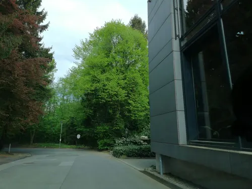
Restaurant Habbel's
Restaurant · German, Mediterranean · 3.3 km
127 Gevelsberger Straße, Sprockhövel
Mo,Tu closed; We-Sa 18:00-22:30; Su 12:00-14:30, 17:00-22:00
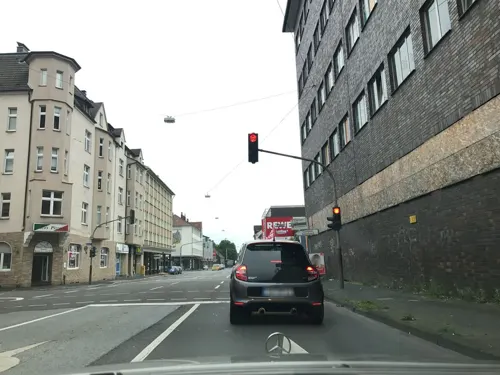
Sushi & Asia Food
Restaurant · Sushi, Asian · 4.6 km
132 Enneper Straße, Hagen
Mo-Fr 11:00-21:00; We off; Sa-Su 12:30-21:30
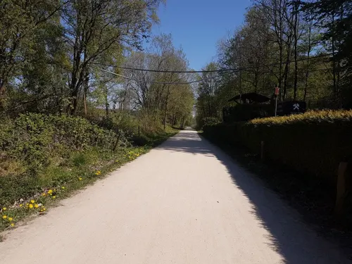

Cafe & Restaurant - Yuva an der Hülsenbecke
Cafe · Coffee Shop, Regional, Cake, Steak House · 3.8 km
36 Hülsenbecke, Ennepetal
Tu-Fr 17:00-21:00; Sa-Su 12:00-20:00

Moghul
Restaurant · Indian · 4.8 km
83 Enneper Straße, Hagen
Tu-Sa 17:00-22:00; Su 12:00-15:00,17:00-22 :00
Pizza Genova
Restaurant · Pizza
91 Mittelstraße, Gevelsberg
Su-Th,PH 11:00-14:30,17:00-23:00; Fr,Sa 11:00-14:30,17:00-24:00

Bäckerei Steinbrink
Bakery · 2.5 km
75 Voerder Straße, Ennepetal
Mo-Fr 06:00-18:00; Sa 06:00-13:00; Su 08:00-11:00
138 more on the map.
History
The town has a history of nearly 785 years. The archbishop of Cologne Engelbert II of Berg was killed on November 7, 1225 by his cousin Frederick of Isenberg in Gievilberch. As a consequence, a monastery of atonement (German: Sühnekloster) was established at the place of Engelbert's death and became the origin of the settlement resulting in today's Gevelsberg.
The population grew strongly in the 19th century, when many small industries related to iron processing were developed.
Gevelsberg received its coat of arms (a brick gable on a green hill, and a cogwheel indicating its industry) by decree of the Prussian Department of the Interior in 1903. In the mid-1950s a city wall was added to the coat of arms.
From the History section of Gevelsberg on Wikipedia, under CC BY-SA 4.0.
More about Gevelsberg
Geography
The town lies in the valley of the river Ennepe in the Süder Uplands, which is part of the Rhenish Massif. Gevelsberg lies about halfway between Wuppertal and Hagen, and is part of the industrial Ruhr Region. The lowest elevation is the Ennepe river at Vogelsang (132 m or 433 ft) and highest is the Hageböllinger Kopf (336 m or 1,102 ft). Its east-to-west length is 7.1 kilometres (4+3⁄8 miles) and the north to south length is 7.15 km (4+7⁄16 mi).
From the Wikipedia article Gevelsberg, under CC BY-SA 4.0.
Notable people from Gevelsberg
 Lena Oberdorfassociation football player (2001-)Photo: Steffen Prößdorf, CC BY-SA 4.0
 Thorsten HenseconomistPhoto: Delis Linos, CC0
- Kjell WätjenGerman footballer (born 2006)
- Michael CramerGerman politician (born 1949)
- Elisabeth HöngenGerman singer (mezzo-soprano)
- Peter StangierGerman politician (1898-1962)
- Heinz LohmannGerman organist and composer (1934-2001)
- Rudolf BoeckmannGerman soldier and Knight's Cross recipient (1895-1944)
- Mike BeckmannGerman gymnast
- Friedrich GotschalkDanish businessman and banker
- Karl NeuhoffGerman paratrooper and Knight's Cross recipient (1915-2001)
Born in Gevelsberg, according to Wikidata (CC0). Each name links to its Wikipedia article.
Where to stay6
Churches and places of worship27
Shopping51
Gas and EV charging21
Schools, colleges and libraries37
Wilhelm-Kraft-Gesamtschule des Ennepe-Ruhr-Kreises
School · 4.1 km
10 Geschwister-Scholl-Straße, Sprockhövel
Healthcare16
Map of Gevelsberg
250 places. The map loads OpenStreetMap tiles when you open it.
Getting there and nearby towns
Dortmund Airport (DTM) is the nearest airport with scheduled flights listed in OpenStreetMap, 29 km away.
- Ennepetal 3 km southeast, about 3 min by car
- Schwelm 5 km southwest, about 5 min by car
- Sprockhövel 7 km northwest, about 7 min by car
- Wetter 8 km northeast, about 8 min by car
- Hagen 10 km northeast, about 10 min by car
- Herdecke 11 km northeast, about 11 min by car
- Breckerfeld 11 km southeast, about 11 min by car
- Radevormwald 13 km south, about 13 min by car
- Witten 14 km north, about 14 min by car
- Wuppertal 15 km southwest, about 15 min by car
Drive times are estimates from straight-line distance, not routes.
Towns near Gevelsberg


Keep exploring
Local news
Headlines from INDB.
Reviews, tips and questions
Loading what members have shared...
Sources and licences
- GeoNames (CC BY 4.0): population, coordinates, regions and time zone
- Mapillary (see each image): photos
- OpenStreetMap contributors (ODbL 1.0): places, airports, map data
- Wikidata (CC0 1.0): elevation, founding date, time zone, website
- Wikimedia Commons (see each image): photos
- Wikipedia (CC BY-SA 4.0): overview and history text
Photo credits
- Gevelsberg - Mittelstraße - Ennepebrücke - Stadtzeichen 01, Frank Vincentz, CC BY-SA 3.0
- WittenerStr 1 Gevelsberg Denkmal, Ulomek-foto de, CC BY-SA 4.0
- Motorradparkplatz Gevelsberg 1, Gmbo 2013, CC0
- Mittelstrasse13gevelsberg, Ulomek-foto de, CC BY-SA 4.0
- Schillerstraße 16 Gevelsberg Denkmal, Ulomek-foto de, CC BY-SA 4.0
- Sparkassegevelsberg, Ulomek-foto de, CC BY-SA 4.0
- Ennepebogen Gevelsberg, Ulomek-foto de, CC BY-SA 4.0
- Neustrasse5-gevelsberg, Ulomek-foto de, CC BY-SA 4.0
- Kölner Str 16 Gevelsberg Denkmal, Ulomek-foto de, CC BY-SA 4.0
- Neustrasse16-gevelsberg, Ulomek-foto de, CC BY-SA 4.0
- Sparkassegevelsbergnebengeb, Ulomek-foto de, CC BY-SA 4.0
- Schillerstrasse19a-gevelsberg, Ulomek-foto de, CC BY-SA 4.0
- Schillerstrasse19-gevelsberg, Ulomek-foto de, CC BY-SA 4.0
- Südstrasse350-gevelsberg, Ulomek-foto de, CC BY-SA 4.0
- Sudfeldstraße 5 Gevelsberg Denkmal, Ulomek-foto de, CC BY-SA 4.0
- Goethestrasse25-gevelsberg, Ulomek-foto de, CC BY-SA 4.0
- Mittelstrasse61gevelsberg, Ulomek-foto de, CC BY-SA 4.0
- Milskotter Straße 2 Gevelsberg Denkmal, Ulomek-foto de, CC BY-SA 4.0
- An der Königsburg 1 Gevelsberg Denkmal, Ulomek-foto de, CC BY-SA 4.0
- Entering the yard at Gevelsberg (49221436062), Kevin Prince, CC BY-SA 2.0
- Mittelstrasse97gevelsberg, Ulomek-foto de, CC BY-SA 4.0
- Mylinghauserstrasse16-gevelsberg, Ulomek-foto de, CC BY-SA 4.0
- Mittelstraße 105 Gevelsberg Denkmal, Ulomek-foto de, CC BY-SA 4.0
- Mittelstrasse105gevelsberg, Ulomek-foto de, CC BY-SA 4.0
- Mylinghauserstrasse20-gevelsberg, Ulomek-foto de, CC BY-SA 4.0
- 2021-05-29-Hike-Gevelsberg-City-Forest-photo-09, Velopilger, CC BY-SA 4.0
- Bahnhofstr 29 Gevelsberg Denkmal, Ulomek-foto de, CC BY-SA 4.0
- 2021-05-29-Hike-Gevelsberg-City-Forest-photo-08, Velopilger, CC BY-SA 4.0
- Ennepetal Kluterthöhle, Arnoldius, CC BY-SA 4.0
- Gevelsberg - Rocholzallee - Gut Rocholz 03 ies, Frank Vincentz, CC BY-SA 3.0
- Evangelische Kirche Milspe2, giggel, CC BY 3.0
- Villa Altenloh, Grenzestein, CC BY-SA 3.0
- Hageböllinger Kopf, Gereon K., CC BY-SA 3.0
- Gevelsberg - Elberfelder Straße - Erlöserkirche 11, Frank Vincentz, CC BY-SA 3.0
- Tor Haus Martfeld, DooFi, CC BY 3.0
- Ennepetal Voerde - Lindenstraße 08 ies, Frank Vincentz, CC BY-SA 3.0
- Villa Brackelsberg 1, Grenzestein, CC BY-SA 3.0
- Ennepetal Voerde - Volkssternwarte 02 ies, Frank Vincentz, CC BY-SA 3.0
- NSG Gevelsberger Stadtwald-12.06.13-2, Ökologix, CC BY-SA 3.0
- Ennepetal-Kluterhöhle-Eingang, Dat doris, CC BY-SA 4.0
- NSG Südholz (14), DiAuras, CC BY-SA 4.0
- NSG Krabbenheider Bach in Gevelsberg nordwestl. Teil (8), DiAuras, CC BY-SA 4.0
- NSG EN-022 Hasper Bachtal (46), DiAuras, CC BY-SA 4.0
- Gevelsberg - Wittener Straße13 - Stadtbücherei 05 ies, Frank Vincentz, CC BY-SA 3.0
- Stadtbücherei Sprockhövel, Conny, CC BY-SA 3.0
- Hagen NSG-Aske, Bärwinkel,Klaus, CC BY 3.0
- Schwelm - Martfeld - Helios Klinikum 07 ies, Frank Vincentz, CC BY-SA 3.0
- Sprockhoevel-HasslinghausenKirche1-Asio, Asio otus, CC BY-SA 3.0
- Gevelsberg - Rosendahler Straße - St Engelbert 06, Frank Vincentz, CC BY-SA 3.0
- Gut Oberleveringhausen, Morty, CC BY-SA 3.0
- Ennepetal, Milsper Str. 38, St. Johann Baptist, von O, Im Fokus, CC BY-SA 4.0
- Eingang Kluterhoehle01, Markus Schweiss, CC BY-SA 3.0
- Gut Ahlhausen (Ennepetal) (1), DiAuras, CC BY-SA 4.0
- Ennepetal, Milsper Str. 175, Im Fokus, CC BY-SA 4.0
- Ennepetal, Hochstr. 1, Bild 2, Im Fokus, CC BY-SA 4.0
- Ennepetal, Bremenplatz 33, Bremenstadion, von NW, Bild 2, Im Fokus, CC BY-SA 4.0
- Street-level photo, saschahaberkorn, CC BY-SA 4.0
- Street-level photo, thoschi, CC BY-SA 4.0
- Street-level photo, thoschi, CC BY-SA 4.0
- Street-level photo, do8pgg, CC BY-SA 4.0
- Street-level photo, thoschi, CC BY-SA 4.0
- Street-level photo, thoschi, CC BY-SA 4.0
- Street-level photo, saschahaberkorn, CC BY-SA 4.0
- Street-level photo, saschahaberkorn, CC BY-SA 4.0
- Street-level photo, saschahaberkorn, CC BY-SA 4.0
- Street-level photo, VIA_DT, CC BY-SA 4.0
- Street-level photo, thoschi, CC BY-SA 4.0
- Street-level photo, thoschi, CC BY-SA 4.0
- Street-level photo, thoschi, CC BY-SA 4.0
- Street-level photo, klaus100000, CC BY-SA 4.0
- Street-level photo, do8pgg, CC BY-SA 4.0
- Street-level photo, miguel_andrade, CC BY-SA 4.0
- Street-level photo, fuffel, CC BY-SA 4.0
- Street-level photo, uwekoch, CC BY-SA 4.0
- Street-level photo, uwekoch, CC BY-SA 4.0
- Street-level photo, uwekoch, CC BY-SA 4.0
- Street-level photo, bravewaffle, CC BY-SA 4.0
- Street-level photo, changchun1, CC BY-SA 4.0
- Street-level photo, thoschi, CC BY-SA 4.0


Page built November 9, 2026. Spotted a mistake? Tell us or suggest a place.