


Why visit Uedem
Townapedia lists 82 museums and landmarks, 39 parks and trails, 43 places to eat, 12 places to stay and 16 attractions in and around town.
Highlights include Bauernmarkt Lindchen, Hochwald-Spargel Poen, Haus Kolk and Schloss Kalbeck.
Weather in Uedem
Forecast from MET Norway (CC BY 4.0). Full forecast
About Uedem
Uedem (German pronunciation: [ˈyːdəm]) is a municipality in the district of Cleves, in North Rhine-Westphalia, Germany. It is located near the border with the Netherlands.
From the Wikipedia article Uedem (this version), under CC BY-SA 4.0.
Things to do16
Hochwald-Spargel Poen
Farm and orchard · 4.3 km
5 Am Hochwald, Uedem
Mo-Fr 09:00-18:00, Sa,Su 08:00-17:00



Großmarkthalle Lindchen
Farm and orchard · 5.1 km
Mo-Fr 04:00-18:00; Sa 04:00-13:00
4 more on the map.
Museums and landmarks82

Haus Kolk
Monument and historic site · 1.8 km
1987 noch bescheidener, eingeschossiger Bau von 1648; vollständiger Wiederaufbau als Herrenhaus 2001 bis 2005, mit Grabensystem und...

Schloss Kalbeck
Monument and historic site · 4.7 km
Großzügige zweiflügelige Anlage, Neorenaissance; Ersatz für 1907 abgebranntes Alt-Kalbeck; auch Renteigebäude, Pavillon und Garten geschützt
Windmühle
Monument and historic site · 6.7 km
Trotz der späteren Nutzungsänderung (Wohnung) sowie der fehlenden technischen Ausstattung (Flügel, Krühsterz, Mahlwerk) ist der...
20 Am Mühlenberg


Gefallenendekmal
Monument and historic site · 3.8 km
Für die Gefallenen des WKI, fortgeführt für WKII; großer sarkophanähnlicher Sokel, darauf Skulptur eines liegenden, sterbenden Soldaten...
Gut Sandfurth
Monument and historic site · 3.7 km
Große mehrflügelige Hofanlage; Vorderhaus zweigeschossiges Backsteingebäude mit Walmdach; Mittelhaus und Hinterhaus veraendert; Park mit...
Landwehr
Monument and historic site · 4.2 km
Heute Grenze Goch/Uedem; "Keppelsche Lant-Wehr" bzw. "Uedemsche Grentze"
Landwehr
Monument and historic site · 4.2 km
Heute Grenze Uedem/Goch/Weeze; "Keppelsche Lant-Wehr", "Uedemsche Grentze" und "Kahlbecksche Grentze"
Landwehr
Monument and historic site · 5.4 km
Stark verflachter doppelter Wall; nördlich "Gut Fort", die Scheune auf künstlichen Hügel; der Bach ist Grenze Goch/Weeze

Neulouisendorfer Mühle
Monument and historic site · 5.1 km
Ehemalige Turmwindmühle, zum Wohnhaus umgebaut
Niederungsmote Holthuisenhof
Monument and historic site · 5.0 km
Reste einer Niederungsmotte, 63x54 m; 10m breiter Graben
70 more on the map.
Parks, trails and playgrounds39



27 more on the map.
Restaurants and cafes43

Michelone
Restaurant · Pizza · 6.6 km
2 Alter Markt, Weeze
Tu-Th 11:30-14:00,17:00-22:30; Fr,Sa 11:30-14:00,17:00-23:00; Su...

Jan an de Fähr
Restaurant · 5.3 km
9 Höst-Vornicker-Weg, Weeze
Fr 17:00-21:00; Sa-Su 11:00-21:00; Mo-Th off
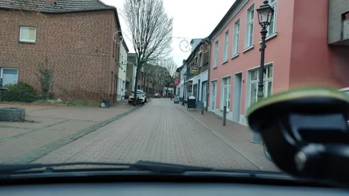
Spiegelhoff
Bakery
Ehemals Artz, ehemals Spiegelhoff, ehemals Notz
1 Weberplatz, Uedem
Su-Mo off; Tu-Th 07:00-13:00,15:00-18:30; Fr 12:00-18:30; Sa 07:00-12:30
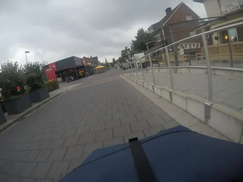
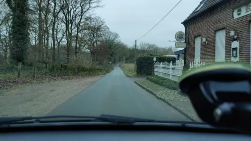
Groß
Bakery
6 Mühlenstraße, Uedem
Mo-Fr 05:30-18:00; Tu off; Sa 05:30-17:00; Su 07:00-17:00; PH Tu...


Hohe Mühle
Cafe · 1.3 km
Eine der ältesten aus Stein gebauten Windmühlen am Niederrhein, saniert 1989; Begegnungsstätte, Café und Aussichtsturm
Sa-Su 14:30-17:00 || "nach Vereinbarung"

Hosselmann
Bakery · 6.7 km
3 Cyriakusplatz
Mo-Sa 06:00-20:00; Su,PH off
31 more on the map.
History
The history of Uedem goes back to the 5th century when Frankish nobleman Udo started a settlement in the area. In 866, the first official mention of "Odeheimero Marca" appeared. with Uedem gaining town privileges in 1359.
In November 1614, the Treaty of Xanten was signed in Cleves, dividing some of the territory around Uedem.
From 1794 onwards, the First French Republic occupied the city of Uedem, and in 1798 town privileges were revoked. The occupation ended in 1814 with the First Peace of Paris.
After the Nazi takeover in 1933, Uedem fell under the administrative control of Gau Essen. Bombing during World War 2 destroyed parts of Uedem, but the city has since recovered. After the war, Uedem became a center for Bundeswehr operations, and since 1993 has hosted the NATO Combined Air Operations Centre Uedem.
From the History section of Uedem on Wikipedia, under CC BY-SA 4.0.
Where to stay12
Churches and places of worship13
Shopping10
Gas and EV charging11
Schools, colleges and libraries8
Healthcare5
Zentralapotheke der Katholisches Karl-Leisner-Klinikum gGmbH
Clinic and pharmacy · 0.6 km
37 Wellesweg, Uedem
Emanuel van Lin, Dr. med. Anja Ilgemann und Dr. med. Heike Stattaus
Clinic and pharmacy · 6.6 km
212 Voßheider Straße, Goch
Katholisches Karl-Leisner-Klinikum Wilhelm-Anton-Hospital Goch
Hospital · 6.5 km
Map of Uedem
239 places. The map loads OpenStreetMap tiles when you open it.
Getting there and nearby towns
Airport Weeze (NRN) is the nearest airport with scheduled flights listed in OpenStreetMap, 11 km away.
- Weeze 7 km southwest, about 7 min by car
- Goch 8 km west, about 8 min by car
- Kalkar 8 km north, about 8 min by car
- Kevelaer 9 km south, about 9 min by car
- Kapellen 12 km southeast, about 12 min by car
- Xanten 12 km east, about 12 min by car
- Rees 14 km northeast, about 14 min by car
- Kleve 17 km northwest, about 17 min by car
- Geldern 17 km south, about 17 min by car
- Alpen 19 km southeast, about 19 min by car
Drive times are estimates from straight-line distance, not routes.
Local news
Headlines from INDB.
Reviews, tips and questions
Loading what members have shared...
Sources and licences
- GeoNames (CC BY 4.0): population, coordinates, regions and time zone
- Mapillary (see each image): photos
- OpenStreetMap contributors (ODbL 1.0): places, airports, map data
- Wikidata (CC0 1.0): elevation, founding date, time zone, website
- Wikimedia Commons (see each image): photos
- Wikipedia (CC BY-SA 4.0): overview and history text
Photo credits
- Uedem, Gerold Schelm, CC BY-SA 3.0
- Stolpersteinlage Uedem Agathawall 3, Gmbo 2013, CC0
- Stolperstein Uedem Agathawall 3 Synagoge, Gmbo 2013, CC0
- Stolpersteine Uedem Agathawall 3, Gmbo 2013, CC0
- Stolperstein Uedem Mosterstraße 17 Irma Oster, Gmbo 2013, CC0
- Stolperstein Uedem Mosterstraße 17 Albert Oster, Gmbo 2013, CC0
- Stolpersteine Uedem Mosterstraße 17, Gmbo 2013, CC0
- Stolperstein Uedem Lohstraße 30 Selma Marchand, Gmbo 2013, CC0
- Stolperstein Uedem Lohstraße 30 Henriette Devries, Gmbo 2013, CC0
- Stolpersteine Uedem Lohstraße 30, Gmbo 2013, CC0
- Stolpersteinlage Uedem Lohstraße 30, Gmbo 2013, CC0
- Stolperstein Uedem Mosterstraße 14 Hedwig Bock, Gmbo 2013, CC0
- Stolperstein Uedem Mosterstraße 14 Bertha Bock, Gmbo 2013, CC0
- Stolperstein Uedem Mosterstraße 14 Ida Rosenthal, Gmbo 2013, CC0
- Stolpersteine Uedem Mosterstraße 14, Gmbo 2013, CC0
- Stolperstein Uedem Mosterstraße 14 Josephina Bock, Gmbo 2013, CC0
- Stolpersteinlage Uedem Mosterstraße 14, Gmbo 2013, CC0
- Stolperstein Uedem Mosterstraße 14 Hedwig David, Gmbo 2013, CC0
- Stolperstein Uedem Lohstraße 6 Alex Oppenheimer, Gmbo 2013, CC0
- Stolperstein Uedem Lohstraße 6 Ernst Oppenheimer, Gmbo 2013, CC0
- Stolperstein Uedem Lohstraße 6 Emilie Löwenthal, Gmbo 2013, CC0
- Stolpersteine Uedem Lohstraße 6, Gmbo 2013, CC0
- Stolperstein Uedem Lohstraße 14 Maria Bienemann, Gmbo 2013, CC0
- Stolpersteine Uedem Lohstraße 14, Gmbo 2013, CC0
- Stolpersteinlage Uedem Lohstraße 14, Gmbo 2013, CC0
- Stolpersteinlage Uedem Lohstraße 6, Gmbo 2013, CC0
- Stolpersteinlage Uedem Lohstraße 17, Gmbo 2013, CC0
- Stolperstein Uedem Lohstraße 17 Hermann Devries, Gmbo 2013, CC0
- Stolperstein Uedem Lohstraße 17 Ruth Devries, Gmbo 2013, CC0
- Stolperstein Uedem Lohstraße 17 Selma Devries, Gmbo 2013, CC0
- Stolperstein Uedem Lohstraße 17 Johanna Herz, Gmbo 2013, CC0
- Stolpersteine Uedem Lohstraße 17, Gmbo 2013, CC0
- Stolperstein Uedem Lohstraße 17 Alex Devries, Gmbo 2013, CC0
- Stolperstein Uedem Lohstraße 17 Hilde Devries, Gmbo 2013, CC0
- Stolperstein Uedem Lohstraße 17 Max Devries, Gmbo 2013, CC0
- Kolping-Stele, Uedem-7908, Raimond Spekking, CC BY-SA 4.0
- Kolping-Stele, Uedem-7909, Raimond Spekking, CC BY-SA 4.0
- Kolping-Stele, Uedem-7910, Raimond Spekking, CC BY-SA 4.0
- Kolping-Stele, Uedem-7911, Raimond Spekking, CC BY-SA 4.0
- HausHertefeld01, Sir Gawain, CC BY-SA 3.0
- Weeze - Sankt Cyriakus 02 ies, Frank Vincentz, CC BY-SA 3.0
- Weeze, de evangelische kerk Dm12 foto2 2013-04-30 13.35, Michielverbeek, CC BY-SA 3.0
- Haus Kolk 2012, Alohaakua, CC BY-SA 3.0
- 452 Kervenheimer Mühle, Burg Kevelaer-Kervenheim, Käthe u. Bernd Limburg, www.limburg-bernd.de, CC BY-SA 3.0 de
- Scheune, Uedemerbruch - 0869, Elke Wetzig, CC BY-SA 4.0
- Kalkar Neulouisendorfer Mühle PM19-01, Pieter Delicaat, CC BY-SA 4.0
- Uedem - Hohe Mühle 06 ies, Frank Vincentz, CC BY-SA 3.0
- Evangelische Kirche Neulouisendorf 11 PM16, Pieter Delicaat, CC BY-SA 4.0
- Zur Heiligen Familie, Uedemerbruch - 0851, Elke Wetzig, CC BY-SA 4.0
- Uedem, katholische Pfarrkirche Sankt Laurentius foto7 2016-05-05 15.51, Michielverbeek, CC BY-SA 4.0
- Street-level photo, Hightower-, CC BY-SA 4.0
- Street-level photo, poxonline, CC BY-SA 4.0
- Street-level photo, poxonline, CC BY-SA 4.0
- Street-level photo, poxonline, CC BY-SA 4.0
- Street-level photo, poxonline, CC BY-SA 4.0
- Street-level photo, poxonline, CC BY-SA 4.0
- Street-level photo, poxonline, CC BY-SA 4.0
- Street-level photo, poxonline, CC BY-SA 4.0
- Street-level photo, poxonline, CC BY-SA 4.0
- Street-level photo, poxonline, CC BY-SA 4.0
- Street-level photo, mfa, CC BY-SA 4.0
- Street-level photo, mfa, CC BY-SA 4.0
- Street-level photo, poxonline, CC BY-SA 4.0
- Street-level photo, poxonline, CC BY-SA 4.0


Page built November 9, 2026. Spotted a mistake? Tell us or suggest a place.