


Kleve, Germany
Kleve is a town of 49,072 people in North Rhine-Westphalia, Germany, founded in 1092.
Why visit Kleve
Townapedia lists 126 museums and landmarks, 83 parks and trails, 148 places to eat, 25 places to stay and 33 attractions in and around town.
Highlights include Tiergarten Kleve, Emmerich Rhine Bridge, Wasserburg Rindern and Alte Mühle Donsbrüggen.
Weather in Kleve
Forecast from MET Norway (CC BY 4.0). Full forecast
About Kleve
Kleve (German pronunciation: [ˈkleːvə] ; traditional English: Cleves KLEEVZ; Dutch: Kleef [ˈkleːf] ; French: Clèves [klɛv]; Spanish: Cléveris; Latin: Clivia; Low Rhenish: Kleff) is a town in the Lower Rhine region of northwestern Germany near the Dutch border and the River Rhine. From the 11th century onwards, Cleves was capital of a county and later a duchy. Today, Cleves is the capital of the district of Kleve in the German state of North Rhine-Westphalia. The city is home to one of the campuses of the Rhine-Waal University of Applied Sciences.
From the Wikipedia article Kleve (this version), under CC BY-SA 4.0.
Travel tips from other travellers: Kleve on Wikivoyage (CC BY-SA 4.0).
Photos of Kleve


Things to do33

Tiergarten Kleve
Zoo and aquarium · 1.5 km
74 Tiergartenstraße, Kleve
Mar-Oct: Mo-Su 09:00-18:00; Nov-Feb: Mo-Su 09:00-17:00

Emmerich Rhine Bridge
Bridge · 7.6 km
Longest suspension bridge in Germany


Aurora Kaas GmbH
Farm and orchard · 5.7 km
Familienkäserei seit 1980, Biokäse aus Kuh-Schaf-oder Ziegenmilch
55 Im Hammereisen, Kranenburg
Th-Fr 10:00-19:00, Sa 10:00-14:00
Hofmolkerei Speetenhof
Farm and orchard · 5.1 km
Lieferservice, Direktvertrieb, Familienbetrieb
120 Wibbeltstraße, Kranenburg
Mo-Sa 08:00-19:00
DAD die am Deich
Farm and orchard · 3.6 km
8 Banndeich, Kleve
Th 14:00-18:00; Fr 10:00-18:00; Sa 10:00-14:00

XOX-Theater Kleve
Cinema and theater · 0.9 km
Theatre in Kleve, Germany
21 more on the map.
Museums and landmarks126


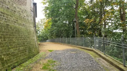
Schwanenturm
Museum
1 Schloßberg, Kleve
Apr-Oct: Mo-Su 11:00-17:00; Nov-Mar: Sa, Su 11:00-17:00




114 more on the map.
Parks, trails and playgrounds83




Gemeinschaftsgarten Versöhnungskirche
Park · 0.8 km
Jede*r darf ernten. Herzliche Einaldung vobreizukommen
71 more on the map.
Restaurants and cafes148
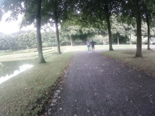
Altes Landhaus
Restaurant · German · 1.3 km
1 Joseph-Beuys-Allee, Kleve
Tu-Sa 11:00-22:00; Su 09:00-21:00
Panna&Cioccolato
Ice cream · 5.0 km
Opened März -Oktober, check website.
2 Binnenfeld, Kranenburg
Mo-Su 12:00-22:00, 12:00-20:30, 15:00-20:30
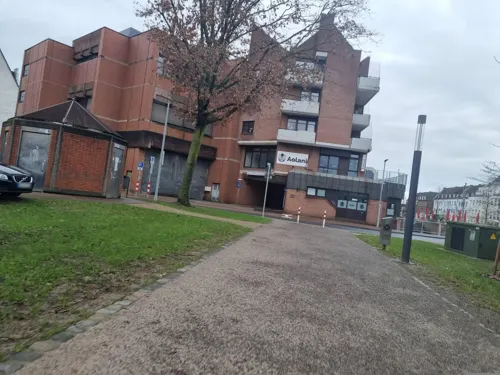
Pizzeria Capriccio II
Restaurant · Pizza
11 Brücktor, Kleve
Tu-Fr 11:30-14:00,17:00-24:00; Sa-Su 17:00-24:00
Gasthaus Früh
Bar and pub
5 Gasthausstraße, Kleve
Tu,We 16:00-23:00; Th 16:00-24:00; Fr,Sa 16:00-01:00; Su,Mo off

Cafe Königsgarten
Restaurant · German
53 Königsgarten, Kleve
Mo,Tu off; We-Fr 17:00-23:00; Sa 11:00-23:00; Su 11:00-22:00

Eiscafe & Pizzeria SICILIA
Cafe · Ice Cream, Italian, Pizza · 4.4 km
16 Klosterplatz, Bedburg-Hau
Th-Tu 12:00-21:00; We off
136 more on the map.
History
The name Kleff probably derives from Middle Dutch clef, clif 'cliff, bluff', referring to the promontory on which the Schwanenburg castle was constructed. Since the city's coat of arms displays three clover leaves (German Klee, Low German Kliev), the city's name is sometimes linked by folk etymology to the clover, but the corresponding Dutch word is klaver.
The Schwanenburg Castle, which was the residence of the Counts and later the Dukes of Cleves, stands on a steep hill. It is located at the northern terminus of the Kermisdahl where it joins with the Spoykanal, which was previously an important transportation link to the Rhine. The old castle has a massive tower, the Schwanenturm 180 feet (55 m) high, that is associated in legend with the Knight of the Swan, immortalized in Richard Wagner's Lohengrin.
Medieval Kleve grew together from four parts – the Schwanenburg Castle, the village below the castle, the first city of Kleve on Heideberg Hill, and the Neustadt ("New City"), dating from the 14th century. In 1242 Kleve received city rights. The County of Cleves, which roughly covered today's districts of Kleve, Wesel and Duisburg, was united with the Duchy of Mark in 1368. It was made a duchy itself in 1417, then united with the neighboring duchies of Jülich and Berg in 1521, when John III, Duke of Cleves, married Mary, heiress of Jülich-Berg-Ravenburg.
Read more of the history
Kleve's most famous native was Anne of Cleves (1515–1557), daughter of John III, Duke of Cleves and (briefly) the fourth wife of Henry VIII of England. Several local businesses are named after her, including the Anne von Kleve Galerie.
The ducal dynasty became extinct in the male line in 1609, leading to a succession crisis in the duchies: the War of the Jülich Succession (1609–1614). After the Thirty Years' War ended in 1648, the succession dispute was resolved with Cleves passing to the elector of Brandenburg, thus becoming an exclave of the Margraviate of Brandenburg, later Brandenburg-Prussia.
During the Thirty Years' War the city had been under the control of the Dutch Republic, which in 1647 had given Johann Moritz von Nassau-Siegen administrative control over the city. He approved a renovation of Schwanenburg Castle in the baroque style, constructed a baroque palace, the Prinzenhof, and commissioned the construction of extensive gardens that greatly influenced European landscape design. Significant amounts of his original plan for Kleve were put into effect and have been maintained to the present, a particularly well-loved example of which is the Forstgarten (Forest Garden). In 1685, a commune of French Huguenots was established in the town, and French church services were held in the castle. In 1701, Cleves became part of the Kingdom of Prussia.
During the War of the First Coalition, Cleves was captured by French Revolutionary troops on 19 October 1794. In 1795 it was incorporated into the Roer department, which became part of the Cisrhenian Republic in 1797, which in turn was formally annexed by the French First Republic in 1802, becoming the French First Empire in 1804. Prussia retrieved the city in 1815.
The mineral waters of Kleve and the wooded parkland surrounding it made it a fashionable spa in the 19th century. At this time, Kleve was named "Bad Cleve" (English: Spa of Cleves). It was not until 1935 when the German spelling of its name was officially changed from Cleve to Kleve.
During World War II Kleve was the site of one of the two radio wave stations that served the Knickebein aircraft navigation system. Luftwaffe bombers used radio beams from Kleve and a second station at Stolberg to navigate to British targets. The Knickebein system was eventually jammed by the British. It was replaced by the higher frequency X-Gerät system, which used transmitter stations located on the channel coast of France.
Kleve was heavily bombed during the Second World War, and over 90% of buildings in the city were severely damaged. During a raid on 7 October 1944 a Halifax bomber crashed into the Schwanenburg Castle. Most of the destruction was the result of a raid late in the war in 1945, conducted at the request of Lieutenant-General Brian Horrocks in preparation for Operation Veritable. Horrocks recounted his decision in the 1973 television documentary The World at War:
"Then they came to me and they said, 'Do you want the town of Cleve taken out?' By 'taken out' they meant the whole of the heavy bombers putting on to Cleve. Now, I knew that Cleve was a very fine old historical German town. Anne of Cleve, one of Henry VIII's wives, came from there. I knew that there were a lot of civilians in Cleve, men, women and children. If I said no, they would live. If I said yes, they would die. A terrible decision you’ve got to take. But... everything depended on getting a high piece of ground at Nütterden. The German reserves would have to come through Cleve, and we would have to breach the Siegfried Line and get there. And your own lives, your own troops, must come first, so I said yes, I did want it taken out. But when all those bombers went over, the night just before zero hour, to take out Cleve, I felt a murderer. And after the war I had an awful lot of nightmares, but always Cleve."
Horrocks later said that this had been "the most terrible decision I had ever taken in my life" and that he felt "physically sick" when he saw the bombers overhead.
As a result of the bombing, and subsequent fighting in the town (notably by the 129th Brigade of the 43rd Wessex Division, which entered the town in error on 10 February), relatively little of the pre-1945 city remains. Those structures spared include a number of historic villas built during the heyday of the spa Bad Kleve, located along the B9 near the Tiergarten. Of those buildings destroyed, many were reconstructed, including most of the Schwanenburg and the Stiftskirche, the Catholic parish church. Constructed on high ground, many of these landmarks can be seen from the surrounding communities.
From the History section of Kleve on Wikipedia, under CC BY-SA 4.0.
Notable people from Kleve
 Govert Flinckpainter from the Northern Netherlands (1615-1660)Photo: Govert Flinck, Public domain
 Joos van CleveFlemish painter (1485–1540)Photo: Joos van Cleve, Public domain
 Barbara HendricksGerman SPD politicianPhoto: Unknown author, CC BY-SA 4.0
 Marie Eleonore of ClevesDuchess consort of Prussia, (1550-1608)Photo: Unidentified painter, Public domain
 Anna of ClevesDuchess of Jülich-Cleves-Berg by birth and by marriage Countess Palatine of NeuburgPhoto: Master of Ac Monogram, Public domain
 Princess Henriette Amalia of Anhalt-DessauRegent of Nassau-Dietz (1666-1726)Photo: Attributed to Lancelot Volders, Public domain
- Anacharsis ClootsPrussian noble (1755-1794)
- John II, Duke of ClevesDuke of Cleves
- Agnes of ClevesNavarrese royal consort, Princess consort of Viana
- Magdalene of Jülich-Cleves-Bergdaughter of Duke Wilhelm of Jülich-Cleves-Berg and Countess Palatine of Pfalz-Zweibrücken (1553-1633)
- Bernhard von GuddenGerman psychiatrist (1824-1886)
- Catherine of ClevesDuchess of Guelders (lived 1417 to 1479)
Born in Kleve, according to Wikidata (CC0). Each name links to its Wikipedia article.
Where to stay25
Churches and places of worship32
Klinikkirche
Church · Catholic, Protestant · 4.0 km
4 Nördlicher Rundweg, Bedburg-Hau
Alte Kirche St. Antonius Hau
Church · Catholic · 3.8 km
3 An der Kirche, Bedburg-Hau
St. Martinuns
Church · Catholic · 3.0 km
41 Koppelstraße, Bedburg-Hau
Kapuzinerkloster
Church · Catholic · 1.0 km
45 Rindernscher Deich, Kleve
Shopping55
Gas and EV charging19
Schools, colleges and libraries34
Freiherr-vom-Stein Gymnasium Kleve
School · 0.7 km
9 Römerstraße, Kleve
Healthcare28
Map of Kleve
250 places. The map loads OpenStreetMap tiles when you open it.
Getting there and nearby towns
Airport Weeze (NRN) is the nearest airport with scheduled flights listed in OpenStreetMap, 21 km away.
- Kranenburg 8 km west, about 8 min by car
- Pfalzdorf 9 km south, about 9 min by car
- Kalkar 12 km southeast, about 12 min by car
- Goch 12 km south, about 12 min by car
- Uedem 17 km southeast, about 17 min by car
- Rees 18 km east, about 18 min by car
- Weeze 18 km south, about 18 min by car
- Isselburg 23 km east, about 23 min by car
- Kevelaer 24 km south, about 24 min by car
- Xanten 26 km southeast, about 26 min by car
Drive times are estimates from straight-line distance, not routes.
Towns near Kleve


Keep exploring
Local news
Headlines from INDB.
Reviews, tips and questions
Loading what members have shared...
Sources and licences
- GeoNames (CC BY 4.0): population, coordinates, regions and time zone
- Mapillary (see each image): photos
- OpenStreetMap contributors (ODbL 1.0): places, airports, map data
- Wikidata (CC0 1.0): elevation, founding date, time zone, website, landmarks and historic places
- Wikimedia Commons (see each image): photos
- Wikipedia (CC BY-SA 4.0): overview and history text
Photo credits
- Kleve tiergarten ausblick, Sebastian Veelken, CC BY-SA 3.0
- Kleve 30-12-2019 028, DeVrolijkeSchrijver, CC BY 4.0
- Kleve 30-12-2019 029, DeVrolijkeSchrijver, CC BY 4.0
- Kleve 30-12-2019 036, DeVrolijkeSchrijver, CC BY 4.0
- Kleve 30-12-2019 031, DeVrolijkeSchrijver, CC BY 4.0
- Kleve 30-12-2019 030, DeVrolijkeSchrijver, CC BY 4.0
- Kleve 04-12-2019 41, DeVrolijkeSchrijver, CC BY 4.0
- Kleve 04-12-2019 27, DeVrolijkeSchrijver, CC BY 4.0
- Kleve 04-12-2019 29, DeVrolijkeSchrijver, CC BY 4.0
- Kleve 04-12-2019 33, DeVrolijkeSchrijver, CC BY 4.0
- Kleve 04-12-2019 40, DeVrolijkeSchrijver, CC BY 4.0
- Kleve 04-12-2019 31, DeVrolijkeSchrijver, CC BY 4.0
- Kleve 04-12-2019 38, DeVrolijkeSchrijver, CC BY 4.0
- Kleve 04-12-2019 28, DeVrolijkeSchrijver, CC BY 4.0
- Kleve 04-12-2019 34, DeVrolijkeSchrijver, CC BY 4.0
- Kleve 04-12-2019 36, DeVrolijkeSchrijver, CC BY 4.0
- Kleve 04-12-2019 30, DeVrolijkeSchrijver, CC BY 4.0
- Kleve 04-12-2019 42, DeVrolijkeSchrijver, CC BY 4.0
- Kleve 04-12-2019 35, DeVrolijkeSchrijver, CC BY 4.0
- Kleve 04-12-2019 39, DeVrolijkeSchrijver, CC BY 4.0
- Kleve 04-12-2019 44, DeVrolijkeSchrijver, CC BY 4.0
- Kleve 04-12-2019 24, DeVrolijkeSchrijver, CC BY 4.0
- Kleve 04-12-2019 25, DeVrolijkeSchrijver, CC BY 4.0
- Kleve 04-12-2019 32, DeVrolijkeSchrijver, CC BY 4.0
- Kleve 04-12-2019 37, DeVrolijkeSchrijver, CC BY 4.0
- Kleve 04-12-2019 26, DeVrolijkeSchrijver, CC BY 4.0
- Kleve 04-12-2019 43, DeVrolijkeSchrijver, CC BY 4.0
- Kleve 0092, Quahadi Añtó 11:06, 30 December 2016 (UTC), CC BY-SA 4.0
- Kleve 30-12-2019 037, DeVrolijkeSchrijver, CC BY 4.0
- Kleve 30-12-2019 027, DeVrolijkeSchrijver, CC BY 4.0
- Kleve 30-12-2019 025, DeVrolijkeSchrijver, CC BY 4.0
- Kleve 30-12-2019 026, DeVrolijkeSchrijver, CC BY 4.0
- Kleve 30-12-2019 023, DeVrolijkeSchrijver, CC BY 4.0
- Kleve 30-12-2019 022, DeVrolijkeSchrijver, CC BY 4.0
- Kleve 30-12-2019 024, DeVrolijkeSchrijver, CC BY 4.0
- Kleve 30-12-2019 032, DeVrolijkeSchrijver, CC BY 4.0
- Regenbogen Kleve PM230420 01, Pieter Delicaat, CC BY-SA 4.0
- Regenbogen Kleve PM230420 02, Pieter Delicaat, CC BY-SA 4.0
- Kleve, Germany - panoramio (1), Kell Kell, CC BY-SA 3.0
- Kleve 0095, Quahadi Añtó 11:06, 30 December 2016 (UTC), CC BY-SA 4.0
- Rheinbrücke Emmerich Gesamtansicht, Raimond Spekking, CC BY-SA 4.0
- Kranenburg - Katharinenhof 02 ies, Frank Vincentz, CC BY-SA 3.0
- Schloss Moyland Panorama, 1, Rainer Lippert , bearbeitet durch Alchemist-hp, CC0
- FH Rhein-Waal Kleve (3), EveryPicture, CC BY-SA 3.0
- Kleve - Schwanenburg - 20210428065546, Helfrich, CC BY-SA 4.0
- Alt St. Antonius Abbas (Hau)3, Chris06, CC0
- Burg ranzow kleve, MiraculixHB, CC0
- Freiherr-v-stein-gymnasium kleve, MiraculixHB, CC0
- Kleine Kirche (Kleve) (3), Chris06, CC BY-SA 4.0
- LVR-Klinik Bedburg-Hau PM18-01, Pieter Delicaat, CC BY-SA 4.0
- Museum Kurhaus KLeve-4-DSC00789, Perlblau, CC BY-SA 3.0
- St martinus qualburg 2, St_martinus_qualburg.JPG : MiraculixHB 18:54, 19 September 2007 (UTC) derivative work: Rabanus Flavus ( talk ), Public domain
- NRW, Kleve - Stiftskirche, Островский Александр, Киев, CC BY-SA 3.0
- Wasserburg rindern, MiraculixHB, Public domain
- Schloss gnadenthal, MiraculixHB, Public domain
- Konrad Adenauer Gymnasium Front, Kadenauerd, CC BY-SA 4.0
- 2018-03-26 Hau Neue St. Antonius-Kirche, Fantaglobe11, CC BY-SA 4.0
- Naturschutzgebiet Emmericher Ward PM18-04, Pieter Delicaat, CC BY-SA 4.0
- St lambertus dunsbrueggen, MiraculixHB, Public domain
- KLE-044 Kranenburg Aussicht vom Wolfsberg, Photogek, CC BY-SA 3.0
- NSG Hingstberg PM20-09, Pieter Delicaat, CC BY-SA 4.0
- Bedburg-Hau Schlenk 16 PM18-04, Pieter Delicaat, CC BY-SA 4.0
- Huisberden St. Petrus PM17-1, Pieter Delicaat, CC BY-SA 4.0
- Sankt Anna, Karin Laakes, CC BY-SA 3.0
- Neue kirche st willibrord kleve kellen, MiraculixHB, CC0
- LVR-Klinik Bedburg-Hau Klinikkirche PM18-06, PIeter Delicaat, CC BY-SA 4.0
- Christus koenig kleve2, MiraculixHB, CC0
- Kleve NSG Geldenberg PM19-04, Pieter Delicaat, CC BY-SA 4.0
- Naturschutzgebiet Kermisdahl PM20-03, Pieter Delicaat, CC BY-SA 4.0
- Kranenburger Bruch Naturschutzgebiet, Dajome 19, CC BY-SA 4.0
- Teich sieben quellen, MiraculixHB, Public domain
- XOX-Theater Kleve, Karin Laakes 01:30, 8. Jul. 2009 (CEST), CC BY-SA 3.0
- Neuer Tiergarten Kleve, Raimond Spekking, CC BY-SA 4.0
- Alte Mühle Donsbrüggen PM22-01, Pieter Delicaat, CC BY-SA 4.0
- Street-level photo, helfrich, CC BY-SA 4.0
- Street-level photo, helfrich, CC BY-SA 4.0
- Street-level photo, helfrich, CC BY-SA 4.0
- Street-level photo, helfrich, CC BY-SA 4.0
- Street-level photo, poxonline, CC BY-SA 4.0
- Street-level photo, Lowiekse, CC BY-SA 4.0
- Street-level photo, helfrich, CC BY-SA 4.0
- Street-level photo, helfrich, CC BY-SA 4.0
- Street-level photo, helfrich, CC BY-SA 4.0
- Street-level photo, helfrich, CC BY-SA 4.0
- Street-level photo, helfrich, CC BY-SA 4.0
- Street-level photo, helfrich, CC BY-SA 4.0
- Street-level photo, helfrich, CC BY-SA 4.0
- Street-level photo, helfrich, CC BY-SA 4.0
- Street-level photo, helfrich, CC BY-SA 4.0
- Street-level photo, helfrich, CC BY-SA 4.0
- Street-level photo, helfrich, CC BY-SA 4.0
- Street-level photo, helfrich, CC BY-SA 4.0
- Street-level photo, helfrich, CC BY-SA 4.0
- Street-level photo, poxonline, CC BY-SA 4.0
- Street-level photo, poxonline, CC BY-SA 4.0
- Street-level photo, helfrich, CC BY-SA 4.0
- Street-level photo, RobotChrome, CC BY-SA 4.0
- Street-level photo, helfrich, CC BY-SA 4.0
- Street-level photo, helfrich, CC BY-SA 4.0


Page built November 9, 2026. Spotted a mistake? Tell us or suggest a place.