


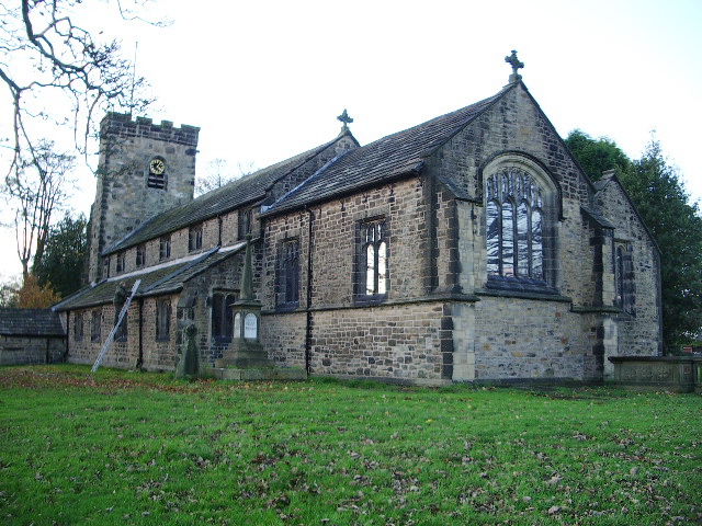


Accrington, United Kingdom
Accrington is a town of 34,897 people in England, United Kingdom.
Why visit Accrington
Townapedia lists 6 museums and landmarks, 12 parks and trails, 34 places to eat, 1 place to stay and 1 attraction in and around town.
Highlights include Vue, Haworth Art Gallery, Oak Hill Park Mansion and Crown Ground.
Weather in Accrington
Forecast from MET Norway (CC BY 4.0). Full forecast
About Accrington
Accrington is a town in the Hyndburn borough of Lancashire, England. It lies about 4 miles (6 km) east of Blackburn, 6 miles (10 km) west of Burnley, 13 miles (21 km) east of Preston, 20 miles (32 km) north of Manchester and is situated on the culverted River Hyndburn. Commonly abbreviated by locals to "Accy", the town has a population of 35,456 according to the 2011 census. Accrington is the largest settlement and the seat of the Hyndburn borough council.
From the Wikipedia article Accrington (this version), under CC BY-SA 4.0.
Travel tips from other travellers: Accrington on Wikivoyage (CC BY-SA 4.0).
Things to do1

Museums and landmarks6

Haworth Art Gallery
Museum · 0.9 mi
Art gallery, museum and park in Lancashire, England, United Kingdom

Peel Monument
Monument and historic site · 0.6 mi
Just after the start of the 1900s, land owned by the Peel family was donated to the people of Accrington by William Peel. Although he...
Parks, trails and playgrounds12

Crown Ground
Sports field and stadium · 0.9 mi
Livingstone Road, Accrington



Gatty Park
Park · 0.9 mi
Awarded a Green Flag for 2016 - 2017 Gatty Park BB5 4AE is around 3 hectares and situated to the north of Hyndburn Road in the township...

Restaurants and cafes34


The Crown Inn
Bar and pub · 0.9 mi
Whalley Road, Accrington
Mo-Th 12:00-23:00; Fr-Sa 12:00-00:30; Su 09:00-22:30
The Whitakers Arms
Bar and pub · 0.7 mi
322 Burnley Road, Accrington
Mo-Th 12:00-23:00; Fr-Sa 12:00-00:00; Su 12:00-22:30

The Grey Horse Hotel
Bar and pub · 0.7 mi
263 Whalley Road, Accrington
Mo-We 12:00-23:30; Th-Su 12:00-00:00
22 more on the map.
History
The name "Accrington" likely has Anglo-Saxon origins. The earliest known recording of the name is found in the Parish of Whalley records from 850, where it is written as "Akeringastun". In subsequent records, the name appears in various forms, including "Akarinton" in 1194, "Akerunton", "Akerinton", and "Akerynton" in 1258, "Acrinton" in 1292, "Ackryngton" in 1311, and "Acryngton" in 1324. The name may derive from the Old English words "æcern", meaning "acorn", and "tun", meaning "farmstead" or "village", thus possibly meaning "acorn farmstead". However, some sources argue that this interpretation is not definitive and that alternative explanations may exist.
New Accrington, the southern part of the town, was historically part of the Forest of Blackburnshire. The area's abundance of oak trees can be inferred from local place names such as Broad Oak and Oak Hill. Acorns, a product of oak trees, were once a crucial food source for swine, which may have led to the naming of a farmstead after this resource. In the Lancashire dialect, "acorn" is pronounced "akran", which might have influenced the name's development.
Read more of the history
No known Old English personal name corresponds to the first element in "Accrington". Nevertheless, the Frisian names "Akkrum" and "Akkeringa", as well as the Dutch name "Akkerghem", are believed to derive from the personal name "Akker". This finding suggests the possibility of a related Old English name from which "Accrington" could have originated. It is also worth noting that "Ingas" is the Old Norse word for "tribe", which may be relevant to the name's origin.
Overall, the etymology of "Accrington" is complex and there are several theories about its origin. While the "acorn farmstead" interpretation is the most commonly accepted explanation, further research and analysis may be needed to confirm or refute this theory, or to identify alternative possibilities.
There appears to be no mention of Accrington from the Roman period. The area typically appears to be heavily forested, with very few established settlements. According to folklore, a tall Danish tribal leader named Wada invaded the area between 760 and 798; who seems to have founded Waddington, Paddington (Padiham) and Akeringastun (Accrington). Descendants of the Wada held much of the lands until the sixteenth century. In 1442, the Waddingtons' hold leases on Berefeld (Bellfield), and in 1517 it is recorded that Thomas Waddington transferred the lands Scaytcliff (Scaitcliffe) and Peneworth (Pennyworth) to Nicholas Rishton and to his Son Geoffrey.
Accrington covers two townships which were established in 1507 following disafforestation; those of Old Accrington and New Accrington; which were merged in 1878 with the incorporation of the borough council. The William Yates map of The county Palatine of Lancaster printed in 1786 shows Old Accrington included the area of Oaklea and also the intersection of the Winburn River (now the River Hyndburn) and Warmden Brook. New Accrington included the area of Green Haworth and Broadfield. There have been settlements there since the medieval period, likely in the Grange Lane and Black Abbey area, and the King's Highway which passes above the town was at one time used by the kings and queens of England when they used the area for hunting when the Forest of Accrington was one of the four forests of the hundred of Blackburnshire.
Robert de Lacy gave the manor of Accrington to the monks of Kirkstall in the 12th century. The monks built a grange there; removing the inhabitants to make room for it. The locals got their revenge by setting fire to the new building, destroying its contents and in the process killing the three lay brothers who occupied it. An area of the town is named 'Black Abbey', a possible reference to the murders. Regardless of whatever happened, Accrington did not remain under monastic control for long before reverting to the de Lacys.
It is thought the monks of Kirkstall may have built a small chapel there during their tenure for the convenience of those in charge residing there and their tenants, but the records are uncertain. What is known is that there was a chapel in Accrington prior to 1553 where the vicar of Whalley was responsible for the maintenance of divine worship. However it did not have its own minister and it was served, when at all, by the curate of one of the adjacent chapels. In 1717 Accrington was served by the curate of Church, who preached there only once a month. St. James's Church was built in 1763, replacing the old chapel however it did not achieve parochial status until as late as 1870.
Until around 1830, visitors considered Accrington to be just a "considerable village". The Industrial Revolution, however, resulted in large changes and Accrington's location on the confluence of a number of streams made it attractive to industry and a number of mills were built in the town in the mid-18th century. Further industrialisation then followed in the late-18th century and local landowners began building mansions in the area on the outskirts of the settlement where their mills were located while their employees lived in overcrowded unsanitary conditions in the centre.
Industrialisation resulted in rapid population growth during the 19th century, as people moved from over North West England to Accrington, with the population increasing from 3,266 in 1811 to 10,376 in 1851 to 43,211 in 1901 to its peak in 1911 at 45,029.
This fast population growth and slow response from the established church allowed non-conformism to flourish in the town. By the mid-19th century, there were Wesleyan, Primitive Methodist, United Free Methodist, Congregationalist, Baptist, Swedenborgian, Unitarian, Roman Catholic and Catholic Apostolic churches in the town. The Swedenborgian church was so grand that it was considered to be the 'Cathedral' of that denomination.
From the History section of Accrington on Wikipedia, under CC BY-SA 4.0.
More about Accrington
Geography
Accrington is a hill town located at between the Pennines and the West Pennine Moors, within a bowl and largely encircled by surrounding hills to rising to a height of 409 metres (1,342 ft) in the case of Hameldon Hill to the east. The River Hyndburn or Accrington Brook flows through the centre of the town. Hill settlements origins were as the economic foci of the district engaging in the spinning and weaving of woollen cloth. Wool, lead and coal were other local industries.
Geographical coordinates: 53° 46' 0" North, 2° 21' 0" West. Height above sea level: there is a spot height outside the Market Hall which is 133.5 metres (438 ft) the benchmark on the side of the neighbouring Town Hall is 441.10 feet (134.45 m). The highest height in the town is 320 metres (1,050 ft) which is in Baxenden and the lowest at the town hall which is at 132.5 metres (435 ft). Accrington is lowering in elevation travelling northwards towards the Hyndburn. North of the river the elevation rises again, crossing over the watershed between Hyndburn and River Calder, both eventually leading into River Ribble via separate routes. The Hyndburn district further north eventually falls to the modest elevation of the Calder river banks.
Economy
Historically, cotton and textile machinery were important industries in Accrington, with many mills and factories operating in the town during the 19th and early 20th centuries. The town was renowned for its production of cotton cloth, and several of its mills became famous for their high-quality fabrics, including the Victoria and Jubilee mills. However, like many other towns in Lancashire, the decline of the cotton industry in the mid-20th century led to a significant reduction in manufacturing activity in Accrington.
One notable industrial product associated with Accrington is NORI bricks, a type of iron-hard engineering brick that was produced in nearby Huncoat. The NORI brickworks were established in the 1860s, and their products were widely used in the construction of mills, factories, and other industrial buildings throughout the north of England, as well as Blackpool Tower and the Empire State Building. The brickworks closed in 2013 due to declining demand, but reopened in 2015 after being acquired by a local businessman.
Education
The college in the town centre is Accrington and Rossendale College; nearby universities include University Centre at Blackburn College, and the University of Central Lancashire in Preston.
From the Wikipedia article Accrington, under CC BY-SA 4.0.
Notable people from Accrington
 Jon AndersonEnglish musicianPhoto: Sven Mandel, CC BY-SA 4.0
 Harrison BirtwistleEnglish composer (1934–2022)Photo: MITO SettembreMusica, CC BY 2.0
 Ron HillEnglish former runner and clothing entrepreneur (1938–2021)Photo: Bert Verhoeff for Anefo, CC BY-SA 3.0 nl
 Julie HesmondhalghEnglish actressPhoto: Harry (Howard) Potts, CC BY 2.0
 Graham JonesBritish politician (born 1966)Photo: Chris McAndrew, CC BY 3.0
 Dominic KnowlesEnglish association football player (born 1992)Photo: Mattythewhite, CC BY-SA 3.0
- Mike DuxburyEnglish footballer (born 1959)
- Graham LloydEnglish cricketer (born 1969)
- John TomlinsonBritish opera singer (born 1946)
- Richard ChaplowBritish footballer (born 1985)
- Shokat AliBritish snooker player
- Graeme FowlerEnglish Test and County cricketer (born 1957)
Born in Accrington, according to Wikidata (CC0). Each name links to its Wikipedia article.
Where to stay1
Pilkingtons Bed & Breakfast
Motel and hotel · 0.5 mi
135 Blackburn Road, Accrington
Churches and places of worship19
Shopping12
Gas and EV charging4
Schools, colleges and libraries25
Accrington Benjamin Hargreaves Church of England Primary School
School · Anglican
Barnfield Street, Accrington
Accrington St John with St Augustine Church of England Primary School
School · Anglican
Maudsley Street, Accrington
Baxenden St John's Church of England Primary School
School · Anglican · 1.5 mi
Church Avenue, Accrington
Green Haworth Church of England Primary School
School · Anglican · 1.5 mi
School House Lane, Accrington
Oswaldtwistle St Paul's Church of England Primary School
School · Anglican · 1.4 mi
Union Road, Accrington
Sacred Heart Roman Catholic Primary School, Church
School · Roman Catholic · 1.2 mi
Bradshaw Row, Accrington
St Christopher's Church of England High School
School · Anglican · 1.0 mi
Queen's Road West, Accrington
St Mary Magdalen's Church of England Primary School
School · Anglican · 0.5 mi
Devonshire Street, Accrington
St Oswald's Roman Catholic Primary School, Accrington
School · Roman Catholic · 1.2 mi
Hartley Avenue, Accrington
Healthcare5
Acorn Primary Healthcare Centre
Clinic and pharmacy · 1.1 mi
421 Blackburn Road, Accrington
Baxenden Pharmacy
Clinic and pharmacy · 1.4 mi
514-516 Manchester Road, Accrington
Map of Accrington
119 places. The map loads OpenStreetMap tiles when you open it.
Getting there and nearby towns
Warton Aerodrome (WRT) is the nearest airport with scheduled flights listed in OpenStreetMap, 22 miles away.
- Great Harwood 3 mi northwest, about 5 min by car
- Haslingden 4 mi south, about 6 min by car
- Padiham 4 mi northeast, about 6 min by car
- Blackburn 5 mi west, about 8 min by car
- Rawtenstall 5 mi southeast, about 8 min by car
- Burnley 6 mi northeast, about 10 min by car
- Darwen 6 mi southwest, about 9 min by car
- Brierfield 7 mi northeast, about 11 min by car
- Bacup 7 mi southeast, about 12 min by car
- Ramsbottom 8 mi south, about 12 min by car
Drive times are estimates from straight-line distance, not routes.
Towns near Accrington


Keep exploring
Local news
Headlines from INDB.
Reviews, tips and questions
Loading what members have shared...
Sources and licences
- GeoNames (CC BY 4.0): population, coordinates, regions and time zone
- Mapillary (see each image): photos
- OpenStreetMap contributors (ODbL 1.0): places, airports, map data
- Wikidata (CC0 1.0): elevation, founding date, time zone, website, landmarks and historic places
- Wikimedia Commons (see each image): photos
- Wikipedia (CC BY-SA 4.0): overview and history text
Photo credits
- Cut Mark at Accrington, Old Adelphi Pub, Ray Hutchings, CC BY-SA 4.0
- Cut Mark at Accrington, Water Street, Ray Hutchings, CC BY-SA 4.0
- Cut Mark at Accrington, 1 Abbey Street, Ray Hutchings, CC BY-SA 4.0
- St Bartholomew's Church, Great Harwood, Alexander P Kapp, CC BY-SA 2.0
- St James' Church, Altham, Alexander P Kapp, CC BY-SA 2.0
- St John's Church, Great Harwood, Alexander P Kapp, CC BY-SA 2.0
- St James, Accrington (6224146136), Tim Green from Bradford, CC BY 2.0
- St John's Church, Baxenden, David Dixon, CC BY-SA 2.0
- Accrington Stanley Crown Ground 2019, COYB01, CC BY-SA 4.0
- War Memorial, Oak Hill Park, Accrington, Stuart Wilding, CC BY-SA 2.0
- Street-level photo, tonys999, CC BY-SA 4.0
- Street-level photo, tonys999, CC BY-SA 4.0


Page built November 10, 2026. Spotted a mistake? Tell us or suggest a place.