


Why visit Acton
Townapedia lists 96 museums and landmarks, 84 parks and trails, 151 places to eat, 36 places to stay and 28 attractions in and around town.
Highlights include Bush Hall, Richmond Theatre, Kew Palace and The Musical Museum.
Weather in Acton
Forecast from MET Norway (CC BY 4.0). Full forecast
About Acton
Acton is a town in West London, England, within the London Borough of Ealing. It is 6.1 miles (10 km) west of Charing Cross.
From the Wikipedia article Acton, London (this version), under CC BY-SA 4.0.
Photos of Acton


Things to do28

Bush Hall
Cinema and theater · 1.9 mi
Bush Hall was built in 1904. It was used as a soup kitchen during World War II, in the late 1950s and early 1960s as a bingo hall and...
310 Uxbridge Road, London

Richmond Theatre
Cinema and theater · 3.6 mi
Theatre in Richmond 1765–1884

Barnes Railway Bridge
Bridge · 2.7 mi
Railway bridge and footbridge in London, England, UK

Bush Theatre
Cinema and theater · 2.2 mi
Theatre in Shepherd's Bush, London, England

Hammersmith Apollo
Cinema and theater · 2.6 mi
Music and entertainment venue in Hammersmith, London, England, UK


King's Theatre, Hammersmith
Cinema and theater · 2.7 mi
Former theatre in Hammersmith, London, England

London Butterfly House
Zoo and aquarium · 2.7 mi
Zoo in Middlesex, England

Lyric Theatre
Cinema and theater · 2.4 mi
Theatre in King Street, in the London Borough of Hammersmith and Fulham

Old Shepherd’s Bush Library
Cinema and theater · 2.2 mi
Former library in London, now home to the Bush Theatre

Orange Tree Theatre
Cinema and theater · 3.3 mi
Theatre in Richmond, London, England

16 more on the map.
Museums and landmarks96


Hogarth's House
Museum · 1.8 mi
Hogarth Lane, London
Tu-Su 12:00-17:00; PH 12:00-17:00; Dec 24-26 off; Jan 01 off; easter off

London Museum of Water and Steam
Museum · 1.5 mi
Green Dragon Lane, London
Th-Su 10:00-16:00; Jul 22-Aug 28 We 10:00-16:00; SH 10:00-16:00


Bolan's Rock Shrine
Monument and historic site · 3.4 mi
Memorial in Barnes, London

Boston Manor
Museum · 2.2 mi
Historic house museum in Brentford, London, UK

Bromhead Memorial
Monument and historic site · 3.6 mi
War memorial in Richmond Cemetery, London

Fulham Palace
Museum · 3.7 mi
Grade I listed historic house museum in London Borough of Hammersmith and Fulham, United Kingdom


The Ealing Doll House
Museum · 1.3 mi
12 Haven Green, London
Mo-Fr || "by appointment"; Sa 11:30-15:30
84 more on the map.
Parks, trails and playgrounds84


Gunnersbury Triangle Local Nature Reserve
Hiking and trails · 1.0 mi

Litten Nature Reserve
Park · 3.6 mi
Nature reserve in London, England


East Sheen Common
Park · 3.6 mi
Public space in East Sheen, London, England

72 more on the map.
Restaurants and cafes151
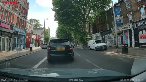

The Crown and Anchor
Bar and pub · Burger, Fish And Chips, Wings · 1.2 mi
374 Chiswick High Road, London
Mo-Sa 12:00-23:00; Su 12:00-22:00
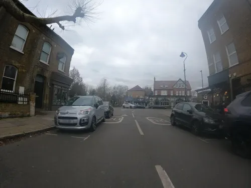
Paperback Coffee & Books
Cafe · Coffee Shop · 1.3 mi
73 St Mary's Road, London
Mo-Th 08:00-16:00; Fr-Sa 08:00-17:00; Su 08:00-15:00

Princess Victoria
Bar and pub · 1.5 mi
217 Uxbridge Road, London
Mo-Th 11:00-23:00; Fr-Sa 11:00-24:00; Su 11:00-22:30

The Duke of Sussex
Bar and pub · 1.0 mi
75 South Parade, London
Mo-Th 12:00-23:00; Fr-Sa 12:00-24:00; Su 12:00-22:00

The Forester
Bar and pub · 1.9 mi
2 Leighton Road, London
Mo 11:00-22:00; Tu-Sa 11:00-24:00; Su 11:00-22:30

The Old Pack Horse
Bar and pub · 1.2 mi
434 Chiswick High Road, London
Mo-Th,Sa 12:00-24:00; Fr 12:00-26:00; Su 12:00-23:00

George & Dragon
Bar and pub
183 High Street, London
Mo-Th 17:00-23:00; Fr 15:00-24:00; Sa 12:00-24:00; Su 12:00-22:00

George and Devonshire
Bar and pub · 1.9 mi
Dating back to 1650, the George & Devonshire in Chiswick serves up a slice of history alongside its fabulous food and drink
8 Burlington Lane, London
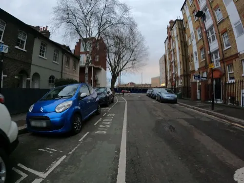
Kuyamoto
Restaurant · Japanese · 1.2 mi
"Sushi & bento"
470 Chiswick High Road, London
Mo-We 12:00-15:00,17:00-22:00; Th-Sa 12:00-15:00,17:00-22:30; Su...
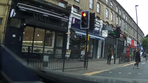
O!Burger / O!Pizza
Restaurant · Pizza, Burger, Pasta · 1.0 mi
Burger and pizza resturaunt with eat-in and take away. Pre-order burgers: https://o-burger.co.uk/, Pre-order pizza: https://o-pizza.online/
115 The Vale, London
Mo-Su 11:30-23:00

Caffè Nero
Cafe · Coffee Shop · 1.2 mi
34 The Broadway, London
Mo-Fr 06:30-20:30; Sa 07:00-20:30; Su 08:00-20:30
139 more on the map.
History
A number of finds indicate prehistoric settlement in Acton. The earliest are a cluster of Upper Palaeolithic and Mesolithic flint cores, flakes and artefacts found mainly to the north of Churchfield Road. Around the Mill Hill Park area, a Neolithic axe, and a group of Bronze Age Deverel-Rimbury urns and cremated bone were found, along with an Iron Age pot shard. Iron Age coins were also found near Bollo Lane. The Roman period is represented by a ditch in the same area, and a hoard north of Springfield Gardens. In the Middle Ages the northern half of the parish was heavily wooded. Oaks and elms still stood along roads and hedgerows and in private grounds in the early 20th century, but most of the woodland had been cleared by the 17th century, even on the extensive Old Oak common.
Landholders figuring in county records were resident by 1222 and houses were recorded from the late 13th century. The main settlement, Church Acton or Acton town, lay slightly west of the centre of the parish along the highway to Oxford (Uxbridge Road) at the 5-mile post out of London. By 1380 some of the tenements, such as The Tabard and The Cock, along the south side of the road, were inns. The hamlet of East Acton, mentioned in 1294, consisted of farmhouses and cottages north and south of common land known as East Acton green by 1474.
Read more of the history
Medieval settlement was mainly around the two hamlets. At Church Acton most of the farmhouses lay along the Oxford road or Horn Lane, with only a few outlying farms. Friars Place Farm at the north end of Horn Lane and the moated site to the west, occupied until the 15th century, were early farms. East of Friars Place farm were commons: Worton or Watton Green and Rush green in the 16th and 17th centuries, and Friars Place in the 18th century, where there was some settlement by 1664. To the north-west were Acton or Old Oak wells, known by 1613. In the parish's extreme south, a few farmhouses on the northern side of Acton common or Acton Green were mentioned as in Turnham Green until the 19th century and were linked more closely with that village than with Acton. Gregories, mentioned in 1551 as a copyhold tenement with 30 a. near Bollo Lane and the Brentford high road, probably lay in Acton.
Londoners were increasingly involved in land sales from the early 14th century but apparently did not live in Acton until the late 15th. The manor, part of Fulham, had no resident (demesne) lord, and apart from a brief period before c. 1735, when a branch of the landed Somerset (Duke of Beaufort's) family lived in Acton, there were no large resident landowners. Many of the tenements without land, including most of the inns, frequently changed hands.
The parish had 158 communicants in 1548. In 1664 it had 72 chargeable households and 59 exempt, with 6 empty houses. Six houses had 10 or more hearths, 16 had from 5 to 9, 33 had 3 or 4, 23 had 2, and 53 had 1. Acton had about 160 families resident in the mid 18th century.
By the 17th century Acton's proximity to London had made it a summer retreat for courtiers and lawyers. Sir Richard Sutton bought the seat at East Acton known later as Manor House in 1610 and Sir Henry Garraway probably rebuilt Acton House in 1638. Sir John Trevor MP bought several Acton properties in the mid 17th century, including Berrymead/Berrymede, improving it with a lake and stream, home of George Savile, 1st Marquess of Halifax and his second son after him, and afterwards of the Duke of Kingston-upon-Hull, with a much-praised landscape.
Acton was lauded as "blessed with very sweet air" in 1706 by rector urging a friend in verse to move there. The fashion for medicinal waters brought a brief period of fame, with the exploitation of the wells at Old Oak common, when East Acton and Friars Place were said to be thronged with summer visitors, who had brought about improvement in the houses there. Although high society had left Acton by the mid 18th century, many professional and military men bought houses there, sometimes including a small park, until well into the 19th century. The break-up of the 800 acres (3.2 km2) Fetherstonhaugh estate, which had had no resident owner, produced four or five small estates whose owners, professional men such as Samuel Wegg, John Winter, and Richard White, were active in parish affairs. Grand early homes included: Heathfield Lodge, West Lodge, and East Lodge by Winter c. 1800, Mill Hill House by White, and Woodlands at Acton Hill soon afterwards. Acton Green also became increasingly popular, being near Chiswick High Road (the Great West Road). Fairlawn, substantial, on west side of the green, was the home of the botanist John Lindley (1797–1865) as was the house to the north and Bedford House, another home of Lindley, and Melbourne House further east. A short row of houses had been built on the south side of the green by 1800.
In 1804, Derwentwater House was built in the grounds of Acton House by the Selby family.
In 1812, twenty almshouses were built by the Worshipful Company of Goldsmiths on the former Perryn estate, on land which had been left to the company by John Perryn in 1657.
There were 241 inhabited houses in 1801 and 426 by 1831. Growth took place mainly in the established residential neighbourhoods of Acton town and East Acton, but Acton Green also had acquired a cluster of cottages and houses at the bottom of Acton Lane by 1842. Acton was mostly rural in 1831. The few mansions contrasted sharply with most of the houses, which were described as 'beneath mediocrity of character'. Despite an overall rise in the number of houses, poor rates had to be increased in the 1820s because of a growing number of empty dwellings.
From the History section of Acton, London on Wikipedia, under CC BY-SA 4.0.
More about Acton
Education
There are six state-funded primary schools in Acton, Berrymede Junior School, Derwentwater Primary School, East Acton Primary School, St Vincent's RC Primary School, West Acton Primary School, West Twyford Primary School. The Ark (charity) has opened two primary academies in Acton, Ark Priory Primary Academy in 2013 and Ark Byron Primary Academy in 2015, the latter is based in Acton Park.
Acton has three state-funded secondary high schools, Ark Acton Academy (formerly Acton High School), Twyford Church of England High School and The Ellen Wilkinson School for Girls. Acton was once home to another independent school, Haberdashers' Aske's School for Girls before it changed its site to Elstree, the Acton site becoming the Cardinal Newman Roman Catholic High School.
From the Wikipedia article Acton, London, under CC BY-SA 4.0.
Notable people from Acton
 Alan RickmanBritish actor and director (1946–2016)Photo: Marie-Lan Nguyen, CC BY 2.0
 Hal Robson-KanuWelsh association football player (born 1989)Photo: Steindy ( talk ) 16:14, 10 November..., CC BY-SA 3.0
 Les FerdinandEnglish association football player (born 1966)Photo: Brian Minkoff- London Pixels, CC BY-SA 4.0
 Bruce Fraser, 1st Baron Fraser of North CapeRoyal Navy admiral of the fleet (1888-1981)Photo: Royal Navy official photographer, Public domain
 Adam FaithEnglish singer, actor and financial journalist (1940–2003)Photo: Jack de Nijs for Anefo / Anefo, CC0
 Freddie de GuingandBritish Army general (1900–1979)Photo: Official photograph, Public domain
 Ethel PedleyAustralian writerPhoto: High Resolution Scan Provided by..., CC BY-SA 4.0
 Gerald Grahamrecipient of the Victoria Cross (1831–1899)Photo: Unknown author Unknown author, Public domain
 Mark SmithEnglish actor and body builderPhoto: RealTVfilms, CC BY-SA 3.0
- Kit HaringtonEnglish actor (born 1986)
- Asma al-AssadFirst Lady of Syrian Arab Republic (2000-2024)
- Bill OwenBritish actor and songwriter (1914–1999)
Born in Acton, according to Wikidata (CC0). Each name links to its Wikipedia article.
Where to stay36
Churches and places of worship71
Cathedral of the Nativity of the Mother of God and the Holy Royal Martyrs
Church · Orthodox · 1.3 mi
57 Harvard Road, London
Shopping73
Gas and EV charging33
Schools, colleges and libraries39
Healthcare36
HCA UK Chiswick Outpatients & Diagnostics Centre
Clinic and pharmacy · 1.2 mi
347-353 Chiswick High Road, London
Map of Acton
250 places. The map loads OpenStreetMap tiles when you open it.
Getting there and nearby towns
RAF Northolt (NHT) is the nearest airport with scheduled flights listed in OpenStreetMap, 7 miles away.
- Kew 2 mi south, about 3 min by car
- West Ealing 2 mi west, about 3 min by car
- Brentford 2 mi southwest, about 3 min by car
- Shepherds Bush 2 mi east, about 4 min by car
- Harlesden 2 mi northeast, about 4 min by car
- Willesden 2 mi northeast, about 4 min by car
- Barnes 3 mi southeast, about 4 min by car
- Mortlake 3 mi south, about 4 min by car
- Wembley 3 mi north, about 5 min by car
- East Sheen 3 mi south, about 5 min by car
Drive times are estimates from straight-line distance, not routes.
Towns near Acton


Keep exploring
Local news
Headlines from INDB.
Reviews, tips and questions
Loading what members have shared...
Sources and licences
- GeoNames (CC BY 4.0): population, coordinates, regions and time zone
- Mapillary (see each image): photos
- OpenStreetMap contributors (ODbL 1.0): places, airports, map data
- Wikidata (CC0 1.0): elevation, founding date, time zone, website, landmarks and historic places
- Wikimedia Commons (see each image): photos
- Wikipedia (CC BY-SA 4.0): overview and history text
Photo credits
- Actontownhall2, Patche99z, Public domain
- Chatsworth, Acton 2025-08-29, Ewan Munro, CC BY-SA 4.0
- Chatsworth, Acton, W3, Ewan-M, CC BY-SA 2.0
- Red Lion and Pineapple, Acton, W3 (4462904803), Ewan Munro from London, UK, CC BY-SA 2.0
- Wesleyan chapel, Acton (47247), Rc1959, CC BY-SA 4.0
- Red Lion and Pineapple, Acton 2025-08-29, Ewan Munro, CC BY-SA 4.0
- Wesleyan chapel, Acton (21801), Rc1959, CC BY-SA 4.0
- Redback, Acton, W3 (4463685390), Ewan Munro from London, UK, CC BY-SA 2.0
- Aeronaut, Acton, W3, Ewan-M, CC BY-SA 2.0
- Second Richmond Theatre (1765-1884), Unknown author Unknown author, Public domain
- BarnesRailwayBridgeUpstream, Graeme Kerr, CC BY 2.5
- Hammersmith Apollo 2008 06 19, Alex.muller, CC BY-SA 3.0
- Hammersmith flyover 6523r, Patche99z, Public domain
- The lyric hammersmith, Tarquin Binary, Public domain
- Passmore Edwards Library Shepherds Bush, Alex Williams, CC BY-SA 3.0
- Marc Bolan's Rock Shrine - 1 - 2023-01-21, The wub, CC BY-SA 4.0
- Boston manor front 2943, P.g.champion, CC BY-SA 2.0 uk
- Bromhead memorial with wreaths, Robert Smith, CC BY-SA 4.0
- Fulham Palace, Michael Coppins, CC BY-SA 4.0
- Pond Walpole 734, P.g.champion, CC BY 2.0 uk
- Bishops-park, Peter Damian, CC BY-SA 3.0
- Blondin Park nature reserve 6, Dudley Miles, CC BY-SA 3.0
- Duke's Hollow, Dudley Miles, CC BY-SA 3.0
- Litten Local Nature Reserve, Dudley Miles, CC BY-SA 3.0
- Loftus Road 36, Zakarie Faibis, CC BY-SA 4.0
- Chiswick House from SE, Michael Coppins, CC BY-SA 4.0
- London Transport Museum (42206944281), Wei-Te Wong from Taipei City, Taiwan, Republic of China, CC BY-SA 2.0
- Griffin Park aerial 2011, Photo: Andreas Praefcke, Public domain
- The Musical Museum, Brentford, London., Jim Linwood, CC BY 2.0
- Bush Hall London, Chris Brown, CC BY-SA 2.0
- Gunnersbury Triangle 'Mangrove Swamp', Chiswick Chap, CC BY-SA 3.0
- Hogarths house 5832, Unknown author, Public domain
- Holiday Inn Express, North End Road, Fulham, London 01, Edwardx, CC BY-SA 4.0
- London Museum of Water & Steam entrance, Smurfy, CC0
- Queen Charlotte's and Chelsea Hospital, London in spring 2013 (7), Chmee2, CC BY-SA 3.0
- George and Devonshire, Chiswick, W4 (4794395278), Ewan Munro from London, UK, CC BY-SA 2.0
- Old Pack Horse, Chiswick, W4 (2446507593), Ewan Munro from London, UK, CC BY-SA 2.0
- St Nicholas church Chiswick 806r, Patche99z, Public domain
- Forester, Northfields, W13 (7970746162), Ewan Munro from London, UK, CC BY-SA 2.0
- Russian Orthodox Cathedral, Gunnersbury - 1, The wub, CC BY-SA 4.0
- Acton Hill Church 2015, Bándíttos, CC BY-SA 4.0
- Ravenscourt Baptist Church 02, Edward Hands, CC BY-SA 4.0
- Crown and Anchor, Chiswick, W4 (4802177647), Ewan Munro from London, UK, CC BY-SA 2.0
- Duke of Sussex Corner View, Ian Alexander, CC BY-SA 4.0
- George & Dragon - Acton, MattB-503, CC BY-SA 4.0
- Princess Victoria Pub, Alexander Williams, CC BY-SA 4.0
- Ealing Fields High School 1, Katya H., CC BY-SA 4.0
- St. Lukes Church on Uxbridge Road in London W12, spring 2013 (3), Chmee2, CC BY-SA 3.0
- Kew Palace (5942717068), xlibber, CC BY 2.0
- Saint Benedict's Church, Ealing Abbey (View from South - 01), Doyle of London, CC BY-SA 4.0
- Butterfly at Syon House, Keven Law from Los Angeles, USA, CC BY-SA 2.0
- St Augustine's Priory 1, Mx. Granger, CC0
- Long Wood, Norwood Green 1, Dudley Miles, CC BY-SA 3.0
- Fox Wood, Ealing 1, Dudley Miles, CC BY-SA 3.0
- Bush Theatre - Passmore Edwards plaque - 7 Uxbridge Road London W12 8LJ, Spudgun67, CC BY-SA 4.0
- The Kings Theatre (Hammersmith and Fulham Historic Buildings Group), Spudgun67, CC BY-SA 4.0
- GOC Richmond 213 Orange Tree Theatre, Richmond (14700706386), Peter O'Connor aka anemoneprojectors, CC BY-SA 2.0
- Dress from Ealing and Hounslow Gunnersbury Park Museum 2024-07-10, Matt Brown, CC BY 2.0
- Street-level photo, RyanBush, CC BY-SA 4.0
- Street-level photo, milhouse, CC BY-SA 4.0
- Street-level photo, southglos, CC BY-SA 4.0
- Street-level photo, milhouse, CC BY-SA 4.0
- Street-level photo, IpswichEdits, CC BY-SA 4.0
- Street-level photo, southglos, CC BY-SA 4.0
- Street-level photo, southglos, CC BY-SA 4.0
- Street-level photo, milhouse, CC BY-SA 4.0
- Street-level photo, southglos, CC BY-SA 4.0
- Street-level photo, southglos, CC BY-SA 4.0
- Street-level photo, southglos, CC BY-SA 4.0
- Street-level photo, RyanBush, CC BY-SA 4.0
- Street-level photo, ameanea, CC BY-SA 4.0
- Street-level photo, milhouse, CC BY-SA 4.0
- Street-level photo, southglos, CC BY-SA 4.0
- Street-level photo, southglos, CC BY-SA 4.0
- Street-level photo, milhouse, CC BY-SA 4.0
- Street-level photo, RyanBush, CC BY-SA 4.0
- Street-level photo, RyanBush, CC BY-SA 4.0
- Street-level photo, RyanBush, CC BY-SA 4.0
- Street-level photo, milhouse, CC BY-SA 4.0
- Street-level photo, milhouse, CC BY-SA 4.0
- Street-level photo, milhouse, CC BY-SA 4.0
- Street-level photo, RyanBush, CC BY-SA 4.0
- Street-level photo, milhouse, CC BY-SA 4.0
- Street-level photo, RyanBush, CC BY-SA 4.0
- Street-level photo, RyanBush, CC BY-SA 4.0
- Street-level photo, RyanBush, CC BY-SA 4.0
- Street-level photo, RyanBush, CC BY-SA 4.0
- Street-level photo, southglos, CC BY-SA 4.0
- Street-level photo, southglos, CC BY-SA 4.0
- Street-level photo, RyanBush, CC BY-SA 4.0
- Street-level photo, milhouse, CC BY-SA 4.0


Page built November 10, 2026. Spotted a mistake? Tell us or suggest a place.