


Why visit Wembley
Townapedia lists 6 museums and landmarks, 48 parks and trails, 184 places to eat, 15 places to stay and 5 attractions in and around town.
Highlights include The Questors Theatre, Horsenden Hill, Pitzhanger Manor and Preston Park.
Weather in Wembley
Forecast from MET Norway (CC BY 4.0). Full forecast
About Wembley
Wembley () is a district in the London Borough of Brent, north-west London, 8 miles (13 km) northwest of Charing Cross. It includes the wards of Alperton, Barn Hill, Kenton, Northwick Park, Preston, Sudbury, Tokyngton and Wembley Central, Wembley Hill and Wembley Park. The population was 133,616 in 2021, an increase of 20,000 since 2011.
From the Wikipedia article Wembley (this version), under CC BY-SA 4.0.
Photos of Wembley


Things to do5




Watkin's Tower
Monument and historic site · 0.8 mi
Partially completed iron lattice tower in London, England
Museums and landmarks6

Pitzhanger Manor
Museum · 2.9 mi
Grade I listed historic house museum in the London Borough of Ealing, United Kingdom


Parks, trails and playgrounds48


Gladstone Park
Park · 2.6 mi
Park in the Dollis Hill area of north-west London, England

Grove Farm
Park · 1.9 mi
Local Nature Reserve in the London Borough of Ealing, England, UK

Hanger Hill Wood
Park · 1.9 mi
Nature reserve in the London Borough of Ealing, England, UK

Litten Nature Reserve
Park · 2.7 mi
Nature reserve in London, England

Masons Field
Park · 2.4 mi
Local Nature Reserve in London Borough of Brent

Northala Fields
Park · 3.4 mi
Park located in Northolt, in the London Borough of Ealing


36 more on the map.
Restaurants and cafes184

Ace Cafe
Cafe · 1.1 mi
North Circular Road, Stonebridge, London
Mo-Sa 07:00-23:00; Su,PH 07:00-22:30 || "to 2 a.m. when operating...
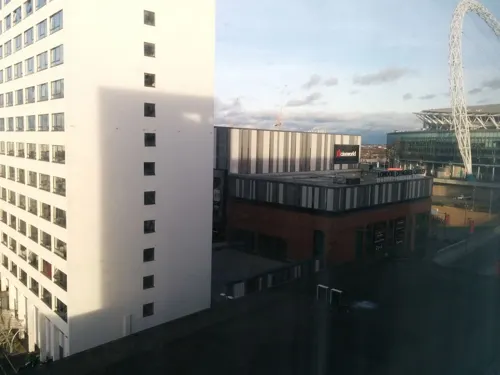
Big Moe's Diner
Diner · American · 0.6 mi
Wembley Park Boulevard, Wembley
Mo-Th 11:30-21:45; Fr 11:30-22:30; Sa 09:00-22:30; Su 09:00-21:45
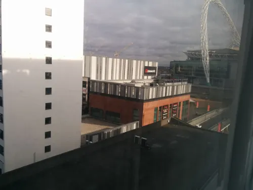
Frankie & Benny's
Diner · American · 0.6 mi
Unit 100, Level 2 Wembley Park Boulevard, Wembley
Mo-Th 12:00-22:00; Fr-Sa 12:00-23:00; Su 12:00-22:00
Nando's
Restaurant · Chicken, Portuguese · 0.6 mi
Wembley Park Boulevard, Wembley
Mo-Su "Open until late"
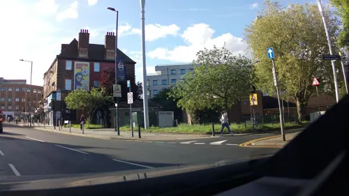
The Arch
Bar and pub · Indian · 0.5 mi
324 Harrow Road, Wembley
Mo-Tu 16:00-23:00; We-Th 12:00-23:00; Fr-Sa 12:00-01:00; Su 12:00-23:00


Maru's Bhajia House
Restaurant · Indian, African · 0.6 mi
230 Ealing Road, Wembley
Mo off; Tu-Th 12:00-21:00; Fr-Su 12:00-21:30

TGI Fridays
Diner · American · 0.7 mi
Unit 1 - 3 Wembley Park Boulevard, Wembley
Su-Th 12:00-22:30; Fr-Sa 12:00-23:00
Wagamama
Restaurant · Asian · 0.6 mi
Wembley Park Boulevard, Wembley
Mo-Th 11:00-22:30; Fr-Sa 11:00-23:00; Su 11:00-22:00
Wembley Tandoori
Restaurant · Indian, Nepalese · 0.9 mi
133 Wembley Park Drive, Wembley
Mo-Fr 12:00-14:00, 17:30-23:00; Sa 17:30-23:00; Su 17:30-22:30
Zizzi
Restaurant · Italian · 0.6 mi
Wembley Park Boulevard, Wembley
Mo-Sa 12:00-23:00; Su 12:00-22:30; Dec 25 off
172 more on the map.
History
Wembley is derived from the Old English proper name "Wemba" and the Old English "lea" for meadow or clearing. The name was first mentioned in the charter of 825 of Selvin. A further instance may be seen in the Plea Rolls of the Common Pleas, as Wambeleye.
The village of Wembley grew up on the hill by the clearing with the Harrow Road south of it. Much of the surrounding area remained wooded. In 1547 there were but six houses in Wembley. Though small, it was one of the wealthiest parts of Harrow. At the dissolution of the monasteries in 1543, the manor of Wembley fell to Richard Andrews and Leonard Chamberlain, who sold it to Richard Page, Esq., of Harrow on the Hill, the same year. There was a mill on Wembley Hill by 1673.
The Page family continued as lords of the manor of Wembley for several centuries and eventually commissioned Humphry Repton (1752–1818) the landscape gardener to design what is now Wembley Park. Wembley Park thus derived its name from Repton's habit of referring to the areas he designed as "parks".
The former Barley Mow pub was recorded in 1722 thus was the earliest long-lasting pub of Wembley.
Read more of the history
In 1837, the London & Birmingham Railway (now part of the West Coast Main Line) was opened from London Euston through Wembley to Hemel Hempstead, and completed to Birmingham Curzon Street the following year. The changing names of the local station demonstrated the increasing importance of the 'Wembley' name. 'Sudbury' station opened in 1845, renamed as 'Sudbury and Wembley' in 1882, renamed as 'Wembley for Sudbury' in 1910, renamed as 'Wembley Central' in 1948, at the time of the Olympic Games.
To modernise the service, a new Watford DC line was built alongside the main lines and Bakerloo line trains, and electric trains to Broad Street started in 1917. Electric trains to London Euston began running in 1922. Since 1917, there have been six platforms at what is now Wembley Central station. In 1880, the Metropolitan Railway opened its line from Baker Street through the eastern side of Wembley, but only built a station, Wembley Park, in 1894. There are now three physically separate services, the London to Aylesbury Line, the Metropolitan line and the Jubilee line. Only the latter two services have platforms at Wembley Park station.
Anne and Frances Copland, who in 1843 inherited Sudbury Lodge and its lands, gave a plot for a church to serve the southern part of Harrow parish. In spite of less support from local farmers, who preferred part of Lord Northwick's property on Wembley Hill, the sisters' offer was accepted since they would bear all the cost of building. The church of Saint John the Evangelist, Wembley, designed by George Gilbert Scott and W. B. Moffatt, was consecrated in 1846, in which year Wembley became a parish. It was built of flint with stone dressings, in the Gothic style, and comprised chancel, nave, northeast chapel, and wooden bell turret. A north aisle was added in 1859 and a south aisle in 1900; extensions were made to the west to designs of G. P. Pratt in 1935. It has one church bell.
In November 1905, the Great Central Railway (now, in this section, part of the Chiltern Main Line) opened a new route for fast expresses that by-passed the congested Metropolitan Railway tracks. It ran between Neasden Junction, south of Wembley, and Northolt Junction, west of London, where a new joint main line with the Great Western Railway began. Local passenger services from London Marylebone were added from March 1906, when new stations were opened, including 'Wembley Hill', next to what later became the site of Wembley Stadium – the national stadium of English sport – which opened for the FA Cup Final of April 1923, remaining open for 77 years until it closed for reconstruction in October 2000. After a long planning and redevelopment process dogged by a series of funding problems and construction delays, the new stadium finally opened its doors in March 2007. Wembley Hill station was renamed 'Wembley Complex' in May 1978, before getting its present name of 'Wembley Stadium' in May 1987.
Wembley was also served by tram (route 62) and later trolleybus (route 662) which ran through the Harrow Road from Sudbury to Paddington until the abandonment of the networks. The route is now mostly served by bus route 18 which is also one of the busiest bus routes in all of London today.
The 1937-built fire brigade headquarters of Middlesex County Council on Harrow Road, in Moderne style, is now a fire station of the London Fire Brigade. It is statutorily recognised and protected in the initial category, Grade II, of listed building.
Wembley, in common with much of northwest London, had an extensive manufacturing industry, but much of it closed in the 1980s. Its factories included Glacier Metals (bearings), Wolf Power Tools, Sunbeam Electrical Appliances, Griffin & George (laboratory equipment) and GEC (whose research laboratories, opened in 1923, were one of the first of their type in the United Kingdom).
What had been Wembley Park hosted the British Empire Exhibition of 1924–1925. Until the 2000s, remnants of the many reinforced concrete buildings, including the original Wembley Stadium, remained, but nearly all have now been removed, to make way for redevelopment.
Most of the rest of Wembley's housing consists of inter-war semi-detached houses and terraces and of modern apartment blocks, with a significant minority of detached houses.
Expansion in the town centre continued. In 1929 the Majestic Theatre was opened, later becoming Odeon Wembley cinema. It closed in 1961 and was demolished, replaced by a C&A store (today a Wilko store). Another cinema in the town was an ABC cinema originally opened as The Regal in 1937, on Ealing Road, which operated until 1976. After this it operated for some years as an independent cinema showcasing Bollywood films. The building was demolished in 1987.
From the History section of Wembley on Wikipedia, under CC BY-SA 4.0.
More about Wembley
Geography
Until the nineteenth century, Wembley was rural. In broadest terms Wembley has eight main green spaces, all but the golf course being public (no farms or private parks exist). The formal five are King Edward VII Park, set out in 1914 slightly north of the centre (10.5 hectares), Barham Park (10.5 hectares), One Tree Hill Park, Sudbury Green and Brent River Park / Tokyngton Recreation Ground (20.26 hectares) has been restored, returning the river to a more natural course. The informal three are Horsenden Hill, Vale Farm sports ground (30 hectares) and partly horse-grazed Barn Hill (19.9 hectares), east of which is its Kingsbury continuation: Fryent Country Park.
Sudbury Golf Course abuts the Paddington Arm of the Grand Union Canal, with a towpath running into central London. Sudbury Squash and Tennis Club has outdoor tennis courts, an indoor squash court, and a clubhouse. Wembley is a short distance away from the Welsh Harp reservoir and open space, created in the early 19th century by damming the River Brent to provide water for the Grand Union Canal.
Economy
The main shopping area was generally centred on Wembley High Road, Central Square, and Ealing Road. Unlike typical British high streets Wembley does not have a town centre network or pedestrianised high streets, with almost all commercial high street businesses along a 1000-yard stretch of road (High Road). In 1971 the High Road was seen as being the 11th best place to shop in London. However, it had fallen to 24th place by 1987. Ealing Road remains important as a centre of South Asian jewellery and gold shops, attracting people from as far afield as Leicester, but otherwise the focus of shopping has shifted north and east to the more recent development of London Designer Outlet in Wembley Park, which is part of the Stadium's complex and also includes a fully pedestrianised street near the Stadium. The regenerations were co-funded by Brent Council to add an attractive shopping destination.
The Wembley Sunday Market was a popular market held weekly from the 1970s until 2014 and run by Wendy Fair Markets. The market was ousted by the landowners, Quintain, in favour of the London Designer Outlet development. The market was then set up at the former Unisys tower near Stonebridge Park station before it was closed within a year by the council citing traffic disruption.
From the Wikipedia article Wembley, under CC BY-SA 4.0.
Notable people from Wembley
 Riz AhmedBritish actor and rapper (born 1982)Photo: Harald Krichel, CC BY-SA 4.0
 Jacob MurphyEnglish association football player (born 1995)Photo: SonoGrazy, CC BY-SA 4.0
 Josh MurphyEnglish association football player (born 1995)Photo: Nick from Bristol, UK, CC BY 2.0
 Kieron ForbesBritish footballer (born 1990)Photo: Bruce Fenn, CC BY-SA 3.0
 Matthew GouldBritish civil servant and former diplomatPhoto: UK in Israel, CC BY 2.0
 Jerry RobertsBritish businessman and wartime codebreakerPhoto: Cpt Jerry Roberts, CC0
 Victor GoddardRoyal Air Force air marshal (1897–1987)Photo: Thomas Cantrell Dugdale, Public domain
- Stanley SadieBritish musicologist (1930–2005)
- Raymond GoslingBritish physicist (1926-2015)
- Michelle DillonBritish triathlete
- Diana ChurchillBritish actress (1913-1994)
- John SinclairEnglish musician, born 1952
Born in Wembley, according to Wikidata (CC0). Each name links to its Wikipedia article.
Where to stay15
Churches and places of worship62
Shopping27
Gas and EV charging7
Schools, colleges and libraries41
Healthcare19
Shilun's Pharmacy
Clinic and pharmacy · 1.0 mi
3 The Parade, Sudbury Heights Avenue
Stanley Corner Medical Centre
Clinic and pharmacy · 0.6 mi
1-3 Stanley Close, Wembley
Map of Wembley
250 places. The map loads OpenStreetMap tiles when you open it.
Getting there and nearby towns
RAF Northolt (NHT) is the nearest airport with scheduled flights listed in OpenStreetMap, 5 miles away.
- Sudbury 1 mi west, about 2 min by car
- Harrow 2 mi northwest, about 4 min by car
- Harrow on the Hill 2 mi northwest, about 3 min by car
- Harlesden 2 mi southeast, about 4 min by car
- Willesden 3 mi southeast, about 5 min by car
- West Ealing 3 mi southwest, about 5 min by car
- Northolt 3 mi west, about 5 min by car
- Headstone 3 mi northwest, about 6 min by car
- Harrow Weald 4 mi northwest, about 7 min by car
- Golders Green 4 mi east, about 7 min by car
Drive times are estimates from straight-line distance, not routes.
Towns near Wembley


Keep exploring
Local news
Headlines from INDB.
Reviews, tips and questions
Loading what members have shared...
Sources and licences
- GeoNames (CC BY 4.0): population, coordinates, regions and time zone
- Mapillary (see each image): photos
- OpenStreetMap contributors (ODbL 1.0): places, airports, map data
- Wikidata (CC0 1.0): elevation, founding date, time zone, website, landmarks and historic places
- Wikimedia Commons (see each image): photos
- Wikipedia (CC BY-SA 4.0): overview and history text
Photo credits
- Cmglee London Wembley aerial, Cmglee, CC BY-SA 4.0
- 037 - London 2012 at Wembley Central, Randomly London, CC BY-SA 2.0
- Wembley Central station 5, Oxyman, CC BY 2.5
- Wembley Central station 4, Oxyman, CC BY 2.5
- 038 - Flats at Wembley Central, Randomly London, CC BY-SA 2.0
- Wembley Central station 3, Oxyman, CC BY 2.5
- Wembley, Veľká Británia - panoramio (3), Bohuslav Jonathan Tó…, CC BY-SA 3.0
- Wembley Central station 2, Oxyman, CC BY 2.5
- Wembley Central station 1, Oxyman, CC BY 2.5
- Wembley Central station 6, Oxyman, CC BY 2.5
- Wembley Central station 9, Oxyman, CC BY 2.5
- Wembley Central railway station 2105969 767c3da5, Ben Brooksbank, CC BY-SA 2.0
- Questors Theatre, Ealing, Roger Green, CC BY-SA 4.0
- Pitzhanger, Peter Jordan, CC BY-SA 2.0
- Preston Park, Dudley Miles, Public domain
- Fryent Country Park view north, Dudley Miles, Public domain
- Gladstone Park Horses, Unknown author, Public domain
- Grove Farm, Ealing 1, Dudley Miles, CC BY-SA 3.0
- Litten Local Nature Reserve, Dudley Miles, CC BY-SA 3.0
- Northwick Park open space and hospital, David Howard, CC BY 2.0
- Our Lady of Willesden - St Mary's Church a, Timothy Titus, CC BY 4.0
- Stmarysacton2, Patche99z, Public domain
- Harley night at the Ace Cafe (19533866653), Dave_S. from Witney, England, CC BY 2.0
- Michaela Community School Buildings January 2022, Jonathan A Jones ( talk ), CC BY-SA 4.0
- Horsenden Hill - panoramio, Keith Daulby, CC BY 3.0
- BSA riders at 2007 Ace Cafe reunion, Reg Mckenna from New Malden, UK, CC BY 2.0
- Fox Wood, Ealing 1, Dudley Miles, CC BY-SA 3.0
- Ark Academy, Wembley - panoramio (4), Bohuslav Jonathan Tó…, CC BY-SA 3.0
- Masons Field 6, Dudley Miles, CC BY-SA 4.0
- Old Oak with hollows in Hanger Hill Wood (London Borough of Ealing)20180527 164853, Nalsenai, CC BY-SA 4.0
- PearTreeParkJune2026, Asteuartw, CC BY 4.0
- ARTHUR LUCAN (ARTHUR TOWLE) 1887-1954 Entertainer and creator of Old Mother Riley lived here, Spudgun67, CC BY-SA 4.0
- Ealing-Common-old-drinking-fountain-DMS-01, DMS, CC BY-SA 3.0
- Northala fields northolt london, Romazur, CC BY-SA 3.0
- Street-level photo, southglos, CC BY-SA 4.0
- Street-level photo, southglos, CC BY-SA 4.0
- Street-level photo, southglos, CC BY-SA 4.0
- Street-level photo, southglos, CC BY-SA 4.0
- Street-level photo, southglos, CC BY-SA 4.0
- Street-level photo, petermead, CC BY-SA 4.0
- Street-level photo, petermead, CC BY-SA 4.0
- Street-level photo, RyanBush, CC BY-SA 4.0
- Street-level photo, RyanBush, CC BY-SA 4.0
- Street-level photo, RyanBush, CC BY-SA 4.0
- Street-level photo, RyanBush, CC BY-SA 4.0
- Street-level photo, southglos, CC BY-SA 4.0
- Street-level photo, laye, CC BY-SA 4.0
- Street-level photo, RyanBush, CC BY-SA 4.0


Page built November 10, 2026. Spotted a mistake? Tell us or suggest a place.