


Harlesden, United Kingdom
Harlesden is a town of 17,162 people in England, United Kingdom.
Why visit Harlesden
Townapedia lists 20 museums and landmarks, 48 parks and trails, 227 places to eat, 12 places to stay and 17 attractions in and around town.
Highlights include Lexi Cinema, Bush Theatre, Ben Uri Gallery and Brent Museum.
Weather in Harlesden
Forecast from MET Norway (CC BY 4.0). Full forecast
About Harlesden
Harlesden is a district in the London Borough of Brent, situated just north of Old Oak Common and the Grand Union Canal.
From the Wikipedia article Harlesden (this version), under CC BY-SA 4.0.
Photos of Harlesden


Things to do17

Bush Theatre
Cinema and theater · 2.5 mi
Theatre in Shepherd's Bush, London, England


Embassy Theatre
Cinema and theater · 3.3 mi
Theatre in Camden, London, England

Everyman Cinema
Cinema and theater · 3.3 mi
Cinema and former theatre in Hampstead, London, England

Golders Green Hippodrome
Cinema and theater · 3.4 mi
Theatre in London, England, UK


Kiln Theatre
Cinema and theater · 2.2 mi
Theatre and cinema in Kilburn, Brent, London, England

King's Theatre, Hammersmith
Cinema and theater · 3.4 mi
Former theatre in Hammersmith, London, England

Old Shepherd’s Bush Library
Cinema and theater · 2.5 mi
Former library in London, now home to the Bush Theatre

Cock Tavern Theatre
Cinema and theater · 2.4 mi
Former pub theatre in Kilburn, London (2009-2011)
Hampstead Theatre
Cinema and theater · 3.3 mi
Theatre in Hampstead, London, England
5 more on the map.
Museums and landmarks20

Emery Walker's House
Museum · 3.4 mi
House in London Borough of Hammersmith and Fulham, London, England, UK

Freud Museum London
Museum · 3.2 mi
Historic house museum in London, England, United Kingdom

Golders Green War Memorial
Monument and historic site · 3.3 mi
War memorial in London

Humanitarian Memorial
Monument and historic site · 3.1 mi
Memorial in Gunnersbury Park, London

Kelmscott House
Museum · 3.4 mi
House museum in London Borough of Hammersmith and Fulham, Greater London, England, United Kingdom


Pitzhanger Manor
Museum · 3.1 mi
Grade I listed historic house museum in the London Borough of Ealing, United Kingdom

Statue of Saint Volodymyr
Monument and historic site · 2.9 mi
1988 monument in London

8 more on the map.
Parks, trails and playgrounds48


Little Wormwood Scrubs
Park · 1.4 mi
Park in London Borough of Hammersmith and Fulham, United Kingdom


Brook Green
Park · 3.2 mi
Neighbourhood, street and park in the London Borough of Hammersmith and Fulham


Emslie Horniman's Pleasance
Park · 2.0 mi
Park in Royal Borough of Kensington and Chelsea, London, UK

Furnival Gardens
Park · 3.4 mi
Park in Hammersmith, London, near the River Thames



36 more on the map.
Restaurants and cafes227

Ace Cafe
Cafe · 1.2 mi
North Circular Road, Stonebridge, London
Mo-Sa 07:00-23:00; Su,PH 07:00-22:30 || "to 2 a.m. when operating...

Beer + Burger
Bar and pub · Burger · 1.4 mi
Beer bar that sells burgers
88 Walm Lane, London
Mo-Th 16:00-23:00; Fr-Sa 12:00-23:00; Su 12:00-22:30
Kadiri's
Restaurant · Indian · 1.2 mi
High Road, London
Tu-Th 17:00-22:00; Fr 12:00-22:00; Sa,Su 12:00-22:00
Sacro Cuore
Restaurant · Pizza · 1.5 mi
45 Chamberlayne Road, London
Su-Th 12:00-22:30; Fr-Sa 12:00-23:00
Sanzio
Restaurant · Italian · 1.5 mi
26 Station Parade, London
We-Th 12:00-15:00, 18:00-22:00; Fr-Sa 12:00-23:00; Su 12:00-22:00
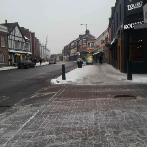
Brasa
Restaurant · Portuguese · 1.1 mi
988-992 Harrow Road, London
Mo off; Tu-Th 17:00-22:00; Fr-Su 12:00-22:00
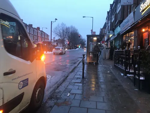

LaDuDu
Restaurant · Vietnamese · 1.5 mi
10 Quay Walk, Wembley
Tu off; We-Th 11:00-14:00,17:00-19:00; Fr 11:00-14:00,17:00-20:00;...

215 more on the map.
History
Harlesden was once a Saxon settlement. The Domesday Book calls it "Hervlvestvne". For centuries the area was a small rural community set in orchards with some inns.
In the 19th century, Harlesden, then a rural village in the parish of Willesden, began to develop some of its urban appearance with the arrival of the railways. Willesden Junction, Kensal Green and Harlesden stations on the London & Birmingham Railway all had an effect on the developing village. Cottages for railway and industrial workers were built, as was grander housing for the local middle class. The London–Harrow coach passed through the village every day by 1839. The village gained a blacksmith, grocer and a shoemaker during this period.
Read more of the history
Harlesden increasingly lost its rural nature, with factories replacing farms and woodland. Sewerage arrived here in 1871 and soon houses were being built. A mainly middle class population resided here who enjoyed the availability of numerous churches, cinemas, a court, a library and recreational pleasure at Roundwood Park. From late Victorian times until the 1930s, housing completed its spread across the area, and Harlesden became part of the London conurbation. A jubilee clock tower was built in 1888. As well as train links, Harlesden had a frequent horse-drawn omnibus service to Paddington as early as 1890, with Electric trams caming to Harlesden in 1907. That year also saw the opening of Willesden Hippodrome Theatre, which was destroyed by German bombing in 1940. Much of the working class in Harlesden suffered from poverty, with the Willesden Chronicle mentioning "nearness to starvation" of those people in 1908.
In 1908, the Olympic Games were held in London. The marathon race course went through Harlesden, and ended at the White City Stadium. The course entered Harlesden via Craven Park Road, turned down Manor Park Road, down the High Street and passed the Jubilee Clock. After that, the course headed towards North Acton via Station Road and passing Willesden Junction.
Mainly after World War I, one of Europe's biggest industrial estates was constructed at nearby Park Royal, and large factories there and within Harlesden included McVitie & Price (later United Biscuits) from 1910, and Heinz from 1919. Industrial growth led to a middle class exodus as Harlesden turned entirely into a working class area in the inter-war period. The McVitie & Price factory became the largest biscuit factory in the western world, employing 2,600 people by 1978.
By 1939 the last of the really large Victorian houses, Roundwood House and Knowles Tower, had both been demolished by Willesden Council. At 6am on 16 January 1939, the Irish Republican Army blew up the Harlesden electricity cable bridge. The bridge crossed the Grand Junction Canal, and carried the power line from Battersea Power Station. No one was injured in the attack. In the interwar period, a cargo ship, built on Tyneside, was named after the area. In 1941, the ship was sunk by the German battle cruiser Gneisenau, approximately 600 miles west of Newfoundland. Seven members of the crew were killed.
In the 1950s, the transport of coal from Durham and steel from Sheffield became a main contributor to the local economy, these industries employed a mass of labour from Irish and Jamaican immigrants.
The image of Harlesden today began to take shape in the 1950s, 1960s and 1970s. Continued immigration from Ireland and new immigration from the Caribbean and the Indian sub-continent changed the racial and cultural make up of the area. Despite the immigration the population of Harlesden still declined from 39,527 in 1951 to 26,970 in 1971, but remained densely populated. Prefab homes for those made homeless by Second World War bombings were still in existence by the end of the 1960s.
By the 1960s, the Curzon Crescent estate was known for poverty and became a vandalism hotspot. At the same time, immigration from the West Indies and Indian sub-continent led to racist articles in a national newspaper. Poverty increased further by the decline of industry and the building of Brent Cross Shopping Centre. Steps were taken to improve the area, such as the Harlesden City Challenge community project in the 1990s that involved the creation of public artwork in the area, as well as the renovation of the jubilee clock on the High Street in 1997. More recently from the end of the 20th century the area has become home to Brazilian, Portuguese and Somali communities, as well as Polish, Afghan and Colombian communities.
Prince Charles visited Harlesden in March 2007. He commented "I don't think I have enjoyed myself so much for a long time going down the high street and popping into one or two shops. I'm sorry I couldn't go into more of them."
In the late 2010s, reduced crime rates led to higher house prices, but the district retains a non-gentrified atmosphere. In 2015 a new community "Town Garden" was opened for locals to garden, socialise and exercise, established by the funding of local volunteers and charities. It has become a green sanctuary in the heart of Harlesden.
From the History section of Harlesden on Wikipedia, under CC BY-SA 4.0.
More about Harlesden
Geography
Harlesden is located north of Old Oak Common and the Grand Union Canal. Harrow Road flows through the centre of the area which goes eastwards to Paddington and west towards Wembley.
Arts and culture
Harlesden and some of its surroundings in Brent played a key part in the development of the reggae music business in the UK. In the 1960s Planetone Studios Sonny Roberts the heartbeat of Rhythm & Blues and Ska recordings, releasing and distribution followed by Trojan Records who became a major reggae label, producing successful artists within and in Jamaica, such as Desmond Dekker and Toots and the Maytals, and numerous top 20 UK singles during the 1970s. Another popular label of reggae and other black music was Jet Star, which called itself "the world's largest reggae distributors".
The Brent Black Music Cooperative Rehearsal Studios was set up in Willesden in 1983 by a grant from Brent council. It provided a studio and training for numerous local and international acts such as The Last Poets and Aswad.
In 1970, Sonny Roberts established the first specialist record shop called Orbitone Records, retailing various genres of music but in the mid 1970s became the hub premises for producing, licensing and distributing soca music. During the mid 1970s and 1980s, dozens of record shops filled the Harlesden streets of Church Road, Craven Park Road and the High Street. As of 2020, two still remain in operation on Craven Park Road: Hawkeye and Starlight Records.
From the Wikipedia article Harlesden, under CC BY-SA 4.0.
Notable people from Harlesden
 Sabrina WashingtonBritish singerPhoto: Charlielou10, CC BY 4.0
 Roger SlomanBritish actorPhoto: Tiger Aspect Productions, CC BY 3.0
 Francis BourgeoisBritish trainspotter and social media personalityPhoto: JaceMerlyn, CC BY-SA 4.0
 Carla Marie Williamssongwriter and singerPhoto: Carla Marie Williams, CC BY-SA 4.0
 Bruce WellsEnglish boxerPhoto: Unknown Unknown, CC BY-SA 3.0 de
 Gappy RanksBritish dancehall musicianPhoto: Elise, CC BY-SA 2.0
- Paul MersonEnglish footballer and manager (born 1968)
- C. D. BroadEnglish philosopher (1887–1971)
- Shane RichieBritish actor
- George P. L. WalkerBritish volcanologist (1926–2005)
- Huw Lloyd-LangtonEnglish guitarist (1951–2012)
- Richard LangleyFootballer (born 1979)
Born in Harlesden, according to Wikidata (CC0). Each name links to its Wikipedia article.
Where to stay12
Churches and places of worship80
Neasden - St Catherine w St Paul
Church · Anglican · 1.4 mi
Tanfield Avenue, London
Shopping31
Gas and EV charging18
Schools, colleges and libraries49
Healthcare23
Map of Harlesden
250 places. The map loads OpenStreetMap tiles when you open it.
Getting there and nearby towns
RAF Northolt (NHT) is the nearest airport with scheduled flights listed in OpenStreetMap, 7 miles away.
- Sudbury 3 mi west, about 5 min by car
- Harrow 4 mi northwest, about 7 min by car
- Kew 4 mi south, about 7 min by car
- Harrow on the Hill 4 mi northwest, about 7 min by car
- Highgate 4 mi northeast, about 7 min by car
- Archway 5 mi east, about 9 min by car
- Northolt 5 mi west, about 8 min by car
- London 6 mi east, about 9 min by car
- City of Westminster 6 mi southeast, about 9 min by car
- Islington 6 mi east, about 10 min by car
Drive times are estimates from straight-line distance, not routes.
Towns near Harlesden


Keep exploring
Local news
Headlines from INDB.
Reviews, tips and questions
Loading what members have shared...
Sources and licences
- GeoNames (CC BY 4.0): population, coordinates, regions and time zone
- Mapillary (see each image): photos
- OpenStreetMap contributors (ODbL 1.0): places, airports, map data
- Wikidata (CC0 1.0): elevation, founding date, time zone, website, landmarks and historic places
- Wikimedia Commons (see each image): photos
- Wikipedia (CC BY-SA 4.0): overview and history text
Photo credits
- Chiswick Park Footbridge 04, Juan Gutierrez Andres, CC BY-SA 4.0
- Embassy Theatre London, presentattempt, CC BY 2.0
- Hammersmith flyover 6523r, Patche99z, Public domain
- Kiln Theatre, QueensOfTheHighRoad, CC BY-SA 4.0
- Passmore Edwards Library Shepherds Bush, Alex Williams, CC BY-SA 3.0
- BU Gallery Exterior 2015 (1), Benuricw, CC BY-SA 4.0
- Freud Museum London 2, Rup11, CC BY-SA 3.0
- War memorial at Golders Green (12465422183), Ian Wright, CC BY-SA 2.0
- Gunnersbury Park, The Humanitarian Memorial (2025), AndyScott, CC0
- Kelmscott House, Bernard Burns, CC BY-SA 3.0
- Casa de Leighton, Londres, Inglaterra, 2022-11-26, DD 40, Diego Delso, CC BY-SA 4.0
- Pitzhanger, Peter Jordan, CC BY-SA 2.0
- Ruler of Ukraine statuette Volodymir bright, Lemur12 ; processed by Off-shell, CC BY-SA 3.0
- Gladstone Park Horses, Unknown author, Public domain
- Little Wormwood Scrubs in London, spring 2013 (9), Chmee2, CC BY-SA 3.0
- Brook Green Park in London in spring 2013 (4), Chmee2, CC BY-SA 3.0
- Childs Hill Park, Dudley Miles, CC0
- Chiswick Park by the RRP, Steve Cadman, CC BY-SA 2.0
- Furnivall Gardens, Hammersmith, ZeevoX, CC BY-SA 4.0
- Golders Hill Park in 2006, Martin Addison, CC BY-SA 2.0
- All Saints Church Tower, Notting Hill - London, Jim Linwood, CC BY 2.0
- Turnham Green Church 3, Armchair, CC0
- Stmarysacton2, Patche99z, Public domain
- Our Lady of Willesden - St Mary's Church a, Timothy Titus, CC BY 4.0
- Harley night at the Ace Cafe (19533866653), Dave_S. from Witney, England, CC BY 2.0
- London Temple, The original uploader was Nikkul at English Wikipedia ., CC BY-SA 2.0
- Holiday Inn Express, North End Road, Fulham, London 01, Edwardx, CC BY-SA 4.0
- QPCS Front 05, The original uploader was Fabrib at English Wikipedia ., CC BY-SA 3.0
- Church of St Andrew, Willesden, Bernard Burns, CC BY-SA 3.0
- Kensal Green Cemetery view December 2005, Unknown author, CC BY-SA 2.0
- BSA riders at 2007 Ace Cafe reunion, Reg Mckenna from New Malden, UK, CC BY 2.0
- Roundwood Park, Unknown author, Public domain
- The Emslie Horniman Pleasance (2945072572), Steve Cadman from London, U.K., CC BY-SA 2.0
- Greville Place 4, Dudley Miles, CC BY-SA 4.0
- Brent, Veľká Británia - panoramio (21), Bohuslav Jonathan Tó…, CC BY-SA 3.0
- Two Pressed Steel Class 117 3 car suburban dmu W51334, W59486, W51376 (8326084561), Hugh Llewelyn, CC BY-SA 2.0
- North British Type 2 D6357 (8319156704), Hugh Llewelyn, CC BY-SA 2.0
- Pullman Trailer First Restaurant Kitchen (TFLRK) W60737 (8323378694), Hugh Llewelyn, CC BY-SA 2.0
- Freightliner (8315845048), Hugh Llewelyn, CC BY-SA 2.0
- Brush Type 4 D1670 (8317832743), Hugh Llewelyn, CC BY-SA 2.0
- Bush Theatre - Passmore Edwards plaque - 7 Uxbridge Road London W12 8LJ, Spudgun67, CC BY-SA 4.0
- Everyman Cinema Club, Hampstead, NW3 (2487183245), Ewan Munro from London, UK, CC BY-SA 2.0
- Golders Green Hippodrome North End Road London NW11 7RP, Spudgun67, CC BY-SA 4.0
- The Kings Theatre (Hammersmith and Fulham Historic Buildings Group), Spudgun67, CC BY-SA 4.0
- Ealing-Common-old-drinking-fountain-DMS-01, DMS, CC BY-SA 3.0
- Beer + Burger, Willesden, NW2, Ewan-M, CC BY-SA 2.0
- Street-level photo, Roufster, CC BY-SA 4.0
- Street-level photo, Semir_Mapillary, CC BY-SA 4.0
- Street-level photo, nikolaristov992, CC BY-SA 4.0
- Street-level photo, Roufster, CC BY-SA 4.0
- Street-level photo, RyanBush, CC BY-SA 4.0
- Street-level photo, asturksever, CC BY-SA 4.0
- Street-level photo, Roufster, CC BY-SA 4.0
- Street-level photo, matth81, CC BY-SA 4.0
- Street-level photo, southglos, CC BY-SA 4.0
- Street-level photo, melisdaozer, CC BY-SA 4.0
- Street-level photo, southglos, CC BY-SA 4.0
- Street-level photo, Semir_Mapillary, CC BY-SA 4.0
- Street-level photo, Semir_Mapillary, CC BY-SA 4.0
- Street-level photo, RyanBush, CC BY-SA 4.0
- Street-level photo, Semir_Mapillary, CC BY-SA 4.0
- Street-level photo, southglos, CC BY-SA 4.0
- Street-level photo, asturksever, CC BY-SA 4.0
- Street-level photo, Roufster, CC BY-SA 4.0
- Street-level photo, Roufster, CC BY-SA 4.0
- Street-level photo, Roufster, CC BY-SA 4.0
- Street-level photo, laye, CC BY-SA 4.0
- Street-level photo, laye, CC BY-SA 4.0
- Street-level photo, Roufster, CC BY-SA 4.0
- Street-level photo, gness, CC BY-SA 4.0
- Street-level photo, subashi, CC BY-SA 4.0


Page built November 10, 2026. Spotted a mistake? Tell us or suggest a place.