


Shepherds Bush, United Kingdom
Shepherds Bush is a town of 39,724 people in England, United Kingdom.
Why visit Shepherds Bush
Townapedia lists 124 museums and landmarks, 84 parks and trails, 142 places to eat, 36 places to stay and 35 attractions in and around town.
Highlights include Bush Hall, Eventim Apollo, Kensington Palace and Leighton House Museum.
Weather in Shepherds Bush
Forecast from MET Norway (CC BY 4.0). Full forecast
About Shepherds Bush
Shepherd's Bush is a suburb of West London, England, within the London Borough of Hammersmith and Fulham 4.9 miles (7.9 km) west of Charing Cross, and identified as a major metropolitan centre in the London Plan.
From the Wikipedia article Shepherd's Bush (this version), under CC BY-SA 4.0.
Things to do35

Bush Hall
Cinema and theater · 0.5 mi
Bush Hall was built in 1904. It was used as a soup kitchen during World War II, in the late 1950s and early 1960s as a bingo hall and...
310 Uxbridge Road, London


Bush Theatre
Cinema and theater
This building was originally the Shepherd's Bush library, one of 24 public libraries founded by Victorian newspaper proprietor and...
7 Uxbridge Road, London


Barnes Railway Bridge
Bridge · 2.6 mi
Railway bridge and footbridge in London, England, UK

Barons Court Theatre
Cinema and theater · 1.2 mi
Pub theatre in West Kensington, London

Battersea Bridge
Bridge · 2.7 mi
Arch bridge with cast-iron girders and granite piers crossing the River Thames in London

Battersea Railway Bridge
Bridge · 2.8 mi
Bridge across the River Thames in London


23 more on the map.
Museums and landmarks124

Kensington Palace
Monument and historic site · 1.4 mi
Royal residence set in Kensington Gardens, London, England, UK
Kensington Garen, London
Mo-Su 09:00-16:00


Museum of Brands
Museum · 0.9 mi
111-117 Lancaster Road, London
Mo-Sa 10:00-17:00; Su 11:00-17:00; Dec 24-26 off


Antique Breadboard Museum
Museum · 2.9 mi
Small museum in Putney, London, England, UK

Bolan's Rock Shrine
Monument and historic site · 2.8 mi
Memorial in Barnes, London

Chiswick House
Museum · 2.2 mi
Neo-Palladian villa in the Chiswick district of London, England, UK

Design Museum
Museum · 1.0 mi
224-238 Kensington High Street, London
Mo-Th 10:00-17:00; Fr-Su 10:00-18:00; Sep 16-Dec 31 Sa...
The Mosaic Rooms
Museum · 1.3 mi
Contemporary Culture from the Arab World.
226 Cromwell Road, London
Tu-Su 11:00-18:00
Carlyle's House
Museum · 2.6 mi
Historic house museum in London, England, UK
112 more on the map.
Parks, trails and playgrounds84


Gunnersbury Park
Park · 3.1 mi
Park in the London Borough of Hounslow, United Kingdom

Hanger Hill Wood
Park · 3.3 mi
Nature reserve in the London Borough of Ealing, England, UK

Barn Elms
Park · 2.2 mi
Open space in Barnes in the London Borough of Richmond upon Thames
72 more on the map.
Restaurants and cafes142

Prince of Teck
Bar and pub · 1.4 mi
161 Earl's Court Road, London
Mo-Th 08:30-23:30; Fr,Sa 08:30-00:00; Su 08:30-23:30

Princess Victoria
Bar and pub · 0.9 mi
217 Uxbridge Road, London
Mo-Th 11:00-23:00; Fr-Sa 11:00-24:00; Su 11:00-22:30

The Elgin
Bar and pub · 0.9 mi
96 Ladbroke Grove, London
Mo-Th 10:00-23:00, Su 11:00-22:30, Fr,Sa 10:00-24:00

Goat Tavern
Bar and pub · 1.4 mi
3 Kensington High Street, London
Mo-Th 12:00-23:00; Fr,Sa 12:00-24:00; Su 12:00-22:00
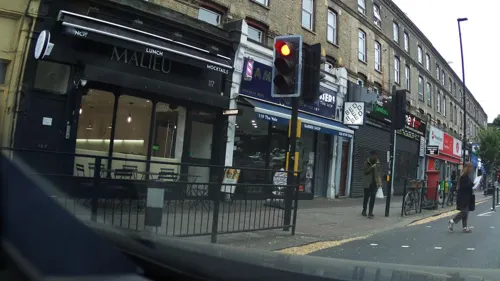
O!Burger / O!Pizza
Restaurant · Pizza, Burger, Pasta · 1.4 mi
Burger and pizza resturaunt with eat-in and take away. Pre-order burgers: https://o-burger.co.uk/, Pre-order pizza: https://o-pizza.online/
115 The Vale, London
Mo-Su 11:30-23:00

The Churchill Arms
Bar and pub · 1.1 mi
119 Kensington Church Street, London
Mo-Sa 11:00-23:00; Su 12:00-22:30

The Greyhound
Bar and pub · 1.4 mi
1 Kensington Square, London
Mo-We,Sa 12:00-23:00; Th,Fr 12:00-00:00; Su 12:00-22:30



Kin Pizza
Restaurant · Pizza, Detroit Steel-Pan, American · 0.5 mi
Detroit Steel-Pan Pizza Restaurant, offering lunch and dinner dine-in and take away pizza. Indoor, outdoor and private seating areas...
101 Wood Lane, London
Tu-We 12:00-20:00
130 more on the map.
History
The name Shepherd's Bush is thought to have originated from the use of the common land here as a resting point for shepherds on their way to Smithfield Market in the City of London. An alternative theory is that it could have been named after someone in the area, because in 1635 the area was recorded as "Sheppard's Bush Green".
Evidence of human habitation can be traced back to the Iron Age. Shepherd's Bush enters the written record in the year 704 when it was bought by Waldhere, Bishop of London as a part of the "Fulanham" estate.
Until 1834, Shepherd's Bush was part of the ancient parish of Fulham, when it became part of the civil parish of
Hammersmith. It was anciently in Middlesex, from 1856 was part of the area of the Metropolitan Board of Works, and joined the County of London when that was created in 1889.
A map of Middlesex dated 1841 shows Shepherd's Bush to be largely undeveloped and chiefly rural in character, with much open farmland, compared with fast-developing Hammersmith. Residential development began in earnest in the late 19th century, as London's population expanded relentlessly. In 1904 the Roman Catholic Church of the Holy Ghost and St Stephen, built in the Gothic style with a triple-gabled facade of red brick and Portland stone, was completed and opened for use.
Read more of the history
Like other parts of London, Shepherd's Bush suffered from bomb damage during World War II, especially from V-1 flying bomb attacks (known as "doodlebugs" or "buzzbombs"), which struck randomly and with little warning.
On 13 April 1963, the Beatles recorded their first-ever BBC Television broadcast at Lime Grove Studios in Shepherd's Bush. The group returned in 1964 for a further recording. Lime Grove Studios was demolished in 1994 to make way for residential accommodation.
More recently, the White City bus station is housed in the redeveloped Dimco Buildings (1898), Grade II listed red brick buildings which were originally built in 1898 as a shed for a London Underground power station. The Dimco buildings were used as a filming location for the 'Acme Factory' in the 1988 film Who Framed Roger Rabbit, and later served as the interior of the British Museum in The Mummy Returns.
From the History section of Shepherd's Bush on Wikipedia, under CC BY-SA 4.0.
More about Shepherds Bush
Geography
The area's focal point is Shepherd's Bush Green (also known as Shepherds Bush Common), a triangular area of about 8 acres (3 ha) of open grass surrounded by trees and roads with shops, with Westfield shopping centre to its north.
The Green is a hub on the local road network, with four main roads radiating from the western side of the green and three roads approaching its eastern apex, meeting at the large Holland Park Roundabout. This position makes it an important node of the bus network, with eighteen bus routes arriving there. It is also served by five London Underground stations (see Transport below): Shepherd's Bush and White City both on the Central line, and Shepherd's Bush Market, Goldhawk Road and Wood Lane all on the Hammersmith & City and Circle lines.
To the east, Shepherd's Bush is bounded by the physical barrier of the West London railway line and the grade-separated West Cross Route (part of the aborted 1960s London Motorway Box scheme); the Holland Park Roundabout and the small Addison Bridge to the south are the only ways to cross this barrier from Shepherds Bush.
Most of the areas to the east of the barrier differ significantly in character, being associated with the more affluent Holland Park and Notting Hill; although the Edward Woods Estate just to the north-east of the roundabout is part of and is managed by the London Borough of Hammersmith and Fulham.
From the Wikipedia article Shepherd's Bush, under CC BY-SA 4.0.
Notable people from Shepherds Bush
 Central CeeBritish rapper (born 1998)Photo: 200izo, CC BY-SA 4.0
 Steve JonesEnglish guitaristPhoto: Birgit Fostervold, CC BY-SA 4.0
 Leo WoodallBritish actor (born 1996)Photo: HBO, CC BY 3.0
 Adam BuxtonBritish actor and comedianPhoto: TimDuncan, CC BY-SA 4.0
 Danny McCullochBritish bassist (1945–2015)Photo: Photographer: F. van Geelen, CC BY-SA 3.0 nl
 Tony ButlerBritish bassistPhoto: Rob Glover from Bradford, UK, CC BY-SA 2.0
 Cecil F. UnderwoodBritish ornithologist (1867–1943)Photo: not stated, Public domain
- Simon SheltonBritish actor (1966-2018)
- June FouldsBritish track and field athlete (1934–2020)
- Eric PorterBritish actor (1928-1995)
- Sarla BehnEnglish Gandhian social activist
- Carlo LittleEnglish rock and roll drummer (1938–2005)
Born in Shepherds Bush, according to Wikidata (CC0). Each name links to its Wikipedia article.
Where to stay36
Churches and places of worship65
Shopping68
Gas and EV charging17
Schools, colleges and libraries38
Larmenier & Sacred Heart Catholic Primary School
School · Roman Catholic · 0.7 mi
41a Brook Green, London
Healthcare34
Map of Shepherds Bush
250 places. The map loads OpenStreetMap tiles when you open it.
Getting there and nearby towns
RAF Northolt (NHT) is the nearest airport with scheduled flights listed in OpenStreetMap, 9 miles away.
- Willesden 2 mi north, about 3 min by car
- Barnes 2 mi southwest, about 4 min by car
- Harlesden 3 mi northwest, about 4 min by car
- Mortlake 3 mi southwest, about 5 min by car
- Kew 3 mi southwest, about 5 min by car
- London 4 mi east, about 7 min by car
- City of Westminster 4 mi east, about 6 min by car
- East Sheen 4 mi southwest, about 6 min by car
- Belsize Park 4 mi northeast, about 6 min by car
- Chalk Farm 4 mi northeast, about 7 min by car
Drive times are estimates from straight-line distance, not routes.
Towns near Shepherds Bush


Keep exploring
Local news
Headlines from INDB.
Reviews, tips and questions
Loading what members have shared...
Sources and licences
- GeoNames (CC BY 4.0): population, coordinates, regions and time zone
- Mapillary (see each image): photos
- OpenStreetMap contributors (ODbL 1.0): places, airports, map data
- Wikidata (CC0 1.0): elevation, founding date, time zone, website, landmarks and historic places
- Wikimedia Commons (see each image): photos
- Wikipedia (CC BY-SA 4.0): overview and history text
Photo credits
- Shepherd's bush, The original uploader was Darqknight47 at English Wikipedia ., CC BY-SA 2.5
- Hammersmith Bridge 1, London, UK - April 2012, Diliff, CC BY-SA 3.0
- BarnesRailwayBridgeUpstream, Graeme Kerr, CC BY 2.5
- Battersea Railway Bridge, London 04, Edwardx, CC BY-SA 3.0
- Chiswick-Bridge-15-540-3, Patche99z, Public domain
- Chiswick Park Footbridge 04, Juan Gutierrez Andres, CC BY-SA 4.0
- Kensington Palace, Steve Cadman from London, U.K., CC BY-SA 2.0
- Marc Bolan's Rock Shrine - 1 - 2023-01-21, The wub, CC BY-SA 4.0
- Chiswick House from SE, Michael Coppins, CC BY-SA 4.0
- Bishops-park, Peter Damian, CC BY-SA 3.0
- Chiswick Park by the RRP, Steve Cadman, CC BY-SA 2.0
- Gunnersbury Park Museum, Brentford, Hounslow, London, England-26Feb2012, tpholland, CC BY 2.0
- Loftus Road 36, Zakarie Faibis, CC BY-SA 4.0
- 20060330-011-holland-park-pond, Ghouston 12:34, 1 April 2006 (UTC), CC0
- LAMDA building, Charles Yarnold ( en:User:Solex1001 ), CC BY-SA 2.5
- Hammersmith Apollo 2008 06 19, Alex.muller, CC BY-SA 3.0
- Shepherd's Bush Empire, Alex Williams, CC BY-SA 3.0
- Creek Cathedral London-Westminster, Ricardalovesmonuments, CC BY-SA 4.0
- All Saints Church Tower, Notting Hill - London, Jim Linwood, CC BY 2.0
- Burlington Danes Academy school in London, spring 2013 (1), Chmee2, CC BY-SA 3.0
- Bush Hall London, Chris Brown, CC BY-SA 2.0
- Kelmscott House, Bernard Burns, CC BY-SA 3.0
- Casa de Leighton, Londres, Inglaterra, 2022-11-26, DD 40, Diego Delso, CC BY-SA 4.0
- Linley Sambourne House, Jhsteel, CC BY-SA 3.0
- Museum of Brands Building, Museum of Brands, CC BY-SA 4.0
- Our Lady of Victories, Kensington, 2016 03, Edwardx, CC BY-SA 4.0
- Queen Charlotte's and Chelsea Hospital, London in spring 2013 (7), Chmee2, CC BY-SA 3.0
- ShpeherdsBushPavilion, Alex Williams, CC BY-SA 3.0
- St Mary Abbots 25, Edwardx, CC BY-SA 3.0
- St Cuthbert's Earls Court 22, Edwardx, CC BY-SA 3.0
- Elgin, Ladbroke Grove, W11 (4118229890), Ewan Munro from London, UK, CC BY-SA 2.0
- Prince of Teck, Earls Court 04, Edwardx, CC BY-SA 3.0
- The George, Hammersmith 01, Edwardx, CC BY-SA 3.0
- Hammersmith Park, Alexander Williams, CC BY-SA 4.0
- Kings Mall Shopping Centre King Street W6 2013, Unreal Ltd, CC BY-SA 4.0
- St Matthew's, Bayswater 09, Edwardx, CC BY-SA 3.0
- Church of St Paul, Hammersmith, Bernard Burns, CC BY-SA 3.0
- Goat Tavern, Kensington, W8 (6981899748), Ewan Munro from London, UK, CC BY-SA 2.0
- Kensington Congregational Chapel, London 2016 04, Edwardx, CC BY-SA 4.0
- Greyhound, Kensington, W8 (3348971905), Ewan Munro from London, UK, CC BY-SA 2.0
- St Barnabas' Church, Kensington 07, Jonathan Cardy, CC BY-SA 4.0
- Churchill Arms, Kensington, W8 (7459617058), Ewan Munro from London, UK, CC BY-SA 2.0
- Princess Victoria Pub, Alexander Williams, CC BY-SA 4.0
- The Thematic House, October 2021 02, No Swan So Fine, CC BY-SA 4.0
- Shepherd's Bush Library in London Borough of Hammersmith and Fulham, spring 2013 (1), Chmee2, CC BY-SA 3.0
- The Oak 2020, TheFrog001, CC0
- Coronet Theatre, London, Mx. Granger, CC0
- Curtains Up, Barons Court, W14 (19120034783), Ewan Munro from London, UK, CC BY-SA 2.0
- The Emslie Horniman Pleasance (2945072572), Steve Cadman from London, U.K., CC BY-SA 2.0
- Old Oak with hollows in Hanger Hill Wood (London Borough of Ealing)20180527 164853, Nalsenai, CC BY-SA 4.0
- Wastenotcuttingboard, Sobebunny, CC BY-SA 3.0
- Bush Theatre - Passmore Edwards plaque - 7 Uxbridge Road London W12 8LJ, Spudgun67, CC BY-SA 4.0
- Battersea Bridge at sunset - panoramio, lizericson, CC BY-SA 3.0
- Ealing-Common-old-drinking-fountain-DMS-01, DMS, CC BY-SA 3.0
- Bar Zaika, Kensington, W8 (7127993121), Ewan Munro from London, UK, CC BY-SA 2.0
- Street-level photo, matth81, CC BY-SA 4.0
- Street-level photo, southglos, CC BY-SA 4.0
- Street-level photo, matth81, CC BY-SA 4.0
- Street-level photo, mapeadora, CC BY-SA 4.0
- Street-level photo, southglos, CC BY-SA 4.0
- Street-level photo, erias, CC BY-SA 4.0
- Street-level photo, southglos, CC BY-SA 4.0
- Street-level photo, kkl, CC BY-SA 4.0
- Street-level photo, IpswichEdits, CC BY-SA 4.0
- Street-level photo, southglos, CC BY-SA 4.0
- Street-level photo, domdomegg, CC BY-SA 4.0
- Street-level photo, southglos, CC BY-SA 4.0
- Street-level photo, southglos, CC BY-SA 4.0
- Street-level photo, IpswichEdits, CC BY-SA 4.0
- Street-level photo, southglos, CC BY-SA 4.0
- Street-level photo, laye, CC BY-SA 4.0
- Street-level photo, IpswichEdits, CC BY-SA 4.0
- Street-level photo, athuler, CC BY-SA 4.0
- Street-level photo, laye, CC BY-SA 4.0
- Street-level photo, mapeadora, CC BY-SA 4.0
- Street-level photo, mapeadora, CC BY-SA 4.0
- Street-level photo, matth81, CC BY-SA 4.0
- Street-level photo, mapeadora, CC BY-SA 4.0
- Street-level photo, chuck, CC BY-SA 4.0
- Street-level photo, tcoppel, CC BY-SA 4.0


Page built November 10, 2026. Spotted a mistake? Tell us or suggest a place.