


Brentford, United Kingdom
Brentford is a town of 10,750 people in England, United Kingdom.
Why visit Brentford
Townapedia lists 84 museums and landmarks, 96 parks and trails, 187 places to eat, 16 places to stay and 17 attractions in and around town.
Highlights include Orange Tree Theatre, Richmond Theatre, Kew Palace and The Musical Museum.
Weather in Brentford
Forecast from MET Norway (CC BY 4.0). Full forecast
About Brentford
Brentford is a suburban town in West London, England and part of the London Borough of Hounslow. It lies at the confluence of the River Brent and the Thames, 8 miles (13 km) west of Charing Cross.
From the Wikipedia article Brentford (this version), under CC BY-SA 4.0.
Photos of Brentford


Things to do17

Orange Tree Theatre
Cinema and theater · 1.5 mi
Theatre in Richmond, London, England
53 Kew Road, London

Richmond Theatre
Cinema and theater · 1.7 mi
Theatre built in 1899 in Richmond, London, England
Little Green, Richmond

London Butterfly House
Zoo and aquarium · 0.6 mi
Zoo in Middlesex, England

Lyric Theatre
Cinema and theater · 3.6 mi
Theatre in King Street, in the London Borough of Hammersmith and Fulham

Q Theatre
Cinema and theater · 1.0 mi
Former theatre and cinema in Chiswick, Hounslow, London, England

Richmond Bridge
Bridge · 2.0 mi
18th-century bridge in London, England

Richmond Lock and Footbridge
Bridge · 1.7 mi
Lock and pedestrian bridge, situated on the River Thames in south west London

Richmond Railway Bridge
Bridge · 1.8 mi
Grade II listed steel bridge in London Borough of Richmond upon Thames, United Kingdom

The Exchange, Twickenham
Cinema and theater · 2.7 mi
Theatre and arts venue in the London Borough of Richmond upon Thames


Watermans
Cinema and theater · 0.4 mi
Arts centre including a theatre and cinemas in Brentford, Hounslow, London, England
5 more on the map.
Museums and landmarks84

Kew Palace
Monument and historic site · 0.6 mi
Grade I listed historic house museum in London Borough of Richmond upon Thames, United Kingdom
Apr 03-Sep 24 11:00-18:00


London Museum of Water and Steam
Museum · 0.8 mi
Green Dragon Lane, London
Th-Su 10:00-16:00; Jul 22-Aug 28 We 10:00-16:00; SH 10:00-16:00

Boston Manor
Museum · 0.6 mi
Historic house museum in Brentford, London, UK
Boston Manor Road, Brentford


Syon House
Museum · 0.7 mi
House with park in Isleworth, west London, England, UK

Bromhead Memorial
Monument and historic site · 2.2 mi
War memorial in Richmond Cemetery, London


Ham House
Museum · 2.9 mi
Historic house museum in Ham, London Borough of Richmond upon Thames, England, UK

Kilmorey Mausoleum
Monument and historic site · 1.8 mi
Mausoleum in St Margarets, London

72 more on the map.
Parks, trails and playgrounds96


Gunnersbury Triangle Local Nature Reserve
Hiking and trails · 1.7 mi


Marble Hill Park
Park · 2.6 mi
Parkland in Twickenham, in the London Borough of Richmond upon Thames, England, UK


Brentford Dock Marina
Marina and boat launch · 0.4 mi

East Sheen Common
Park · 2.4 mi
Public space in East Sheen, London, England
84 more on the map.
Restaurants and cafes187
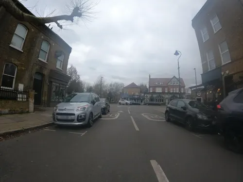
Paperback Coffee & Books
Cafe · Coffee Shop · 1.3 mi
73 St Mary's Road, London
Mo-Th 08:00-16:00; Fr-Sa 08:00-17:00; Su 08:00-15:00

The Forester
Bar and pub · 1.5 mi
2 Leighton Road, London
Mo 11:00-22:00; Tu-Sa 11:00-24:00; Su 11:00-22:30

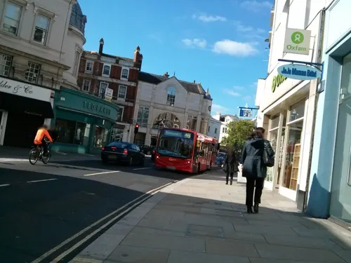
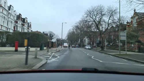
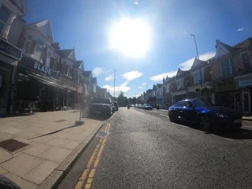
Da Shack
Restaurant · Hawaiian · 0.8 mi
156 South Ealing Road, London
Mo-Th 12:00-21:00; Fr-Sa 12:00-22:00; Su 12:00-20:00
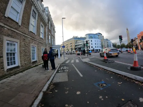
Express Tavern
Bar and pub · 0.9 mi
Pub located close to Kew bridge, large back garden, serves food and drink
56 Kew Bridge Road, London
Su-Th 11:00-23:00; Fr-Sa 11:00-24:00
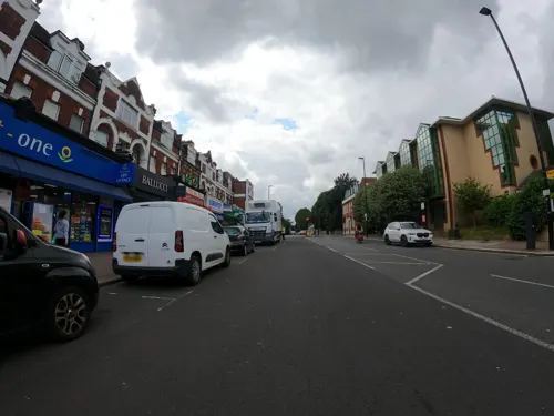



175 more on the map.
History
The name is recorded as Breguntford in 705 in an Anglo-Saxon charter and means ford over the River Brent'.
The name of the river derives from * brigant-, a Brythonic word, meaning "high" or "elevated" (possibly in a holy sense). The river may also have been associated with the goddess Brigantia. The suffix '-ford' is Old English. The ford was most likely located where the main road crossed the river. New Brentford is recorded as Newe Braynford in 1521 and was previously known as Westbraynford. Old Brentford is recorded as Old Braynford in 1476 and was previously known as Estbraynford.
The settlement pre-dates the Roman occupation of Britain, and thus pre-dates the founding of nearby London. Many pre-Roman artefacts have been excavated in and around the area in Brentford known as 'Old England'. Bronze Age pottery and burnt flints have been found at separate sites in Brentford. The quality and quantity of the artefacts suggests that Brentford was a meeting point for pre-Romanic tribes. One well known Iron Age piece from about 100 BC – AD 50 is the Brentford horn-cap – a ceremonial chariot fitting that formed part of local antiquarian Thomas Layton's collection, now held by the Museum of London. The Celtic knot pattern (the 'Brentford Knot') on this item has been copied for use on modern jewellery.
Read more of the history
Local history accounts and an inscription outside the County Court claim that Julius Cæsar crossed the Thames here during his invasion of Britain in 54 BC, and fought a battle with Cassivellaunus close by. Cæsar describes the place as fortified with sharp stakes. The discovery of sharp stakes in the riverside at Brentford Dock in the early 20th century was taken by Montagu Sharpe as evidence of a fortified crossing-site, and Caesar's battle. The stakes were removed as a hazard to river traffic, and Sharpe's claims are not supported by further excavations.
Historically part of Middlesex, in the southeastern corner of Elthorne Hundred, it has formed part of Greater London since 1965.
In November 1642 a Royalist army advancing on London overcame a much smaller Parliamentarian force in battle at Brentford. The town was ransacked in the immediate aftermath of the engagement.
A local town fair, the Brentford Festival, has been held in Brentford every September since 1900.
The building of Brentford Dock was started in 1855 and it was formally opened in 1859. The dock yard is now a marina and housing estate.
A notable family from Brentford was the 18th-/19th-century architectural father and son partnership, the Hardwicks. Thomas Hardwick Senior (1725–1798) and Thomas Hardwick Junior (1752–1829) were both from Brentford and are buried in the old church of St Laurence. Hardwick Senior was the master mason for the Adam Brothers during the construction of Syon House. Hardwick Junior assisted in the building of Somerset House and was known for his designs of churches in the capital. He was also a tutor of J. M. W. Turner and he helped start Turner's illustrious career in art. Both father and son did a great deal of remodelling and rebuilding on the church of St Laurence.
781 Council of Brentford recording settlement of a dispute between King Offa of Mercia, and the Bishop of Worcester
1016 Battle of Brentford between the invading Canute and Edmund Ironside
1616 – 1617 Pocahontas, a Native American woman, belonging to the Powhatan people, resided in Brentford with her husband, John Rolfe and son Thomas.
1682 "A very violent storm of rain, accompanied with thunder and lightning, caused a sudden flood, which did great damage to the town of Brentford."
1717 Brentford Turnpike Trust founded to maintain the road between Kensington and Hounslow
1756 Ronalds nursery established by Hugh Ronalds' father on Brentford High Street (closed 1880)
1805 Start of operations of the Grand Junction Canal (later the Grand Union Canal)
1806 James Montgomrey's father James Montgomrey Snr commenced operating a large timber mill at Montgomrey's Wharf, a yard formerly occupied by his cousin (relocated 1911)
1815 – 1817 John Quincy Adams, sixth President of the US, lived in Brentford.
1828 William Corder was arrested on Wednesday 23 April at Everley Grove House, Ealing Lane in Brentford, for the notorious Red Barn Murder.
1841 Brentford was flooded, caused by the Brent Reservoir becoming overfull so that the overflow cut a breach in the earth dam. Several lives lost.
1849 Start of operations of the Hounslow Loop line, providing service to Kew Bridge, Brentford Central and Syon Lane stations in the Brentford area.
1859 Start of operations of the Great Western & Brentford Railway, built in part on James Montgomrey's land and linking Brentford Dock to the Great Western Railway main line at Southall. Additional passenger station named 'Brentford Town' later constructed just north of Brentford High Street.
1884 Start of operations of Boston Manor Underground station (then known as Boston Road).
1889 Brentford Football Club founded by a rowing club seeking a winter sport.
30 May 1925 – Great West Road officially opened by King George V. Later the Brentford section became known as the Golden Mile due to the large number of factories that relocated there to take advantage of the good communications. The factories provided high employment and stimulation to the local economy.
1 January 1929 – Grand Junction Canal bought by the Regent's Canal and amalgamated with other canals to form the Grand Union Canal.
From the History section of Brentford on Wikipedia, under CC BY-SA 4.0.
More about Brentford
Economy
Brompton Bicycle (Headquarters), manufacturer of folding bicycles was based here for many years, but moved to a new factory in Greenford, Ealing in 2017
Global Blue (previously Global Refund) (Formerly the EMC Corporation HQ, aka 'EMC Tower')
Heidelberg Graphic Equipment Ltd. (subsidiary of Heidelberger Druckmaschinen AG)
From the Wikipedia article Brentford, under CC BY-SA 4.0.
Notable people from Brentford
 Bernard LeeBritish actor (1908–1981)Photo: film screenshot (United Artists), Public domain
 David GentlemanBritish artist (born 1930)Photo: GrindtXX, CC BY-SA 4.0
 Melbourne InmanEnglish snooker and billiards player (1878–1951)Photo: The original uploader was Richard..., Public domain
 Johnny Cronsheyspeed skater from the UKPhoto: Alf Schrøder (1880-1951), Public domain
- Gareth ThomasBritish actor (1945–2016)
- Donald BissetBritish actor (1910-1995)
- John Richardsonspecial effects supervisor from the United Kingdom
- John NixonBritish Indian Army general (1857–1921)
- William Lewisfootball person
- John BardonEnglish actor (1939-2014)
- Richard ShawEnglish football player and manager (born 1968)
- John Macallan SwanEnglish painter, sculptor, and etcher (1847–1910)
Born in Brentford, according to Wikidata (CC0). Each name links to its Wikipedia article.
Where to stay16
Best Western Northfields Ealing Hotel
Motel and hotel · 0.9 mi
264 Northfield Avenue, London
Churches and places of worship84
Cathedral of the Nativity of the Mother of God and the Holy Royal Martyrs
Church · Orthodox · 1.4 mi
57 Harvard Road, London
Shopping46
Gas and EV charging23
Schools, colleges and libraries52
Our Lady and St John's Catholic Primary School
School · Roman Catholic · 0.4 mi
Boston Park Road, Brentford
Healthcare32
HCA UK Chiswick Outpatients & Diagnostics Centre
Clinic and pharmacy · 1.7 mi
347-353 Chiswick High Road, London
Map of Brentford
250 places. The map loads OpenStreetMap tiles when you open it.
Getting there and nearby towns
Heathrow Airport (LHR) is the nearest airport with scheduled flights listed in OpenStreetMap, 6 miles away.
- Kew 1 mi east, about 2 min by car
- Isleworth 2 mi southwest, about 3 min by car
- Richmond 2 mi south, about 3 min by car
- Harlesden 4 mi northeast, about 7 min by car
- Cranford 5 mi west, about 7 min by car
- Hanworth 5 mi southwest, about 8 min by car
- Sudbury 5 mi north, about 8 min by car
- Northolt 5 mi northwest, about 8 min by car
- Hampton 6 mi southwest, about 9 min by car
- Harrow 6 mi north, about 10 min by car
Drive times are estimates from straight-line distance, not routes.
Towns near Brentford


Keep exploring
Local news
Headlines from INDB.
Reviews, tips and questions
Loading what members have shared...
Sources and licences
- GeoNames (CC BY 4.0): population, coordinates, regions and time zone
- Mapillary (see each image): photos
- OpenStreetMap contributors (ODbL 1.0): places, airports, map data
- Wikidata (CC0 1.0): elevation, founding date, time zone, website, landmarks and historic places
- Wikimedia Commons (see each image): photos
- Wikipedia (CC BY-SA 4.0): overview and history text
Photo credits
- Brentford skyline 4670, Patche99z, Public domain
- Brentford Free Church, ZeevoX, CC BY-SA 4.0
- Brentford Library (Carnegie Library 1903), DanielCahen01, CC BY 4.0
- Brentford Library (3476605225), JuliaC2006 from Rochester, UK, CC BY 2.0
- Brentford Library in Boston Manor Road - panoramio, Maxwell Hamilton, CC BY-SA 3.0
- Brentford Library, memorial, Rc1959, CC0
- The Brentford War Memorials - panoramio, Maxwell Hamilton, CC BY-SA 3.0
- Brentford Library, Rc1959, CC0
- Brentford Library, memorial (82572), Rc1959, CC0
- Brentford Library, memorial (32865), Rc1959, CC0
- Brentford Library, memorial (31415), Rc1959, CC0
- Brentford Library, memorial (26958), Rc1959, CC0
- The lyric hammersmith, Tarquin Binary, Public domain
- Richmond 018 Richmond Bridge TT panorama, Amandajm, CC BY-SA 3.0
- Richmond Lock from Isleworth,Middx looking SE, Unknown author, CC BY-SA 3.0
- Richmond Railway Bridge 333r1, Patche99z, CC BY 3.0
- The Exchange, Twickenham, Robert Smith, CC BY-SA 4.0
- Questors Theatre, Ealing, Roger Green, CC BY-SA 4.0
- Twickenham Bridge312-315b, Patche99z, CC BY 3.0
- Kew Palace (5942717068), xlibber, CC BY 2.0
- Boston manor front 2943, P.g.champion, CC BY-SA 2.0 uk
- Syon House West Aspect, Russ Hamer, CC BY-SA 3.0
- Bromhead memorial with wreaths, Robert Smith, CC BY-SA 4.0
- Ham House, London, Stevekeiretsu, CC BY-SA 4.0
- Entrance to The Kilmorey Mausoleum, Maxwell Hamilton, CC BY 2.0
- Blondin Park nature reserve 6, Dudley Miles, CC BY-SA 3.0
- Richmond Deer Park Obelisk, Amanda Slater from Coventry, West Midlands, UK, CC BY-SA 2.0
- London - April 2009 (3496483619), Cristian Bortes from Cluj-Napoca, Romania, CC BY 2.0
- Pesthouse Common Open Space, Richmond (14989254591), Loz Pycock from London, UK, CC BY-SA 2.0
- Kew Baptist Church, Robert Smith, CC BY-SA 4.0
- All Hallows Parish Church in Twickenham, Maxwell Hamilton, CC BY 2.0
- Bethlehem Chapel, Robert Smith, CC BY-SA 4.0
- London Transport Museum (42206944281), Wei-Te Wong from Taipei City, Taiwan, Republic of China, CC BY-SA 2.0
- Griffin Park aerial 2011, Photo: Andreas Praefcke, Public domain
- The Musical Museum, Brentford, London., Jim Linwood, CC BY 2.0
- Gunnersbury Triangle 'Mangrove Swamp', Chiswick Chap, CC BY-SA 3.0
- London Museum of Water & Steam entrance, Smurfy, CC0
- The Barn Church, Kew, Robert Smith, CC BY-SA 3.0
- Forester, Northfields, W13 (7970746162), Ewan Munro from London, UK, CC BY-SA 2.0
- Russian Orthodox Cathedral, Gunnersbury - 1, The wub, CC BY-SA 4.0
- Attila The Hungarian Barman Doing His Thing Hilton London Syon Park, Jack Oughton, CC BY-SA 3.0
- Syon Park Lake, Russ Hamer, CC BY-SA 3.0
- Richmond lending library (36446003082), JuliaC2006 from Rochester, UK, CC BY 2.0
- Former Currys HQ and factory, Kto288, CC BY-SA 2.5
- King William's Temple, Kew Gardens (3997546741), Rob Young from United Kingdom, CC BY 2.0
- Dome building, Richmond, Stevekeiretsu, CC BY-SA 4.0
- Ealing Fields High School 1, Katya H., CC BY-SA 4.0
- St Paul's CofE Primary School, Brentford (panorama), ZeevoX, CC BY-SA 4.0
- St Lawrence's Church, Brentford, London, Jim Linwood, CC BY 2.0
- Butterfly at Syon House, Keven Law from Los Angeles, USA, CC BY-SA 2.0
- Beatrice Lewisohn Q theatre programme 1935, Unknown author Unknown author, Public domain
- Isleworth, Gumley House, AndyScott, CC BY-SA 4.0
- Long Wood, Norwood Green 1, Dudley Miles, CC BY-SA 3.0
- GOC Richmond 213 Orange Tree Theatre, Richmond (14700706386), Peter O'Connor aka anemoneprojectors, CC BY-SA 2.0
- Richmond Theatre ceiling and chandelier, Gts-tg, CC BY-SA 4.0
- The Riverside Promenade in Waterman's Park in Brentford - panoramio, Maxwell Hamilton, CC BY-SA 3.0
- Dress from Ealing and Hounslow Gunnersbury Park Museum 2024-07-10, Matt Brown, CC BY 2.0
- Richmond Green 5260-6s, Patche99z, CC BY-SA 3.0
- Ealing-Common-old-drinking-fountain-DMS-01, DMS, CC BY-SA 3.0
- Street-level photo, milhouse, CC BY-SA 4.0
- Street-level photo, milhouse, CC BY-SA 4.0
- Street-level photo, milhouse, CC BY-SA 4.0
- Street-level photo, milhouse, CC BY-SA 4.0
- Street-level photo, milhouse, CC BY-SA 4.0
- Street-level photo, milhouse, CC BY-SA 4.0
- Street-level photo, milhouse, CC BY-SA 4.0
- Street-level photo, milhouse, CC BY-SA 4.0
- Street-level photo, milhouse, CC BY-SA 4.0
- Street-level photo, milhouse, CC BY-SA 4.0
- Street-level photo, milhouse, CC BY-SA 4.0
- Street-level photo, milhouse, CC BY-SA 4.0
- Street-level photo, milhouse, CC BY-SA 4.0
- Street-level photo, alexanderar, CC BY-SA 4.0
- Street-level photo, southglos, CC BY-SA 4.0
- Street-level photo, milhouse, CC BY-SA 4.0
- Street-level photo, alexanderar, CC BY-SA 4.0
- Street-level photo, ecatmur, CC BY-SA 4.0
- Street-level photo, RyanBush, CC BY-SA 4.0
- Street-level photo, ecatmur, CC BY-SA 4.0
- Street-level photo, milhouse, CC BY-SA 4.0
- Street-level photo, milhouse, CC BY-SA 4.0


Page built November 10, 2026. Spotted a mistake? Tell us or suggest a place.