


Why visit Alton
Townapedia lists 9 museums and landmarks, 13 parks and trails, 57 places to eat, 2 places to stay and 6 attractions in and around town.
Highlights include Alton Assembly Rooms, Jane Austen's House Museum, Curtis Museum and Worldham Golf Club.
Weather in Alton
Forecast from MET Norway (CC BY 4.0). Full forecast
About Alton
Alton is a market town and civil parish in East Hampshire, England, near the source of the northern branch of the River Wey. It is on the A31 road 8.5 miles (13.7 km) southeast of Farnham and 16 miles (26 km) northwest of Winchester.
From the Wikipedia article Alton, Hampshire (this version), under CC BY-SA 4.0.
Travel tips from other travellers: Alton on Wikivoyage (CC BY-SA 4.0).
Photos of Alton

Things to do6



Museums and landmarks9

Jane Austen's House Museum
Museum · 1.3 mi
Historic house museum in East Hampshire, UK
Winchester Road, Alton


Gliding Heritage Centre
Museum · 3.3 mi
Aviation museum in Lasham Airfield, Hampshire, England, UK




Parks, trails and playgrounds13




1 more on the map.
Restaurants and cafes57
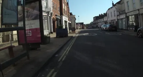
Alton Thai Cuisine
Restaurant · Thai
7 Normandy Street, Alton
Mo 17:30-22:00; We,Th,Su 12:00-15:00,17:30-22:00; Fr,Sa...
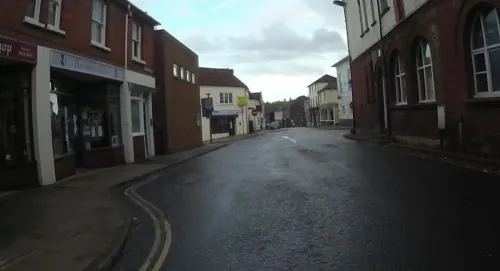

O'Connors
Restaurant
"Secret Garden, Bistro and B&B"
12 Normandy Street, Alton


The Wheatsheaf
Bar and pub
7 Market Street, Alton
Tu,We 12:00-22:00, Th-Sa 12:00-01:00, Su 12:00-18:00; Mo off

Ten Tun Tap House
Bar and pub
An independent bar specialising in beer and cider from independent producers.
1 Westbrook Walk, Alton
Mo-We 16:00-22:00; Th 16:00-23:00; Fr-Sa 12:00-23:00; Su 12:00-22:00
45 more on the map.
History
The River Wey has a source in the town, and the name Alton comes from an Anglo-Saxon word "aewielltun" meaning "farmstead at the source of the river". Alton was recorded in the Domesday Survey of 1086 as Aoltone. During the Saxon period Alton was known as Aweltun.
The Alton Hoard of Iron Age coins and jewellery found in the vicinity of the town in 1996 is now in the British Museum.
There is evidence of a Roman posting station at Neatham near Alton, probably called Vindomis, and a ford across the River Wey on the line of a Roman road that ran from Chichester to Silchester. An Anglo-Saxon settlement was established in the area and a 7th-century cemetery was discovered during building excavations. It contained grave goods including the Alton Buckle which is on display in the Curtis Museum and considered to be the finest piece of Anglo-Saxon craftsmanship found in Hampshire. The buckle, found in the grave of a warrior, has a silver-gilt body set with garnets and glass.
Read more of the history
In 1001 Danish forces invaded England and during the First Battle of Alton the forces of Wessex came together and fought against them. About 81 Englishmen were killed, including Ethelwerd the King's high-steward, Leofric of Whitchurch, Leofwin the King's high-steward, Wulfhere a bishop's thane, and Godwin of Worthy, Bishop Elfsy's son. The Danes were the victors although Danish casualties were higher and fleeing Englishmen took refuge in Winchester.
Alton (as Aoltone in the 'Odingeton Hundred — Hantescire') is recorded as having the most valuable market in the Domesday Book. There were 13 households and was in the Hundred of Neatham.
The Treaty of Alton was signed in 1101 between William the Conqueror's eldest son Robert II of Normandy and his brother Henry I of England. Henry had seized the throne while his elder brother was away on the First Crusade. Robert returned to claim the throne, landing in Portsmouth. The brothers met in Alton and agreed terms which formed the Treaty of Alton. Part of the main street through Alton is called Normandy Street, probably reflecting this event.
The first recorded market in Alton was in 1232, although the market at Neatham first recorded in the Domesday Book may also have been in the town. Blome wrote in 1673 of a 'market on Saturdays, which is very great for provisions, where also are sold good store of living cattle'. The Saturday market is featured on Kitchin's map of Hampshire (1751) which marks the town as Alton Mt. Sat.
1307 was, in fact, the first year of Edward II's reign but Edmund of Woodstock was not lord of the manor then. According to the Victoria County History (written after Curtis' book):-
In 1273 Edward I granted the manor [of Alton Westbrook] to his mother, Queen Eleanor, who died in 1291, when it reverted to the Crown and was granted in 1299 as dower to his second wife, Margaret of France. On the death of Queen Margaret in 1317, it again came to the Crown, and Edward II gave it in 1319 to his brother Edmund of Woodstock, Earl of Kent.
As can be seen, Queen Margaret held the manor until 1317 and so the fair could not have been granted to Edmund of Woodstock in 1307.
The correct date for the grant seems to be 22 November 1320 (according to the Charter Rolls, 14 Edward II, no.15). The grant was for a 9-day fair – the vigil [eve] and feast of Whitsuntide and seven days after.
The two main manors in Alton – Alton Eastbrook and Alton Westbrook – had a fair each. That of Alton Eastbrook has no extant charter, and may never have had one. It was originally held on St Lawrence's Day and so its origin was, presumably, the patronal festival. The religious aspect would have ceased when the country was no longer Roman Catholic. This fair seems to have been held on Crown Close (which is in the manor of Alton Eastbrook) in the early 19th century. When this land was built upon, the fair moved and was held where ever the Westbrook fair was – the Market Place, various meadows and the Butts.
The date of the Eastbrook fair was changed to Michaelmas in the mid-18th century as it came during harvest time and the farmers were not satisfied. Some accounts for this fair in the early 18th century do survive and show that there was a cheese fair as well the usual mix of travelling and local people with stalls and stands – people selling lace, gloves, books, gingerbread, bodices, sugar plums, toys, soap and knives, to name but a few. By the late 19th century, this fair was said to be mainly for horses, sheep and, occasionally, hops. Alton still has an annual fair, but it now takes the form of a carnival.
A battle was fought in Alton during the English Civil War. A small Royalist force was quartered in the town when on 13 December 1643 they were surprised by a Parliamentary army of around 5,000 men. The Royalist cavalry fled, leaving Sir Richard Bolle (or Boles) and his infantry to fight. Outnumbered, the Royalists were forced into the Church of St Lawrence, where Bolle was killed along with many of his men. Over 700 Royalist soldiers were captured and bullet holes from the battle are still visible in the church today.
In 1665, Alton suffered an outbreak of bubonic plague, but soon recovered.
From the History section of Alton, Hampshire on Wikipedia, under CC BY-SA 4.0.
More about Alton
Geography
Alton is located at the eastern end of the Hampshire Downs, a belt of chalk overlooking the Weald. The town is bordered to the east by Wealden Grassland. Nearby Brockham Hill, situated 3.5 miles (5.6 kilometres) northeast of Alton, rises to 225 metres (738 feet) above sea level.
Alton is between Farnham 9 miles (14 km) to the northeast and Winchester 16 miles (26 km) to the southwest. London is 52 miles (84 km).
Alton is a small built-up area according to the ONS built-up area classification.
Along with the rest of South East England, Alton has a temperate climate which is generally warmer than the rest of the country. The annual mean temperature is approximately 9 °C (48.2 °F) and shows a seasonal and a diurnal variation. January is the coldest month with mean minimum temperatures between 0.5 and 2 °C (32.9 and 35.6 °F). June and July are the warmest months in the area with average daily maximum around 21 °C (69.8 °F).
Economy
There have been a number of breweries in Alton since 1763, with Hall & Co. and Crowley & Co. establishing large brewery operations in Turk Street in the 1800s. As the brewing industry consolidated in the c.20th, these breweries were acquired by Courage Ltd and Watney, Combe Reid & Co. Ltd. A further brewery was opened nearby in Manor Park in December 1962 to produce Harp Lager as part of a consortium involving Guinness, Courage and a number of other partners. Watney, Combe Reid & Co. Ltd closed its brewery in 1970 and it became a depot until the 1980s. The original Courage site and Manor Park was sold to Bass Brewers in 1979 who closed the original brewery in 1980 to replace it with a warehouse and kegging facility. Following further mergers and sales within the brewing industry, Coors Brewing Company acquired the Manor Park brewery in 2001. The brewery produced Carling, Grolsch and Worthington until it was closed in 2015 due to a decline of demand for beer and a loss of a third party contract.
Alton was significant in the 18th century for the manufacture of paper and of dress materials including ribbed druggets, shallons, silks and serges, bombazine and figured barragons.
Arts and culture
Jane Austen Regency Week is a celebration of the time the author Jane Austen spent in Alton and Chawton and is held in June each year.
The Allen Gallery serves as Alton's art gallery. It houses a large, permanent ceramics collection as well as temporary exhibitions.
Holybourne Theatre is on the site of a former Nissen hut that was converted into a theatre by German prisoners-of-war during World War II. Plays have been performed there since 1950, but the official opening was not until 1971.
Alton Morris was formed in 1979, and have been Morris dancing both in the United Kingdom and abroad. They often perform at Alton street events.
Local choirs include Alton Amateur Operatic and Dramatic Society, established in 1921, who perform two musical shows and one play each year in a wide variety of musical and dramatic styles. Alton Community Choir sings unaccompanied Hampshire folk songs as well as some African, gospel, blues and calypso music.
A new Alton Arts Festival took place over 10 days in July 2024 and continues to date.
Education
Alton lies approximately midway between the University of Winchester and the University of Surrey at Guildford but its nearest University campus is the University for the Creative Arts in Farnham. It is home to Treloar's, an independent educational establishment founded in 1907 by Sir William Purdie Treloar, Lord Mayor of London, to provide education for young people with physical disabilities. Treloar's now runs Treloar School and College, a provision of education for pupils aged from 2–25 with physical and learning difficulties in Holybourne.
The state secondary schools in Alton are Eggar's School (formerly the Grammar School), and Amery Hill School. Eggar's School was founded in 1642 by John Eggar of Moungomeries as the Free Grammar School. It later became known as Eggar's School. It occupied a site in Anstey Road until it moved to a new site in Holybourne in 1968. In 2012 the school converted to academy status, as a means to secure existing standards and to further develop the school.
Sixth-form education is provided by Alton College, which has gained outstanding inspection reports from Ofsted.
From the Wikipedia article Alton, Hampshire, under CC BY-SA 4.0.
Notable people from Alton
 William CurtisBritish scientist (1746-1799)Photo: Unknown author Unknown author, Public domain
 Jimmy DickinsonEnglish footballer (1925-1982)Photo: Pompey Rog, CC BY-SA 4.0
 Mark StentEnglish record producer and mixing engineerPhoto: Madelynnelyse, CC BY-SA 3.0
 Matthew OffordBritish politician (born 1969)Photo: David Woolfall, CC BY 3.0
 Geoffrey RowellBishop in Europe; Bishop of Basingstoke; British Anglican bishopPhoto: Claus Rainer Michalek, CC BY-SA 3.0
 Elijah WaringWelsh writer (1787–1857)Photo: Unknown author Unknown author, Public domain
 William Curtis GreenEnglish architect (1875–1960)Photo: Carl Vandyk (17 January 1851 – 18..., Public domain
- John GoodyerEnglish botanist (1592-1664)
- Harry CharlesBritish equestrian
- Samantha WarrinerNew Zealand triathlete
- Fanny AdamsEnglish murder victim
- John Murrayfounder of the Universalist denomination in the United States
Born in Alton, according to Wikidata (CC0). Each name links to its Wikipedia article.
Where to stay2
Churches and places of worship13
Shopping13
Gas and EV charging1
Schools, colleges and libraries14
Healthcare7
Map of Alton
135 places. The map loads OpenStreetMap tiles when you open it.
Getting there and nearby towns
RAF Odiham (ODH) is the nearest airport with scheduled flights listed in OpenStreetMap, 6 miles away.
- Basingstoke 9 mi northwest, about 15 min by car
- Petersfield 10 mi south, about 16 min by car
- Haslemere 12 mi east, about 20 min by car
- Tadley 15 mi northwest, about 25 min by car
- Frimley 15 mi northeast, about 25 min by car
- Godalming 16 mi east, about 25 min by car
- Sandhurst 16 mi northeast, about 26 min by car
- Camberley 16 mi northeast, about 26 min by car
- Crowthorne 17 mi northeast, about 28 min by car
- Reading 21 mi north, about 34 min by car
Drive times are estimates from straight-line distance, not routes.
Towns near Alton


Keep exploring
Local news
Headlines from INDB.
Reviews, tips and questions
Loading what members have shared...
Sources and licences
- GeoNames (CC BY 4.0): population, coordinates, regions and time zone
- Mapillary (see each image): photos
- OpenStreetMap contributors (ODbL 1.0): places, airports, map data
- Wikidata (CC0 1.0): elevation, founding date, time zone, website, landmarks and historic places
- Wikimedia Commons (see each image): photos
- Wikipedia (CC BY-SA 4.0): overview and history text
Photo credits
- Bakers Arms, Alton, Paul the Archivist, CC BY-SA 4.0
- Hamptons International Lettings Alton, Hamptonsinternational, CC BY-SA 4.0
- Jane Austen's House Museum, Chawton, Simon Burchell, CC BY-SA 4.0
- Manuel Crested Wren at Gliding Heritage Centre (34085281530), Mike Burdett from CROMER, UK, CC BY-SA 2.0
- St mary's bentworth22, Ericoides, CC BY-SA 3.0
- All Saints Alton, Ericoides, CC BY-SA 3.0
- Church of St Lawrence from the north-west, Ericoides, CC BY-SA 3.0
- Church of the Holy Rood, Holybourne 15, Simon Burchell, CC BY-SA 3.0
- Alton House Hotel, Paul the Archivist, CC BY-SA 4.0
- Swan Hotel, Alton, Paul the Archivist, CC BY-SA 4.0
- 12 Normandy St, Alton, Paul the Archivist, CC BY-SA 4.0
- War Memorial, Alton 01, Paul the Archivist, CC BY-SA 4.0
- Crown Close, Alton 10 - Inwood Court, Paul the Archivist, CC BY-SA 4.0
- Church of St Lawrence from the north-west2, Ericoides, CC BY-SA 4.0
- Crown Close, Alton 07 - Curtis Museum, Paul the Archivist, CC BY-SA 4.0
- Saint John Henry Newman 20211024 114021, Dcs57, CC BY-SA 4.0
- William Curtis House, Alton 02, Paul the Archivist, CC BY-SA 4.0
- Street-level photo, jpennycook, CC BY-SA 4.0
- Street-level photo, jpennycook, CC BY-SA 4.0
- Street-level photo, southglos, CC BY-SA 4.0
- Street-level photo, jpennycook, CC BY-SA 4.0
- Street-level photo, noid, CC BY-SA 4.0
- Street-level photo, jpennycook, CC BY-SA 4.0
- Street-level photo, jpennycook, CC BY-SA 4.0
- Street-level photo, jpennycook, CC BY-SA 4.0
- Street-level photo, jpennycook, CC BY-SA 4.0
- Street-level photo, noid, CC BY-SA 4.0
- Street-level photo, richardbrand, CC BY-SA 4.0


Page built November 10, 2026. Spotted a mistake? Tell us or suggest a place.