


Reading, United Kingdom
Reading is a city of 318,014 people in England, United Kingdom, founded in 871.
Why visit Reading
Townapedia lists 85 museums and landmarks, 90 parks and trails, 145 places to eat, 38 places to stay and 21 attractions in and around town.
Highlights include Progress Theatre, The Hexagon, Riverside Museum at Blake's Lock and Museum Of English Rural Life.
Weather in Reading
Forecast from MET Norway (CC BY 4.0). Full forecast
About Reading
Reading is a town and borough in Berkshire, England, and the county town of Berkshire. It is Berkshire's largest town, with a total population of 203,795 in its built-up area as of 2021. Most of its built-up area lies within the Borough of Reading, although some outer suburbs are parts of neighbouring local authority areas. It is located in the Thames Valley at the confluence of the rivers Thames and Kennet.
From the Wikipedia article Reading, Berkshire (this version), under CC BY-SA 4.0.
Travel tips from other travellers: Reading on Wikivoyage (CC BY-SA 4.0).
Photos of Reading


Things to do21

Progress Theatre
Cinema and theater · 1.0 mi
Community theatre in Reading, Berkshire, UK
The Mount, Reading

The Hexagon
Cinema and theater
Theatre and arts centre in Reading, Berkshire, England
Queens Walk, Reading


Caversham Lock and Weir
Bridge · 0.4 mi
Lock and weir on the River Thames in Berkshire, England

Christchurch Bridge
Bridge · 0.4 mi
Pedestrian and cycle bridge across the River Thames in the centre of Reading, UK


Reading Festival Bridge
Bridge · 1.9 mi
Bridge in United Kingdom built for the final weekend in August most years and removed shortly afterwards.


Vue
Cinema and theater
Mill Lane, Reading
Mo-Th 15:00-21:00; Fr 14:00-22:00; Sa 10:00-22:00; Su 10:00-21:00
9 more on the map.
Museums and landmarks85

Riverside Museum at Blake's Lock
Museum · 0.6 mi
Local museum in Berkshire, England
Gas Works Road, Reading
Apr-Sep Mo-Su 10:00-18:00

Museum Of English Rural Life
Museum · 0.7 mi
Museum in Reading, England, United Kingdom
Tu-Fr 09:00-17:00; Sa,Su 10:00-17:00; Mo off


Maiwand Lion
Monument and historic site
Sculpture in Reading (UK) by George Blackall Simonds commemorating the battle of Maiwand

Mapledurham House
Monument and historic site · 3.4 mi
An Elizabethan stately home in Mapledurham, Oxfordshire, England, UK

Reading Museum
Museum
Local museum in Reading, Berkshire, England, UK
Tu-Fr 10:00-16:00; Sa 10:00-17:00




Simeon Monument
Monument and historic site
Monument in Reading, United Kingdom
73 more on the map.
Parks, trails and playgrounds90


Courage Park
Park · 1.3 mi
A public park in the suburb of Coley Park in Reading, England


McIlroy Park
Park · 2.4 mi
Public park and local nature reserve in Tilehurst, Reading, UK


Arthur Newbery Park
Park · 2.8 mi
Public park in Tilehurst, Reading, UK
Cintra Park
Park · 1.1 mi
Park in the English town of Reading
Cintra Avenue, Reading
78 more on the map.
Restaurants and cafes145
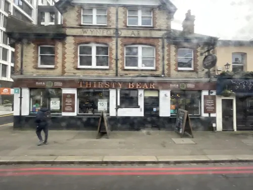

The Butler
Bar and pub · 0.4 mi
85-91 Chatham Street, Reading
Mo-Th 12:00-23:00, Fr,Sa 12:00-24:00, Su 12:00-22:30
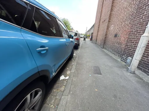
The Nags Head
Bar and pub · 0.5 mi
5 Russell Street, Reading
Su-Th 12:00-23:00; Fr 12:00-24:00; Sa 11:00-24:00
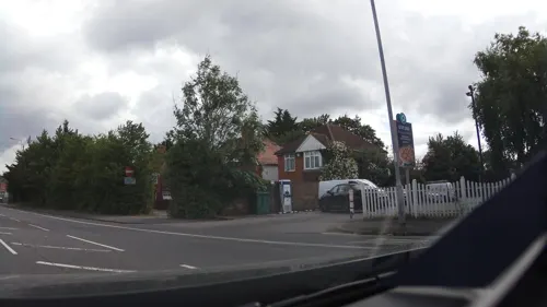
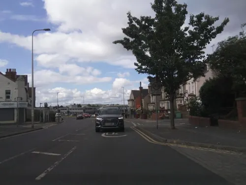
Dhaulagiri Kitchen
Restaurant · Nepalese, Indian · 1.2 mi
Nepalese and Indian Cafe Restaurant
63 Basingstoke Road, Reading
Mo-Fr 11:00-22:30; Sa, Su 10:30-22:30
London Street Brasserie
Restaurant · International, Fine Dining
2-4 London Street, Reading
Mo-Th 12:00-22:00, Fr-Sa 12:00-22:30, Su 12:00-20:30
Nando's
Restaurant · Chicken, Portuguese
30-31 Friar Street, Reading
Mo-Sa 11:00-23:00; Su 12:00-22:30


The Rose and Thistle
Bar and pub · 0.8 mi
43 Argyle Road, Reading
Mo-Fr 17:00-20:30; Sa 12:00-20:30; Su 12:00-19:30

133 more on the map.
History
Occupation at the site of Reading may date back to the Roman period, possibly in the form of a trading port for Calleva Atrebatum. However, the first clear evidence for Reading as a settlement dates from the 8th century, when the town came to be known as Readingas. The town grew around a crossing of the River Kennet, about 1 mile (1.6 km) upstream from its confluence with the River Thames.
In late 870, an army of Danes invaded the kingdom of Wessex and set up camp at Reading. On 4 January 871, in the first Battle of Reading, King Ethelred and his brother Alfred the Great attempted unsuccessfully to breach the Danes' defences. The battle is described in the Anglo-Saxon Chronicle, and that account provides the earliest known written record of the existence of Reading. The Danes remained in Reading until late in 871, when they retreated to their winter quarters in London.
Following the Norman conquest of England in 1066, William the Conqueror gave land in and around Reading to his foundation of Battle Abbey. In Domesday Book, the town was explicitly described as a borough. The presence of six mills is recorded: four on land belonging to the king and two on the land given to Battle Abbey.
Read more of the history
Reading Abbey was founded in 1121 by Henry I, who is buried within the Abbey grounds. As part of his endowments, he gave the abbey his lands in Reading, along with land at Cholsey. The foundation of Reading Abbey led to the town becoming a place of pilgrimage and enhanced the town's prosperity, however the relationship between abbey and town was to prove strained at times.
In 1253 Reading's Merchant Guild successfully petitioned for the grant of a charter from the King and negotiated a division of authority with the Abbey. In 1312, King Edward II directed that its bridges should be kept in good order.
It is not known how badly Reading was affected by the Black Death that swept through England in the 14th century, but it is known that the abbot, Henry of Appleford, was one of its victims in 1361, and that nearby Henley lost 60% of its population.
The Abbey was largely destroyed in 1538 during Henry VIII's dissolution of the monasteries. The last abbot, Hugh Faringdon, was subsequently tried and convicted of high treason and hanged, drawn and quartered in front of the Abbey Church.
By 1525, Reading was the largest town in Berkshire and the tenth largest town in England when measured by taxable wealth reported in tax returns. By 1611, it had a population of over 5,000 and had grown rich on its trade in cloth, as instanced by the fortune made by local merchant John Kendrick.
Reading played a role during the English Civil War. Despite its fortifications, it had a Royalist garrison imposed on it in 1642. The subsequent Siege of Reading by Parliamentary forces succeeded in April 1643. The town's cloth trade was especially badly damaged, and the town's economy did not fully recover until the 20th century. Reading played a significant role during the Glorious Revolution: the second Battle of Reading was the only substantial military action of the campaign.
The 18th century saw the beginning of a major iron works in the town and the growth of the brewing trade for which Reading was to become famous. Agricultural products from the surrounding area still used Reading as a market place, especially at the famous Reading cheese fair but now trade was coming in from a wider area.
Reading's trade benefited from better designed turnpike roads which helped it establish its location on the major coaching routes from London to Oxford and the West Country. In 1723, despite considerable local opposition, the Kennet Navigation opened the River Kennet to boats as far as Newbury. Opposition stopped when it became apparent that the new route benefited the town. After the opening of the Kennet and Avon Canal in 1810, one could go by barge from Reading to the Bristol Channel.
From 1714, and probably earlier, the role of county town of Berkshire was shared between Reading and Abingdon. In the eighteenth and nineteenth centuries it was one of the southern termini of the Hatfield and Reading Turnpike that allowed travellers from the north to continue their journey to the west without going through the congestion of London.
During the 19th century, the town grew rapidly as a manufacturing centre. It was reformed as a municipal borough by the Municipal Corporations Act 1835 and in 1836 the Reading Borough Police were founded. The Great Western Railway arrived in 1841, followed by the South Eastern Railway in 1849 and the London and South Western Railway in 1856.
After the Summer Assizes (courts of assize) were moved from Abingdon to Reading in 1867, the privy council made Reading the sole county town of Berkshire in 1869. The town became a county borough under the Local Government Act 1888.
In the 19th and 20th centuries, the town's three largest industries were known as the Three Bs: beer (1785–2010, H & G Simonds), bulbs (1837–1974, Suttons Seeds), and biscuits (1822–1976, Huntley and Palmers). Over the century, the town's population had grown from around 9,400 to 59,000.
The town continued to expand in the 20th century, annexing Caversham across the River Thames in Oxfordshire in 1911, as well as most of Tilehurst to the west at the same time. Reading suffered much less physical damage than many other English towns and cities during the two world wars of the 20th century, although many citizens were killed or injured. In one significant air raid on 10 February 1943 a single Luftwaffe plane strafed and bombed the town centre, causing 41 deaths and over 100 injuries.
From the History section of Reading, Berkshire on Wikipedia, under CC BY-SA 4.0.
More about Reading
Geography
Reading is 42 miles (68 km) north of the English south coast, 40 miles west of London and 40 miles east of Swindon. The centre of Reading is on a low ridge between the River Thames and River Kennet, close to their confluence, reflecting the town's history as a river port. Just above the confluence, the Kennet cuts through a narrow steep-sided gap in the hills forming the southern flank of the Thames flood plain. The Kennet, which naturally divided into multiple shallow streams through the centre of Reading, was embanked as part of the construction of the Kennet and Avon Canal in the 18th century, allowing the development of wharves. The floodplains adjoining Reading's two rivers are subject to occasional flooding.
As Reading has grown, its suburbs have spread: to the west between the two rivers into the foothills of the Berkshire Downs as far as Calcot, Tilehurst and Purley; to the south and south-east on the south side of the River Kennet as far as Whitley Wood and Lower Earley and as far north of the Thames into the Chiltern Hills as far as Caversham Heights, Emmer Green and Caversham Park Village. Outside the central area, the floors of the valleys containing the two rivers remain largely unimproved floodplain. Apart from the M4 curving to the south there is only one road across the Kennet flood plain. All other routes between the three built-up areas are in the central area.
Economy
Reading is a commercial centre in the Thames Valley and Southern England. The town hosts the headquarters of several British companies and the United Kingdom offices of foreign multinationals, as well as being a major retail centre. Whilst located close enough to London to be sometimes regarded as part of the London commuter belt, Reading is a net inward destination for commuters. During the morning peak period, there are some 30,000 inward arrivals in the town, compared to 24,000 departures. Major companies Microsoft, Oracle and Hibu (formerly Yell Group) have their headquarters in the Reading area. The insurance company Prudential has an administration centre in the town. PepsiCo and Wrigley also have offices in the town.
Arts and culture
Every year Reading hosts the Reading Festival, which has been running since 1971. The festival takes place on the Friday, Saturday and Sunday of the August bank holiday weekend and is the largest of its kind in the United Kingdom aside from the Glastonbury Festival. Reading Festival takes place at Little Johns Farm in Reading, Richfield Avenue. For some twenty years until 2006, Reading was also known for its WOMAD Festival until it moved to Charlton Park in Malmesbury, Wiltshire.
The Reading Beer Festival was first held in 1994 and has now grown to one of the largest beer festivals in the United Kingdom. It is held at King's Meadow for the five days immediately preceding the May Day bank holiday every year. Reading also holds Reading Pride, an annual LGBT festival in Kings Meadow.
The Frank Matcham-designed Royal County Theatre, built in 1895, was located on the south side of Friar Street. It burned down in 1937. Within the town hall is a 700-seat concert hall that houses a Father Willis organ. Reading theatre venues include The Hexagon and South Street Arts Centre. Reading Repertory Theatre is based at Reading College: its Royal Patron is Prince Edward, Duke of Edinburgh.
From the Wikipedia article Reading, Berkshire, under CC BY-SA 4.0.
Notable people from Reading
 Kate WinsletEnglish actress (born 1975)Photo: Colleen Sturtevant, CC BY-SA 4.0
 Sam MendesBritish stage and film director (born 1965)Photo: Frankie Fouganthin, CC BY-SA 4.0
 Natalie DormerEnglish actressPhoto: Gage Skidmore, CC BY-SA 3.0
 Mike OldfieldEnglish musician (born 1953)Photo: Total number of my uploaded files : 1116, CC BY-SA 3.0
 William LaudArchbishop of Canterbury (1573-1645)Photo: After Anthony van Dyck, Public domain
 Charlie Brookerjournalist, broadcaster and writer from EnglandPhoto: MTV UK, CC BY 3.0
 Simon Coxassociation football player (born 1987)Photo: Michael Kranewitter, CC BY-SA 3.0 at
 John SykesBritish guitarist (1959–2025)Photo: Sproily, Public domain
- Ricky GervaisBritish comedian
- Richard BurnsBritish rally driver (1971–2005)
- Cormac Murphy-O'ConnorCatholic cardinal (1932-2017)
- Eliza BennettBritish actress and singer
Born in Reading, according to Wikidata (CC0). Each name links to its Wikipedia article.
Where to stay38
Sure Hotel by Best Western Reading
Motel and hotel · 0.9 mi
39 Christchurch Road, Reading
Churches and places of worship58
Shopping71
Gas and EV charging24
Schools, colleges and libraries38
Healthcare36
Map of Reading
250 places. The map loads OpenStreetMap tiles when you open it.
Getting there and nearby towns
Blackbushe Airport (BBS) is the nearest airport with scheduled flights listed in OpenStreetMap, 11 miles away.
- Slough 17 mi east, about 27 min by car
- Woking 20 mi southeast, about 32 min by car
- Watford 28 mi northeast, about 46 min by car
- Sutton 34 mi east, about 55 min by car
- Swindon 36 mi west, about 57 min by car
- City of Westminster 36 mi east, about 58 min by car
- London 37 mi east, about 59 min by car
- Tottenham 40 mi east, about 1 h by car
- Walthamstow 42 mi east, about 1 h by car
- Southampton 43 mi southwest, about 1 h 15 min by car
Drive times are estimates from straight-line distance, not routes.
Towns near Reading


Keep exploring
Local news
Headlines from INDB.
Reviews, tips and questions
Loading what members have shared...
Sources and licences
- GeoNames (CC BY 4.0): population, coordinates, regions and time zone
- Mapillary (see each image): photos
- OpenStreetMap contributors (ODbL 1.0): places, airports, map data
- Wikidata (CC0 1.0): elevation, founding date, time zone, website, landmarks and historic places
- Wikimedia Commons (see each image): photos
- Wikipedia (CC BY-SA 4.0): overview and history text
Photo credits
- Early-Mid 18th Century buildings in Friar Street, Reading, Tom Bastin from Reading, UK, CC BY 2.0
- Reading County Court, UK - 20150707, Smuconlaw ., CC BY-SA 4.0
- Reading ayuntamiento, User:Miguel303xm~commonswiki, CC BY-SA 2.5
- Reading Town Hall, UK - 20150707, Smuconlaw ., CC BY-SA 4.0
- Carousel bus to High Wycombe in Reading 2025-01-29 12.05.52 (cropped), Chris j wood, CC BY-SA 4.0
- Carousel bus to High Wycombe in Reading 2025-01-29 12.05.52, Chris j wood, CC BY-SA 4.0
- Friar Street, Reading, August 2025, Gazamp, CC BY-SA 4.0
- Town Hall Square from Friar Street, Reading, August 2025, Gazamp, CC BY-SA 4.0
- 160-163 Friar Street, Reading, August 2025, Gazamp, CC BY-SA 4.0
- ProgressTheatre, Tcbently, CC BY-SA 4.0
- Reading the Hexagon Theatre, Chris Downer, CC BY-SA 2.0
- Caversham Bridge, Jystyn at English Wikipedia, Public domain
- Reading, UK - panoramio (42), Wojciech Zabolotny, CC BY-SA 3.0
- Reading Cycle and Pedestrian Bridge 02, Chris j wood, CC BY-SA 4.0
- Reading Bridge, Ben Sutherland from Forest Hill, London, European Union, CC BY 2.0
- Reading Festival Bridge, Rod Allday., CC BY-SA 2.0
- ShiplakeRlyBr01, Motmit, CC BY-SA 3.0
- Riverside Museum at Blake's Lock, Juan J. Martínez from Exeter, UK, CC BY-SA 2.0
- Cole Museum of Zoology Elephant Skeleton, Chris_huh ( talk ) ( Uploads ), Public domain
- The Maiwand Lion, Forbury Gardens, Reading 2, Jim Linwood, CC BY 2.0
- MapledurhamHouse01, Motmit, CC BY-SA 3.0
- Reading Town Hall (July 19, 2007), Leslie, CC BY 2.0
- Palmer Park, Reading, Andrew Smith, CC BY-SA 2.0
- Forbury Gardens, Reading, Andrew Smith, CC BY-SA 2.0
- King's Meadow, Reading, Ben Sutherland from Forest Hill, London, European Union, CC BY 2.0
- Reading Abbey interior, Chris Wood ( User:chris_j_wood )., CC BY-SA 4.0
- CavershamPark, Yablochko ( talk ) ( Uploads ), CC0
- ReadingGreyfriars, JohnArmagh, Public domain
- Heelas, Broad Street, Reading, Tom Bastin from Reading, UK, CC BY 2.0
- Malmaison Hotel, Reading (3), Leslie, CC BY 2.0
- Royal Berkshire Hospital 3, Juan J. Martínez from Exeter, UK, CC BY-SA 2.0
- St Laurence, Friar Street, Reading, Tom Bastin from Reading, UK, CC BY 2.0
- The George Hotel 2, Tom Bastin from Reading, UK, CC BY 2.0
- MillSonning, Mariegriffiths, CC BY-SA 4.0
- Watlington House, Tom Bastin from Reading, UK, CC BY 2.0
- Earley St Peter's Church of England Primary School, Tim Landy, CC BY-SA 4.0
- St James' Church Centre, Woodley, Berkshire, Tim Landy, CC BY-SA 4.0
- The Maiwand Lion, Forbury Gardens, QuentinUK, CC BY-SA 3.0
- Castle Street, Reading (1), Tom Bastin from Reading, UK, CC BY 2.0
- The Oracle (559896489), Uli Harder, CC BY-SA 2.0
- View of Peckover Hall in Autumn, Joggs64, CC BY-SA 4.0
- Coley Park 2014-03-22 16.27.26, Chris j wood, CC BY-SA 4.0
- High Bridge, Reading, Tom Bastin from Reading, UK, CC BY 2.0
- Milk delivery cart - Museum of English Rural Life 2025-05-03, Andy Li, CC0
- Courage Park 2014-05-17 16.29.02, Chris j wood, CC BY-SA 4.0
- McIlroy Park 03, Chris j wood, CC BY-SA 4.0
- Butler & Sons Wine 2015-06-06 22.49.29, Chris j wood, CC BY-SA 4.0
- Street-level photo, 4004, CC BY-SA 4.0
- Street-level photo, 4004, CC BY-SA 4.0
- Street-level photo, southglos, CC BY-SA 4.0
- Street-level photo, 4004, CC BY-SA 4.0
- Street-level photo, jpennycook, CC BY-SA 4.0
- Street-level photo, southglos, CC BY-SA 4.0
- Street-level photo, southglos, CC BY-SA 4.0
- Street-level photo, jpennycook, CC BY-SA 4.0
- Street-level photo, southglos, CC BY-SA 4.0
- Street-level photo, 4004, CC BY-SA 4.0
- Street-level photo, 4004, CC BY-SA 4.0
- Street-level photo, southglos, CC BY-SA 4.0
- Street-level photo, jpennycook, CC BY-SA 4.0
- Street-level photo, 4004, CC BY-SA 4.0
- Street-level photo, 4004, CC BY-SA 4.0
- Street-level photo, southglos, CC BY-SA 4.0
- Street-level photo, 4004, CC BY-SA 4.0
- Street-level photo, 4004, CC BY-SA 4.0
- Street-level photo, southglos, CC BY-SA 4.0
- Street-level photo, 4004, CC BY-SA 4.0
- Street-level photo, southglos, CC BY-SA 4.0
- Street-level photo, southglos, CC BY-SA 4.0
- Street-level photo, southglos, CC BY-SA 4.0
- Street-level photo, 4004, CC BY-SA 4.0
- Street-level photo, 4004, CC BY-SA 4.0
- Street-level photo, 4004, CC BY-SA 4.0
- Street-level photo, southglos, CC BY-SA 4.0
- Street-level photo, 4004, CC BY-SA 4.0
- Street-level photo, laye, CC BY-SA 4.0


Page built November 10, 2026. Spotted a mistake? Tell us or suggest a place.