


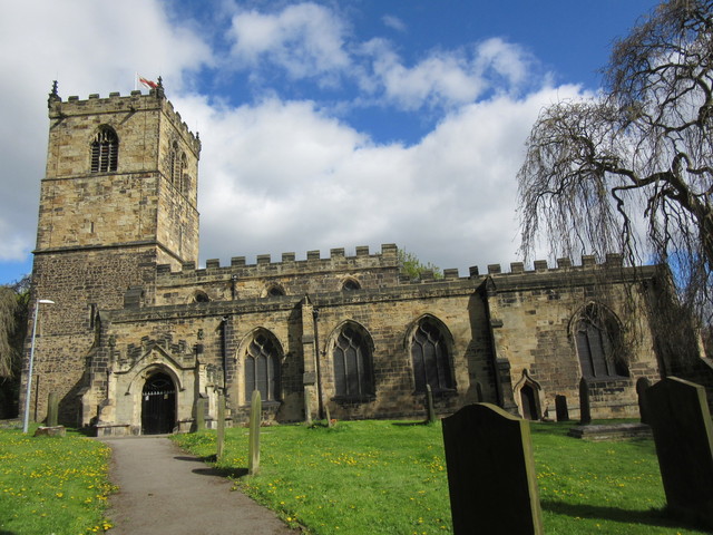
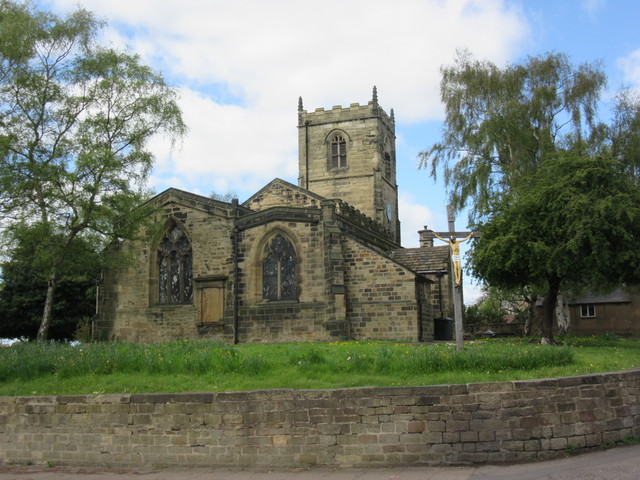
Bolton upon Dearne, United Kingdom
Bolton upon Dearne is a town of 13,236 people in England, United Kingdom.
Why visit Bolton upon Dearne
Townapedia lists 2 museums and landmarks, 9 parks and trails, 7 places to eat and 1 place to stay in and around town.
Highlights include Phoenix Park and Denaby Ings.
Weather in Bolton upon Dearne
Forecast from MET Norway (CC BY 4.0). Full forecast
About Bolton upon Dearne
Bolton upon Dearne is a village in the Metropolitan Borough of Barnsley, South Yorkshire, England, in the part of the Dearne Valley through which the River Dearne passes. Historically part of the West Riding of Yorkshire, it is approximately 7 miles (11 km) east of Barnsley, 10 miles (16 km) west of Doncaster and 8 miles (13 km) north of Rotherham.
From the Wikipedia article Bolton upon Dearne (this version), under CC BY-SA 4.0.
Photos of Bolton upon Dearne


Museums and landmarks2

Parks, trails and playgrounds9

Phoenix Park
Park · 1.7 mi
Park in Thurnscoe, South Yorkshire, England, UK

Denaby Ings
Park · 3.1 mi
Nature reserve in South Yorkshire, England, United Kingdom



Restaurants and cafes7

Marseb Filipino Cuisine and Milk Tea
Restaurant · Filipino, Asian · 1.3 mi
Discover authentic Filipino flavours at Marseb Filipino Cuisine, Yorkshire's only Filipino restaurant. Located in Goldthorpe, Rotherham,...
20 High Street, Rotherham


Where to stay1
Holiday Inn Express Rotherham North
Motel and hotel · 1.5 mi
Manvers Way, Rotherham
History
The name Bolton derives from the Old English bōðltūn meaning 'a collection of buildings'.
Bolton upon Dearne was an ancient parish. It was recorded in the Domesday Book as part of the Manor of Bolton-upon-Dearne with Goldthorpe which was owned by Roger de Busli.
In the early 18th century Barnsley attorney William Henry Marsden Esquire of Burntwood Hall bought the Manor of Bolton on Dearne with Goldthorpe with over 1,000 acres (4 km2) of land for £10,000. Bolton upon Dearne and Goldthorpe are recorded in the 1761–1767 Inclosure Awards. The Marsden family continued to hold the manor until 1815.
Bolton upon Dearne became part of Doncaster Rural District under the Local Government Act 1894 until 1899, when it became a separate urban district. Bolton upon Dearne Urban District was abolished in 1937 under a County Review Order, becoming part of the large Dearne Urban District, along with Thurnscoe and part of Barnburgh parish. On 1 April 1937 the parish was abolished to form Dearne. In 1931 the parish had a population of 14,245. It is now in the unparished area of Dearne. At the 2011 Census the village in the Dearne South Ward of the Barnsley Metropolitan Council had a population of 6,744.
From the History section of Bolton upon Dearne on Wikipedia, under CC BY-SA 4.0.
Notable people from Bolton upon Dearne
- Willie WatsonEnglish footballer (1920-2004)
- Percy AshtonEnglish association football player (1909-1985)
- Helene PalmerBritish actress (1928-2011)
- Albert WatsonEnglish footballer (1918-2009)
- Billy Watson, Snr.English footballer (1893-1962)
- Brian MarshallEnglish footballer (born 1954)
- Stan WildBritish gymnast
- George Lunn(1915-2000)
Born in Bolton upon Dearne, according to Wikidata (CC0). Each name links to its Wikipedia article.
Churches and places of worship13
Shopping8
Gas and EV charging4
Schools, colleges and libraries12
Wath upon Dearne Community Library
Library · 1.5 mi
21 Montgomery Road, Rotherham
Healthcare2
Map of Bolton upon Dearne
58 places. The map loads OpenStreetMap tiles when you open it.
Getting there and nearby towns
Leeds Bradford Airport (LBA) is the nearest airport with scheduled flights listed in OpenStreetMap, 28 miles away.
- Wath upon Dearne 2 mi southwest, about 2 min by car
- Mexborough 2 mi southeast, about 3 min by car
- Wombwell 3 mi west, about 5 min by car
- Rawmarsh 4 mi south, about 6 min by car
- Conisbrough 4 mi southeast, about 7 min by car
- Rotherham 6 mi south, about 10 min by car
- Hoyland Nether 6 mi west, about 9 min by car
- Cudworth 6 mi northwest, about 9 min by car
- South Elmsall 6 mi north, about 9 min by car
- Doncaster 8 mi east, about 12 min by car
Drive times are estimates from straight-line distance, not routes.
Towns near Bolton upon Dearne


Keep exploring
Local news
Headlines from INDB.
Reviews, tips and questions
Loading what members have shared...
Sources and licences
- GeoNames (CC BY 4.0): population, coordinates, regions and time zone
- Mapillary (see each image): photos
- OpenStreetMap contributors (ODbL 1.0): places, airports, map data
- Wikidata (CC0 1.0): elevation, founding date, time zone, website, landmarks and historic places
- Wikimedia Commons (see each image): photos
- Wikipedia (CC BY-SA 4.0): overview and history text
Photo credits
- Bolton upon Dearne St Andrew GeoUK3326950, JThomas, CC BY-SA 2.0
- 20303 "Max Joule" Bolton Upon Dearne 241019, kitmasterbloke, CC BY 2.0
- 20302 Bolton upon Dearne, kitmasterbloke, CC BY 2.0
- Overlooking-Mining-Monument, Jonathan Thacker, CC BY-SA 2.0
- All saints church, Darfield, ChicXulub, CC BY-SA 4.0
- ChurchofStAndrewTheApostleinBoltonUponDearne - 04052015, ChicXulub, CC BY-SA 4.0
- 20303 "Max Joule" and 20302 at speed Bolton on Dearne, kitmasterbloke, CC BY 2.0
- Bolton-on-Dearne railway station, Ben Brooksbank, CC BY-SA 2.0
- Street-level photo, cuttlebug, CC BY-SA 4.0
- Street-level photo, lvl5, CC BY-SA 4.0
- Street-level photo, lvl5, CC BY-SA 4.0
Page built November 10, 2026. Spotted a mistake? Tell us or suggest a place.