


Mexborough, United Kingdom
Mexborough is a town of 15,079 people in England, United Kingdom.
Why visit Mexborough
Townapedia lists 11 museums and landmarks, 7 parks and trails, 32 places to eat and 1 place to stay in and around town.
Highlights include Conisbrough Castle, Cenotaph, Phoenix Park and Denaby Ings.
Weather in Mexborough
Forecast from MET Norway (CC BY 4.0). Full forecast
About Mexborough
Mexborough is a town in the City of Doncaster District, South Yorkshire, England, between Manvers and Denaby Main, on the River Don close to where it joins the River Dearne, and the A6023 road. It is contiguous with Swinton to the southwest and Conisbrough to the east.
From the Wikipedia article Mexborough (this version), under CC BY-SA 4.0.
Museums and landmarks11

Conisbrough Castle
Monument and historic site · 2.8 mi
Grade I listed historic house museum in Conisbrough, Doncaster, South Yorkshire, England, UK

Parks, trails and playgrounds7

Phoenix Park
Park · 3.3 mi
Park in Thurnscoe, South Yorkshire, England, UK

Denaby Ings
Park · 1.5 mi
Nature reserve in South Yorkshire, England, United Kingdom
Thrybergh Country Park
Park · 2.5 mi
Nature reserve in South Yorkshire, England

Restaurants and cafes32




20 more on the map.
Where to stay1

History
Mexborough is located at the north-eastern end of a dyke known as the Roman Ridge, which is thought to have been constructed either by the Brigantian tribes in the 1st century AD, perhaps as a defence against the Roman invasion of Britain, or after the 5th century to defend the British kingdom of Elmet from the Angles.
The earliest known written reference to Mexborough is found in the Domesday Book of 1086 (Mechesburg), which states that before the Norman Conquest of England the area had been controlled by the Saxon lords Wulfheah and Ulfkil. Following the Conquest, the area fell under the control of the Norman Baron Roger de Busli. The remains of an earthwork in Castle Park are thought to have been a motte-and-bailey castle constructed in the 11th century shortly after the Conquest.
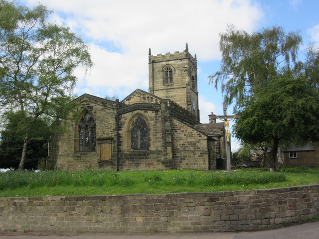
St John the Baptist's Church includes elements that date from the 12th century. A few other pre-1800 buildings remain, including several public houses: the Ferryboat Inn, the George and Dragon, the Bull's Head and the Red Lion. Most of the buildings in the town are post-1800.
Read more of the history
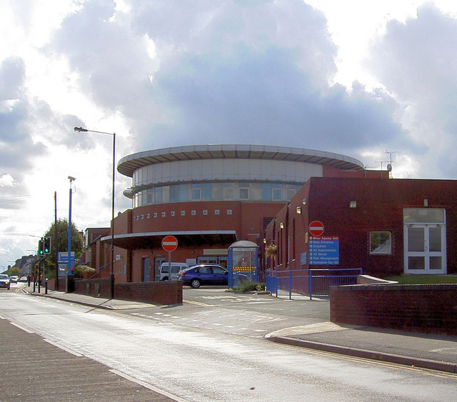
Throughout the 18th, 19th and much of the 20th century the town's economy was based around coal mining, quarrying, brickworks and the production of ceramics, and it soon became a busy railway junction. These industries led to an increase in industrial illness and an increase in the mortality rate. Although the town boasted a cottage hospital, the lack of suitable facilities led to Lord Montagu donating land for a new hospital to be built. Lord Montagu laid the first stone at the site in 1904. The site is still a working hospital, which now forms part of the Doncaster and Bassetlaw NHS trust.
The industries that led to the creation of Montagu Hospital not only brought problems to the town but also led to an increase in population and, for some, an increase in wealth and opportunity. Many more public houses and other businesses were created, many of which are still trading today. It was in one of these public houses, the Montagu Arms, that Stan Laurel stayed overnight after performing at the town's Prince of Wales Theatre on 9 December 1907.
During the second half of the 19th century, as in many other industrial towns, a Cooperative Society was formed in Mexborough. It was modelled on the consumer cooperative set up by the Rochdale Pioneers in 1844. In 1861, nine working men met at the home of James Simpson in Mexborough and decided to form the Mexborough Working Men's Industrial Society (later renamed the Mexborough Cooperative Society). The aim of the Society was to supply (at first to the nine men themselves) the necessary things of life. Membership quickly grew and by the 1890s it stood at 1,200. At one time, there were ten shops across the built-up area of Mexborough. By 1903, land had been purchased in the middle of Mexborough on which to build a large and grand new central store, but then suddenly in 1904 the Mexborough Cooperative Society went into liquidation. Soon afterwards it was taken over by the Barnsley British Co-operative Society. One of Mexborough's landmarks is closely associated with the Cooperative Society. This is the former Barnsley British Cooperative Society flour mill, which stands on the north side of the River Don Navigation, close to the Church of St John the Baptist. It started off as the "Don Roller Mills". It was owned by James White, who sold it to the Barnsley British Cooperative Society in 1912.
The Old Market Hall opened in 1880, and was replaced by the current indoor market in 1974, with the old building later becoming a pub.
For more than a hundred years the railway locomotive maintenance and stabling depot (colloquially known as "Mexborough Loco") was a major employer. The South Yorkshire, Doncaster and Goole Railway arrived in Mexborough in 1850. The extensive coal traffic generated by the local collieries required railway locomotives to haul it and these locomotives required driving, firing, refuelling, maintenance and stabling. Mexborough was chosen as the site for a large 15-road depot. In its heyday it had an allocation of about 150 locomotives. In the 1920s it was the stabling point for the LNER Garratt, then the most powerful locomotive in the UK. The depot closed in 1964. Following the demise of coal-mining in the 1980s, Mexborough, like many ex-mining towns and villages, is still in the process of economic and social recovery.
The Rock Pottery originally operated as Beevers & Ford. In 1839 it was bought by James Reed, whose son John renamed the business the "Mexborough Pottery", and expanded the works. On the bankruptcy of the Rockingham Pottery in 1842, John Reed bought many of its moulds and continued their production, though with different transfer prints and also in a plain green with a leaf design impressed "Reed".
From the History section of Mexborough on Wikipedia, under CC BY-SA 4.0.
Notable people from Mexborough
 Brian BlessedBritish actor (born 1936)Photo: Kevin Paul, CC BY 4.0
 Dennis PriestleyEnglish darts playerPhoto: Chris Ibbotson, CC BY-SA 2.0
 Graham OliverEnglish guitaristPhoto: Frank Schwichtenberg, CC BY-SA 3.0
 Luke FosterBritish footballer (born 1985)Photo: Mattythewhite, CC BY-SA 3.0
- Mike HawthornBritish racing driver (1929–1959)
- Donald WatsonEnglish vegan activist
- Eric BrookEnglish footballer (1907–1965)
- Keith BarronEnglish actor (1934-2017)
- Kenneth HaighBritish actor (1931-2018)
- Karen WalkerBritish association footballer (born 1969)
- Lionel SmithEnglish footballer (1920-1980)
- Dan ClarkeBritish open-wheel racing driver
Born in Mexborough, according to Wikidata (CC0). Each name links to its Wikipedia article.
Churches and places of worship13
Shopping4
Gas and EV charging3
Schools, colleges and libraries15
Healthcare2
Map of Mexborough
88 places. The map loads OpenStreetMap tiles when you open it.
Getting there and nearby towns
Leeds Bradford Airport (LBA) is the nearest airport with scheduled flights listed in OpenStreetMap, 30 miles away.
- Wath upon Dearne 2 mi west, about 4 min by car
- Rawmarsh 3 mi southwest, about 5 min by car
- Rotherham 5 mi southwest, about 8 min by car
- Wombwell 5 mi northwest, about 8 min by car
- Doncaster 7 mi east, about 11 min by car
- South Elmsall 7 mi north, about 12 min by car
- Sheffield 10 mi southwest, about 17 min by car
- Stocksbridge 12 mi west, about 20 min by car
- Penistone 14 mi west, about 23 min by car
- Wakefield 16 mi northwest, about 25 min by car
Drive times are estimates from straight-line distance, not routes.
Towns near Mexborough


Keep exploring
Local news
Headlines from INDB.
Reviews, tips and questions
Loading what members have shared...
Sources and licences
- GeoNames (CC BY 4.0): population, coordinates, regions and time zone
- OpenStreetMap contributors (ODbL 1.0): places, airports, map data
- Wikidata (CC0 1.0): elevation, founding date, time zone, website, landmarks and historic places
- Wikimedia Commons (see each image): photos
- Wikipedia (CC BY-SA 4.0): overview and history text
Photo credits
- Mexborough - former BBCS Bakery, Dave Bevis, CC BY-SA 2.0
- Mexborough - Station Road Bridge, Dave Bevis, CC BY-SA 2.0
- ConisbroughCastle, Rob Bendall ( Highfields ), Attribution
- Overlooking-Mining-Monument, Jonathan Thacker, CC BY-SA 2.0
- ChurchofStAndrewTheApostleinBoltonUponDearne - 04052015, ChicXulub, CC BY-SA 4.0
- Mexborough - Montague Hospital, Steve F, CC BY-SA 2.0
Page built November 10, 2026. Spotted a mistake? Tell us or suggest a place.