


Why visit Auckley
Townapedia lists 5 museums and landmarks, 11 parks and trails, 25 places to eat, 4 places to stay and 1 attraction in and around town.
Highlights include Yorkshire Wildlife Park, Blaxton War Memorial, Potteric Carr Nature Reserve and Yorkshire Wildlife Park.
Weather in Auckley
Forecast from MET Norway (CC BY 4.0). Full forecast
About Auckley
Auckley is a village and civil parish in the City of Doncaster in South Yorkshire, England, about five miles east of Doncaster city centre. According to the 2011 census the parish had a population of 3,745, increasing to 4,962 at the 2021 census. The parish includes the areas of Auckley and Hayfield Green.
From the Wikipedia article Auckley (this version), under CC BY-SA 4.0.
Things to do1

Yorkshire Wildlife Park
Zoo and aquarium · 0.6 mi
Jan-Feb Mo-Su 09:45-16:00; Mar Mo-Su 09:45-17:00; Apr-Nov Mo-Fr...
Museums and landmarks5
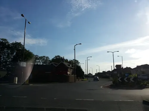

Parks, trails and playgrounds11

Potteric Carr Nature Reserve
Park · 3.1 mi
Nature reserve in South Yorkshire, England



Restaurants and cafes25




13 more on the map.
History
The name Auckley derives from the Old English alcalēah or alhalēah meaning 'Alca's' or 'Alha's wood or clearing'.
In 1870–72, John Marius Wilson's Imperial Gazetteer of England and Wales described Auckley as:
Auckley, or Awkley, a township in the parish of Finningley, and partly in Notts, partly in W. R. Yorkshire; 3 miles E by N of Rossington r. station, and 5 ESE of Doncaster. Acres, 1,970. Pop., 309. Houses, 69.
In the 1960s, substantial housing development took place in Auckley to accommodate the families at RAF Finningley. This began with the Spey Drive Estate.
Since the closure of RAF Finningley in 1996 and its subsequent development as Doncaster Sheffield Airport, there has been significant development of the old airfield estate around Hayfield Lane. The old RAF housing has been purchased by South Yorkshire Housing Association and private individuals. New homes, businesses, schools and a hotel have been built around the airport.
From the History section of Auckley on Wikipedia, under CC BY-SA 4.0.
More about Auckley
Education
Auckley has four schools Hayfield Lane Primary School and Auckley Junior and Infant School for under 11's and The Hayfield School for children aged between 11 and 16. Additionally Hill House provides private education for children aged 3–18.
Following the restructuring of the education provision in Doncaster, New College Doncaster opened in 2017 on Hurst Lane, providing post-16 education for students aged 16–18.
The Hayfield School was ranked as one of the best schools in the region in 2006/2007. It was the 2nd highest achieving school in the entire Doncaster district (for GCSE results).
Hill House School was then ranked as one of the best schools in the region in 2012. It was the 1st highest achieving school in the entire Doncaster District (for GCSE results.)
Hill House School is now currently ranked as one of the best schools in the region from 2012 to the present day in 2025. It is the 1st highest achieving school in the entire Doncaster District and the North of England. Hill House pupils achieved the highest GCSE and A level results in the area this year with 47% of A levels graded at A*/A, with a third of pupils gaining straight As and A*s, and the school securing its seventh consecutive year of a 100% pass rate. 79% of results were at grade B and above.
From the Wikipedia article Auckley, under CC BY-SA 4.0.
Where to stay4
Churches and places of worship2
Shopping5
Schools, colleges and libraries6
Branton St Wilfrid's Church of England Primary School
School · Anglican · 0.8 mi
Valley Drive, Doncaster
Healthcare2
Map of Auckley
61 places. The map loads OpenStreetMap tiles when you open it.
Getting there and nearby towns
Humberside Airport (HUY) is the nearest airport with scheduled flights listed in OpenStreetMap, 28 miles away.
- Armthorpe 3 mi northwest, about 4 min by car
- Kirk Sandall 4 mi northwest, about 7 min by car
- Doncaster 5 mi west, about 8 min by car
- Bentley 6 mi west, about 9 min by car
- Thorne 8 mi north, about 13 min by car
- Adwick le Street 8 mi northwest, about 13 min by car
- Conisbrough 9 mi west, about 14 min by car
- Maltby 9 mi southwest, about 15 min by car
- Blyth 9 mi south, about 14 min by car
- Mexborough 11 mi west, about 18 min by car
Drive times are estimates from straight-line distance, not routes.
Towns near Auckley


Keep exploring
Local news
Headlines from INDB.
Reviews, tips and questions
Loading what members have shared...
Sources and licences
- GeoNames (CC BY 4.0): population, coordinates, regions and time zone
- Mapillary (see each image): photos
- OpenStreetMap contributors (ODbL 1.0): places, airports, map data
- Wikidata (CC0 1.0): elevation, founding date, time zone, website, landmarks and historic places
- Wikimedia Commons (see each image): photos
- Wikipedia (CC BY-SA 4.0): overview and history text
Photo credits
- Eagle and Child, Auckley, Graham Hogg, CC BY-SA 2.0
- Potteric Carr Bridges over Mother Drain, Dave Taylor, CC BY-SA 2.0
- Street-level photo, endszbrxns, CC BY-SA 4.0
- Street-level photo, endszbrxns, CC BY-SA 4.0
Page built November 10, 2026. Spotted a mistake? Tell us or suggest a place.