

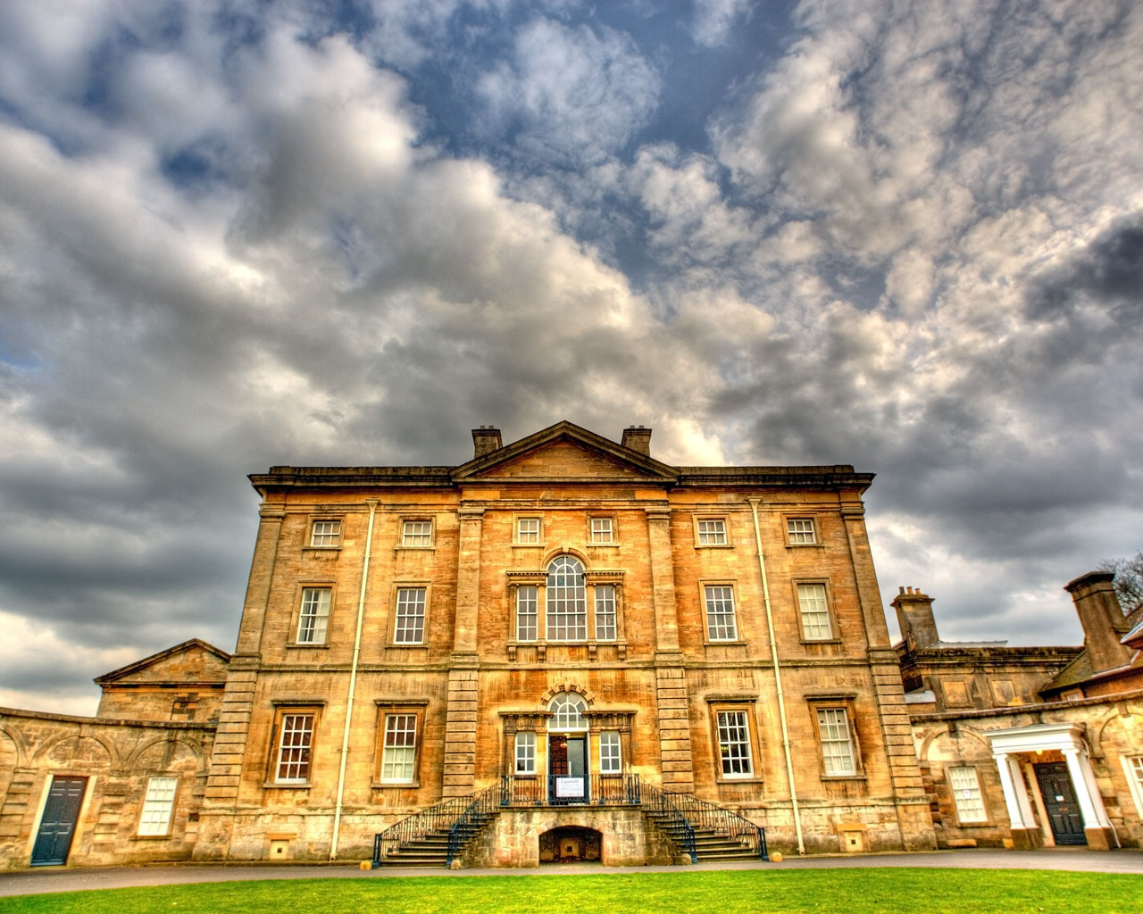


Adwick le Street, United Kingdom
Adwick le Street is a town of 19,481 people in England, United Kingdom.
Why visit Adwick le Street
Townapedia lists 2 museums and landmarks, 3 parks and trails, 8 places to eat and 1 place to stay in and around town.
Highlights include Brodsworth Hall, Cusworth Hall and Park, Thorpe Marsh Nature Reserve and Owston Hall Golf Course.
Weather in Adwick le Street
Forecast from MET Norway (CC BY 4.0). Full forecast
About Adwick le Street
Adwick le Street is a village in the City of Doncaster, South Yorkshire, England. It is situated north-west of Doncaster. It had a population of 2,815 as of 2014.
From the Wikipedia article Adwick le Street (this version), under CC BY-SA 4.0.
Museums and landmarks2

Brodsworth Hall
Museum · 2.4 mi
Grade I listed historic house museum in Brodsworth, Doncaster, South Yorkshire, England, UK

Cusworth Hall and Park
Museum · 2.9 mi
Grade I listed historic house museum in Sprotbrough and Cusworth, Doncaster, South Yorkshire, England, UK
Parks, trails and playgrounds3

Thorpe Marsh Nature Reserve
Park · 2.9 mi
Nature reserve in South Yorkshire, England


Restaurants and cafes8


The Little Tea Pot Cafe
Cafe · 1.1 mi
215 Skellow Road, Doncaster
Mo-Fr 05:30-21:00; Sa 06:00-21:00; Su 07:00-21:00

Where to stay1

History
The town derives its name from the great north British Roman routeway, Ermine Street. This road, also known as the Roman Ridge, follows the A638 (former A1) northwards through the centre of Doncaster (former Danum) until the junction of the A635 and A638. It follows to the west of the A638, and passes along the western perimeter of Woodlands, dividing the estate from the Red House industrial park. It rejoins the Great North Road (the A1 at this point) at the Red House interchange.
The name Adwick derives from the Old English addawīc meaning 'Adda's trading settlement'.
In December 2007, archaeologists from ARCUS were called in after site workers preparing for the construction of the brand new North Ridge Community School unearthed human remains. The new School, for special needs children, was to be built adjacent to North Doncaster Technology College (now Outwood Academy Adwick).
40 graves were discovered; 37 containing skeletal remains dating between 660 AD and 880 AD, the Middle Saxon period. There was some erosion and disturbance on the site. A small number of grave goods were found but in the future, any artefacts will be archived in Doncaster Museum.
Read more of the history
This is believed to be the first Anglo-Saxon or early Medieval cemetery of this type found in South Yorkshire and one of the most significant Anglo-Saxon finds in the country. The earliest references to the settlement are found in the Domesday Book of 1086.
From the History section of Adwick le Street on Wikipedia, under CC BY-SA 4.0.
More about Adwick le Street
Economy
In the past, there was a pub in the village called the Red House. This was north of the main village, on the former A1 (now the A638), and gave its name to the Red House interchange (former roundabout before 1979) of the A1(M) and A638; nearby is the Red House industrial park. Until August 1961, the A1 passed through the parish. On the nearby Red House industrial park, next to the A1(M), is a B&Q distribution centre, and the headquarters of dfs. The industrial park is in the parish of Brodsworth.
Education
On Windmill Balk Lane was Outwood Academy Adwick, an academy, since 1 September 2009. This replaced North Doncaster Technology College. Previous to this it had been Adwick School which had made a successful bid for Technology College status in 2001. Before that it was the co-educational Percy Jackson Grammar School of 1939, which became a comprehensive (Adwick School) in 1968 when it merged with Adwick High School of 1965. On 25 February 2013, a new Outwood Academy building, adjacent to the A638, was completed and opened to pupils. The unused complex of old school buildings on the site was demolished and new outdoor sporting facilities and Sports Hall provided on the 'Old School' field. Immediately to the north of Outwood Academy, stands the newly built Outwood Institute of Education offering leadership, professional development and training to young people.
On the southern side of Windmill Balk Lane is Park Primary School opposite the Outwood Academy Entrance and tennis courts.
From the Wikipedia article Adwick le Street, under CC BY-SA 4.0.
Notable people from Adwick le Street
- Clive BakerEnglish association football player (1934-2012)
Born in Adwick le Street, according to Wikidata (CC0). Each name links to its Wikipedia article.
Churches and places of worship4
St Joseph & St Teresa's, Askern
Church · Roman Catholic · 0.5 mi
Welfare Road, Doncaster
Shopping4
Gas and EV charging2
Schools, colleges and libraries10
St Joseph & St Teresa's Catholic Primary School
School · Roman Catholic · 0.5 mi
Doncaster Lane, Doncaster
Healthcare3
Map of Adwick le Street
37 places. The map loads OpenStreetMap tiles when you open it.
Getting there and nearby towns
Leeds Bradford Airport (LBA) is the nearest airport with scheduled flights listed in OpenStreetMap, 28 miles away.
- Doncaster 4 mi southeast, about 6 min by car
- South Elmsall 4 mi northwest, about 7 min by car
- Kirk Sandall 5 mi east, about 8 min by car
- Armthorpe 6 mi southeast, about 10 min by car
- Conisbrough 6 mi south, about 10 min by car
- Bolton upon Dearne 7 mi southwest, about 11 min by car
- Mexborough 7 mi southwest, about 11 min by car
- Wath upon Dearne 8 mi southwest, about 13 min by car
- Wombwell 9 mi west, about 15 min by car
- Thorne 10 mi east, about 15 min by car
Drive times are estimates from straight-line distance, not routes.
Towns near Adwick le Street


Keep exploring
Local news
Headlines from INDB.
Reviews, tips and questions
Loading what members have shared...
Sources and licences
- GeoNames (CC BY 4.0): population, coordinates, regions and time zone
- Mapillary (see each image): photos
- OpenStreetMap contributors (ODbL 1.0): places, airports, map data
- Wikidata (CC0 1.0): elevation, founding date, time zone, website, landmarks and historic places
- Wikimedia Commons (see each image): photos
- Wikipedia (CC BY-SA 4.0): overview and history text
Photo credits
- Adwick le Street - Methodist Church, Bill Henderson, CC BY-SA 2.0
- Cusworth Hall 1, Foto43, CC BY 2.0
- Main Embankment at NMH (Thorpe Marsh Nature Reserve), NJLE17, CC BY-SA 4.0
- All Saints' Church, Woodlands, South Yorkshire, Dave Bevis, CC BY-SA 2.0
- Adwick - St Laurence Church, Dave Bevis, CC BY-SA 2.0
- Brodsworth Hall - panoramio - PJMarriott (1), PJMarriott, CC BY 3.0
- Street-level photo, lamaar639, CC BY-SA 4.0
- Street-level photo, cuttlebug, CC BY-SA 4.0
- Street-level photo, cuttlebug, CC BY-SA 4.0
- Street-level photo, cuttlebug, CC BY-SA 4.0
- Street-level photo, cuttlebug, CC BY-SA 4.0
Page built November 10, 2026. Spotted a mistake? Tell us or suggest a place.