


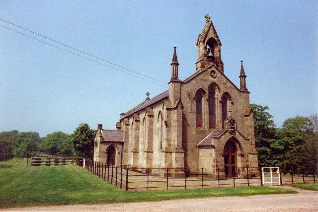

Why visit Audlem
Townapedia lists 1 museum or landmark, 1 park or trail, 7 places to eat and 1 attraction in and around town.
Weather in Audlem
Forecast from MET Norway (CC BY 4.0). Full forecast
About Audlem
Audlem is a village and civil parish in the Cheshire East district of Cheshire, England. In 2021, it had a population of 1,832.
From the Wikipedia article Audlem (this version), under CC BY-SA 4.0.
Photos of Audlem


Things to do1

Museums and landmarks1
Parks, trails and playgrounds1

Restaurants and cafes7
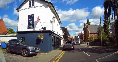

Shroppie Fly
Bar and pub
Shropshire Street, Audlem
Mo-Th 10:30-23:00; Fr 10:30-18:00+; Sa 09:00-18:00+; Su 09:00-22:00


The Village Chippy
Fast food · Fish And Chips
13 Cheshire Street
Mo-Sa 11:30-13:45,16:30-20:00
History
Audlem was mentioned in the Domesday Book in 1086 as Aldelime. By the late 13th century, St James' Church had been founded and Edward I granted it a market charter in 1295.
The arrival of the Shropshire Union Canal in 1835 was a significant development for Audlem. The canal boosted the local economy by facilitating the transport of goods and materials, particularly agricultural produce and coal. During this period, many of the village's distinctive Georgian and Victorian buildings were constructed. Audlem’s flight of 15 locks, designed by Thomas Telford, are a notable engineering feature. Though commercial activity on the canal virtually ceased in the 1950s, it is now an important source of tourism for the village. The canal continues to draw visitors and leisure boaters alike along the waterway itself and to walk the picturesque path.
In 2008 village residents launched an online referendum on transferring the village to Wales from England, in a protest over prescription and parking charges in England. A vote was held which received 88 in favour of the change, and 40 against; no further action was taken.
There are many historic buildings including Moss Hall is an Elizabethan timber-framed hall from 1616 one-half mile (0.8 km) from Audlem village centre.
From the History section of Audlem on Wikipedia, under CC BY-SA 4.0.
More about Audlem
Education
Audlem has clubs for tennis, badminton, football, cricket, golf, pigeon racing (or pigeon-fancying), caravanning, bell ringing, rambling and bowls. Cyclists meet informally at The Tearoom at No.11.
Saint James' Primary School is the only school in the village.
From the Wikipedia article Audlem, under CC BY-SA 4.0.
Notable people from Audlem
- Peter EllsonEnglish professional footballer (1925-2014)
- Alice E. GillingtonBritish writer and poet, journalist and anthropologist
- May ByronBritish writer (1861-1936)
Born in Audlem, according to Wikidata (CC0). Each name links to its Wikipedia article.
Churches and places of worship8
Shopping1
Schools, colleges and libraries1
Map of Audlem
20 places. The map loads OpenStreetMap tiles when you open it.
Getting there and nearby towns
Hawarden Airport (CEG) is the nearest airport with scheduled flights listed in OpenStreetMap, 24 miles away.
- Nantwich 6 mi north, about 9 min by car
- Market Drayton 6 mi south, about 9 min by car
- Betley 7 mi northeast, about 11 min by car
- Crewe 8 mi north, about 13 min by car
- Whitchurch 8 mi west, about 12 min by car
- Newcastle under Lyme 11 mi east, about 18 min by car
- Alsager 11 mi northeast, about 18 min by car
- Bunbury 11 mi northwest, about 17 min by car
- Sandbach 12 mi northeast, about 20 min by car
- Stoke-on-Trent 13 mi east, about 22 min by car
Drive times are estimates from straight-line distance, not routes.
Towns near Audlem


Keep exploring
Local news
Headlines from INDB.
Reviews, tips and questions
Loading what members have shared...
Sources and licences
- GeoNames (CC BY 4.0): population, coordinates, regions and time zone
- Mapillary (see each image): photos
- OpenStreetMap contributors (ODbL 1.0): places, airports, map data
- Wikidata (CC0 1.0): elevation, founding date, time zone, website, landmarks and historic places
- Wikimedia Commons (see each image): photos
- Wikipedia (CC BY-SA 4.0): overview and history text
Photo credits
- 28 Stafford Street, Audlem, Dave.Dunford, CC BY-SA 4.0
- The organ, St James' Church, Audlem, Andrewrabbott, CC BY-SA 4.0
- Nave and chancel of St James' Church, Audlem, Andrewrabbott, CC BY-SA 4.0
- Audlem Baptist Church, Row17, CC BY-SA 2.0
- St John's Church, Hunsterson, Mike Grose, CC BY-SA 2.0
- Burleydam 2, Peter I. Vardy, Public domain
- St James' Church, Audlem, Andy and Hilary, CC BY-SA 2.0
- Ivy House, No 19 and Holly House 01, Dave.Dunford, CC BY-SA 4.0
- Ivy House, No 19 and Holly House 02, Dave.Dunford, CC BY-SA 4.0
- Street-level photo, tallguy, CC BY-SA 4.0
- Street-level photo, tallguy, CC BY-SA 4.0
- Street-level photo, tallguy, CC BY-SA 4.0
- Street-level photo, tallguy, CC BY-SA 4.0

Page built November 10, 2026. Spotted a mistake? Tell us or suggest a place.