



Why visit Crewe
Townapedia lists 12 museums and landmarks, 14 parks and trails, 143 places to eat, 10 places to stay and 2 attractions in and around town.
Highlights include Lyceum Theatre, Odeon, Crewe Heritage Centre and Crewe War Memorial.
Weather in Crewe
Forecast from MET Norway (CC BY 4.0). Full forecast
About Crewe
Crewe is a railway town and civil parish in the unitary authority of Cheshire East, in Cheshire, England. At the 2021 census, the parish had a population of 55,318 and the built-up area had 76,437. The town is best known as a large railway junction and home to Crewe Works; for many years, it was a major railway engineering facility for manufacturing and overhauling locomotives, but is now much reduced in size. From 1946 until 2002, it was also the home of Rolls-Royce motor car production.
From the Wikipedia article Crewe (this version), under CC BY-SA 4.0.
Travel tips from other travellers: Crewe on Wikivoyage (CC BY-SA 4.0).
Things to do2

Lyceum Theatre
Cinema and theater
Theatre in Crewe, England
Heath Street, Crewe

Museums and landmarks12

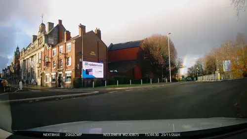
Crewe War Memorial
Monument and historic site
Grade II listed war memorial in Crewe, Cheshire, England, UK


Boer War Memorial, Crewe
Monument and historic site · 1.1 mi
Grade II listed war memorial in Crewe, Cheshire East, Cheshire, England, UK
Parks, trails and playgrounds14


Queen's Park, Crewe
Park · 1.2 mi
Park in Crewe, Cheshire, England, UK



2 more on the map.
Restaurants and cafes143
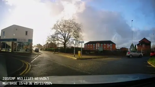
Greenway Cakes
Bakery · 0.9 mi
1 Greenway, Crewe
We 10:00-15:00; Th 10:00-16:30; Fr 10:00-16:30; Sa 10:00-15:00
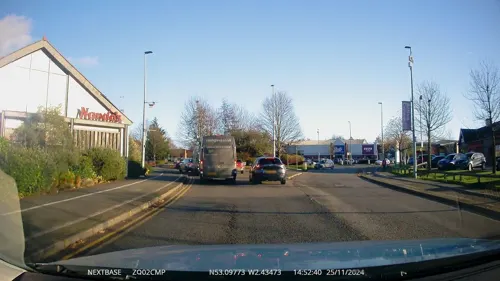



The Woodside
Bar and pub · 1.4 mi
Valley Road, Crewe
Mo-Th 12:00-23:00; Fr-Sa 12:00-24:00; Su 12:00-23:00
Lucky Star
Restaurant · Chinese · 0.6 mi
115A West Street, Crewe
PH,Mo-Su 16:30-23:30
131 more on the map.
History
The name derives from an Old Welsh word criu, meaning 'weir' or 'crossing'. The earliest record is in the Domesday Book, where it is written as Creu. The original settlement of Crewe lies to the east of the modern town and was historically a township in the parish of Barthomley. The original settlement formally changed its name to Crewe Green in 1984 to distinguish it from the newer town to its west.
The town of Crewe owes its existence to Crewe railway station, which opened in 1837 on the Grand Junction Railway. When the route for the railway was being planned, alternative routes and locations for the main station in this area were considered; Winsford, seven miles (eleven kilometres) to the north, had rejected an earlier proposal, as had local landowners in neighbouring Nantwich, four miles (six kilometres) away. The company then settled on the route through Crewe and the station was built in fields near Crewe Hall. The station was in the township of Crewe, but the land north-west of the station was in the neighbouring township of Monks Coppenhall, which formed part of the parish of Coppenhall.
Read more of the history
The company built its main locomotive works to the north of Crewe railway station; a railway colony soon started developing in the area north-west of the station. In 1840, Joseph Locke, chief engineer of the Grand Junction Railway, produced plans for a new town there. The railway company built much of the early town itself in the 1840s and 1850s. Although the nascent town was in the township of Monks Coppenhall rather than the Crewe township, it was known as Crewe from the start. The modern town of Crewe was thus named after the railway station, rather than the other way round.
The population expanded rapidly to reach 40,000 by 1871. The town has a large park, Queen's Park, laid out by engineer Francis Webb; the land for which was donated by the London and North Western Railway (LNWR), the successor to the GJR. It has been suggested that their motivation was to prevent the rival Great Western Railway building a station on the site, but the available evidence indicates otherwise.
Webb took a great interest in local politics and was "the most influential individual in the town." "Described just before his retirement as 'the King of Crewe', Webb came to exercise control over the working lives of over 18,000 men - one third of the total LNWR workforce. Over half these lived in Crewe, with around 8,000 being employed at the locomotive works. Several recreational and sporting organisations were a direct result of Webb's influence and others received benefit from his support." These included the LNWR Cricket Club (established in 1850) and the Crewe Alexandra Athletic Club (established in 1867). However, Webb's influence allegedly also extended to intimidation of Liberal Party supporters. In September 1885, the editor of the Crewe Chronicle published charges against Webb, saying "That through the action, direct and indirect, of Tory railway officialism, the political life of Crewe is cramped and hindered beyond recognition". In November 1889, the borough council debated a motion which accused LNWR managers of working with Crewe Tories "to crush Liberalism altogether out of the town": "...by intimidation and persecution of your Liberal workmen, and by making the chances of promotion depend upon subserviency to the Tory political demands of the Management, they have created a state of political serfdom in the works." In December 1889, Liberal statesman William Ewart Gladstone wrote a letter to the Chronicle condemning the company's behaviour in the town.
The railway provided an endowment towards the building and upkeep of Christ Church. Until 1897, its vicar, non-conformist ministers and schoolteachers received concessionary passes; the school having been established in 1842. The company provided a doctor's surgery with a scheme of health insurance. A gasworks was built and the works water supply was adapted to provide drinking water and a public baths. The railway also opened a cheese market in 1854 and a clothing factory for John Compton, who provided the company uniforms, while McCorquodale of Liverpool set up a printing works.
During World War II, the strategic presence of the railways and Rolls-Royce engineering works (turned over to producing aircraft engines) made Crewe a target for enemy air raids and it was in the flight path to Liverpool. The borough lost 35 civilians to these. The worst raid was on 29 August 1940 when some 50 houses were destroyed, close to the station.
The town unsuccessfully bid for city status, as part of the Platinum Jubilee Civic Honours in 2022.
From the History section of Crewe on Wikipedia, under CC BY-SA 4.0.
More about Crewe
Economy
The railways still play a part in local industry at Crewe Works, which carries out train maintenance and inspection. It has been owned by Alstom since 2021. At its height, the site employed over 20,000 people but, by 2005, fewer than 1,000 remained, with a further 270 redundancies announced in November of that year. Currently Alstom employs 6,000 people across the UK and Ireland. Much of the site once occupied by the works has been sold; it is now occupied by a supermarket, leisure park and a large health centre.
Crewe Electric TMD, an electric locomotive traction maintenance depot, lies to the north of the railway station; it is operated by DB Cargo UK. Crewe Diesel TMD, the former diesel locomotive depot closed in 2003; it was reopened in 2015 as a maintenance facility for Locomotive Services Limited, having undergone major structural repairs.
The Bentley Crewe car factory is on Pyms Lane, to the west of town. As of early 2010, there were about 3,500 employees working at the site. The factory used to produce Rolls-Royce cars, until the licence for the brand transferred from Bentley's owners Volkswagen to rival BMW in 2003.
There is a BAE Systems Land & Armaments factory in the village of Radway Green, near Alsager, producing small arms ammunition for the British armed forces.
Arts and culture
Crewe Heritage Centre is located on the site of the old locomotive works. The museum has three signal boxes and an extensive miniature railway, with many steam, diesel and electric traction exhibits. The most prominent exhibits are the Class 370 Advanced Passenger Train and two HST power cars.
The Grade II-listed Edwardian Lyceum Theatre is in the centre of Crewe. It was built in 1911 and shows drama, ballet, opera, music, comedy and pantomime. The theatre was originally located on Heath Street from 1882. The Axis Arts Centre is on the Manchester Metropolitan University (MMU) campus in Crewe; it relocated from the university's Alsager Campus when it closed. The centre has a programme of touring new performance and visual art work. The Axis centre closed at the end of the spring 2019 season, with the withdrawal of MMU from the Crewe campus. The Box on Pedley Street is the town's main local music venue.
Both the Lyceum Theatre and the Axis Arts Centre feature galleries; the private Livingroom art gallery is on Prince Albert Street. The town's main library is on Prince Albert Square, opposite the Municipal Buildings.
There is a museum dedicated to Primitive Methodism in the nearby village of Englesea-Brook.
Education
Cheshire has adopted the comprehensive school model of secondary education, so all of the schools under its control cater for pupils of all levels of ability. Until the late 1970s, Crewe had two grammar schools, Crewe Grammar School for Boys, now Ruskin High School, and Crewe Grammar School for Girls, now the Oaks Academy (formerly Kings Grove School). The town's two other secondary schools are Sir William Stanier School, a specialist technology and arts academy, and St. Thomas More Catholic High School, specialising in mathematics and computing and modern foreign languages.
Although there are eight schools for those aged 11–16 in Crewe and its surrounding area, Cheshire College South & West is one of only two local providers of education for pupils aged 16 and over, and the only one in Crewe. The college also provides educational programmes for adults, leading to qualifications such as Higher National Diplomas (HNDs) or foundation degrees. In the 2006–07 academic year, 2,532 students aged 16–18 were enrolled, along with 3,721 adults.
From the Wikipedia article Crewe, under CC BY-SA 4.0.
Notable people from Crewe
 Nick PowellEnglish association football playerPhoto: MGPetch, CC0
 Bryony PageBritish trampolinistPhoto: Gérald Garitan, CC BY-SA 4.0
 Matthew LangridgeBritish oarsmanPhoto: Mike Fay, CC BY 2.0
 John PearsonBritish footballer (1868-1931)Photo: Unknown author Unknown author, Public domain
 Paul MaynardBritish politician (born 1975)Photo: Richard Townshend, CC BY 3.0
 Kelvin MellorEnglish footballer (born 1991)Photo: Paul W, CC BY-SA 3.0
 Mike WoodBritish politician (born 1946)Photo: Thedarkarches, CC0
- Luke GreenbankBritish swimmer
- Jimmy MacDonaldBritish actor (1906–1991)
- Shanaze ReadeEnglish bicycle motocross rider and track cyclist
- Neil BrooksAustralian swimmer, Olympic gold medallist (born 1962)
- Rob HulseBritish footballer (born 1979)
Born in Crewe, according to Wikidata (CC0). Each name links to its Wikipedia article.
Where to stay10
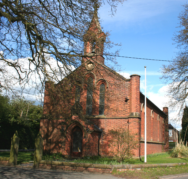
Churches and places of worship33
Coppenhall Saint Michaels
Church · Anglican · 0.6 mi
Ford Lane, Crewe
Shopping32
Gas and EV charging8
Schools, colleges and libraries25
Healthcare7
Crewe Pharmacy and Travel Vaccination Centre
Clinic and pharmacy · 0.7 mi
139-141 Nantwich Road, Crewe
Map of Crewe
250 places. The map loads OpenStreetMap tiles when you open it.
Getting there and nearby towns
Manchester Airport (MAN) is the nearest airport with scheduled flights listed in OpenStreetMap, 19 miles away.
- Nantwich 4 mi southwest, about 6 min by car
- Sandbach 5 mi northeast, about 7 min by car
- Alsager 6 mi east, about 9 min by car
- Middlewich 7 mi north, about 11 min by car
- Winsford 7 mi northwest, about 12 min by car
- Kidsgrove 8 mi east, about 14 min by car
- Newcastle under Lyme 11 mi southeast, about 18 min by car
- Congleton 11 mi northeast, about 17 min by car
- Stoke-on-Trent 12 mi southeast, about 20 min by car
- Northwich 12 mi north, about 19 min by car
Drive times are estimates from straight-line distance, not routes.
Towns near Crewe


Keep exploring
Local news
Headlines from INDB.
Reviews, tips and questions
Loading what members have shared...
Sources and licences
- GeoNames (CC BY 4.0): population, coordinates, regions and time zone
- Mapillary (see each image): photos
- OpenStreetMap contributors (ODbL 1.0): places, airports, map data
- Wikidata (CC0 1.0): elevation, founding date, time zone, website, landmarks and historic places
- Wikimedia Commons (see each image): photos
- Wikipedia (CC BY-SA 4.0): overview and history text
Photo credits
- Municipal Buildings, Crewe, Arwel Parry (en:, cy:, meta:, commons:), CC BY-SA 3.0
- Crewe banner, Alex Liivet from Chester, United Kingdom, CC0
- Crewe (33916958155), Alex Liivet from Chester, United Kingdom, CC0
- Lyceum Theatre, Crewe, Cheshire UK, Arwel Parry, CC BY-SA 3.0
- All Saints, Weston, Espresso Addict, CC BY-SA 4.0
- St Barnabas' Church, Crewe, Margaret Sutton, CC BY-SA 2.0
- St Leonard's Church, Warmingham, Stephen Craven, CC BY-SA 2.0
- St Mary's Church, Crewe (1), Rept0n1x, CC BY-SA 3.0
- Haslington - St Matthew's Church - May 2025, Dominic Nelson, CC BY-SA 4.0
- St Michael's Church, Crewe Green, Steve Lewin, CC BY-SA 2.0
- Queens park crewe towards pavilion, FREON101, CC BY-SA 3.0
- Gresty Road, Crewe, Andrew Smith, CC BY-SA 2.0
- 370006 at Crewe Heritage Centre, Three76Five43Nine72, CC BY 4.0
- APT-P 2nd interior (26604590367 f69e1c23ee k) (XAM-E1), Alex Liivet from Chester, United Kingdom, CC0
- Street-level photo, mapillarygelec, CC BY-SA 4.0
- Street-level photo, mapillarygelec, CC BY-SA 4.0
- Street-level photo, ricorico, CC BY-SA 4.0
- Street-level photo, mapillarygelec, CC BY-SA 4.0
- Street-level photo, mapillarygelec, CC BY-SA 4.0


Page built November 10, 2026. Spotted a mistake? Tell us or suggest a place.