


Chippenham, United Kingdom
Chippenham is a town of 35,800 people in England, United Kingdom.
Why visit Chippenham
Townapedia lists 74 museums and landmarks, 83 parks and trails, 219 places to eat, 30 places to stay and 10 attractions in and around town.
Highlights include Reel Cinema, Chippenham Town Hall, Chippenham Museum & Heritage Centre and Calne Heritage Centre.
Weather in Chippenham
Forecast from MET Norway (CC BY 4.0). Full forecast
About Chippenham
Chippenham is a market town and civil parish in north-west Wiltshire, England. It lies 13 miles (21 km) north-east of Bath, 86 miles (138 km) west of London and is near the Cotswolds Area of Outstanding Natural Beauty. The town was established on a crossing of the River Avon, where some form of settlement is believed to have existed since before Roman times. It was a royal vill and probably a royal hunting lodge, under Alfred the Great.
From the Wikipedia article Chippenham (this version), under CC BY-SA 4.0.
Travel tips from other travellers: Chippenham on Wikivoyage (CC BY-SA 4.0).
Photos of Chippenham


Things to do10
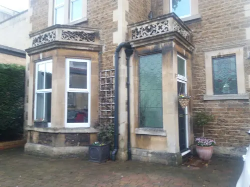

Chippenham Town Hall
Cinema and theater · 0.4 mi
Town hall and arts venue complex in Chippenham, Wiltshire, England, UK

Allington Farm Shop
Farm and orchard · 1.3 mi
Sheldon Corner
Mo-We 09:00-17:30; Th-Sa 09:00-18:00; Su 09:30-16:00
V & P Collins Farmshop
Farm and orchard · 5.5 mi
81,83 Devices road
Mo-Fr 09:00-17:30; Sa 09:00-17:00; Su 09:00-13:00

Museums and landmarks74

Butter Cross
Monument and historic site · 5.0 mi
Stone steps using old masonry, 2 high rubble stone steps serving as plinth to top section made up of Perpendicular style window head in...

Corsham Court
Museum · 3.0 mi
Grade I listed English country house in Wiltshire, England, UK
Market Cross
Monument and historic site · 5.0 mi
The cross consists of a stone pedestal 1.11m square raised on two steps in the centre of a raised stone platform 6.05m square. A high...


Great Chalfield Manor
Museum · 7.2 mi
Grade I listed English country house in Atworth, Wiltshire, England, UK


Atwell-Wilson Motor Museum
Museum · 6.1 mi
Stockley Lane, Calne
Feb 01-Nov 30: Tu-Su,PH 10:00-16:00; Dec 01-Jan 31 closed

Bury Camp
Monument and historic site · 6.0 mi
Site of an Iron Age multivallate hillfort located in Wiltshire, England, UK
62 more on the map.
Parks, trails and playgrounds83

Vincients Wood
Park · 1.1 mi
Nature reserve in Wiltshire, England, UK




71 more on the map.
Restaurants and cafes219
Amici Ristorante Italiano
Restaurant · Italian, Italian Pizza · 0.4 mi
29 New Road
Mo-Fr 12:00-14:30, 17:00-21:30; Sa-Su 17:00-21:30
COQ Gourmet Burgers & Bar
Restaurant · Burger, Chicken · 0.5 mi
20 Timber Street
Tu-Th 17:00-21:00; Fr, Sa 09:00-21:00
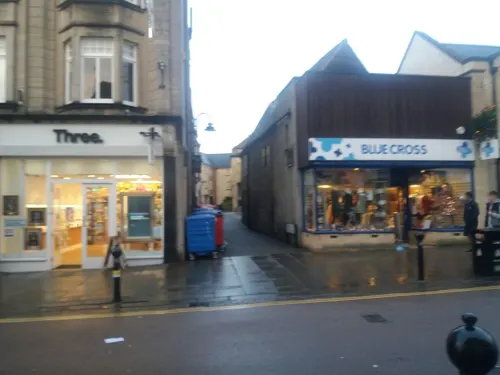
Coffee#1
Cafe · Coffee Shop · 0.4 mi
19 High Street, Chippenham
Mo-Fr 07:30-17:30; Sa 08:00-18:00; Su 09:00-17:00



Caffè Nero
Cafe · Coffee Shop · 0.4 mi
18-19 Borough Parade
Mo-Fr 07:00-18:00; Sa 07:30-18:30; Su 08:00-18:00
Coffee Gems
Cafe · Coffee Shop · 0.4 mi
1 Market Place
Mo-Fr 08:00-17:00; Sa 08:30-17:00; Su 09:00-16:00
Divine On The Green
Cafe · 5.5 mi
Cafe and evening Wine bar Wine bar open 18:00 - 23:00 Friday & Saturday
35 New road, Calne
Tu-Sa 09:00-18:00
Fay's Bistro
Cafe · Sandwich, Breakfast, Ice Cream, Tea, Sausage, Cake, Local, Coffee Shop, Pancake, Chicken, Diner · 5.4 mi
3 Beach Terrace, Calne
Mo-Sa 09:00-17:00; Su 09:30-15:30
207 more on the map.
History
The Anglo-Saxon Chronicle records the town as Cippanhamme: this could refer to a person called Cippa who had his hamm, an enclosure in a river meadow. An alternative theory suggests that the name is derived from the Anglo-Saxon word ceap, meaning 'market'. The name is recorded variously as Cippanhamm (878), Cepen (1042), Cheppeham (1155), Chippenham (1227), Shippenham (1319) and Chippyngham (1541). In John Speed's map of Wiltshire (1611), the name is spelt both "Chippenham" (for the hundred) and "Chipnam" (for the town).
Remains of Romano-British settlements are visible in the wall behind the former magistrates' court, and recent redevelopments of the town have shown up other evidence of early settlements.
The town (not counting the Roman villages now within its boundaries) is believed to have been founded by Anglo-Saxons around AD 600. The first record of the town dates from 853, when Æthelswith, daughter of King Æthelwulf of Wessex was given in marriage to King Burgred of Mercia at the ‘royal estate (villa regia) called Chippenham, and the marriage was conducted in royal style’. According to Bishop Asser's Life of King Alfred, Chippenham was, under Alfred's reign, a royal vill; historians have also argued, from its proximity to the royal forests at Melksham and Barden, that it was probably a hunting lodge.
Read more of the history
Danish Vikings successfully besieged Chippenham in 878. Later that year, at the Battle of Ethandun, Alfred decisively defeated the Danes, whose forces then surrendered to Alfred at Chippenham (ushering in the establishment of the Danelaw).
In 1042, the royal holding in Chippenham makes mention of a church. The 1086 Domesday Book listed Chippenham as Chepeham, with a substantial population of 177 households.
In Norman times, the royal properties were separated into the manors of Sheldon, Rowden and Lowden. Records show that the town expanded into Langstret (now the Causeway) from 1245, and from 1406 into Le Newstret (now the New Road area of town). Throughout this period, Chippenham continued to have a thriving market in the town centre.
The A4 that runs through Chippenham incorporates parts of the 14th-century medieval road network that linked London to Bristol. This was an important road for the English cloth trade, and so its upkeep was funded in part by Bristol cloth merchants.
Chippenham was represented in the Parliament of England from 1295, and Queen Mary granted the town a Charter of Incorporation in 1554.
Analysis of the wood used to build the Yelde Hall indicates that the market hall was built around 1450. The Shambles and Buttercross were built after 1570. The Shambles were destroyed in a fire in 1856 but the Yelde Hall survived.
The parish of Chippenham Without encompasses the deserted medieval village of Sheldon, devastated by plague; all that remains today is Sheldon Manor, Wiltshire's oldest inhabited manor house, dating from 1282.
The wool industry took off in the 16th century, partly due to the river. The plague hit the town hard in 1611 and 1636. This, a recession in the woollen industry, and a drop in corn production in 1622 and 1623, caused massive hardship for the town's population. The trade in cloth faced further problems during the English Civil War due to a Royalist proclamation that prohibited the sale of cloth to the Parliamentarian-controlled London.
In 1747, a bribery and corruption scandal (involving two members of parliament for Chippenham) led to the downfall of Sir Robert Walpole's government.
A branch to Chippenham off the Wilts & Berks Canal was built in 1798, terminating at a wharf at Timber Street near the marketplace; the main commodity traded was coal. The site of the wharf is now the town's bus station, and part of Pewsham Way follows the line of the branch. The Great Western Railway arrived in Chippenham in 1841, and in turn attracted many new businesses. The arrival of these businesses required new housing which led to the expansion of the town into land north of the railway, which in turn led to the growth of further industries to support the building work.
The arrival of the railway promoted the growth of industrial agricultural businesses. In the middle of the 19th century, Chippenham was a major centre for the production of dairy and ham products; this led, later, to Nestlé and Matteson's having factories in the town centre. The railway also led to the growth of railway engineering works in Chippenham: the first of these was Roland Brotherhood in 1842. A variety of companies then took over part or all of the business on the site, until in 1935 Westinghouse Brake and Signal Company Ltd took over the site fully. The signalling side of the business remains at the Chippenham site and is now owned by Siemens Rail Automation Group; the brakes business was taken over by the German company Knorr-Bremse, and is in nearby Melksham.
On 17 April 1960, American singers Eddie Cochran and Gene Vincent, and songwriter Sharon Sheeley, were involved in a car crash in Chippenham at Rowden Hill. Cochran died as a result of his injuries and a memorial plaque was erected near the site.
On 13 February 1998, two unexploded bombs from World War II were discovered in the field behind Hardens Mead during preparations for the building of Abbeyfield School. About 1,100 residents in the east of Chippenham had to be evacuated for two nights until the army carried out a controlled explosion. The Army initially tried to defuse the larger 750 kg (1,650 lb) device, but it was decided that owing to the bomb's orientation in the ground this would be too dangerous.
From the History section of Chippenham on Wikipedia, under CC BY-SA 4.0.
More about Chippenham
Geography
Chippenham is in western Wiltshire, at a prominent crossing of the River Avon. It is located between the Marlborough Downs to the east, the southern Cotswolds to the north and west, and Salisbury Plain to the south-east.
The town is surrounded by sparsely populated countryside and there are several woodlands in or very near the town, such as Bird's Marsh, Vincients Wood and Briars Wood.
Suburbs include Cepen Park (North & South), Hardenhuish, Monkton, Lowden, Pewsham, Primrose Hill, Englands, Frogwell, Derriads, The Folly, Redland, Queens Crescent, Lackham, Fenway Park and Hill Rise; these loosely correspond to local government wards.
The original Buttercross, a stone structure, was erected in c. 1570 and stood at the centre of the Shambles at the current location of Barclays Bank. It was used for the sale of meat and dairy products. In 1889, Mr E.C. Lowndes bought the structure for £6 and re-erected it as a gazebo in the kitchen garden of the manor house at Castle Combe, where it fell into disrepair. The Buttercross was re-erected in 1995 by the Chippenham Civic Society, funded by many local people and organisations. It currently stands as the centre-piece of the pedestrianised area of the town centre, where a market is held each Friday and Saturday.
Economy
Historically a market town, Chippenham's economy has since changed to that of a commuter town with residents travelling to workplaces in Bath, Bristol, Swindon and even London (almost 100 miles to the east).
Several large businesses have been located in the region, with the biggest former employer being Westinghouse, now owned by Siemens, whose factory complex lies next to the railway station. The company undertakes railway signalling contracts for Network Rail, London Underground as well as railway operators in other parts of the world, e.g. Beijing Subway, Oslo Public Transport Administration, SMRT Corporation, Kowloon-Canton Railway Corporation, MTR Corporation and many others. Parts of the Westinghouse site are occupied by a range of companies. There are a number of other industrial sites around the town, Bumpers Farm being the largest.
In 2005, Wincanton PLC, Europe's second-largest logistics organisation, consolidated its head office operations and moved to the newly developed Methuen Park office development in west Chippenham, where it employs around 350 people. In 2025, work began on a rail signalling facility on the outskirts of the town. Siemens are due to relocate once the building is completed.
Arts and culture
The Chippenham Folk Festival takes place every year, usually over the Whitsuntide weekend.
There is an annual festival in remembrance of American rock and roll singer Eddie Cochran, who died on 17 April 1960 following a car accident in Chippenham on his way back to London during a tour.
From 1963, the Town Museum was housed in the Yelde Hall. By 2000, it had outgrown the site and moved to the former Magistrates' Court in the Market Place. The museum charts the history of the town from Neolithic times until today. By 2005, the museum had attracted over 90,000 visitors.
Education
In his will of 1661, Richard Scott directed that his house in Cooke's Street should be used as a school, and William Woodruffe gave an annuity of £5 in 1664 for the teaching of ten poor boys. In 1713 the school was reopened with a benefaction of £10 per annum for 24 boys.
From 1875 a private venture grammar school existed in Chippenham, conducted in St Mary Street by Mr Wilson and from 1883 by Mr Cruikshank.
In 1891, the Technical Instruction Act 1889 (52 & 53 Vict. c. 76) and the Technical Instruction Act 1891 (54 & 55 Vict. c. 4) provided financial assistance for evening classes in various science and arts subjects. Earlier voluntary classes were now coordinated, and this became the beginning of a national system of technical education. Subjects included Shorthand, Animal Physiology, Chemistry, Physics, Hygiene, Carpentry and Dressmaking.
From the Wikipedia article Chippenham, under CC BY-SA 4.0.
Notable people from Chippenham
 Jeremy CorbynBritish politician, leader of the Labour Party 2015 to 2020Photo: Jessica Taylor, CC BY 3.0
 Gabrielle AplinBritish singer-songwriterPhoto: Sjviktor, CC BY-SA 4.0
 Danny KentEnglish motorcyclistPhoto: Box Repsol, CC BY 2.0
 Robert SymsBritish politician (born 1956)Photo: Richard Townshend, CC BY 3.0
 Charles Talbot, 1st Baron TalbotBritish politicianPhoto: After John Vanderbank, Public domain
 Adrian MabenScottish film directorPhoto: Matej Zloch, CC BY-SA 4.0
 Darren EadieEnglish association football player and manager (born 1975)Photo: Skippo10, CC BY-SA 3.0
 Beryl May DentEnglish mathematical physicist (1900–1977)Photo: George Louis Eves (1869–1938) /..., Public domain
- Jude Soonsup-BellThai association football player (born 2004)
- Paul CornellBritish writer
- Francis KilvertBritish writer (1840–1879)
- Piers CorbynBritish political activist (born 1947)
Born in Chippenham, according to Wikidata (CC0). Each name links to its Wikipedia article.
Where to stay30
Churches and places of worship91
Shopping48
Gas and EV charging25
Schools, colleges and libraries59
Forest and Sandridge Church of England Primary School
School · Anglican · 6.0 mi
Cranesbill Road, Melksham
Healthcare12
Map of Chippenham
250 places. The map loads OpenStreetMap tiles when you open it.
Getting there and nearby towns
Cotswold Airport (GBA) is the nearest airport with scheduled flights listed in OpenStreetMap, 15 miles away.
- Corsham 3 mi southwest, about 5 min by car
- Calne 5 mi east, about 9 min by car
- Melksham 6 mi south, about 10 min by car
- Devizes 9 mi southeast, about 15 min by car
- Trowbridge 10 mi south, about 17 min by car
- Royal Wootton Bassett 11 mi northeast, about 18 min by car
- Bath 12 mi southwest, about 19 min by car
- Yate 14 mi northwest, about 22 min by car
- Westbury 14 mi south, about 23 min by car
- Swindon 16 mi northeast, about 26 min by car
Drive times are estimates from straight-line distance, not routes.
Towns near Chippenham


Keep exploring
Local news
Headlines from INDB.
Reviews, tips and questions
Loading what members have shared...
Sources and licences
- GeoNames (CC BY 4.0): population, coordinates, regions and time zone
- Mapillary (see each image): photos
- OpenStreetMap contributors (ODbL 1.0): places, airports, map data
- Wikidata (CC0 1.0): elevation, founding date, time zone, website, landmarks and historic places
- Wikimedia Commons (see each image): photos
- Wikipedia (CC BY-SA 4.0): overview and history text
Photo credits
- The Old Laundry, Chippenham. - panoramio, Robert Powell, CC BY-SA 3.0
- 69, Marshfield Road, Chippenham 01, Simon Burchell, CC BY-SA 4.0
- 69, Marshfield Road, Chippenham 02, Simon Burchell, CC BY-SA 4.0
- 69, Marshfield Road, Chippenham 03, Simon Burchell, CC BY-SA 4.0
- St Andrew's Chippenham, My another account ( talk ), CC0
- CorshamCourtFront, Rodhullandemu, CC BY-SA 3.0
- Great Chalfield Manor 12, Trish Steel, CC BY-SA 2.0
- Lacock Abbey view from south, Jürgen Matern, CC BY-SA 2.5
- St. Michael & All Angels (13544583034), Hugh Llewelyn from Keynsham, UK, CC BY-SA 2.0
- Castle.combe.hotel.arp, Arpingstone, Public domain
- Castle Combe Market Cross 1998, Rodhullandemu, CC BY-SA 4.0
- Lacock Abbey exhibition centre and ticket office. - panoramio, grumpylumixuser, CC BY 3.0
- Church of St. Anne, Bowden Hill, Wiltshire, UK - Diliff, Diliff, CC BY-SA 3.0
- 1363984 II THE METHUEN ARMS HOTEL, HIGH STREET Corsham 20250907 0002, Tilman2007, CC BY-SA 4.0
- Post box SN15 63 (8072111158), shrinkin'violet, CC BY 2.0
- Post box SN15 20 (8071387715), shrinkin'violet, CC BY 2.0
- Post box SN15 20 in the car park (8071416214), shrinkin'violet, CC BY 2.0
- Post box SN15 38 (8071421802), shrinkin'violet, CC BY 2.0
- Street-level photo, tonys999, CC BY-SA 4.0
- Street-level photo, chris_debian, CC BY-SA 4.0
- Street-level photo, tonys999, CC BY-SA 4.0
- Street-level photo, tonys999, CC BY-SA 4.0
- Street-level photo, tonys999, CC BY-SA 4.0
- Street-level photo, jarosor0, CC BY-SA 4.0
- Street-level photo, chris_debian, CC BY-SA 4.0
- Street-level photo, tonys999, CC BY-SA 4.0
- Street-level photo, tonys999, CC BY-SA 4.0
- Street-level photo, tonys999, CC BY-SA 4.0
- Street-level photo, tonys999, CC BY-SA 4.0
- Street-level photo, chris_debian, CC BY-SA 4.0
- Street-level photo, chris_debian, CC BY-SA 4.0
- Street-level photo, RyanBush, CC BY-SA 4.0
- Street-level photo, chris_debian, CC BY-SA 4.0
- Street-level photo, chris_debian, CC BY-SA 4.0
- Street-level photo, RyanBush, CC BY-SA 4.0
- Street-level photo, chris_debian, CC BY-SA 4.0
- Street-level photo, chris_debian, CC BY-SA 4.0
- Street-level photo, chris_debian, CC BY-SA 4.0
- Street-level photo, RyanBush, CC BY-SA 4.0
- Street-level photo, chris_debian, CC BY-SA 4.0


Page built November 10, 2026. Spotted a mistake? Tell us or suggest a place.