


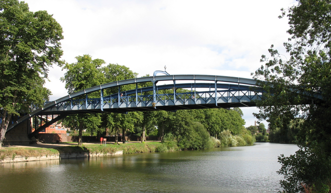

Bayston Hill, United Kingdom
Bayston Hill is a town of 5,079 people in England, United Kingdom.
Why visit Bayston Hill
Townapedia lists 5 museums and landmarks, 9 parks and trails, 24 places to eat, 1 place to stay and 10 attractions in and around town.
Highlights include Atcham Bridge, Belvidere Bridge, Oteley Road and Roman Road.
Weather in Bayston Hill
Forecast from MET Norway (CC BY 4.0). Full forecast
About Bayston Hill
Bayston Hill is a village and civil parish in Shropshire, England. It is 3 miles (5 km) south of the county town Shrewsbury and located on the main A49 road, the Shrewsbury to Hereford road.
From the Wikipedia article Bayston Hill (this version), under CC BY-SA 4.0.
Things to do10

Atcham Bridge
Bridge · 3.4 mi
18th century bridge in Atcham, Shropshire, England, UK

Belvidere Bridge
Bridge · 3.1 mi
Historic bridge in Shrewsbury, Shropshire, England, UK

Cantlop Bridge
Bridge · 2.6 mi
Bridge in Berrington, Shropshire, England, UK


English Bridge
Bridge · 2.2 mi
Bridge over the River Severn in Shrewsbury, Shropshire, England, UK


Porthill Bridge
Bridge · 2.2 mi
Bridge crossing the River Severn in Shrewsbury, Shropshire, England

Shrewsbury Museum and Art Gallery
Cinema and theater · 2.2 mi
Former theatre, now museum in Shrewsbury, England, United Kingdom
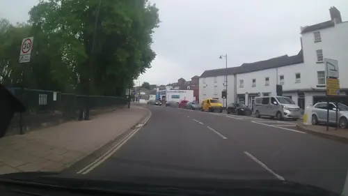

Welsh Bridge
Bridge · 2.4 mi
Bridge over River Severn in Shrewsbury, UK
Museums and landmarks5

Parks, trails and playgrounds9
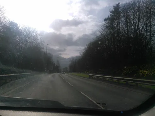
Meole Brace Golf Course
Golf course · 1.3 mi
12 hole Par 68
Nov-Mar: Mo-Fr,Su 08:00-17:00; Nov-Mar: Sa 07:30-17:00; Apr-Oct...



Shrewsbury Business Park
Park · 2.2 mi
Business park in Shrewsbury, Shropshire, England


Restaurants and cafes24
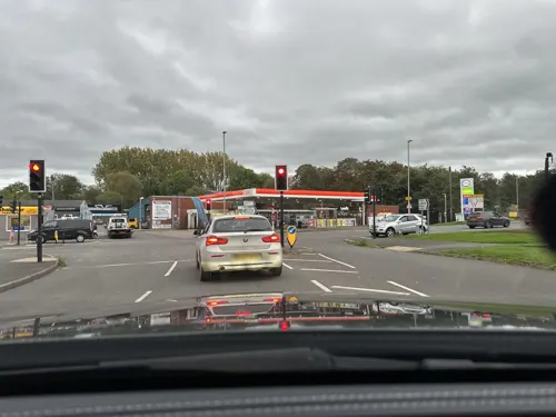
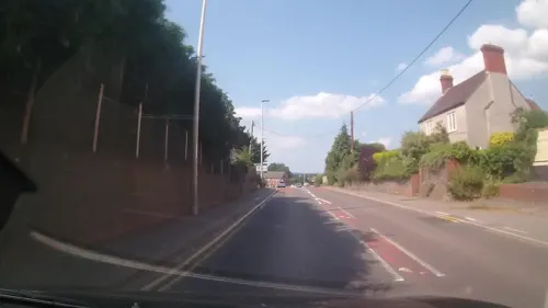




12 more on the map.
History
There is remaining evidence of both an ancient British Iron Age hillfort and a Roman settlement located on the village's high grounds. In the Middle Ages the heavily wooded Bayston Hill and Condover area was established as a Royal hunting forest.
Standing on the east side is the village's oldest archaeological site: a mounded Iron Age bivallate hillfort, relatively low lying for such a structure and oddly named with the Danish name of The Burgs, but probably was not called that until sometime between the 14th and 16th centuries.
The village was surveyed for the Domesday Book during the year 1086, when it was called Begestan. William Pantulf, an Anglo-Norman nobleman, held land there.
A busy rope works, complete with its own windmill built in 1835, existed on Lyth Hill in the 19th century, supplying the many mines, farms and barge owners across the district.
Great Lyth manor house was built in 1638 but had fallen into dereliction by 1948. In recent years it has been rescued and renovated. The present Lord of Wrentnall, Baron of Pulverbatch, is also the present Lord of Great Lyth. {Farrow, M. MA Cantab, Barony of Pulverbatch, Manors of Pulverbatch, Wrentnall, Great Lyth, Baron of Pulverbatch is R. SPRULES, 7 April 2003, copies at The British Library}.
Read more of the history
In 1785 the London architect George Steuart designed and built a brick mansion house, Lythwood Hall for the Blakeway family, which was accessed via a sweeping driveway through landscaped gardens to the west of the village. Steuart went on to build Attingham Hall for the 1st Lord Berwick but Lythwood Hall fell into disrepair under the squireship of the Hulton-Harrop family in the 1890s. It was later split into multi-ownership units.
Bayston Hill was established as a new ecclesiastical parish with the building of Christ Church in 1843 by Edward Haycock, as an amalgamation of sections from the parishes of St. Julian's Shrewsbury, Meole Brace and nearby Condover. The church was built to serve the local miners, quarrymen and railway navvies. The ecclesiastical parish is part of the Diocese of Lichfield.
Although the Shrewsbury and Hereford Railway (now the Welsh Marches Line), runs straight past the village, Bayston Hill has never had its own railway station.
The village became a civil parish in the reorganisation of 1967.
The original 1843 Christ Church church building still stands. A modern successor church was built on a more central site for the newer housing estates in the early 1980s.
In 2001 an application to further extend the Bayston Hill quarry was turned down, after a detailed survey identified six previously unknown historical sites of archaeological importance that would be destroyed by the proposed extension. These included sections of at least one or possibly two AD 43–450 Roman roads, two 1066–1547 medieval or mid 16th century post-medieval roads or trackways, a group of cropmarks suggesting historical earthworks or buildings, and a group of three medieval parish boundary stones.
In August 2003, the section of the A5 road at Bayston Hill was closed, after a large black cat was claimed to have been sighted at the service station. Experts from the West Midland Safari Park assisted a police helicopter in search for the cat, which was not found.
In early 2012 plans to change Bayston Hill's status to a town were abandoned, following concerns by residents. The plans would have seen a Mayor and Deputy Mayor appointed.
From the History section of Bayston Hill on Wikipedia, under CC BY-SA 4.0.
More about Bayston Hill
Geography
Bayston Hill stands on an outcropping spur, of a Pre-Cambrian limestone and sandstone sedimentary rock extension of the Longmyndian range, intruding into the Shropshire plain, with major appearances at Longden, Lyth Hill, Bayston Hill, and Sharpstone Hill. North of the River Severn it does not outcrop again until it appears east of Shrewsbury as Haughmond Hill. The sediments were laid down under a vast warm ocean, surrounded by many volcanoes that were ground down by later Ice Age glaciers, which provided the fertile soil that contributed to Bayston Hill becoming a successful farming community throughout medieval times. There are still several active geological fault lines underlying the area; on 2 April 1990 Bayston Hill experienced an earthquake, measuring 5.4 on the Richter Scale, that was centred on Bishop's Castle.
Education
There is no secondary school in the village, with children over the age of eleven attending a range of secondary schools in the rest of Shrewsbury or Church Stretton.
There were two primary schools in the village, Longmeadow and Oakland Primary Schools. Falling pupil numbers led to local discussions about amalgamating the schools. The idea was supported by some and opposed by others in the community. In September 2008 the statutory notices were formally served by Shropshire County Council and the Diocese of Lichfield, stating their intent to discontinue both Oakland and Longmeadow schools as from 31 August 2009. The Diocese of Lichfield was invited to establish a new Church of England school in Bayston Hill on 1 September 2009. After a vote, the new establishment was named Oakmeadow and its uniform purple. The children of junior age are educated on the old Longmeadow site, and originally infants were to be educated at the Oakland site. However, the Longmeadow site has been extended to house the whole school. The Oakland site has been replaced by housing and a cul-de-sac named Treetop Avenue.
From the Wikipedia article Bayston Hill, under CC BY-SA 4.0.
Notable people from Bayston Hill
 Eric LockRAF fighter ace during WW2Photo: Unknown author Unknown author, Public domain
- Violet BlandBritish suffragette
Born in Bayston Hill, according to Wikidata (CC0). Each name links to its Wikipedia article.
Where to stay1
Churches and places of worship15
Shopping10
Gas and EV charging2
Schools, colleges and libraries6
Meole Brace Church of England Primary School and Nursery
School · Anglican · 0.9 mi
Church Road, Shrewsbury
Oakmeadow Church of England Primary and Nursery School
School · Anglican · 0.5 mi
Longmeadow, Shrewsbury
Healthcare4
Map of Bayston Hill
86 places. The map loads OpenStreetMap tiles when you open it.
Getting there and nearby towns
Hawarden Airport (CEG) is the nearest airport with scheduled flights listed in OpenStreetMap, 36 miles away.
- Shrewsbury 2 mi north, about 4 min by car
- Great Hanwood 2 mi west, about 4 min by car
- Baschurch 9 mi northwest, about 14 min by car
- Shawbury 9 mi northeast, about 14 min by car
- Wellington 10 mi east, about 17 min by car
- Church Stretton 10 mi south, about 16 min by car
- Much Wenlock 10 mi southeast, about 16 min by car
- Ruyton-XI-Towns 10 mi northwest, about 16 min by car
- Hadley 12 mi east, about 19 min by car
- Telford 13 mi east, about 21 min by car
Drive times are estimates from straight-line distance, not routes.
Towns near Bayston Hill


Keep exploring
Local news
Headlines from INDB.
Reviews, tips and questions
Loading what members have shared...
Sources and licences
- GeoNames (CC BY 4.0): population, coordinates, regions and time zone
- Mapillary (see each image): photos
- OpenStreetMap contributors (ODbL 1.0): places, airports, map data
- Wikidata (CC0 1.0): elevation, founding date, time zone, website, landmarks and historic places
- Wikimedia Commons (see each image): photos
- Wikipedia (CC BY-SA 4.0): overview and history text
Photo credits
- Atcham Bridge over the River Severn, Atcham, Shropshire, Christian David, CC BY-SA 4.0
- Belvidere Bridge 01, Harry Mitchell, CC BY 4.0
- Castle walk footbridge, kevin skidmore, CC BY-SA 2.0
- English Bridge a, Dpaajones, CC BY-SA 3.0
- Kingsland BridgeCB, Chris Bayley at en.wikipedia, CC BY-SA 2.5
- Porthill BridgeCB, The original uploader was ChrisJB at English Wikipedia ., CC BY-SA 2.5
- The Music Hall, Shrewsbury 01, Tyssil, CC BY-SA 4.0
- Welsh Bridge, Shrewsbury, Brian Clift, CC BY 2.0
- The Quarry, Shrewsbury (7251), Nilfanion, CC BY-SA 4.0
- Christ Church, Bicton Heath, John S Turner, CC BY-SA 2.0
- Shrewsbury Abbey Exterior, Shropshire, UK - Diliff, Diliff, CC BY-SA 3.0
- Shrewsburycathedral, Fountain Posters, CC BY-SA 3.0
- Shrewsbury Unitarian Church, The Almightey Drill, CC BY-SA 4.0
- Church of St Chad, Shrewsbury 02, Necrothesp, CC BY-SA 3.0
- STFC - New Meadow (Aerial), Alice Humphreys - transatracurium, CC BY-SA 3.0
- Meole Brace Church of Holy Trinity 2013-09-22 12-30-09, Daveyonthemove, CC BY-SA 3.0
- Cantlop Bridge 2016, DeFacto, CC BY-SA 4.0
- Street-level photo, trigpoint, CC BY-SA 4.0
- Street-level photo, trigpoint, CC BY-SA 4.0
- Street-level photo, trigpoint, CC BY-SA 4.0
- Street-level photo, trigpoint, CC BY-SA 4.0
- Street-level photo, trigpoint, CC BY-SA 4.0
- Street-level photo, wasd42, CC BY-SA 4.0
- Street-level photo, trigpoint, CC BY-SA 4.0
- Street-level photo, trigpoint, CC BY-SA 4.0
- Street-level photo, trigpoint, CC BY-SA 4.0
- Street-level photo, trigpoint, CC BY-SA 4.0
- Street-level photo, cyclestreets, CC BY-SA 4.0
- Street-level photo, rac_uk2, CC BY-SA 4.0
- Street-level photo, trigpoint, CC BY-SA 4.0
- Street-level photo, trigpoint, CC BY-SA 4.0
- Street-level photo, trigpoint, CC BY-SA 4.0
- Street-level photo, trigpoint, CC BY-SA 4.0
- Street-level photo, rac_uk2, CC BY-SA 4.0
- Street-level photo, swinetown, CC BY-SA 4.0
- Street-level photo, trigpoint, CC BY-SA 4.0
- Street-level photo, trigpoint, CC BY-SA 4.0
- Street-level photo, trigpoint, CC BY-SA 4.0
- Street-level photo, trigpoint, CC BY-SA 4.0
- Street-level photo, wasd42, CC BY-SA 4.0


Page built November 10, 2026. Spotted a mistake? Tell us or suggest a place.