

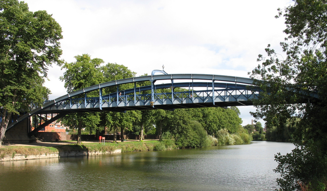


Great Hanwood, United Kingdom
Great Hanwood is a town of 1,090 people in England, United Kingdom.
Why visit Great Hanwood
Townapedia lists 2 museums and landmarks, 2 parks and trails, 2 places to eat and 6 attractions in and around town.
Highlights include English Bridge, Kingsland Bridge and Quarry Park.
Weather in Great Hanwood
Forecast from MET Norway (CC BY 4.0). Full forecast
About Great Hanwood
It is located 3 miles (4.8 km) SW of Shrewsbury town centre, on the A488 road. The A5 is only a mile away. The Cambrian Line runs through the village but there is no longer a railway station here. It was closed in 1964, as a result of the Beeching Axe.
From the Wikipedia article Hanwood (this version), under CC BY-SA 4.0.
Things to do6

English Bridge
Bridge · 3.3 mi
Bridge over the River Severn in Shrewsbury, Shropshire, England, UK


Porthill Bridge
Bridge · 2.8 mi
Bridge crossing the River Severn in Shrewsbury, Shropshire, England

Shrewsbury Museum and Art Gallery
Cinema and theater · 3.1 mi
Former theatre, now museum in Shrewsbury, England, United Kingdom
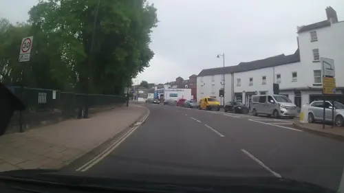

Welsh Bridge
Bridge · 3.1 mi
Bridge over River Severn in Shrewsbury, UK
Museums and landmarks2

Welbatch Pit Mound
Monument and historic site · 0.8 mi
Ruined coal mine tramway that closed in 1940's.
Parks, trails and playgrounds2


Restaurants and cafes2
Notable people from Great Hanwood
- Derwas ChittyBritish priest (1901-1971)
Born in Great Hanwood, according to Wikidata (CC0). Each name links to its Wikipedia article.
Churches and places of worship10
Schools, colleges and libraries3
St Thomas and St Anne's Church of England Primary School
School · Anglican · 0.8 mi
Map of Great Hanwood
25 places. The map loads OpenStreetMap tiles when you open it.
Getting there and nearby towns
Hawarden Airport (CEG) is the nearest airport with scheduled flights listed in OpenStreetMap, 35 miles away.
- Shrewsbury 3 mi northeast, about 5 min by car
- Ruyton-XI-Towns 9 mi northwest, about 14 min by car
- Wellington 13 mi east, about 20 min by car
- Hadley 14 mi east, about 23 min by car
- Ironbridge 14 mi east, about 23 min by car
- Telford 15 mi east, about 25 min by car
- Whittington 15 mi northwest, about 25 min by car
- Oswestry 16 mi northwest, about 26 min by car
- Newport 19 mi east, about 31 min by car
- Bridgnorth 19 mi southeast, about 31 min by car
Drive times are estimates from straight-line distance, not routes.
Towns near Great Hanwood


Keep exploring
Local news
Headlines from INDB.
Reviews, tips and questions
Loading what members have shared...
Sources and licences
- GeoNames (CC BY 4.0): population, coordinates, regions and time zone
- Mapillary (see each image): photos
- OpenStreetMap contributors (ODbL 1.0): places, airports, map data
- Wikidata (CC0 1.0): elevation, founding date, time zone, website, landmarks and historic places
- Wikimedia Commons (see each image): photos
- Wikipedia (CC BY-SA 4.0): overview and history text
Photo credits
- English Bridge a, Dpaajones, CC BY-SA 3.0
- Kingsland BridgeCB, Chris Bayley at en.wikipedia, CC BY-SA 2.5
- Porthill BridgeCB, The original uploader was ChrisJB at English Wikipedia ., CC BY-SA 2.5
- The Music Hall, Shrewsbury 01, Tyssil, CC BY-SA 4.0
- Welsh Bridge, Shrewsbury, Brian Clift, CC BY 2.0
- The Quarry, Shrewsbury (7251), Nilfanion, CC BY-SA 4.0
- Christ Church, Bicton Heath, John S Turner, CC BY-SA 2.0
- Shrewsburycathedral, Fountain Posters, CC BY-SA 3.0
- Shrewsbury Unitarian Church, The Almightey Drill, CC BY-SA 4.0
- Church of St Chad, Shrewsbury 02, Necrothesp, CC BY-SA 3.0
- Street-level photo, trigpoint, CC BY-SA 4.0
- Street-level photo, trigpoint, CC BY-SA 4.0
- Street-level photo, cyclestreets, CC BY-SA 4.0
- Street-level photo, trigpoint, CC BY-SA 4.0
- Street-level photo, trigpoint, CC BY-SA 4.0
- Street-level photo, trigpoint, CC BY-SA 4.0
- Street-level photo, trigpoint, CC BY-SA 4.0
- Street-level photo, trigpoint, CC BY-SA 4.0


Page built November 10, 2026. Spotted a mistake? Tell us or suggest a place.