
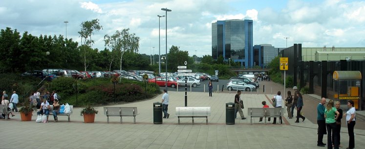


Why visit Telford
Townapedia lists 68 museums and landmarks, 74 parks and trails, 158 places to eat, 39 places to stay and 26 attractions in and around town.
Highlights include Wellington Orbit, Albert Edward Bridge, Jackfield Tile Museum and Benthall Hall.
Weather in Telford
Forecast from MET Norway (CC BY 4.0). Full forecast
About Telford
Telford is a town in the Telford and Wrekin borough in Shropshire, England. The wider borough covers the town, its suburbs and surrounding towns and villages. The town is close to the county's eastern boundary, and near the River Severn. The notable hill near the town called The Wrekin is part of the Shropshire Hills, an Area of Outstanding Natural Beauty.
From the Wikipedia article Telford (this version), under CC BY-SA 4.0.
Travel tips from other travellers: Telford on Wikivoyage (CC BY-SA 4.0).
Photos of Telford

Things to do26
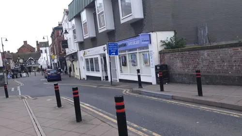
Wellington Orbit
Cinema and theater · 3.4 mi
1 Station Road, Telford
Mo 18:00-21:00; Tu-Sa 10:00-21:00; Su 13:00-21:00

Albert Edward Bridge
Bridge · 3.9 mi
Bridge in Shropshire, England, UK

Coalport Bridge
Bridge · 4.2 mi
Historic cast iron bridge at Coalport, Shropshire, England, UK

Lee Dingle Bridge
Bridge · 3.3 mi
Bridge in Madeley, Telford and Wrekin, Shropshire, England, UK


Telford Theatre
Cinema and theater · 1.3 mi
Theatre in Oakengates, Telford, England, UK

14 more on the map.
Museums and landmarks68

Jackfield Tile Museum
Museum · 3.7 mi
Museum of ceramic tile making, Shropshire, United Kingdom
Church Road, Telford
Feb 19-Mar 22 We-Su 10:00-16:00; Mar 23-Apr 07,Apr 08-Jul 21...

Benthall Hall
Monument and historic site · 4.6 mi
Grade I listed historic house museum in Shropshire, England, UK
The Avenue, Broseley

Blists Hill Victorian Town
Museum · 3.2 mi
Open-air museum in Telford, United Kingdom
Legges Way, Telford
Jul 03-Sep 10,Sep 11-Oct 01 10:00-17:00; Oct 02-29 We-Su...

Coalport China Museum
Museum · 4.0 mi
Industry museum in Coalport, England, United Kingdom
Coalport High Street, Telford
Jan 24-Feb 08,Feb 19-Mar 22 We-Su 10:00-16:00; Feb 10-18...

Museum of the Gorge
Museum · 3.7 mi
Museum in Ironbridge, Shropshire, United Kingdom
The Wharfage, Telford
Mo-Su 10:00-17:00

Coalbrookdale Museum of Iron
Museum · 3.1 mi
Museum in Shropshire, England, United Kingdom
Wellington Road, Telford

The Iron Bridge
Monument and historic site · 3.7 mi
Bridge that crosses the River Severn in Shropshire, England


Sunnycroft
Museum · 3.1 mi
Historic house museum in Wellington, Shropshire, England, UK
200 Holyhead Road, Telford


Broseley Pipeworks
Museum · 4.4 mi
Industrial museum in Broseley, United Kingdom
Duke Street, Broseley

56 more on the map.
Parks, trails and playgrounds74
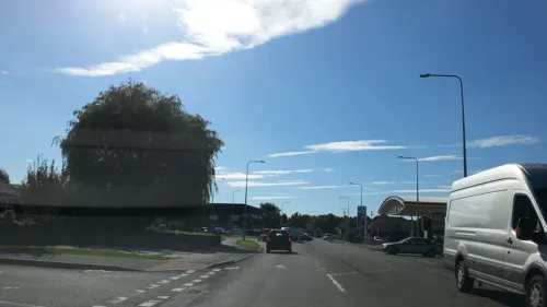



Granville Country Park
Park · 2.7 mi
Nature reserve in Shropshire, England



62 more on the map.
Restaurants and cafes158

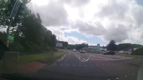
Asda Café
Cafe · Coffee Shop · 2.3 mi
Mo 07:00-24:00; Tu-Fr 00:00-24:00; Sa 00:00-22:00; Su 11:00-17:00
Bella Italia
Restaurant · Italian
Southwater Way, Telford
Mo-Th 12:00-22:00; Fr-Sa 12:00-23:00; Su 12:00-22:00

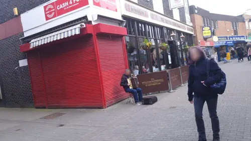
The William Withering
Bar and pub · 3.3 mi
43-45 New Street, Telford
Su-Th 08:00-00:00; Fr,Sa 08:00-01:00

Green Wood Centre Cafe
Cafe · Barbecue · 3.5 mi
Predominantly vegetarian, vegan.
Station Road, Telford
Mo-Su 09:00-15:00

Wildwood
Restaurant · Grill, Pasta, Pizza
2 Park Avenue, Telford
Mo-Th 12:00-20:30; Fr-Sa 12:00-22:00; Su 12:00-20:30

Hickory's Smokehouse
Diner · American · 1.2 mi
Priorslee Avenue, Telford
Mo-Fr 12:00-23:00; Sa-Su 10:00-23:00

The Turf Family Pub
Bar and pub · 1.3 mi
Grove Street, Telford
Mo-Th 16:00-22:00; Fr 16:00-23:00; Sa 09:00-00:00; Su 12:00-23:00
146 more on the map.
History
Early settlement in the area was thought to be on the land that sloped up from the Weald Moors (an area north of the town centre) towards the line along which the Roman Watling Street was built. Farmland surrounded three large estates in the 10th century, namely Wellington, Wrockwardine and Lilleshall.
From the 13th century there was urban development in Wellington and Madeley, where Wenlock Priory founded a new town. Six monastic houses, founded in the 11th and 12th centuries, had large interests in the area's economic growth. They collectively acquired almost half of the area and profited from coal and ironstone mines and iron smithies on their estates.
The area was the site of the 1821 Cinderloo Uprising, which saw 3,000 people protest against the lowering of wages for those working in the local coal industry. The protests resulted in the deaths of three striking colliers.
The New Town was first designated on 16 January 1963 by the Conservative administration as Dawley New Town, covering 9,100 acres (37 km2) of Dawley, Wenlock, Oakengates, Wellington Rural District and Shifnal Rural District. Development started, guided by the Dawley New Town Development Corporation, with the first homes on the new Sutton Hill housing estate being occupied in 1967. Initial planning and design concepts for Dawley New Town were produced by the Birmingham-based John Madin Design Group.
Read more of the history
The Minister proposed an extension of 12,000 acres (4,900 ha) in 1968 (taking in the historic area of Ironbridge Gorge). The Dawley New Town (Designation) Amendment (Telford) Order was made on 29 November 1968, extending the New Town area by 10,143 acres (4,105 ha) of "land lying within the urban districts of Oakengates and Wellington and the rural districts of Shifnal and Wellington". The Order also renamed the new town Telford, after the Scottish-born civil engineer Thomas Telford, who in 1787 became Surveyor of Public Works for Shropshire. Other suggested names at the time were Dawelloak and Wrekin Forest City.
Most of the infrastructure was constructed from the late 1960s and throughout the 1970s, with the major housing and commercial development occurring over three decades up to the early 1990s when the Development Corporation was wound up to be replaced by the Commission for New Towns, later English Partnerships, and most of the property was handed over to the then Wrekin District Council. Telford was now 25 years old and was firmly established as one of the most important towns in the region. There is a Retail Park called Wrekin Retail Park in Wellington.
In 1983, after fierce opposition and three public enquiries, the M54 motorway was completed, connecting the town to the M6 and thence the rest of the UK's motorway network. Other major roads are the A5, A518 and A442, which is commonly known as the Eastern Primary or EP, and is officially branded Queensway.
Many of the new town's residents were originally from the West Midlands conurbation, which includes Wolverhampton, Birmingham, Dudley and Walsall. A majority of the council house tenants in Telford were rehoused from inner-city Birmingham. The rehousing affected existing communities, who were sometimes resentful of the changes. As a result some individuals still refuse to put Telford in their address, instead using the original local name (such as Wellington or Dawley) and often citing the existence of Town Councils as support for the argument "you can't live in a town in a town", e.g. Wellington (Town) Telford (Town). The new town's residents who arrived in the 1960s and 1970s earned the unwanted nickname 'overspill' from people living in the existing towns and villages.
In 2007, a £250 million regeneration plan for the town centre was announced, which includes the pedestrianisation of the road surrounding the shopping centre and the creation of new cafés, bars and shops which would lead to 1,750 new jobs. The reason for the expansion is that the original 'centre' was only ever a shopping place with no real heart. As the 'centre' closed early in the evening there was no nightlife at all in the area, the only major local entertainment areas being in Oakengates and Wellington.
The first phase of the town-centre development, named Southwater, was completed in 2014. The official opening ceremony, on 18 October 2014, included live music and fireworks. The area includes a refurbished library, various chain restaurants, Cineworld IMAX Cinema, a bowling alley/arcade and a new multi-storey car park.
From the History section of Telford on Wikipedia, under CC BY-SA 4.0.
More about Telford
Geography
Telford town centre lies about 16 miles (26 km) east/south-east of Shrewsbury and 20 miles (32 km) north-west of Wolverhampton. The town covers 7,803 hectares (30.13 square miles) and its southern and eastern parts, between the Severn Gorge and Donnington Wood, include the East Shropshire coalfield. North and north-west Telford lie beyond the coalfield's boundary fault on sandstone beds which, along with other Triassic formations, prevail over much of the North Shropshire plain. The town centre stands on a watershed, with land to the south draining towards the River Severn and to the north sloping gently down towards the Weald Moors. The town is dominated by the Wrekin, a large hill of 407 m (1335 ft), south-west of Wellington, straddling the border with the unitary Shropshire Council (before the latter's creation in 2009 the borough of Shrewsbury and Atcham).
Economy
During the economic crisis of the late 1960s (with unemployment doubling nationally during the second half of the decade), unemployment in the then-new town was initially high.
However, in 1967 Halesfield Industrial Estate was founded on the south-eastern edge of the town – the first real answer to Telford's unemployment problems. Other large estates followed, in 1973 with Stafford Park just east of the town centre and in 1979 with Hortonwood, to the north, helping ease the unemployment crisis in a decade which saw an almost unbroken rise in unemployment.
In total, half a million square metres of factory space were provided between 1968 and 1983, making Telford an attractive investment area.
By 1976, Telford had begun to recruit industry from the US, Europe, and Japan. The foreign firms required larger factories, and they began to be built at Stafford Park. By 1983 over 2,000 jobs in Telford were provided by around 40 (mostly American) foreign companies. In contrast to industry in the Black Country at the time, these new companies focused on high-technology industries rather than the heavy and metal-finishing industries.
Education
Telford has a number of primary and secondary schools. These range from academies such as the Telford Langley School to City Technology Colleges like the Thomas Telford School. 8 miles (13 km) to the north are Adams' Grammar School and Newport Girls High School selective schools located in nearby Newport. Wrekin College, an independent co-educational boarding and day school, is located in the Wellington area of Telford.
Further education was handled by Telford College of Arts and Technology (TCAT) and Telford New College, a sixth-form college located in Wellington. In September 2017 the two colleges merged to form Telford College. There are four other sixth forms located at Haberdashers' Abraham Darby, Holy Trinity Academy, Madeley Academy and Thomas Telford School.
Telford is home to Harper Adams University digital skills hub, based at The Quad. Specialising in food, animal and sustainable education, the university's main campus is also located 9.5 miles to the northeast at Edgmond, near Newport.
From the Wikipedia article Telford, under CC BY-SA 4.0.
Notable people from Telford
 Rob Edwardsassociation football player and managerPhoto: Timmy96, CC0
 Elliott BennettEnglish association football playerPhoto: Ingy The Wingy, CC BY-SA 2.0
 Lee CollinsEnglish footballer (1988–2021)Photo: Mattythewhite, CC BY-SA 4.0
 Taylor Gardner-HickmanEnglish footballer (born 2001)Photo: Timmy96, CC0
- Dorothy WordsworthBritish author, poet and diarist (1771-1855)
- Lewis AllenEnglish film and television director (1905–2000)
- Ryan GilesEnglish footballer
- Adrian GunnellEnglish snooker player
- Jessica Pughbadminton player
- Penny HealeyBritish archer
- Kyle BennettFootballer (born 1990)
- Alfred OnionsBritish politician (1858-1921)
Born in Telford, according to Wikidata (CC0). Each name links to its Wikipedia article.
Where to stay39
Madeley Court Hotel
Motel and hotel · 2.3 mi
Castlefields Way, Telford
Churches and places of worship50
Shopping66
Gas and EV charging15
Schools, colleges and libraries39
Donnington Wood CofE Voluntary Controlled Junior School
School · Anglican · 2.6 mi
Leonard Close, Telford
St Matthew's Church of England Aided Primary School and Nursery Centre
School · Anglican · 2.7 mi
Church Road, Telford
Healthcare28
Ironbridge Pharmacy & Post Office
Clinic and pharmacy · 3.7 mi
9 The Square, Telford
Map of Telford
250 places. The map loads OpenStreetMap tiles when you open it.
Getting there and nearby towns
Birmingham Airport (BHX) is the nearest airport with scheduled flights listed in OpenStreetMap, 34 miles away.
- Wolverhampton 15 mi southeast, about 24 min by car
- Dudley 20 mi southeast, about 32 min by car
- Walsall 21 mi east, about 33 min by car
- West Bromwich 22 mi southeast, about 35 min by car
- Newcastle under Lyme 24 mi north, about 39 min by car
- Stoke-on-Trent 25 mi northeast, about 41 min by car
- Birmingham 27 mi southeast, about 43 min by car
- Sutton Coldfield 28 mi east, about 44 min by car
- Solihull 33 mi southeast, about 54 min by car
- Burton upon Trent 35 mi east, about 56 min by car
Drive times are estimates from straight-line distance, not routes.
Towns near Telford


Keep exploring
Local news
Headlines from INDB.
Reviews, tips and questions
Loading what members have shared...
Sources and licences
- GeoNames (CC BY 4.0): population, coordinates, regions and time zone
- Mapillary (see each image): photos
- OpenStreetMap contributors (ODbL 1.0): places, airports, map data
- Wikidata (CC0 1.0): elevation, founding date, time zone, website, landmarks and historic places
- Wikimedia Commons (see each image): photos
- Wikipedia (CC BY-SA 4.0): overview and history text
Photo credits
- Telford town centre -England, The original uploader was ChrisJB at English Wikipedia ., CC BY 2.5
- ThomasTelfordstatue, Row17, CC BY-SA 2.0
- Albert Edward Bridge, D4nnyt at English Wikipedia, Public domain
- Lee Dingle Bridge, Madeley, Gareth James, CC BY-SA 2.0
- Benthall Hall A, Gammock, CC BY-SA 4.0
- Blists Hill Victorian Town Canal Street November 2021, The Ironbridge Gorge Museum Trust, CC BY-SA 4.0
- Kiln at Coalport China Museum, Scott14 at English Wikipedia, Public domain
- Darby furnace UK, Helen Simonsson, CC BY-SA 3.0
- Ironbridge 2014, Colin, CC BY-SA 4.0
- Bandstand 2, Mrbic ( talk ) ( Uploads ), CC0
- AllSaintsWellington, Nabokov ( talk ). Required citation is: "Photo by Tom Oates, 2009"., CC BY-SA 3.0
- Holy Trinity Church, Coalbrookdale, Mat Fascione, CC BY-SA 2.0
- Sunnycroft Facing Garden, Wehha, CC BY-SA 3.0
- David Hutchinson Stand New Bucks Head, Cls14, CC BY-SA 3.0
- St Andrews Shifnal, w:en:Shropman ( talk | contribs ), CC BY-SA 2.5
- Benthall Church, Gammock, CC BY-SA 4.0
- Christ Church, Wellington, Dave Bevis, CC BY-SA 2.0
- Elephant and Castle, Dawley, Ian S, CC BY-SA 2.0
- Holy Trinity, Wrockwardine Wood, Richard Law, CC BY-SA 2.0
- Enginuity, GeorgeIronbridge, CC BY-SA 4.0
- Dale House Distance, The Ironbridge Gorge Museum Trust, CC BY-SA 4.0
- Shopping - panoramio (5), L. Carlos, CC BY-SA 3.0
- Coalport bridge - panoramio, Tanya Dedyukhina, CC BY 3.0
- Jackfield Tile Museum trade showroom (1), Seth Whales, CC BY-SA 4.0
- The Iron Bridge, diorama, Museum of the Gorge, Ironbridge, Andy Dingley, CC BY-SA 3.0
- Street-level photo, trigpoint, CC BY-SA 4.0
- Street-level photo, msevilla00, CC BY-SA 4.0
- Street-level photo, edloach, CC BY-SA 4.0
- Street-level photo, trigpoint, CC BY-SA 4.0
- Street-level photo, trigpoint, CC BY-SA 4.0
- Street-level photo, ebel, CC BY-SA 4.0
- Street-level photo, trigpoint, CC BY-SA 4.0
- Street-level photo, msevilla00, CC BY-SA 4.0
- Street-level photo, trigpoint, CC BY-SA 4.0
- Street-level photo, JackW25, CC BY-SA 4.0
- Street-level photo, ebel, CC BY-SA 4.0
- Street-level photo, edloach, CC BY-SA 4.0
- Street-level photo, edloach, CC BY-SA 4.0
- Street-level photo, adam2, CC BY-SA 4.0
- Street-level photo, adam2, CC BY-SA 4.0


Page built November 10, 2026. Spotted a mistake? Tell us or suggest a place.