


Why visit Bempton
Townapedia lists 4 museums and landmarks, 4 parks and trails, 3 places to eat, 9 places to stay and 5 attractions in and around town.
Highlights include Bayle Museum, Sewerby Hall and Gardens, Bempton Cliffs RSPB reserve and RSPB Bempton Cliffs.
Weather in Bempton
Forecast from MET Norway (CC BY 4.0). Full forecast
About Bempton
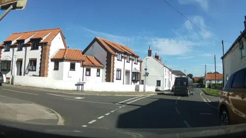
Bempton is a village and civil parish in the East Riding of Yorkshire, England, near the border with North Yorkshire. It is near the North Sea coast and Flamborough Head, and is situated about 4 miles (6.4 km) north of Bridlington. It lies on the B1229 road between Speeton and Flamborough. It is served by Bempton railway station which is on the Yorkshire Coast Line that runs between Hull and Scarborough.
From the Wikipedia article Bempton (this version), under CC BY-SA 4.0.
Things to do5


Museums and landmarks4

Sewerby Hall and Gardens
Museum · 2.0 mi
Grade I listed English country house in East Riding of Yorkshire, England, UK

Parks, trails and playgrounds4

Bempton Cliffs RSPB reserve
Park · 1.3 mi
RSPB nature reserve in the United Kingdom

Restaurants and cafes3
White Horse
Bar and pub
High Street, Bridlington
Mo 16:30-21:00, Tu 16:30-11:00, We,Th 16:30-21:30, Fr 16:00-24:00,...


History
The name Bempton derives from the Old English bēamtūn meaning 'settlement made of wooden beams' or 'settlement near a tree'.
Bempton used to be home to RAF Bempton, an early warning station. It was established in the Second World War as a radar station. It was finally closed in 1972. Some of the old buildings are still visible from the cliff top. The former RAF camp site is now a caravan park.
From the mediaeval era until the 19th century Bempton was part of Dickering Wapentake. Between 1894 and 1974 Bempton was a part of the Bridlington Rural District, in the East Riding of Yorkshire. Between 1974 and 1996 it was part of the Borough of North Wolds (later Borough of East Yorkshire), in the county of Humberside.
From the History section of Bempton on Wikipedia, under CC BY-SA 4.0.
Where to stay9
Churches and places of worship10
Schools, colleges and libraries1
Map of Bempton
36 places. The map loads OpenStreetMap tiles when you open it.
Getting there and nearby towns
Humberside Airport (HUY) is the nearest airport with scheduled flights listed in OpenStreetMap, 39 miles away.
- Bridlington 3 mi south, about 5 min by car
- Scarborough 14 mi northwest, about 22 min by car
- Driffield 14 mi southwest, about 22 min by car
- Beverley 22 mi southwest, about 35 min by car
- Kingston upon Hull 27 mi south, about 44 min by car
- Hedon 27 mi south, about 43 min by car
- Little Weighton 27 mi southwest, about 43 min by car
- Whitby 30 mi northwest, about 49 min by car
- Brough 32 mi southwest, about 52 min by car
- Barton upon Humber 32 mi south, about 52 min by car
Drive times are estimates from straight-line distance, not routes.
Towns near Bempton


Keep exploring
Local news
Headlines from INDB.
Reviews, tips and questions
Loading what members have shared...
Sources and licences
- GeoNames (CC BY 4.0): population, coordinates, regions and time zone
- Mapillary (see each image): photos
- OpenStreetMap contributors (ODbL 1.0): places, airports, map data
- Wikidata (CC0 1.0): elevation, founding date, time zone, website, landmarks and historic places
- Wikimedia Commons (see each image): photos
- Wikipedia (CC BY-SA 4.0): overview and history text
Photo credits
- Bempton Parish Church, Yorkshire, Dr Neil Clifton, CC BY-SA 2.0
- St John the Evangelist Parish Church Sewerby, JThomas, CC BY-SA 2.0
- Bempton Cliffs, JD554, CC BY-SA 3.0
- Bempton Cliffs Stack From New Roll Up Viewing Platform, Crimson Caribou, CC BY-SA 4.0
- Street-level photo, southglos, CC BY-SA 4.0
- Street-level photo, southglos, CC BY-SA 4.0
- Street-level photo, southglos, CC BY-SA 4.0
Page built November 10, 2026. Spotted a mistake? Tell us or suggest a place.