


Bridlington, United Kingdom
Bridlington is a town of 35,154 people in England, United Kingdom.
Why visit Bridlington
Townapedia lists 14 museums and landmarks, 14 parks and trails, 117 places to eat, 21 places to stay and 5 attractions in and around town.
Highlights include The Spa Bridlington, Sewerby Zoo, Sewerby Hall and Bayle Museum.
Weather in Bridlington
Forecast from MET Norway (CC BY 4.0). Full forecast
About Bridlington
Bridlington is a seaside town and civil parish in the East Riding of Yorkshire, England. It is on the Holderness part (Flamborough Head to the Humber estuary) of the Yorkshire Coast by the North Sea. The town is about 28 miles (45 km) north of Hull and 34 miles (55 km) east of York. The stream called Gypsey Race flows through the town and enters the North Sea at the harbour.
From the Wikipedia article Bridlington (this version), under CC BY-SA 4.0.
Travel tips from other travellers: Bridlington on Wikivoyage (CC BY-SA 4.0).
Things to do5

The Spa Bridlington
Cinema and theater
Dance hall, theatre, conference centre and former cinema in Bridlington, England
South Marine Drive, Bridlington



Museums and landmarks14

Sewerby Hall
Monument and historic site · 1.9 mi
Church Lane, Bridlington
Mar 23-Sep 29 11:00-16:30

Sewerby Hall and Gardens
Museum · 1.9 mi
Grade I listed English country house in East Riding of Yorkshire, England, UK

Bondville Model Village
Monument and historic site · 1.5 mi
Sewerby Road, Bridlington
May 01-Oct 31 Mo,We-Sa 09:00-18:00; May 01-Oct 31 Su 09:00-16:00
2 more on the map.
Parks, trails and playgrounds14




2 more on the map.
Restaurants and cafes117
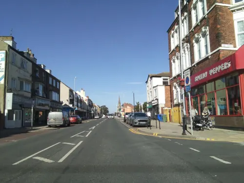
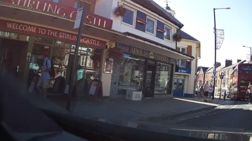
Rustics
Restaurant
30 Queen Street, Bridlington
We-Su 17:00-23:00


Hideaway @ The House of Food ltd
Restaurant · Brunch, Diner, African, British
36 Lansdowne Road, Bridlington
Su,Th 10:00-21:00; Fr-Sa 10:00-22:00


Nut and Nettle
Cafe · Plant Based Food · 1.0 mi
75 High Street, Bridlington
Th-Su 09:00-15:00
105 more on the map.
History
Archaeological evidence shows habitation of the area around the Bronze Age and Roman Britain era. The date of earliest habitation at Bridlington is unknown, but the 2.5-mile (4 km) man-made Danes Dyke at nearby Flamborough Head goes back to the Bronze Age.
A Roman road from York, now Woldgate, can be traced across the Yorkshire Wolds into the town. Roman coins have been found: two hoards in the harbour area, along with two Greek coins from the second century BC — suggesting the port was in use long before the Roman conquest of Britain.
In the fourth century AD, Count Theodosius set up signal stations on the North Yorkshire coast to warn of Saxon raids. It has been suggested that the current town was built near the site of a Roman maritime station called Gabrantovicorum. In the early second-century, Ptolemy described what was possibly Bridlington Bay in his Geography as Γαβραντουικων Ευλίμενος κόλπος: "Gabrantwikone bay suitable for a harbour". No sheltered ancient harbour has been found, coastal erosion will have destroyed traces of any Roman installation near Bridlington Harbour.
Read more of the history
Another position at Flamborough Head is also believed to have been a signal station – probably on Beacon Hill (now a gravel quarry) from where Filey, Scarborough Castle and the Whitby promontory can be seen. Another suggestion has been a line of signal stations stretching south round Bridlington Bay. A fort at Bridlington would have made a centre of operations for these. This counterpart to the northern chain would have guarded a huge accessible anchorage from barbarian piracy.
Near Dukes Park are two bowl barrows known as Butt Hills, designated ancient monuments in the National Heritage List for England of Historic England. Nearby are remains of an Anglo-Saxon cemetery on a farm outside Sewerby. The several suggested origins all trace the name to the Anglo-Saxon custom of matching a personal name with a settlement type. Here the personal names advanced include Bretel, Bridla and Berhtel, attached to -ingtūn, an Old English term for a small farming community. In 1072 the area was given to Gilbert de Gant, uncle of the later king King Stephen; it was inherited by his son Walter and thereafter appears to follow the normal descent of that family.
The 1086 Domesday Book contains the earliest known reference to Bridlington being record as Bretlinton: the settlement has since been called Berlington, Brellington and Britlington before gaining its present name in the 19th century. The Domesday Book records that Bretlinton was the Hunthow Wapentake's meeting point (the wapentake later merged with neighbouring wapentakes to form the Dickering Wapentake). The wapentake was held by Earl Morcar; it later passed to William the Conqueror by forfeiture. It also records the effect of the Harrying of the North: the annual value of the land had fallen from £32 in the time of Edward the Confessor to eight shillings (£0.40) at the time of the survey, comprising two villeins and one socman with one and a half of a carucate, the rest being waste.
Walter de Gant founded an Augustinian priory on the land in 1133, confirmed by Henry I in a charter. Several succeeding kings confirmed and extended Walter de Gant's gift: King Stephen granted an additional right to have a port, King John in 1200 gave permission for a weekly market and an annual fair, and Henry VI allowed three annual fairs, on the Nativity of Mary and the Deposition and Translation of St John of Bridlington in 1446. In 1415 Henry V visited the Priory to give thanks for victory at the Battle of Agincourt.
After the Dissolution of the Monasteries, the manor of Bridlington remained with the Crown until 1624, when Charles I passed it to Sir John Ramsey, who had recently been created Earl of Holderness. In 1633, Sir George Ramsey sold the manor to 13 inhabitants of the town, on behalf of all the manor tenants. In May 1636, a deed was drawn up empowering the 13 men as Lords Feoffees or trust holders of the Manor of Bridlington.
The town began to grow in importance and size around the site of the dispersed priory. In 1643 Queen Henrietta Maria of France landed there with troops to support the Royalist cause in the English Civil War, before moving on to York, which became her headquarters.
The town was originally two settlements: the Old Town about one mile (1.6 km) inland and the quay area where the modern Bridlington Harbour lies. The Bridlington Piers and Harbour Act 1837 (7 Will. 4 & 1 Vict. c. cx) enabled the wooden piers to be replaced with two stone piers to the north and south. Apart from landing fish, the port was used to transport corn: Corn Exchange House can still be seen in Market Place. There used to be mills in the town for grinding it, which led to some breweries starting up locally.
In the Second World War, Bridlington suffered several air raids that caused deaths and much bomb damage. The Royal Air Force had training schools in the town collectively known as RAF Bridlington, with one unit, No. 1104 Marine Craft Unit, continuing until 1980.
The decline in the popularity of British seaside tourism in the 1960s reduced the number of pleasure steamers working from the harbour. By the end of the decade, just three were operating.
From the History section of Bridlington on Wikipedia, under CC BY-SA 4.0.
More about Bridlington
Geography
Bridlington lies 19 miles (31 km) north-north-east of Beverley, 17 miles (27 km) south-east of Scarborough, 11 miles (18 km) north-east of Driffield and 24 miles (39 km) north of Kingston upon Hull, the principal city in the county. It is 179 miles (288 km) north of London. The height above sea level ranges from the beaches to 167 feet (51 m) on Bempton Lane on the outskirts. The Gypsey Race river flows through the town, the last 1⁄2 mi (800 m) being below ground from the Quay Road Car Park. The solid geology of the area is mainly from the Cretaceous period, consisting of chalk overlain by Quaternary boulder clay. The chalk is exposed as the land rises to the north of the town, where a cliff, probably formed in the last interglacial, extends inland at right angles to the present sea cliff, and forms the promontory of Flamborough Head.
Bridlington is in an area said to have the highest coastal erosion rate in Europe. Southwards the coast becomes low, but northwards it is steep and very fine, where the great spur of Flamborough Head projects eastwards. The sea front is guarded by a sea wall and a wide beach with wooden groynes to trap the sand. Offshore, the Smithic Sands sandbank stretches out into the bay, as an important habitat for many marine species. Bridlington north and south beaches have won EU environmental quality awards over the years.
Economy
From the early history of Bridlington, a small fishing port grew up near the coast, later known as Bridlington Quay. After the discovery of a chalybeate spring, the Quay developed in the 19th century into a seaside resort. Bridlington's first hotel was opened in 1805 and it soon became a popular resort with industrial workers from the West Riding of Yorkshire. A new railway station opened on 6 October 1846 between the Quay and the historic town. The area round it was developed and the two areas of the town were combined.
Bridlington's popularity declined along with the industrial parts of the north and the rising popularity of cheap foreign holidays. Although the fishing fleet also declined, the port remains popular with sea anglers for trips along the coast or further out to local shipwrecks. Bridlington has lucrative shellfish exports to France, Spain and Italy, said to be worth several million pounds a year.
Arts and culture
The town is served by the Bridlington-based monthly Bridlington Echo newspaper, Scarborough-based weekly Bridlington Free Press and the East Riding Mail in Hull.
Local radio stations are BBC Radio Humberside, Hits Radio East Yorkshire & North Lincolnshire, Nation Radio East Yorkshire, Capital Yorkshire, Greatest Hits Radio Yorkshire Coast, This is The Coast and Bridlington Gold Radio, a community based station.
Local news and television programmes are provided by BBC Yorkshire and Lincolnshire and ITV Yorkshire. Television signals are received from the Belmont TV transmitter.
Jake Thackray's song "The Hair of the Widow of Bridlington" mocks Bridlington for the ostensible small-mindedness of its inhabitants.
Education
Bridlington Civil Parish has seven primary schools, counting Burlington Infant and Junior together. All are mixed gender, for pupils between three or four and eleven years of age.
Bay Primary School in St Alban Road had 335 pupils in 2013. Burlington Infant School in Marton Road had 239. Burlington Junior School, also in Marton Road, had 320 pupils. Hilderthorpe Primary School in Shaftesbury Road had 328 pupils. Martongate Primary School in Martongate had 424 pupils. Quay Academy in Oxford Street had 390 pupils. Our Lady and Saint Peter RC Primary academy, built in 1977 (formerly St Mary's R.C. Primary School) is located in George Street and had 210 pupils. New Pasture Lane Primary School in Burstall Hill had 177 pupils.
Bridlington School is a mixed-gender specialist Sports and Design and Technology College for 11–18-year-olds. Located in Bessingby Road on the outskirts of the town, it had a 2013 capacity of 1,244 pupils. There have been many notable past pupils.
Headlands School in Sewerby Road caters for mixed-gender eleven to 18-year-olds. It partners the town's other secondary school and had a 2013 capacity of 1,485 pupils.
East Riding College provides tertiary education for students from 16. Located in St Mary's Walk, it is close to Bay Primary School. Courses cover both academic and vocational subjects.
From the Wikipedia article Bridlington, under CC BY-SA 4.0.
Notable people from Bridlington
 Charlie HeatonBritish actorPhoto: JoshPopov, CC BY-SA 4.0
 William KentBritish painter, landscape architect (1685-1748)Photo: William Aikman, Public domain
 Angela EagleBritish politician, Labour MP for Wallasey (born 1961)Photo: UK Home Office, CC BY 2.0
 Maria EagleBritish politician (born 1961)Photo: Richard Townshend, CC BY 3.0
 Richard CresswellEnglish association football player (born 1978)Photo: Mattythewhite, CC BY-SA 3.0
 Adam KhanBritish racing driverPhoto: Lutz H, CC BY 2.0 de
 Andrew DismoreBritish politician (born 1954)Photo: Viljo Wilding, CC BY-SA 4.0
 Edmund Johnston GarwoodBritish geologistPhoto: Bain News Service, publisher, Public domain
 Rosie JonesBritish comedianPhoto: Bryan Berlin, CC BY-SA 4.0
 Humphry SandwithBritish army physician and author (1822–1881)Photo: Unknown author, CC BY 4.0
- William of NewburghEnglish historian
- Mark HermanBritish film director and screenwriter
Born in Bridlington, according to Wikidata (CC0). Each name links to its Wikipedia article.
Where to stay21
Churches and places of worship27
Holy Trinity Parish Church
Church · Anglican · 0.4 mi
Albion Terrace, Bridlington
Our Lady and St Peter's Roman Catholic Church
Church · Catholic
Victoria Road, Bridlington
Shopping18
Gas and EV charging3
Schools, colleges and libraries12
Healthcare9
Map of Bridlington
240 places. The map loads OpenStreetMap tiles when you open it.
Getting there and nearby towns
Humberside Airport (HUY) is the nearest airport with scheduled flights listed in OpenStreetMap, 36 miles away.
- Driffield 12 mi southwest, about 19 min by car
- Scarborough 16 mi northwest, about 26 min by car
- Beverley 19 mi southwest, about 30 min by car
- Kingston upon Hull 24 mi south, about 39 min by car
- Hedon 24 mi south, about 38 min by car
- Brough 29 mi southwest, about 47 min by car
- Barton upon Humber 29 mi south, about 47 min by car
- Whitby 33 mi northwest, about 53 min by car
- Grimsby 36 mi south, about 58 min by car
- York 37 mi west, about 1 h by car
Drive times are estimates from straight-line distance, not routes.
Towns near Bridlington


Keep exploring
Local news
Headlines from INDB.
Reviews, tips and questions
Loading what members have shared...
Sources and licences
- GeoNames (CC BY 4.0): population, coordinates, regions and time zone
- Mapillary (see each image): photos
- OpenStreetMap contributors (ODbL 1.0): places, airports, map data
- Wikidata (CC0 1.0): elevation, founding date, time zone, website, landmarks and historic places
- Wikimedia Commons (see each image): photos
- Wikipedia (CC BY-SA 4.0): overview and history text
Photo credits
- National Bridlington (Kennings), EYBusman, CC BY 2.0
- Kennings British Leyland Showroom, Bridlington, EYBusman, CC BY 2.0
- Bridlington Spa Theatre Auditorium, Carlyleroad, CC BY-SA 4.0
- St Andrews Church Boynton, Trish Steel, CC BY-SA 2.0
- St John the Evangelist Parish Church Sewerby, JThomas, CC BY-SA 2.0
- Headlands School and Science College, Steve Brown, CC BY-SA 2.0
- Our Lady and St Peter's Church front, Bridlington by Beryl Gallagher, Mrs Beryl Gallagher, CC BY-SA 2.0 uk
- Bridlington School, JThomas, CC BY-SA 2.0
- Sewerby Hall (41569921825), Mark Stevenson, CC BY 2.0
- Street-level photo, southglos, CC BY-SA 4.0
- Street-level photo, southglos, CC BY-SA 4.0
- Street-level photo, southglos, CC BY-SA 4.0
- Street-level photo, southglos, CC BY-SA 4.0
- Street-level photo, southglos, CC BY-SA 4.0
- Street-level photo, southglos, CC BY-SA 4.0
- Street-level photo, southglos, CC BY-SA 4.0


Page built November 10, 2026. Spotted a mistake? Tell us or suggest a place.