


Driffield, United Kingdom
Driffield is a town of 13,080 people in England, United Kingdom.
Why visit Driffield
Townapedia lists 4 museums and landmarks, 5 parks and trails, 30 places to eat, 1 place to stay and 1 attraction in and around town.
Highlights include Rose Cottage Farm Shop, Driffield Castle, Danes Graves and Driffield Golf Course.
Weather in Driffield
Forecast from MET Norway (CC BY 4.0). Full forecast
About Driffield
Driffield, also known as Great Driffield (neighbouring Little Driffield), is a market town and civil parish in the East Riding of Yorkshire, England. The civil parish is formed by the town of Driffield and the village of Little Driffield. By road, it is 53 miles (85 km) north-east of Leeds, 29 miles (47 km) east of York and 23 miles (37 km) north of Hull.
From the Wikipedia article Driffield (this version), under CC BY-SA 4.0.
Things to do1

Museums and landmarks4

Driffield Castle
Monument and historic site · 0.4 mi
Motte-and-bailey castle in Driffield, East Riding of Yorkshire, England, UK
Danes Graves
Monument and historic site · 3.4 mi
Archaeological site in Nafferton, East Riding of Yorkshire, England, UK
Parks, trails and playgrounds5



Restaurants and cafes30




18 more on the map.
History
Driffield is of Anglo-Saxon origin, and the name is first attested in the Anglo-Saxon Chronicle where King Aldfrith of Northumbria died on 14 December 705. It is also found in the Domesday Book of 1086, meaning "dirty (manured) field".
A Bronze Age mound outside Driffield was excavated in the 19th century, the contents of which are now kept in the British Museum. It includes a knife, a dagger, a beaker and a greenstone wrist-guard all dating to between 2200 and 1500 BC.
The remains of Driffield Castle, a motte-and-bailey castle, sit at Moot Hill.
RAF Driffield was targeted by the Luftwaffe during the Second World War. On 15 August 1940, a raid by Junkers Ju 88s resulted in 14 deaths and many injuries. RAF Driffield was the site of the first death in the WAAF during the Second World War.
From the History section of Driffield on Wikipedia, under CC BY-SA 4.0.
More about Driffield
Economy
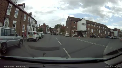
Driffield is centred around Middle Street, its main high street, which hosts both independent retailers and chain stores. On a Thursday, a market is held in the town centre. The original cattle market is thought to have been established in the late 19th century and was located off Eastgate South. It closed in 2001.
Arts and culture
The town is home to Driffield Show, the United Kingdom’s largest one-day annual agricultural show, as well as the Driffield Steam and Vintage Rally – an event held each August showcasing historical vehicles including traction engines, fairground organs, tractors and vintage cars and trucks. A particular focus is placed upon agricultural history, with demonstrations of ploughing and threshing often taking place. The rally is particularly known for the Saturday evening road-run of the steam engines and other vehicles into Driffield town centre, an event which invariably attracts large crowds of spectators.
Driffield also has a small community hospital (known as Alfred Bean Hospital), a fire station, a local police station, and several churches.
Driffield lies in the Yorkshire Wolds, on the Driffield Navigation canal, and near the source of the River Hull. This is maintained by the Driffield Navigation Trust and the group hosts an annual raft race and open day gala at the River Head.
The Driffield Beck runs roughly parallel to the main high street. Some stretches of Driffield Beck are popular for fishing, particularly for brown trout and grayling.
Education
There are two infant schools (Driffield Northfield Infant School and Driffield Church Of England
Voluntary Controlled Infant School), and one larger junior school (Driffield Junior School), which caters for children aged 7–11. Driffield School & Sixth Form is a large secondary school that also contains a sixth form, and so offers education up to A level standard. The town also includes Kings Mill Special School. The nearest independent school is Pocklington School.
From the Wikipedia article Driffield, under CC BY-SA 4.0.
Notable people from Driffield
 Mick WoodmanseyEnglish drummerPhoto: Joana Puig Jodar, CC BY 3.0
 Will AtkinsonBritish footballer (born 1988)Photo: Mattythewhite, CC BY-SA 3.0
 Charlotte FryBritish equestrianPhoto: Eponimm, CC BY 4.0
 Francis William DryGeneticist, biologist, university lecturer, wool researcher (1891-1979)Photo: Unknown photographer, CC BY 3.0 nz
 Senna ProctorBritish racing driverPhoto: BWard 1997, CC BY 4.0
- George William LamplughBritish geologist (1859–1926)
- Jack BrownCricket player of England. (1869-1904)
- William Weaver TomlinsonEnglish historian
- John WellsEnglish rugby union footballer and coach
- Hazel Gaynorauthor
- Patrick HowdleBritish biathlete
- Frank BossardBritish civil servant who spied for the Soviet Union (1912-2001)
Born in Driffield, according to Wikidata (CC0). Each name links to its Wikipedia article.
Where to stay1
Churches and places of worship14
Shopping5
Gas and EV charging2
Schools, colleges and libraries6
Driffield Church of England Voluntary Controlled Infant School
School · Anglican
St John's Road, Driffield
Healthcare4
Bridge Street Dental & Skin Clinic
Clinic and pharmacy
21 Bridge Street, Driffield
Map of Driffield
72 places. The map loads OpenStreetMap tiles when you open it.
Getting there and nearby towns
Humberside Airport (HUY) is the nearest airport with scheduled flights listed in OpenStreetMap, 30 miles away.
- Kingston upon Hull 19 mi south, about 30 min by car
- Hedon 21 mi southeast, about 34 min by car
- Haxby 25 mi west, about 41 min by car
- York 26 mi west, about 42 min by car
- Immingham 29 mi south, about 46 min by car
- Selby 30 mi southwest, about 48 min by car
- Whitby 34 mi north, about 55 min by car
- Thorne 35 mi southwest, about 56 min by car
- Doncaster 44 mi southwest, about 1 h 15 min by car
- Leeds 47 mi west, about 1 h 15 min by car
Drive times are estimates from straight-line distance, not routes.
Towns near Driffield


Keep exploring
Local news
Headlines from INDB.
Reviews, tips and questions
Loading what members have shared...
Sources and licences
- GeoNames (CC BY 4.0): population, coordinates, regions and time zone
- Mapillary (see each image): photos
- OpenStreetMap contributors (ODbL 1.0): places, airports, map data
- Wikidata (CC0 1.0): elevation, founding date, time zone, website, landmarks and historic places
- Wikimedia Commons (see each image): photos
- Wikipedia (CC BY-SA 4.0): overview and history text
Photo credits
- Driffield, MortimerCat, CC BY-SA 3.0
- All Saints Church Nafferton, JThomas, CC BY-SA 2.0
- St Mary, Kirkburn, Steve Brown, CC BY-SA 2.0
- All Saints Church Driffield 2, Keith D, CC BY-SA 3.0
- Street-level photo, aidan573, CC BY-SA 4.0
- Street-level photo, aidan573, CC BY-SA 4.0
- Street-level photo, aidan573, CC BY-SA 4.0
- Street-level photo, aidan573, CC BY-SA 4.0
Page built November 10, 2026. Spotted a mistake? Tell us or suggest a place.