
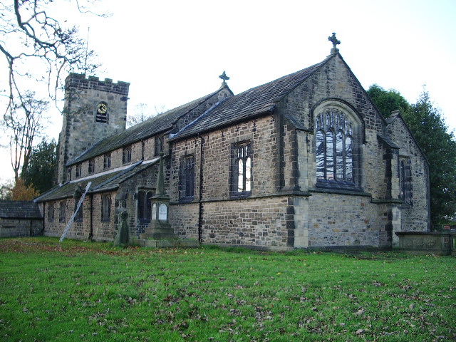


Billington, United Kingdom
Billington is a town of 1,458 people in England, United Kingdom.
Why visit Billington
Townapedia lists 5 museums and landmarks, 6 parks and trails, 24 places to eat, 6 places to stay and 3 attractions in and around town.
Highlights include Whalley Abbey and Hacking Hall.
Weather in Billington
Forecast from MET Norway (CC BY 4.0). Full forecast
About Billington
Billington is a village in the Ribble Valley district of Lancashire, England. It lies between the villages of Whalley and Langho. It forms part of the Billington and Langho civil parish and contains the schools St Augustine's RC High School, St Leonard's Primary and St Mary's Primary. The village population at the 2011 census was 1,409.
From the Wikipedia article Billington, Lancashire (this version), under CC BY-SA 4.0.
Things to do3

Museums and landmarks5



Parks, trails and playgrounds6



Restaurants and cafes24
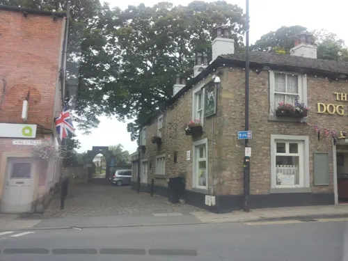
Fifty9 King Street
Bar and pub · 0.8 mi
59 King Street, Whalley
Mo off; Tu-Th 15:00-23:00; Fr-Su 12:00-23:00
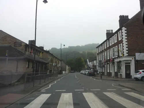
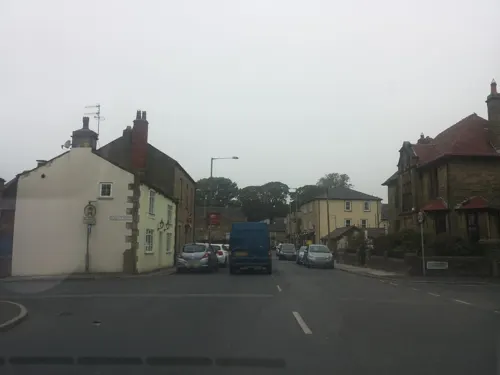


12 more on the map.
History
In 798, early in his reign, Eardwulf of Northumbria fought a battle at Billington Moor against a nobleman named Wada, who had been one of those who killed Æthelred I of Northumbria. Wada was defeated and driven into exile.
A charter written in 1308 mentions a hermitage by the rocks on the eastern side of Billington.
The village has been known previously as Billindon (1203), Billinton (1208), Bilingdon (1241), Belyngton or Bilyngton (14th–16th centuries).
In the 16th century, tenants of the village shared common land known as Billington Common with tenants of local villages Great Harwood and Wilpshire. There also existed a wood of approximately 60 acres named Elker, which contained oak trees, as well as hazel and alder. Oak and ash trees could also be found in the smaller Nab wood, which was around 40 acres.
The Judge Walmsley public house was built in 1749 along the main road close by Whalley bridge. It was formerly situated in the nearby hamlet of Chew. It operated as a coaching inn and contained a barn and stables for horses. It ceased operating as a public house in c2018 ending a long legacy and association in the village.
From the History section of Billington, Lancashire on Wikipedia, under CC BY-SA 4.0.
Where to stay6
Churches and places of worship13
Shopping2
Gas and EV charging1
Schools, colleges and libraries6
Langho and Billington St Leonards Church of England Primary School
School · Anglican · 0.7 mi
Whalley Road, Blackburn
Healthcare2
Map of Billington
68 places. The map loads OpenStreetMap tiles when you open it.
Getting there and nearby towns
Warton Aerodrome (WRT) is the nearest airport with scheduled flights listed in OpenStreetMap, 19 miles away.
- Great Harwood 2 mi south, about 4 min by car
- Clitheroe 4 mi north, about 6 min by car
- Sabden 4 mi east, about 6 min by car
- Blackburn 5 mi southwest, about 8 min by car
- Padiham 5 mi east, about 7 min by car
- Accrington 5 mi southeast, about 8 min by car
- Waddington 5 mi north, about 8 min by car
- Chatburn 6 mi northeast, about 10 min by car
- Burnley 8 mi east, about 13 min by car
- Darwen 8 mi south, about 13 min by car
Drive times are estimates from straight-line distance, not routes.
Towns near Billington


Keep exploring
Local news
Headlines from INDB.
Reviews, tips and questions
Loading what members have shared...
Sources and licences
- GeoNames (CC BY 4.0): population, coordinates, regions and time zone
- Mapillary (see each image): photos
- OpenStreetMap contributors (ODbL 1.0): places, airports, map data
- Wikidata (CC0 1.0): elevation, founding date, time zone, website, landmarks and historic places
- Wikimedia Commons (see each image): photos
- Wikipedia (CC BY-SA 4.0): overview and history text
Photo credits
- St Bartholomew's Church, Great Harwood, Alexander P Kapp, CC BY-SA 2.0
- St John's Church, Great Harwood, Alexander P Kapp, CC BY-SA 2.0
- Northcote Hotel, CillaLowe, CC BY-SA 4.0
- St. Augustine's Roman Catholic High School, Lancashire County Council, CC BY-SA 2.5
- 006-NC-Drone (160915), CillaLoweSwe, CC0
- Whalley Abbey Gatehouse, Alexander P Kapp, CC BY-SA 2.0
- Portfield hillfort 02, Trappedinburnley, CC BY-SA 4.0
- Street-level photo, endszbrxns, CC BY-SA 4.0
- Street-level photo, endszbrxns, CC BY-SA 4.0
- Street-level photo, endszbrxns, CC BY-SA 4.0
- Street-level photo, endszbrxns, CC BY-SA 4.0
- Street-level photo, endszbrxns, CC BY-SA 4.0
- Street-level photo, endszbrxns, CC BY-SA 4.0
- Street-level photo, endszbrxns, CC BY-SA 4.0
- Street-level photo, endszbrxns, CC BY-SA 4.0
- Street-level photo, endszbrxns, CC BY-SA 4.0
- Street-level photo, endszbrxns, CC BY-SA 4.0
- Street-level photo, endszbrxns, CC BY-SA 4.0
- Street-level photo, endszbrxns, CC BY-SA 4.0
- Street-level photo, endszbrxns, CC BY-SA 4.0
- Street-level photo, endszbrxns, CC BY-SA 4.0
- Street-level photo, endszbrxns, CC BY-SA 4.0
Page built November 10, 2026. Spotted a mistake? Tell us or suggest a place.