


Bishopstoke, United Kingdom
Bishopstoke is a town of 17,667 people in England, United Kingdom.
Why visit Bishopstoke
Townapedia lists 6 museums and landmarks, 21 parks and trails, 74 places to eat, 2 places to stay and 5 attractions in and around town.
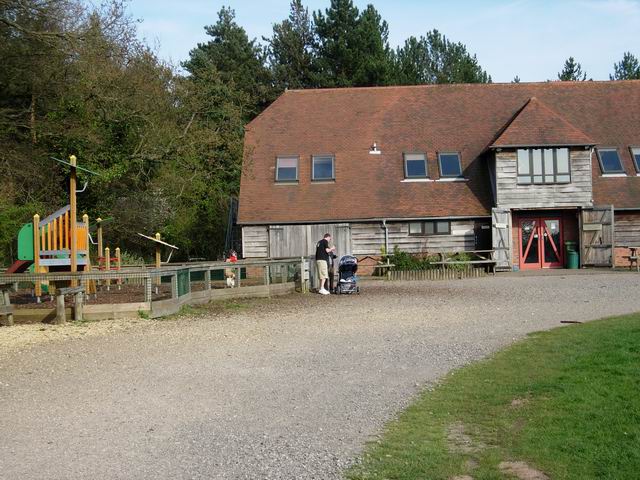
Highlights include The Point, The Point, Eastleigh, Eastleigh Museum and Itchen Valley Country Park.
Weather in Bishopstoke
Forecast from MET Norway (CC BY 4.0). Full forecast
About Bishopstoke
Bishopstoke is a village and civil parish in the Eastleigh district of Hampshire, England. It is recorded as "Stoke" as early as 948 AD when King Eadred granted land there to a thegn called Aelfric. Stoke later came into the possession of the Bishops of Winchester, giving rise to the modern name. The village is about a mile east of Eastleigh town centre, and is on the eastern bank of the River Itchen.
From the Wikipedia article Bishopstoke (this version), under CC BY-SA 4.0.
Photos of Bishopstoke

Things to do5

The Point, Eastleigh
Cinema and theater · 1.2 mi
Theatre and dance centre in Eastleigh, Hampshire, England, in the former Town Hall


Museums and landmarks6

Eastleigh Museum
Museum · 1.1 mi
Museum in Eastleigh, United Kingdom (closed)


Parks, trails and playgrounds21


Lakeside Country Park
Park · 1.7 mi
Railway park in the United Kingdom

Marwell Zoo
Park · 2.9 mi
Zoo situated at Owslebury near Winchester in England
Riverside Park
Park · 3.0 mi
Public park in Southampton, Hampshire, England


9 more on the map.
Restaurants and cafes74
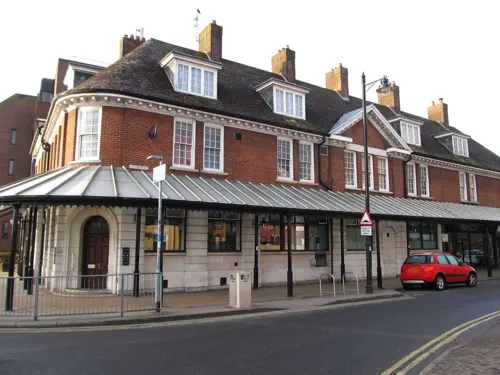
The Anglers Inn
Bar and pub · 0.5 mi
17 Riverside, Eastleigh
Mo-We 14:00-22:00; Th 14:00-23:00; Fr-Su 12:00-23:00
Costa
Cafe · Coffee Shop · 1.0 mi
27-29 Market Street
Mo-Sa 07:00-17:00; Su 08:00-16:30
Delhi 39
Restaurant · Indian · 1.1 mi
39 High Street
Mo-Sa 17:00-23:00; Su 17:00-22:30



62 more on the map.
History
The first mention of Bishopstoke comes in 948 AD as Stoke, when land there was given by King Eadred (grandson of Alfred the Great) to Aelfric, a thegn. The village is recorded in the Domesday Book of 1086.
The Itchen Navigation canal between Winchester and Southampton was completed in 1710 and in use until 1869. Much of it runs through Bishopstoke, including a sluice in use until the closure.
When the London and Southampton Railway was built in 1839 it passed 1 mile (1.6 km) to the west of the village. Bishopstoke railway station was built to serve the area. The town of Eastleigh grew around the station, which changed its name to "Eastleigh and Bishopstoke" in 1889 and then just "Eastleigh" in 1923, reflecting the growing importance of Eastleigh relative to its older neighbour of Bishopstoke.
From the History section of Bishopstoke on Wikipedia, under CC BY-SA 4.0.
Notable people from Bishopstoke
- William GilbertBritish writer and Royal Navy surgeon (1804–1890)
- Thomas Garnierdean of Lincoln (1809–1863)
- Bert PaddingtonEnglish footballer (1881-1932)
- John GarnierEnglish cricketer and Anglican priest
Born in Bishopstoke, according to Wikidata (CC0). Each name links to its Wikipedia article.
Where to stay2
Churches and places of worship21
Emmanuel Baptist Church
Church · Baptist · 1.3 mi
225 Desborough Road, Eastleigh
Shopping9
Gas and EV charging4
Schools, colleges and libraries18
Healthcare7
Map of Bishopstoke
167 places. The map loads OpenStreetMap tiles when you open it.
Getting there and nearby towns
Southampton Airport (SOU) is the nearest airport with scheduled flights listed in OpenStreetMap, 1 miles away.
- Fair Oak 1 mi east, about 2 min by car
- Southampton 5 mi southwest, about 9 min by car
- Romsey 8 mi west, about 12 min by car
- Hythe 8 mi southwest, about 13 min by car
- Cowes 14 mi south, about 23 min by car
- Cosham 14 mi southeast, about 23 min by car
- Portsmouth 16 mi southeast, about 25 min by car
- Lymington 17 mi southwest, about 27 min by car
- Petersfield 17 mi east, about 28 min by car
- Ryde 18 mi southeast, about 29 min by car
Drive times are estimates from straight-line distance, not routes.
Towns near Bishopstoke


Keep exploring
Local news
Headlines from INDB.
Reviews, tips and questions
Loading what members have shared...
Sources and licences
- GeoNames (CC BY 4.0): population, coordinates, regions and time zone
- Mapillary (see each image): photos
- OpenStreetMap contributors (ODbL 1.0): places, airports, map data
- Wikidata (CC0 1.0): elevation, founding date, time zone, website, landmarks and historic places
- Wikimedia Commons (see each image): photos
- Wikipedia (CC BY-SA 4.0): overview and history text
Photo credits
- Itchen Valley Country Park visitor centre, Hugh Venables, CC BY-SA 2.0
- Beach Lake, Lakeside Country Park, Eastleigh, Peter Facey, CC BY-SA 2.0
- Marwell Hall, March 30th 2016, User:Urshankov, CC BY-SA 4.0
- Emmanuel Baptist Church, Cherbourg Road, Eastleigh (June 2019) (1), Hassocks5489, CC0
- St James's Church, Church Hill, West End (NHLE Code 1281100) (May 2019) (1), Hassocks5489, CC0
- St. Alban's Church, Southampton, Michael Ford, CC BY-SA 2.0
- South Stoneham Church, Rosemary Oakeshott, CC BY-SA 2.0
- St. Nicolas Church 1, Brendan and Ruth McCartney, CC BY-SA 2.0
- The Point, Eastleigh, Paul Spencer, CC BY-SA 3.0
- Eastleigh College, Chestnut Avenue, Eastleigh, Hampshire, Mertbiol, CC0
- All Saints Church, Derby Road, Eastleigh (June 2019) (7), Hassocks5489, CC0
- St Thomas's Church, Botley Road, Fair Oak (June 2019) (6), Hassocks5489, CC0
- The Point Eastleigh, Marek . 69 talk, CC BY-SA 3.0
- Eastleigh Museum gallery, Geni, CC BY-SA 4.0
- Street-level photo, sk53, CC BY-SA 4.0
- Street-level photo, southglos, CC BY-SA 4.0
- Street-level photo, sk53, CC BY-SA 4.0
- Street-level photo, southglos, CC BY-SA 4.0
- Street-level photo, southglos, CC BY-SA 4.0
- Street-level photo, sk53, CC BY-SA 4.0
- Street-level photo, sk53, CC BY-SA 4.0
- Street-level photo, sk53, CC BY-SA 4.0
- Street-level photo, sk53, CC BY-SA 4.0
- Street-level photo, southglos, CC BY-SA 4.0
- Street-level photo, southglos, CC BY-SA 4.0
- Street-level photo, southglos, CC BY-SA 4.0
- Street-level photo, southglos, CC BY-SA 4.0
- Street-level photo, sk53, CC BY-SA 4.0
- Street-level photo, sk53, CC BY-SA 4.0
- Street-level photo, southglos, CC BY-SA 4.0
- Street-level photo, iced, CC BY-SA 4.0
- Street-level photo, sk53, CC BY-SA 4.0
- Street-level photo, sk53, CC BY-SA 4.0
- Street-level photo, sk53, CC BY-SA 4.0
- Street-level photo, sk53, CC BY-SA 4.0
- Street-level photo, sk53, CC BY-SA 4.0
- Street-level photo, southglos, CC BY-SA 4.0
- Street-level photo, sk53, CC BY-SA 4.0
- Street-level photo, southglos, CC BY-SA 4.0
- Street-level photo, sk53, CC BY-SA 4.0


Page built November 10, 2026. Spotted a mistake? Tell us or suggest a place.