




Rawmarsh, United Kingdom
Rawmarsh is a town of 18,498 people in England, United Kingdom.
Why visit Rawmarsh
Townapedia lists 10 museums and landmarks, 10 parks and trails, 59 places to eat, 2 places to stay and 2 attractions in and around town.
Highlights include Hoober Stand, Rotherham Bridge, South Yorkshire Transport Museum and The Rockingham Mausoleum.
Weather in Rawmarsh
Forecast from MET Norway (CC BY 4.0). Full forecast
About Rawmarsh
Rawmarsh (locally ) is a village in the Metropolitan Borough of Rotherham, in South Yorkshire, England. Historically within the West Riding of Yorkshire, it is 2 miles (3 km) north-northeast from Rotherham town centre and 3 miles (5 km) south-southwest of Swinton. The village also forms part of the Sheffield Urban Area. The Rawmarsh ward of Rotherham MBC had a population of 13,389 at the 2011 Census.
From the Wikipedia article Rawmarsh (this version), under CC BY-SA 4.0.
Photos of Rawmarsh


Things to do2

Hoober Stand
Monument and historic site · 2.3 mi
Tower in Wentworth, South Yorkshire, England, UK

Rotherham Bridge
Bridge · 2.0 mi
Grade I listed bridge in Rotherham, South Yorkshire, England
Museums and landmarks10


The Rockingham Mausoleum
Monument and historic site · 1.5 mi
Grade I listed building in Wentworth, South Yorkshire, England, UK

Clifton Park Museum
Museum · 2.1 mi
Municipal museum situated in Clifton House on the western edge of Clifton Park in Rotherham, South Yorkshire, England

Greasbrough War Memorial And Railed Enclosure
Monument and historic site · 1.2 mi
War memorial in Rotherham, South Yorkshire, England, UK

Parks, trails and playgrounds10


Thrybergh Country Park
Park · 2.5 mi
Nature reserve in South Yorkshire, England



Restaurants and cafes59


Frankie & Benny's
Diner · American · 1.1 mi
Stadium Way, Rotherham
Mo-Th 09:00-21:00; Fr-Sa 09:00-22:30; Su 09:00-21:00

Parkgate Indian Restaurant
Restaurant · Indian · 0.6 mi
17A Broad Street, Rotherham

URBAN Fresh Burgers & Fries
Restaurant · Burger · 0.9 mi
8 Rotherham Road, Rotherham
47 more on the map.
History
The name has gone through many changes since being recorded as "Rodemesc" in the Domesday Book and "Raumersche" in 1355. The name is of dual origin, "Rode" is from the Old Norse for "red", while the second element is from Old English mersc "Marsh". This led to "Red Marsh", from its situation in the Permian System of red sandstones and marls which run through the area. Localised clays outcrop and the area was formerly known for its potteries.
At the beginning of the 20th century Rawmarsh was described as "an increasing parish" and included the outlying hamlets of Parkgate, Stubbin and Upper Haugh. In 1851 the population was 2,533 but 50 years later this had increased to 14,587. In 1961, the population was 19,700 but, forty years later, at the 2001 census it had reduced to 17,443. Rawmarsh has laid claim to the title of being the largest village in England; however this claim is unsubstantiated and there are indeed many settlements that make this claim.
Read more of the history
Primarily a residential area, Rawmarsh is known for its church, Rawmarsh St Mary's Parish Church, which dominates the view at the top of Rawmarsh Hill. There has been a church in the town since Norman times (c.1127) but the earliest recorded rector was William de Sutton who was instituted on 6 June 1227. The current church was completed in 1838 when the tower was increased in height and the rest rebuilt, James Pigott Pritchett being the architect. In 1869, the tower began to collapse and was rebuilt incorporating features of the original Norman doorway. In 1894 the sanctuary was enlarged and the vestry, organ chamber and north porch were added. The present sanctuary was repaved in 1977 in memory of Canon Scovell, who is also remembered as a street name in the town; the font is Perpendicular in style and is from the old church. More recently restoration work was undertaken in 2003. The church contains two monuments of interest: one to Lady Middleton and her children (1667) who lived for a time at Aldwarke Hall, and the other to John Darley of Kilnhurst (1616).
The Parish Church of Christ Church, Parkgate, separated from Rawmarsh in 1868, was brought back in the early 1960s. There are other churches: St Nicolas, Ryecroft (1928) and a selection of 'Free' churches, Spiritualists, Roman Catholic and Quakers.
From the History section of Rawmarsh on Wikipedia, under CC BY-SA 4.0.
Notable people from Rawmarsh
- Peter ElliottBritish middle-distance runner
- David ClaphamRacing driver and motor sport journalist from South Africa
- George AppleyardEnglish footballer (born 1900)
- Keith BambridgeEnglish footballer (1935-2021)
- Alick JeffreyEnglish footballer (1939-2000)
- Philip BratleyEnglish footballer (1880-1962)
- John MiddletonEnglish footballer (born 1955)
- Allen FosterFootballer (1887-1916)
- John BisbyEnglish professional footballer (1876-1945)
- Jack FosterEnglish footballer (1877-1946)
- Worton DavidSongwriter and music publisher
- Brian SawyerEnglish footballer (born 1938)
Born in Rawmarsh, according to Wikidata (CC0). Each name links to its Wikipedia article.
Where to stay2
Churches and places of worship11
Shopping13
Gas and EV charging1
Schools, colleges and libraries13
Healthcare3
Map of Rawmarsh
124 places. The map loads OpenStreetMap tiles when you open it.
Getting there and nearby towns
Leeds Bradford Airport (LBA) is the nearest airport with scheduled flights listed in OpenStreetMap, 31 miles away.
- Rotherham 2 mi south, about 3 min by car
- Wath upon Dearne 3 mi north, about 5 min by car
- Wombwell 5 mi northwest, about 8 min by car
- Sheffield 7 mi southwest, about 12 min by car
- Doncaster 10 mi northeast, about 16 min by car
- South Elmsall 10 mi north, about 16 min by car
- Stocksbridge 10 mi west, about 17 min by car
- Staveley 13 mi south, about 22 min by car
- Chesterfield 15 mi south, about 24 min by car
- Wakefield 17 mi north, about 27 min by car
Drive times are estimates from straight-line distance, not routes.
Towns near Rawmarsh


Keep exploring
Local news
Headlines from INDB.
Reviews, tips and questions
Loading what members have shared...
Sources and licences
- GeoNames (CC BY 4.0): population, coordinates, regions and time zone
- OpenStreetMap contributors (ODbL 1.0): places, airports, map data
- Wikidata (CC0 1.0): elevation, founding date, time zone, website, landmarks and historic places
- Wikimedia Commons (see each image): photos
- Wikipedia (CC BY-SA 4.0): overview and history text
Photo credits
- St Mary's Church, Rawmarsh, Dave Kelly, CC BY-SA 2.0
- High Street, Rawmarsh, Xboxrocker84, CC BY-SA 4.0
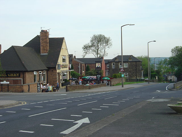
- Earl Grey public house at Rawmarsh, South Yorkshire, England, Alan Murray-Rust, CC BY-SA 2.0
- St Mary's Rectory, Rawmarsh, Dave Bevis, CC BY-SA 2.0
- Clifton House March 2017, Chemical Engineer, CC BY-SA 4.0
- Rotherham Minster, Warofdreams, CC BY-SA 4.0
- Yorkshire Woollen bus 622 (HD7 905), South Yorkshire Transport Museum, 14 September 2008, Pimlico Badger, CC BY-SA 2.0
- Two LEDs, Xboxrocker84, CC BY-SA 4.0
- Lonely ARC, Xboxrocker84, CC BY-SA 4.0
- Blyth Avenue, Xboxrocker84, CC BY-SA 4.0
- Brampton Brierlow - Hoober Stand, Christopher Thomas, CC BY-SA 2.0
- Rotherham - Bridge Street Bridge over Don Navigation, Dave Bevis, CC BY-SA 2.0
- Rockingham Mausoleum, MarinerBuckley, CC BY-SA 4.0
Page built November 10, 2026. Spotted a mistake? Tell us or suggest a place.