


Brackley, United Kingdom
Brackley is a town of 13,018 people in England, United Kingdom.
Why visit Brackley
Townapedia lists 1 museum or landmark, 5 parks and trails, 49 places to eat, 3 places to stay and 2 attractions in and around town.
Highlights include Turweston Green Bridge.
Weather in Brackley
Forecast from MET Norway (CC BY 4.0). Full forecast
About Brackley
Brackley is a market town and civil parish in the West Northamptonshire unitary authority area of Northamptonshire, England. It lies on the borders with Oxfordshire and Buckinghamshire, 9 miles (14 km) east-south-east of Banbury, 19 miles (31 km) north-north-east of Oxford and 22 miles (35 km) south-west of Northampton. Historically a market town based on the wool and lace trade, it was built on the intersecting trade routes between London, Birmingham, the Midlands, Cambridge and Oxford. Brackley is close to Silverstone and home to the Mercedes AMG Petronas F1 Team.
From the Wikipedia article Brackley (this version), under CC BY-SA 4.0.
Travel tips from other travellers: Brackley on Wikivoyage (CC BY-SA 4.0).
Things to do2

Museums and landmarks1

Parks, trails and playgrounds5



Restaurants and cafes49
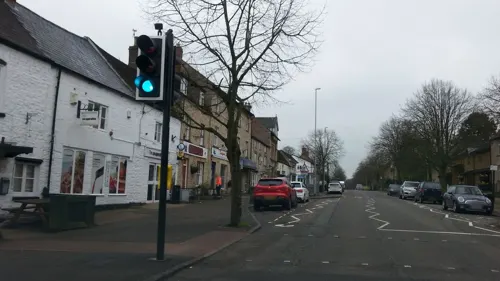
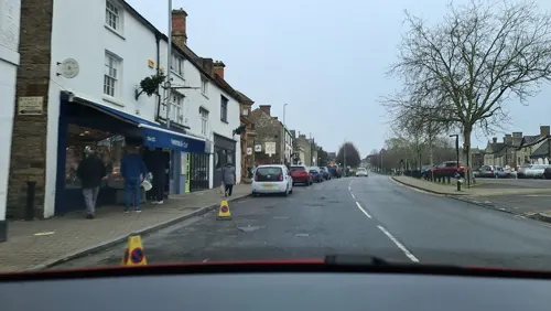

Chilli & Pepper
Restaurant · Indian · 0.5 mi
8 Banbury Road, Brackley
Su-Th 18:00-23:00; Fr-Sa 18:00-23:30
Saffron
Restaurant · Indian · 0.5 mi
10 Banbury Road, Brackley
Mo-Th 17:30-23:00; Fr-Sa 17:30-24:00; Su 12:00-14:30

Costa
Cafe · Coffee Shop · 0.7 mi
Unit 17 Tungsten Trade Park, Brackley
Mo-Sa 07:00-19:00, Su 08:00-18:00

37 more on the map.
History
The place-name 'Brackley' is first attested in the Domesday Book of 1086, where it appears as Brachelai. It appears as Brackelea in 1173 and as Brackeley in the Pipe Rolls in 1230. The name means 'Bracca's glade or clearing'. Brackley was held in 1086 by Earl Alberic, after which it passed to the Earl of Leicester, and to the families of De Quincy and Roland.
In the 11th and 12th centuries, Brackley was in the Hundred of Odboldistow and in the Manor of Halse. Richard I (The Lionheart) named five official sites for jousting tournaments so that such events could not be used as local wars, and Brackley was one of these. The tournament site is believed to be to the south of the castle where the A422 now passes.
The town was the site of an important meeting between the barons and representatives of the King in 1215, the year of Magna Carta. It required King John to proclaim rights, respect laws and accept that the King's wishes were subject to law. It explicitly protected certain rights of the King's subjects, whether freemen, serfs, slaves or prisoners—most notably allowing appeal against unlawful imprisonment. King John and the barons were to have signed Magna Carta at Brackley Castle, but they eventually did so at Runnymede.
Market day was on Sundays until 1218, when it was changed to Wednesdays. It is now on Friday mornings.
Read more of the history
The Tudor antiquary John Leland visited Brackley, where he learned 'a Lord of the Towne' named Neville had (at an uncertain point in the past) had the parish vicar murdered. This he had done by having the man buried alive. The writer Daniel Codd observed that in the grounds of St Peter's Church, a human-shaped stone effigy is sometimes pointed out as being connected with the event.
In 1597, the town was incorporated by Elizabeth I. It had a mayor, six aldermen and 26 burgesses.
In 1602, the metaphysical poet John Donne was elected as Member of Parliament for the constituency of Brackley.
Brackley used to be known for wool and lace-making. It had 20 houses in the 18th century. In August 1882, the Brackley Lawn Tennis Club organised the Brackley LTC Tournament, as part of the Brackley Show.
In 1901, the population of the town was 2,467. From 1974 to 2021, it was part of the South Northamptonshire district.
Brackley used the poor house at Culworth until 1834, when Parliament passed the Poor Law Amendment Act and, as a result, Brackley Poor Law Union was founded. A workhouse for 250 people was built in 1836, south-west of the town on Banbury Road. It was demolished in the 1930s.
From the History section of Brackley on Wikipedia, under CC BY-SA 4.0.
Notable people from Brackley
 Otho HolandEnglish soldier and Knight of the GarterPhoto: Photo British Library; painted by or..., Public domain
 Edward HighampoliticianPhoto: Unknown author, Public domain
 Henry BathurstBishop of NorwichPhoto: Thomas Kirkby, Public domain
- Edward DavisEnglish cricketer (1922-2011)
- Helen FarquharBritish numismatist
- Percy DavisEnglish cricketer (1915-2001)
- William G. Beasleyacademic, author, Japanologist (1919-2006)
- Thomas LathburyEnglish cleric known as an ecclesiastical historian (1798–1865)
- Henry William CaveEnglish photographer and publisher (1854–1913)
- Sir Alexander Bannerman, 11th BaronetBritish aviation pioneer (1871–1934)
- Niki SmartBritish designer
Born in Brackley, according to Wikidata (CC0). Each name links to its Wikipedia article.
Where to stay3
Churches and places of worship8
Shopping7
Gas and EV charging2
Schools, colleges and libraries7
Healthcare5
Brackley Medical Centre & Community Hospital
Hospital · 0.6 mi
Wellington Road, Brackley
Map of Brackley
89 places. The map loads OpenStreetMap tiles when you open it.
Getting there and nearby towns
Oxford Airport (OXF) is the nearest airport with scheduled flights listed in OpenStreetMap, 16 miles away.
- Buckingham 7 mi east, about 12 min by car
- Daventry 15 mi north, about 25 min by car
- Kidlington 16 mi south, about 25 min by car
- Milton Keynes 17 mi east, about 27 min by car
- Northampton 19 mi northeast, about 30 min by car
- Newport Pagnell 19 mi east, about 30 min by car
- Oxford 20 mi south, about 32 min by car
- Cowley 21 mi south, about 34 min by car
- Thame 21 mi south, about 34 min by car
- Witney 22 mi southwest, about 36 min by car
Drive times are estimates from straight-line distance, not routes.
Towns near Brackley


Keep exploring
Local news
Headlines from INDB.
Reviews, tips and questions
Loading what members have shared...
Sources and licences
- GeoNames (CC BY 4.0): population, coordinates, regions and time zone
- Mapillary (see each image): photos
- OpenStreetMap contributors (ODbL 1.0): places, airports, map data
- Wikidata (CC0 1.0): elevation, founding date, time zone, website, landmarks and historic places
- Wikimedia Commons (see each image): photos
- Wikipedia (CC BY-SA 4.0): overview and history text
Photo credits
- BrackleyTownHall(AndrewSmith)Mar2006, Andrew Smith, CC BY-SA 2.0
- St Martin's Catholic Church, Brackley, Richard Rogerson (changes by Rabanus Flavus ), CC BY-SA 4.0
- Evenley StGeorge south, Motacilla, CC BY-SA 3.0
- Street-level photo, southglos, CC BY-SA 4.0
- Street-level photo, adam2, CC BY-SA 4.0
- Street-level photo, adam2, CC BY-SA 4.0
- Street-level photo, adam2, CC BY-SA 4.0
- Street-level photo, adam2, CC BY-SA 4.0
- Street-level photo, alexanderar, CC BY-SA 4.0
- Street-level photo, alexanderar, CC BY-SA 4.0
- Street-level photo, adam2, CC BY-SA 4.0
- Street-level photo, alexanderar, CC BY-SA 4.0
- Street-level photo, southglos, CC BY-SA 4.0
- Street-level photo, southglos, CC BY-SA 4.0
- Street-level photo, adam2, CC BY-SA 4.0
- Street-level photo, adam2, CC BY-SA 4.0
- Street-level photo, southglos, CC BY-SA 4.0
- Street-level photo, laye, CC BY-SA 4.0
- Street-level photo, alexanderar, CC BY-SA 4.0
- Street-level photo, adam2, CC BY-SA 4.0
- Street-level photo, alexanderar, CC BY-SA 4.0
- Street-level photo, southglos, CC BY-SA 4.0
- Street-level photo, southglos, CC BY-SA 4.0
- Street-level photo, southglos, CC BY-SA 4.0
- Street-level photo, adam2, CC BY-SA 4.0
- Street-level photo, adam2, CC BY-SA 4.0
- Street-level photo, adam2, CC BY-SA 4.0
- Street-level photo, adam2, CC BY-SA 4.0
Page built November 10, 2026. Spotted a mistake? Tell us or suggest a place.