


Why visit Harrow
Townapedia lists 11 museums and landmarks, 37 parks and trails, 231 places to eat, 10 places to stay and 6 attractions in and around town.
Highlights include Grosvenor Theatre, Watkin's Tower, Headstone Manor and Headstone Manor and Museum.
Weather in Harrow
Forecast from MET Norway (CC BY 4.0). Full forecast
About Harrow
Harrow () is a town in Greater London, England, and serves as the principal settlement of the London Borough of Harrow. The eastern part of the town, by Northwick Park Hospital, crosses the London Borough of Brent border. Harrow lies about 9.5 miles (15.3 km) north-west of Charing Cross and 5.4 miles (8.7 km) south of Watford. In 2022, the town and localities had an estimated population of 117,651, whereas the wider borough (which also contains Pinner and Stanmore) had a population of 261,185.
From the Wikipedia article Harrow, London (this version), under CC BY-SA 4.0.
Photos of Harrow


Things to do6

Grosvenor Theatre
Cinema and theater · 1.7 mi
Former cinema and theatre in Harrow, London, now a Zoroastrian Centre


Watkin's Tower
Monument and historic site · 2.8 mi
Partially completed iron lattice tower in London, England

Museums and landmarks11

Headstone Manor
Museum · 1.5 mi
Grade I listed manor house in the London Borough of Harrow, England,UK

Headstone Manor and Museum
Museum · 1.5 mi
Museum in London Borough of Harrow, United Kingdom

Heath Robinson Museum
Museum · 2.5 mi
Museum in northwest London, United Kingdom, about W. Heath Robinson

Chandos Mausoleum
Monument and historic site · 2.8 mi
Part of St Lawrence Whitchurch in Harrow, London

Parks, trails and playgrounds37


Bentley Priory Nature Reserve
Park · 3.0 mi
Nature reserve in the London Borough of Harrow, England


Grove Farm
Park · 1.7 mi
Local Nature Reserve in the London Borough of Ealing, England, UK

Harrow Weald Common
Park · 3.2 mi
Nature reserve in Harrow Weald, Greater London, England


Litten Nature Reserve
Park · 3.3 mi
Nature reserve in London, England

Masons Field
Park · 2.5 mi
Local Nature Reserve in London Borough of Brent

Northala Fields
Park · 3.2 mi
Park located in Northolt, in the London Borough of Ealing

25 more on the map.
Restaurants and cafes231
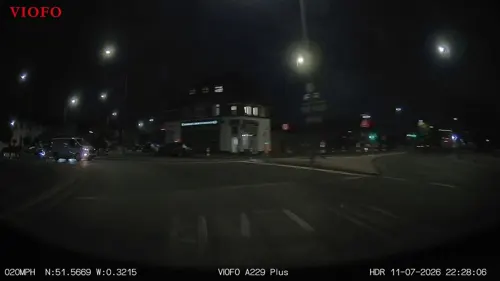
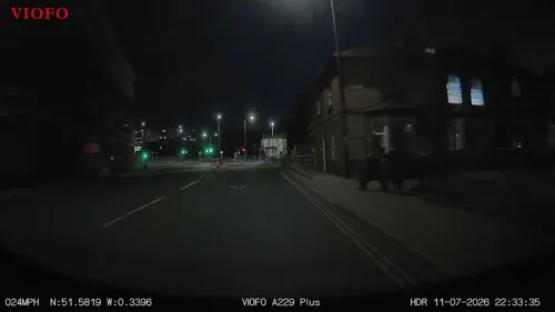
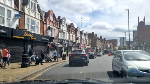
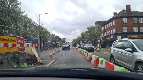
Chennai Srilalitha
Restaurant · Indian · 0.9 mi
"Speciality South Indian Pure Vegetarian Restaurant"
196 Kenton Road, Harrow
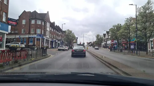
Ram's Pure Vegetarian
Restaurant · Indian · 0.8 mi
"Restaurant, Sweets n' Savouries, Caterers, Banqueting. Punjabi, South Indian & Specialist Surti Cuisine"
201-203 Kenton Road, Harrow


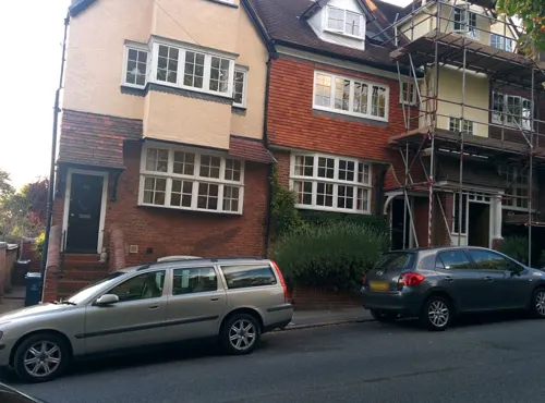
The White Horse
Bar and pub · 0.8 mi
50 Middle Road, Harrow
Mo,Tu 12:00-23:00; We-Sa 12:00-24:00; Su 12:00-22:30


Tunnel Lounge by Flare
Restaurant · Pizza, Burger · 1.0 mi
273 Pinner Road, Harrow
Fr 12:00-23:59; Sa 00:00-02:00; Su 12:00-23:59

219 more on the map.
History
The modern town centre of Harrow was formerly known as Greenhill, and was a small hamlet of farms at the foot of Harrow Hill. For almost a millennium, the centre of Harrow was atop the hill, but this began to change during the 19th century. Circa 1852, the village had 8 houses, 17 cottages, and one inn, with 141 people. This area was part of the hundred of Gore, in the historic county of Middlesex. In 1850 a local board district was established for the central part of the ancient parish of Harrow on the Hill, including the old village and the adjoining hamlets of Greenhill, Roxeth, and Sudbury. One of the oldest surviving buildings, in what is today Harrow, is the Grade I listed Headstone Manor from the 14th century.
Read more of the history
By 1865, a series of roads had been built in Greenhill, including College, Roxborough, Kymberley, Headstone, Clarendon, Byron and St Anns - but few houses. A parish church, St John's Church, was built in 1866 on a farm and Greenhill subsequently became a separate ecclesiastical parish in 1896. The church building has been Grade II listed since 1994. The Metropolitan Railway connection dates from 1880 with the building of Harrow-on-the-Hill station, which led to a housebuilding boom and a population of 4,892 by 1902. Developments westward along the railway in the Headstone and Pinner as well as Roxborough and Wealdstone engulfed Greenhill with new developments, and soon enough there was nothing left of the original village.
In 1899, the junction of Grove Hill and Lowlands Road is said to have been the scene of Britain's first fatal car accident. There is a plaque to commemorate this at the top of Grove Hill where it meets the High Street and Peterborough Hill.
In Greenhill, there was a workmen's club from the 1860s and a public hall, Victoria Hall, by 1888.
The Local Government Act 1894 converted local board districts such as Harrow on the Hill into urban districts. The new town centre, which had grown up around the station, became known simply as Harrow to distinguish it from the original hilltop village. The name of the urban district, which contained both places, remained Harrow on the Hill until 1934 when the district was enlarged and renamed just Harrow. The Harrow Urban District was incorporated to become a municipal borough in 1954, with the same area becoming the London Borough of Harrow on being transferred from Middlesex to Greater London in 1965.
Harrow contributed to the growing photographic industry in the UK; a large industrial premises was built in 1890 by the American Eastman Kodak company in Wealdstone, and by 1965 there were over 100 buildings on a 55-acre site at Kodak Harrow, employing 5,500 people, including a research centre. This facility operated for 125 years. The long chimney has been a landmark in Harrow ever since.
In 1914, a major department store named Sopers opened on Station Road. The site became a Debenhams store; it closed in May 2021 after the collapse of the Debenham's chain. Its facade dated from the 1960s.
During the inter-war period Harrow had grown into a suburb. Almost two-thirds of housing stock in the present day Borough of Harrow dates back to the interwar period.
The modern town of Harrow and much of the borough overall has been defined historically by the growth of the railways, as Harrow expanded and saw housing developments as a result of the building of the Metropolitan Railway into what was, in early Victorian times, the rural areas to the north-west of London. The borough now has many railway stations.
Harrow has been the location of several serious train accidents.
On 7 August 1838, Thomas Port died from injuries received in a train accident near Harrow. His gravestone in the parish churchyard of St Mary's, Harrow-on-the-Hill, states: "To the memory of Thomas Port, son of John Port of Burton-upon-Trent in the County of Stafford, Hat Manufacturer, who near this town had both legs severed from his body by the railway train. With great fortitude, he bore a second amputation by the surgeons and died from loss of blood, August 7th 1838, aged 33 years."
On 26 November 1870, two trains collided at Harrow & Wealdstone station, killing 9 and injuring 44.
On 8 October 1952, three trains collided at Harrow & Wealdstone station, killing 112 people. Of the dead, 64 were railway employees on their way to work. This is the greatest loss of life in any United Kingdom railway accident in peacetime.
Although The Blitz is generally claimed to have started on 7 September 1940, many sources state that one of the earliest bombing raid from the Luftwaffe occurred in Harrow and Wealdstone on 22 August 1940. It caused damage to cinemas, houses and a bank, but with no fatalities. Although Harrow was then in Middlesex, it was classed as a London area by the civil defence as it came under the jurisdiction of the Metropolitan Police. The very first air raid on the present day London area is believed to be the accidental bombing of Croydon Airport on 15 August 1940, which was then in Surrey.
The town was part of the Harrow Urban District, a district council within the county of Middlesex, from 1934 until 1965, which also included parts of Edgware, Hendon, Wembley and Pinner. The London Borough of Harrow was formed in 1965 as the only London borough unaffected by boundary changes.
By the 1950s, Harrow was described as the "capital city of Metro-land". The borough's council Civic Centre building complex was built in 1970–1972, opened 6 May 1973, on Station Road in Wealdstone. Six storeys high and designed by architect Eric Broughton, the building is considered "outdated and costly" in 2018 and was expected to be imminently redeveloped. Throughout the 1960s and 1970s, many new office blocks were built in the town, especially in Lyon Road and the western end of College Road.
From the History section of Harrow, London on Wikipedia, under CC BY-SA 4.0.
More about Harrow
Geography
The borough of Harrow has a leafy, suburban character, much of which is a legacy of it being at the centre of the Metroland developments of the early 20th century.
The town centre is about 220 feet (67 m) above sea level, almost 200 feet (61 m) below the top of Harrow Hill, which is an outlying knoll. The hill is half a mile south of the town centre, and the settlement contains historic architecture and has a village atmosphere. The steep climb towards the hill is clearly visible from Lowlands Road. Other parts of Harrow are not as affluent but are still mostly leafy, particularly the northern part called Harrow Weald. The rural northern slopes of Harrow, around Harrow Weald Common, are part of the Green Belt and contain a conservation area and a Site of Special Scientific Interest (SSSI) adjacent to another SSSI called Bentley Priory Nature Reserve which comes under Stanmore. The area also has the highest elevation in Harrow, as high as 492 feet (150 m) above sea level.
Economy
Central Harrow forms a commercial hub in the north-west of Greater London, with many retail outlets and commercial offices, and increasingly residential apartments in more recent regeneration schemes. Harrow is classified as one of 13 metropolitan centres in the London Plan.
The area has two shopping centres, St Anns and St George's, containing chain stores typical of British high streets. There are also parades of shops throughout Station Road and the ascending, traditional College Road, and over 300 metres (980 ft) of a fully pedestranised shopping/café streets roads (north of St Anns). A large Debenhams department store (174,000 square feet (16,200 m2) of floorspace) was on Station Road. After Debenhams was liquidated, the site is to become an independent department store called The Landmark due to open on 14 October 2021. There are also large Morrisons and Tesco superstores. As of 2012, Harrow has 1,128,050 square feet (104,799 m2) of total town centre floorspace, the lowest of London's metropolitan centres.
Arts and culture
The borough's Harrow Arts Centre is located in Pinner and includes a theatre and several meeting rooms for various arts groups.
The St George's centre has a large Vue cinema. Formerly Sheepcote Road was home to Granada Theatre, opened in 1937, which became a 3 screen cinema in 1973. The building, interior designed by Theodore Komisarjevsky, was Grade II listed in 1988. The cinema went through ownership and name changes from 1989 until it was permanently closed in 1996, six months after the other cinema opening at St George's. After a few years in a derelict condition, the building became a health club gymnasium operated by Gold's Gym. The theatre's original Wurlitzer organ is retained in the building, although currently not accessible to the public, is reported to remain in perfect working condition.
Education
Harrow is best known for Harrow School. An independent boarding school for boys, founded in 1572, Harrow School is considered one of the finest secondary schools in the world. The nearby John Lyon School is another boys' independent school, while another known school is the North London Collegiate School for girls located further in the borough in Edgware.
Harrow is also home to a large University of Westminster campus, located near Northwick Park and the hospital. It serves as the university's base for Media, Arts and Design. The school dates back to 1897 specialising in art, photography and fashion, becoming a college in the 1960s under the name Harrow College of Higher Education. It merged with Polytechnic of Central London (PCL) in 1990, now known as the University of Westminster.
Other educational institutes in or near central Harrow include: Harrow High School, Whitmore High School, St Dominic's Sixth Form College, Salvatorian College and Harrow College.
Greenhill School was built in the 1880s, but the building was demolished in 1967 to make way for shops on St Anns Road. The site is now home to a Marks & Spencer.
From the Wikipedia article Harrow, London, under CC BY-SA 4.0.
Notable people from Harrow
 Dev PatelBritish actor (born 1990)Photo: Gordon Correll, CC BY-SA 2.0
 Priti PatelBritish politician (born 1972)Photo: Simon Dawson / No 10 Downing Street, CC BY 2.0
 Ciaran Clarkassociation football playerPhoto: Michael Kranewitter, CC BY-SA 3.0 at
 Suella BravermanBritish politician (born 1980)Photo: ©House of Commons / Laurie Noble, CC BY 3.0
 Kate NashBritish musicianPhoto: UPROXX, CC BY 3.0
 Adrian MariappaJamaican footballer (born 1986)Photo: @cfcunofficial (Chelsea Debs) London, CC BY-SA 2.0
 Michael RosenBritish children's author and poet (born 1946)Photo: Historyworks, CC BY 2.0
 Rebecca ClarkeEnglish composer and violist (1886–1979)Photo: H. Walter Barnett, Public domain
 Ronald LaceyBritish actor (1935–1991)Photo: The Bright Thoughts Company Limited..., CC BY-SA 4.0
 Ciara Horneformer Irish, current British racing cyclistPhoto: Nicola, CC BY-SA 4.0
 Bevis Mugabiassociation football player (born 1995)Photo: Gadlee, CC BY-SA 4.0
- Maud WatsonEnglish tennis player
Born in Harrow, according to Wikidata (CC0). Each name links to its Wikipedia article.
Where to stay10
Churches and places of worship52
Shopping41
Gas and EV charging9
Schools, colleges and libraries49
Saint Jérôme Church of England Bilingual School
School · Anglican · 0.5 mi
120-138 Station Road, Harrow
Healthcare31
Ash Tree Clinic - Harrow CAMHS
Clinic and pharmacy · 1.5 mi
322, 324, 326 Northolt Road, Harrow
Map of Harrow
250 places. The map loads OpenStreetMap tiles when you open it.
Getting there and nearby towns
RAF Northolt (NHT) is the nearest airport with scheduled flights listed in OpenStreetMap, 4 miles away.
- Watford 6 mi northwest, about 10 min by car
- London 10 mi southeast, about 16 min by car
- City of Westminster 10 mi southeast, about 16 min by car
- Islington 10 mi east, about 17 min by car
- Tottenham 11 mi east, about 18 min by car
- Slough 12 mi southwest, about 20 min by car
- Walthamstow 13 mi east, about 22 min by car
- Sutton 17 mi south, about 27 min by car
- Ilford 17 mi east, about 28 min by car
- High Wycombe 18 mi west, about 29 min by car
Drive times are estimates from straight-line distance, not routes.
Towns near Harrow


Keep exploring
Local news
Headlines from INDB.
Reviews, tips and questions
Loading what members have shared...
Sources and licences
- GeoNames (CC BY 4.0): population, coordinates, regions and time zone
- Mapillary (see each image): photos
- OpenStreetMap contributors (ODbL 1.0): places, airports, map data
- Wikidata (CC0 1.0): elevation, founding date, time zone, website, landmarks and historic places
- Wikimedia Commons (see each image): photos
- Wikipedia (CC BY-SA 4.0): overview and history text
Photo credits
- Moon on the Hill, Harrow, HA1 (6163372441), Ewan Munro from London, UK, CC BY-SA 2.0
- Trinity, Harrow, HA1 (8486322996), Ewan Munro from London, UK, CC BY-SA 2.0
- 21064 Arrives at Harrow-on-the-Hill, TheJRB, CC BY-SA 2.0
- Ace Cinema, Rayners Lane, Bernard Burns, CC BY-SA 3.0
- Headstone Manor, Bernard Burns, CC BY-SA 3.0
- Heath Robinson Museum exterior 2 by Tom Fish, Sharonpink2, CC BY-SA 4.0
- Preston Park, Dudley Miles, Public domain
- Bentley Priory Summerhouse Lake 1, Dudley Miles, CC BY-SA 3.0
- Fryent Country Park view north, Dudley Miles, Public domain
- Grove Farm, Ealing 1, Dudley Miles, CC BY-SA 3.0
- Harrow Weald Common path, Dudley Miles, CC BY-SA 3.0
- Litten Local Nature Reserve, Dudley Miles, CC BY-SA 3.0
- St John the Baptist's Church, Pinner, Middlesex (3960273702), Robert Cutts from Bristol, England, UK, CC BY 2.0
- Harrow Museum Tithe Barn, Bernard Burns, CC BY-SA 3.0
- The Old Schools, Harrow School, Bernard Burns, CC BY-SA 3.0
- 005 - Harrow High School & Sports College, Randomly London, CC BY-SA 2.0
- Salvatorian College, Mx. Granger, CC0
- Harrow Central Mosque, Robert Cutts from Bristol, England, UK, CC BY 2.0
- The Castle, Harrow, 2015 14, Edwardx, CC BY-SA 4.0
- Windermere, North Wembley, HA9 (2468567053), Ewan Munro from London, UK, CC BY-SA 2.0
- Our Lady and St Thomas of Canterbury, Harrow 01, Edwardx, CC BY-SA 4.0
- Church of St John the Baptist Greenhill 1, Tango Mike Bravo, CC BY-SA 4.0
- Headstone Manor manor house, Mx. Granger, CC0
- The Sacred Heart RC Language College, Mx. Granger, CC0
- The Castle Inn, Harrow on the Hill - 2025-04-19, Brett Jordan, CC BY 2.0
- Islip Manor Meadows 6, Dudley Miles, CC BY-SA 3.0
- Masons Field 6, Dudley Miles, CC BY-SA 4.0
- Parish Church of St Mary, Harrow on the Hill, Bernard Burns, CC BY-SA 3.0
- R.M. BALLANTYNE 1825-1894 Author of Books for Boys lived here, Spudgun67, CC BY-SA 4.0
- St Lawrence Whitchurch, Canons Park, Simon from London, United Kingdom, CC BY 2.0
- Northala fields northolt london, Romazur, CC BY-SA 3.0
- Street-level photo, mappo2, CC BY-SA 4.0
- Street-level photo, RyanBush, CC BY-SA 4.0
- Street-level photo, firefishy, CC BY-SA 4.0
- Street-level photo, mappo2, CC BY-SA 4.0
- Street-level photo, RyanBush, CC BY-SA 4.0
- Street-level photo, RyanBush, CC BY-SA 4.0
- Street-level photo, firefishy, CC BY-SA 4.0
- Street-level photo, firefishy, CC BY-SA 4.0
- Street-level photo, laye, CC BY-SA 4.0
- Street-level photo, mappo2, CC BY-SA 4.0
- Street-level photo, firefishy, CC BY-SA 4.0
- Street-level photo, mappo2, CC BY-SA 4.0
- Street-level photo, mappo2, CC BY-SA 4.0
- Street-level photo, mappo2, CC BY-SA 4.0
- Street-level photo, firefishy, CC BY-SA 4.0
- Street-level photo, firefishy, CC BY-SA 4.0
- Street-level photo, laye, CC BY-SA 4.0
- Street-level photo, firefishy, CC BY-SA 4.0
- Street-level photo, firefishy, CC BY-SA 4.0
- Street-level photo, firefishy, CC BY-SA 4.0
- Street-level photo, firefishy, CC BY-SA 4.0


Page built November 10, 2026. Spotted a mistake? Tell us or suggest a place.