



Why visit Bruton
Townapedia lists 8 museums and landmarks, 1 park or trail, 8 places to eat, 1 place to stay and 5 attractions in and around town.
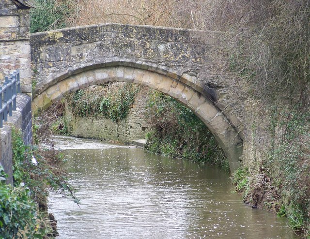
Highlights include Gilcombe Farm Shop, Bow Bridge, Bruton Museum and Dovecote.
Weather in Bruton
Forecast from MET Norway (CC BY 4.0). Full forecast
About Bruton
Bruton is a small market town, and civil parish in Somerset, England, on the River Brue and the A359 between Frome and Yeovil. It is 7 miles (11 km) south-east of Shepton Mallet, just south of Snakelake Hill and Coombe Hill, 10 miles (16 km) north-west of Gillingham and 12 miles (19 km) south-west of Frome. The town and ward have a population of 2,907. The parish includes the hamlets of Wyke Champflower and Redlynch.
From the Wikipedia article Bruton (this version), under CC BY-SA 4.0.
Things to do5
Gilcombe Farm Shop
Farm and orchard · 1.2 mi
Cuckoo Hill, Bruton
Mo-Fr 08:00-17:00, Sa 08:00-14:30, Raw milk 24/7



Museums and landmarks8




Parks, trails and playgrounds1

Restaurants and cafes8
Matt's Kitchen
Restaurant · International, Thai, Moroccan, Byo Wine
51 High Street, Bruton
We-Fr 18:30-22:30
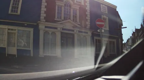
Osip
Restaurant
1 High Street, Bruton
Tu-We 18:00-21:30; Th-Sa 12:00-14:30, 18:00-21:30; Su 12:00-14:30
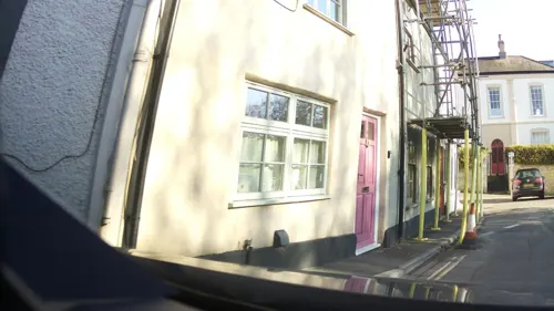
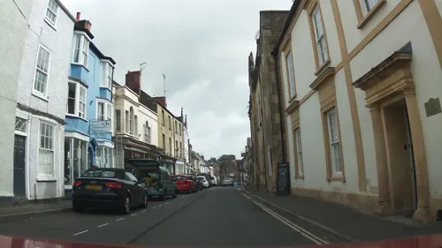

At the Chapel
Restaurant · Modern, Seasonal, Wood Fired Pizza, Pastry, Cake, Bread, Coffee, Wine
28 High Street, Bruton
Mo-Sa 08:00-21:30, Su 08:00-20:00
History
The Church of St Mary, Bruton was founded by Ine of Wessex in the 7th century,
Bruton was listed in the Domesday Book of 1086 as Briuuetone, meaning "Vigorously flowing river" from the Old English tor and Celtic briw meaning vigour. The river has been the site of several watermills and in 2003 the South Somerset Hydropower Group installed their first hydroelectric turbine at Gants Mill at nearby Pitcombe.
Bruton Abbey, a medieval Augustinian priory from which a wall remains in the Plox close to Bow Bridge, was sold after the dissolution of the monasteries to the courtier Sir Maurice Berkeley (died 1581), whose Bruton branch of the Berkeley family converted it into a mansion, which was demolished in the late 18th century.
The Dovecote which overlooks Bruton dates from the 16th century. It was at one time used as a house, possibly as a watchtower and as a dovecote. It is a Grade II* listed building, and an ancient monument, and is managed by the National Trust. The building was once within the deerpark of the Abbey. It was adapted by the monks from a gabled Tudor tower. The conversion to a dovecote took place around 1780. It has over 200 pigeonholes.
Read more of the history
The town is referenced in a folk song "The Bramble Briar", which is also known by the title "Bruton Town". A rare copy of an inspeximus of Magna Carta was found in Bruton in the 1950s and claimed by King's School. The sale of the copy to the Australian National Museum paid for much building work at the school.
Much of the town's history appears in the Bruton Museum's Dovecote Building in the High Street. It includes a tourist information office. Bruton Museum Society, formed in 1989, involves the community and local schools in developing the collection of local artefacts. It moved in 1999 to its current location, which was jointly purchased by South Somerset District Council and Bruton Town Council. The museum also marks the time spent in the town by John Steinbeck. It has organised exhibitions at King's School, including one in 2008 on the work of Ernst Blensdorf. In 2010, an anonymous donor agreed to pay the rent on the building, removing earlier doubts about its viability.
In 2014, Hauser & Wirth opened a gallery and arts centre at a derelict farm outside Bruton.
From the History section of Bruton on Wikipedia, under CC BY-SA 4.0.
More about Bruton
Geography
Work to build the railway at Bruton Railway Cutting exposed geology of the epoch of the Middle Jurassic. It is among the best places in England to display the stratigraphic distinction of fossil ammonites in the Subcontractus and Morrisi zones.
The nearby Godminster Lane Quarry and Railway Cutting is another geological Site of Special Scientific Interest, for study of the Inferior Oolite limestones, of the Middle Jurassic age, laid down in a warm shallow sea some 175 million years ago. The site is unique in that the limestones seen are more closely comparable with rocks of similar age found in the Cotswolds than with rock sequences elsewhere in Somerset. However, the rocks contain the rich assemblage of ammonites typical of the north Dorset/south Somerset area. This feature, along with the unusual limestone sequence, makes the site unique. It is also important as a reference for three sub-divisions (zones) of the Inferior Oolite – the laeviscula, discites and concavum zones.
From the Wikipedia article Bruton, under CC BY-SA 4.0.
Notable people from Bruton
- John Berkeley, 1st Baron Berkeley of StrattonEnglish Peer and soldier
- Michael Bennettcricketer (1909-1982)
- Philip LudwellAmerican politician
- Gilbert GabrielBritish musician
- Frank VigarEnglish cricketer (1917-2004)
- Ernest CassanEnglish cricketer (1835-1904)
- Hugh SexeyEnglish royal auditor
Born in Bruton, according to Wikidata (CC0). Each name links to its Wikipedia article.
Where to stay1
Churches and places of worship16
Shopping1
Gas and EV charging1
Schools, colleges and libraries7
Healthcare2
Map of Bruton
50 places. The map loads OpenStreetMap tiles when you open it.
Getting there and nearby towns
Royal Naval Air Station Yeovilton (YEO) is the nearest airport with scheduled flights listed in OpenStreetMap, 11 miles away.
- Redlynch 1 mi southeast, about 2 min by car
- Castle Cary 3 mi southwest, about 5 min by car
- Evercreech 3 mi northwest, about 5 min by car
- Shepton Mallet 7 mi northwest, about 11 min by car
- Mere 8 mi east, about 13 min by car
- Templecombe 8 mi south, about 13 min by car
- Frome 10 mi northeast, about 16 min by car
- Milborne Port 10 mi south, about 16 min by car
- Wells 11 mi northwest, about 17 min by car
- Midsomer Norton 12 mi north, about 19 min by car
Drive times are estimates from straight-line distance, not routes.
Towns near Bruton


Keep exploring
Local news
Headlines from INDB.
Reviews, tips and questions
Loading what members have shared...
Sources and licences
- GeoNames (CC BY 4.0): population, coordinates, regions and time zone
- Mapillary (see each image): photos
- OpenStreetMap contributors (ODbL 1.0): places, airports, map data
- Wikidata (CC0 1.0): elevation, founding date, time zone, website, landmarks and historic places
- Wikimedia Commons (see each image): photos
- Wikipedia (CC BY-SA 4.0): overview and history text
Photo credits
- Bruton, Nigel Freeman, CC BY-SA 2.0
- Bow Bridge Bruton, Trish Steel, CC BY-SA 2.0
- Former Old Bull Inn, Bruton, Sionk, CC BY-SA 4.0
- Lamyatt church, Phil Williams, CC BY-SA 2.0
- Upton Noble church, Martin Bodman, CC BY-SA 2.0
- Batcombe church, Brian Robert Marshall, CC BY-SA 2.0
- Wyke Champflower church, Chris Downer, CC BY-SA 2.0
- Bruton Museum, Rodw, CC0
- Bruton School for Girls, Rodw, CC0
- Sexeys Hospital, Trish Steel, CC BY-SA 2.0
- Sexey's School, Rodw, CC0
- Bruton Somerset Dovecote, Bruton Somerset at English Wikipedia, Public domain
- Street-level photo, southglos, CC BY-SA 4.0
- Street-level photo, southglos, CC BY-SA 4.0
- Street-level photo, southglos, CC BY-SA 4.0
- Street-level photo, southglos, CC BY-SA 4.0
- Street-level photo, southglos, CC BY-SA 4.0
- Street-level photo, tasty213, CC BY-SA 4.0
- Street-level photo, southglos, CC BY-SA 4.0
- Street-level photo, southglos, CC BY-SA 4.0
- Street-level photo, southglos, CC BY-SA 4.0
- Street-level photo, southglos, CC BY-SA 4.0
- Street-level photo, southglos, CC BY-SA 4.0
- Street-level photo, southglos, CC BY-SA 4.0
- Street-level photo, southglos, CC BY-SA 4.0
- Street-level photo, southglos, CC BY-SA 4.0
- Street-level photo, southglos, CC BY-SA 4.0
- Street-level photo, southglos, CC BY-SA 4.0
- Street-level photo, southglos, CC BY-SA 4.0


Page built November 10, 2026. Spotted a mistake? Tell us or suggest a place.