


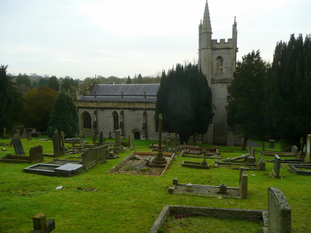


Shepton Mallet, United Kingdom
Shepton Mallet is a town of 10,369 people in England, United Kingdom.
Why visit Shepton Mallet
Townapedia lists 5 museums and landmarks, 2 parks and trails, 16 places to eat, 3 places to stay and 1 attraction in and around town.
Highlights include Market Cross, King's Castle and Kilver Court and Gardens.
Weather in Shepton Mallet
Forecast from MET Norway (CC BY 4.0). Full forecast
About Shepton Mallet
Shepton Mallet is a market town and civil parish in Somerset, England. It lies 16 miles (26 km) south-west of Bath, 18 miles (29 km) south of Bristol and 5 miles (8 km) east of Wells. At the 2021 census, the parish had a population of 10,592 and the built-up area had a population of 9,645.
From the Wikipedia article Shepton Mallet (this version), under CC BY-SA 4.0.
Travel tips from other travellers: Shepton Mallet on Wikivoyage (CC BY-SA 4.0).
Photos of Shepton Mallet

Things to do1

Museums and landmarks5

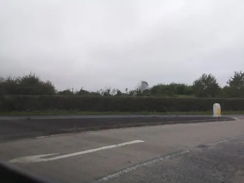

King's Castle
Monument and historic site · 3.4 mi
Iron Age enclosed hilltop settlement in Somerset, England, UK
Parks, trails and playgrounds2

Restaurants and cafes16


4 more on the map.
History
The name Shepton derives from the Old English scoep and tun, meaning "sheep farm"; the Domesday Book of 1086 records a settlement known as Sceaptun in the hundred of Whitstone. The current spelling is recorded at least as far back as 1496, in a letter from Henry VII. The second part of the name derives from that of the Norman family of Malet. Gilbert Malet, son of William Malet, Honour of Eye, held a lease from Glastonbury Abbey around 1100. The second letter "l" appears to have been added to the spelling in the 16th century.
Archaeological investigations have found evidence of prehistoric activity in the Shepton Mallet area, with large amounts of Neolithic flint and some pottery fragments of the late Neolithic period. Two barrows on Barren Down, to the north of the town centre, contained cremation burials from the Bronze Age; another Bronze Age burial site contained a skeleton and some pottery. The remains of Iron Age roundhouses and artefacts such as quernstones and beads were found at Cannard's Grave, as was a probable Iron Age farming settlement at Field Farm. Nearby countryside provides evidence of Iron Age cave dwellings in Ham Woods to the north-west, and several burial mounds at Beacon Hill, a short distance to the north.
Read more of the history
Shepton Mallet is about halfway between the Roman towns of Bath and Ilchester on the Fosse Way. Although there are no visible remains apart from the line of the Roman road, there is archaeological evidence for early military and later civilian settlement lasting into the 5th century. Domed pottery kilns, with pottery still present, were identified on the site of the Anglo-Bavarian Brewery in the mid-19th century, suggesting military activity in the 1st and 2nd centuries. Several hoards of Roman coins ranging from the 1st to 4th centuries have been found and more than 300 fibula brooches, potsherds and other artefacts. A few isolated burials near the Fosse Way were found in the 19th century.
A lead coffin in a rock-cut grave was discovered at a site by the Fosse Way in 1988. This discovery and impending commercial development of the site by the landowner, Showerings, led archaeologists to excavate more extensively in the 1990s. The grave belonged to a cemetery containing 17 burials aligned roughly east and west, indicating probable Christian beliefs. Two smaller cemeteries had graves aligned north–south, possibly signifying pagan religious practices. One burial was in a substantial stone coffin positioned beneath a mausoleum, whose foundations remained.
One find in the Fosse Way burials was a Chi-Rho amulet, thought then to be from the 5th century and considered among the earliest clear evidence of Christianity in England. A copy was presented to the Archbishop of Canterbury, George Carey, by the churches of the Diocese of Bath and Wells. The amulet is in the Museum of Somerset, but analysis by Liverpool University in 2008 using inductively coupled plasma atomic emission spectroscopy showed it was a fake: its silver content dates from the 19th century or later.
Excavations in the 1990s confirmed the presence of a linear settlement along the Fosse Way for perhaps a kilometre, with cobbled streets, wooden and stone workshops and houses (some with two storeys) containing hearths and ovens, workshop areas and a stone-lined well. The many artefacts found included local and imported pottery such as Samian ware, items of jewellery such as brooches, rings and bracelets, toilet items including tweezers, ear scoops and nail cleaners, bronze and iron tools, and a lead ingot which probably originated from the Roman lead mines in the Mendip Hills. Coins minted across the Roman Empire were also found. The finds indicate occupation from the late 1st or early 2nd centuries to the late 4th or early 5th centuries. As no public buildings were found, the settlement was probably not a town.
Evidence of Saxon settlement includes some Saxon stonework in the parish church of St Peter and St Paul. A charter of King Ine of Wessex, from 706, witnessed by nine bishops including the Archbishop of Canterbury, records that the area where Shepton Mallet now stands was passed to Abbot Berwald of Glastonbury Abbey. According to some legends Indract of Glastonbury was buried in Shepton. The town was in the Whitstone Hundred; the hundred courts were held at Cannard's Grave, just south of the town.
The Exeter Domesday Book records that on the death of Edward the Confessor in 1066, the site was held (probably by lease from the Abbey) by one Uluert, and then by Roger de Corcella at the time of the Domesday survey in 1086. When Corcella died, sometime before or around 1100, the land passed to the Malets, a Norman family whose name was added to that of the settlement (and another of their holdings, Curi – now Curry Mallet).
The Malets retained the estate until the reign of King John, when on the death of William Malet (fl. 1192–1215) and the payment by his sons-in-law of a fine of 2000 marks for participating in a rebellion against the king) it passed through his daughter Mabel to her husband Hugh de Vivonne. Some generations later, the part of the estate containing Shepton Mallet was sold to a relative, Sir Thomas Gournay. His son, also Thomas, took part in the murder of Edward II. His estates were confiscated by Edward III in 1337, but returned some years later. When Mathew de Gournay died childless in 1406, the estate reverted to the Crown and was then granted to Sir John de Tiptoft. It was again confiscated from his son by Henry VI during the Wars of the Roses, when the family sided with Edward IV, but restored to Sir John's grandson, Edward Tiptoft, when Edward IV regained the throne. He died without issue, and there followed a succession of grants and reversions until Glastonbury Abbey was dissolved by Henry VIII, and its lands, including Shepton Mallet, were granted to the Duchy of Cornwall in 1536.
From the History section of Shepton Mallet on Wikipedia, under CC BY-SA 4.0.
More about Shepton Mallet
Geography
Shepton Mallet lies in the southern foothills of the Mendip Hills. The area rests geologically on Forest Marble, Blue Lias and Oolitic limestone.
To the north of the town are several caves of the Mendip Hills, including Thrupe Lane Swallet, a geological Site of Special Scientific Interest (SSSI), and the St. Dunstan's Well Catchment, a cave system with a series of spectacularly-decorated caves totalling about 4 miles (6.4 km) of mapped passage. The caves at Fairy Cave Quarry were formed mainly by the erosive action of water beneath the water-table at considerable pressure ("phreatic" development), but as the water table has fallen, many now lie well above it and the system contains a variety of cave formations (stalagmites, stalactites and calcite curtains) which in extent and preservation are among the best in Britain. Shatter Cave and Withyhill Cave are generally seen to be among the finest decorated caves in Britain in terms of sheer abundance of pure white and translucent calcite deposits. Small numbers of greater horseshoe bat (Rhinolophus ferrumequinum), lesser horseshoe bat (R. hipposideros) and Natterer's bat (Myotis nattereri) hibernate in the cave system. An area of nationally rare species-rich, unimproved calcareous grassland of the Sheep's-fescue-Meadow Oat-grass type lies in a field to the east of Stoke Lane Quarry.
Economy
It is felt locally that Shepton Mallet has been in economic decline for some time. Some 350 manufacturing jobs were lost in the late 1990s and early 21st century. However, the District Council asserts that despite the loss in manufacturing, on which Shepton Mallet historically depended, more jobs in distribution, business services and public administration, health, education, quarrying, construction and hi-tech services have been created, so creating a more balanced economy. In 2001, there were slightly more jobs in town than the economically active, giving a small influx.
The town centre has a high proportion of empty premises in Market Place and the adjacent north end of High Street, but the pedestrianised Town Street north of the Market Place to Waterloo Bridge has had marked investment in its heritage, bringing almost full occupancy. Since 2010 a quarter of independent shops is emerging in Town Street and Market Place. Since 2004 town-centre buildings have enjoyed a Heritage Economic Regeneration Scheme and a Townscape Heritage Initiative, which makes grants for building repair, reinstatement of architectural features and enhancement of public spaces, and for community involvement, education and training. As the body that bid for the funding, Mendip District Council has run both schemes, but decisions lie with a steering group of the main stakeholders in the town.
Arts and culture
A town fete called Collett Day is held in June in Collett Park. A free one-day agricultural Mid-Somerset Show is held in fields on the edge of Shepton Mallet in August.
The Glastonbury Festival, Europe's largest music festival, is held slightly west of the village of Pilton, some 3.5 miles (5.6 km) south-west of Shepton. The Bath Festival of Blues and Progressive Music 1970 was held at Shepton Mallet. The town hosts an annual Shepton Mallet Digital Arts Festival founded in 2009.
The town is holds a carnival featuring illuminated carts and masqueraders in November. It is the 5th Carnival in the West Country Carnival Circuit.
In 2007, The Amulet complex in the town centre became a base for the Bristol Academy of Performing Arts (BAPA) and was renamed The Academy. In 2009, BAPA went into administration and was briefly replaced by the Musical Theatre School, before that also failed. The complex's auditorium has the only suspended seating system in the United Kingdom.
The town's weekly newspaper, part of the Mid Somerset Series, is the Shepton Mallet Journal. Events are also covered by the Shepton Gazette, Fosse Way Magazine and Mendip Times.
Local news and television programmes are provided by BBC West and ITV West Country. Television signals are received from the Mendip TV transmitter.
Education
There is one primary school in the town and two infant schools. St Paul's Junior School, the primary school, in Paul Street was assessed as good in 2014. Shepton Mallet Infants School in Waterloo Road was rated good by Ofsted in 2018, as was Bowlish Primary School in 2012.
Education for 11–16 year olds is provided by Whitstone School, a Technology College. In 2013, it was assessed by Ofsted as good.
For post-16 education, students travel to colleges such as Frome Community College, Strode College in Street, and Norton Radstock College in Midsomer Norton.
From the Wikipedia article Shepton Mallet, under CC BY-SA 4.0.
Notable people from Shepton Mallet
 Frederick Clarke WithersEnglish architect (1828–1901)Photo: upload by Gloucester1692, CC BY-SA 4.0
 Vincent PykeAustralian and New Zealand politician (1827–1894)Photo: Photographer unidentified, Public domain
- Walter CharletonEnglish physician, philosopher, and naturalist
- Edmund Adamscricketer (1915-2005)
- Simon Brownetheologian
- John Lewisdepartment store founder, born 1836
- Robert Jewell WithersEnglish architect (1824–1894)
- William MaskellAnglican cleric, Roman Catholic convert and liturgical scholar
- Ed ChamberlinBritish sports broadcaster
- Herbert PhippsEnglish cricketer and merchant
- Ellen BarberBritish heptathlete (born 1997)
- Walter Phipps(1845-1902)
Born in Shepton Mallet, according to Wikidata (CC0). Each name links to its Wikipedia article.
Where to stay3
Churches and places of worship14
Shopping5
Gas and EV charging1
Schools, colleges and libraries4
Healthcare2
Practice Plus Group Hospital, Shepton Mallet
Hospital · 0.7 mi
Old Wells road, Shepton Mallet
Map of Shepton Mallet
53 places. The map loads OpenStreetMap tiles when you open it.
Getting there and nearby towns
Royal Naval Air Station Yeovilton (YEO) is the nearest airport with scheduled flights listed in OpenStreetMap, 13 miles away.
- Wells 5 mi west, about 7 min by car
- Street 9 mi southwest, about 15 min by car
- Bath 15 mi northeast, about 24 min by car
- Warminster 16 mi east, about 26 min by car
- Westbury 16 mi east, about 26 min by car
- Bristol 18 mi north, about 30 min by car
- Yatton 18 mi northwest, about 29 min by car
- Stoke Gifford 23 mi north, about 36 min by car
- Yate 25 mi north, about 40 min by car
- Cardiff 34 mi northwest, about 55 min by car
Drive times are estimates from straight-line distance, not routes.
Towns near Shepton Mallet


Keep exploring
Local news
Headlines from INDB.
Reviews, tips and questions
Loading what members have shared...
Sources and licences
- GeoNames (CC BY 4.0): population, coordinates, regions and time zone
- Mapillary (see each image): photos
- OpenStreetMap contributors (ODbL 1.0): places, airports, map data
- Wikidata (CC0 1.0): elevation, founding date, time zone, website, landmarks and historic places
- Wikimedia Commons (see each image): photos
- Wikipedia (CC BY-SA 4.0): overview and history text
Photo credits
- St Aldhelms church Doulting, Merryn, CC BY-SA 2.0
- Ashwickchurch, Lyn Yates, CC BY-SA 2.0
- Pilton church, Jonathan Billinger, CC BY-SA 2.0
- Dinder Church, Somerset, Wehha, CC BY-SA 3.0
- Former church of St John the Evangelist, East Horrington, Somerset, Ashley Smith, CC BY-SA 4.0
- St Peter and Paul shepton mallet 11-07-03, Wurzeller at English Wikipedia, CC BY-SA 3.0
- Whitstone School, Rodw, CC0
- Shepton Mallet Market Cross 01, Rodw, CC BY-SA 4.0
- Shepton Mallet marketplace08, Wurzeller, CC BY-SA 3.0
- Street-level photo, southglos, CC BY-SA 4.0
- Street-level photo, southglos, CC BY-SA 4.0
- Street-level photo, southglos, CC BY-SA 4.0
- Street-level photo, southglos, CC BY-SA 4.0
- Street-level photo, southglos, CC BY-SA 4.0
- Street-level photo, southglos, CC BY-SA 4.0
- Street-level photo, southglos, CC BY-SA 4.0
- Street-level photo, southglos, CC BY-SA 4.0
- Street-level photo, southglos, CC BY-SA 4.0
- Street-level photo, southglos, CC BY-SA 4.0
- Street-level photo, southglos, CC BY-SA 4.0
- Street-level photo, southglos, CC BY-SA 4.0
- Street-level photo, southglos, CC BY-SA 4.0
- Street-level photo, adam2, CC BY-SA 4.0

Page built November 10, 2026. Spotted a mistake? Tell us or suggest a place.