


Why visit Frome
Townapedia lists 105 museums and landmarks, 78 parks and trails, 386 places to eat, 48 places to stay and 54 attractions in and around town.
Highlights include Redwood Rare Breeds, Memorial Theatre, Rook Lane Chapel and Museum of Bath Stone.
Weather in Frome
Forecast from MET Norway (CC BY 4.0). Full forecast
About Frome
Frome is a town and civil parish in Somerset, England, at the eastern end of the Mendip Hills on the River Frome, 13 miles (21 km) south of Bath. At the 2021 census, it had a population of 28,567.
From the Wikipedia article Frome (this version), under CC BY-SA 4.0.
Things to do54
Redwood Rare Breeds
Farm and orchard · 5.8 mi
Beautiful small holding with really relaxed vibe and lots of gentle goats, pigs, chickens, Rhia, Donkeys, and others. Great for kids and...
Station Road, Wanstrow, Shepton Mallet, Somerset
Mo-Sa 09:00-18:00; Su 10:00-16:00

King Alfred's Tower
Monument and historic site · 8.1 mi
Folly tower in Somerset, England, UK


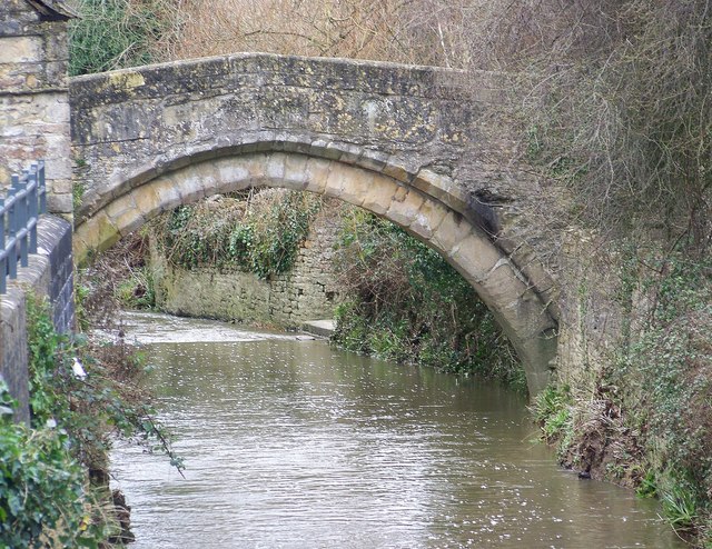
Murtry Aqueduct
Bridge · 1.5 mi
On the line of the Dorset and Somerset Canal which was never completed

Bow Bridge
Bridge · 9.9 mi
Packhorse bridge in Bruton, Somerset, England

Pulteney Bridge
Bridge · 10.8 mi
Grade I listed bridge in Bath, Somerset, England

Gilcombe Farm Shop
Farm and orchard · 8.6 mi
Cuckoo Hill, Bruton
Mo-Fr 08:00-17:00, Sa 08:00-14:30, Raw milk 24/7

Cranmore Tower
Monument and historic site · 6.4 mi
Tower in Cranmore, Mendip, Somerset, England, UK


Warminster Athenaeum
Cinema and theater · 6.3 mi
Theatre in Warminster, England
42 more on the map.
Museums and landmarks105

Rook Lane Chapel
Museum
Arts centre (formerly a chapel) in Frome, Somerset, England, UK
Rook Lane
Mo-Fr 09:00-17:30


Farleigh Hungerford Castle
Monument and historic site · 6.3 mi
Medieval castle in Farleigh Hungerford, Somerset, England, UK

Iford Manor
Monument and historic site · 7.1 mi
Mediaeval/17th century manor house with italianate garden.

Stourhead Gardens
Monument and historic site · 8.5 mi


Aquae Sulis
Monument and historic site · 10.7 mi
Town in Roman Britain on the site of Bath, England

Coleford Aqueduct
Monument and historic site · 5.7 mi
On the line of the Dorset and Somerset Canal which was never completed

Bath Aqua Theatre of Glass
Museum · 11.1 mi
Arts centre and museum in Bath, England, UK
93 more on the map.
Parks, trails and playgrounds78

Vallis Vale
Park · 1.5 mi
Valley and nature reserve in Somerset, England, UK

Longleat Safari and Adventure Park
Park · 3.7 mi
Safari Park in Wiltshire, England

Iford Manor Gardens
Park · 7.2 mi
Grade 1 Italianate garden designed by the architect and landscape gardener Harold Ainsworth Peto who lived here from 1899 to 1933.



Subtropical Swimming Paradise
Sports field and stadium · 4.9 mi
Mo-Su 09:00-20:00
66 more on the map.
Restaurants and cafes386


The Cross Guns
Bar and pub · 7.8 mi
159, Bath
Mo Off; Tu Off; We-Th 11:00-21:00; Fr 11:00-22:00; Sa 11:00-23:00;...
New China Cottage
Restaurant · Chinese · 6.5 mi
23 Market Place
Mo off; Tu-Th 17:30-23:30; Fr-Sa 17:30-24:00; Su 17:30-23:30


Coffee#1
Cafe · Coffee Shop
15-16 Westway Centre, Frome
Mo-Fr 07:30-17:00; Sa 08:00-18:00; Su 09:00-17:00

Noah's Pantry
Cafe · Sandwich, Coffee Shop, Ice Cream, Cake, Pastry, Tea · 8.3 mi
Unit 3B, Bradford on Avon
Th-Mo 10:00-16:00
374 more on the map.
History
Finds from Whatley Quarry near Mells suggest the presence of late Pleistocene mankind.
Neolithic bowl barrows have been located in nearby Trudoxhill. At Murtry Hill, just 3 km to the north-west of Frome, a Neolithic long barrow 35m long by 19m wide was located with substantial upright stones (Orchardleigh Stones), a 'chest' burial and cremation urns. Within Frome itself, another long barrow was found, with skeletons, pottery and a standing stone; its structure seemed similar to the Long Kennet barrow. Others from the Bronze Age have been identified in Berkley to the north-east and near Nunney to the south-west.
The name Frome comes from the Proto-Brythonic word *frāmā (Modern Welsh ffraw), itself from Proto-Celtic *srōm- meaning fair, fine or brisk and describing the flow of the river. In 2019, the BBC ranked Frome as, among places in the UK, having the most difficult name to pronounce.
There is limited evidence of Roman settlement in the area. The remains of a villa were found in the village of Whatley, 3 miles (5 km) to the west of Frome. Another villa is suggested at Selwood. Southill House in Cranmore, 10 miles southwest, has evidence of a villa with a hypocaust. Two villas have been surveyed in the Hemington area, 3 miles (5 km) to the north-west of Frome, alongside other sites, ditches and boundaries.
Read more of the history
A Roman road ran from the west of the Mendips passing south of Frome en route to Old Sarum (Salisbury) and Clausentum (Southampton) or to Moriconium (Hamworthy near Poole), probably for the export of lead and silver from mines in the Mendips. Part of a Romano-British sculpted head and part of a Roman road surface were found near Clink, Frome: possibly linked to a Roman road running south from Aquae Sulis (Bath), but this has been traced only as far as Oldford Farm, Selwood, just 2 miles (3 km) north of Frome. Just to the southeast is Friggle Street, suggestive of a Roman road.
In April 2010, the Frome Hoard, one of the largest hoards of Roman coins discovered in Britain, was found in a field near the town by a metal detectorist; the 52,500 coins dating from the third century AD were in a jar 14 inches (36 cm) below the surface. The coins were excavated by archaeologists from the Portable Antiquities Scheme, and some are now on display in the British Museum. The find was the subject of a BBC TV programme Digging for Britain in August 2010. A further 250 Dubonnic coins had been found in an urn when ploughing near Nunney in 1860; they included those of Claudius who began the conquest of Britain. Other coins continue to be found in this neighbourhood, both Roman and Byzantine.
A church built by St. Aldhelm in 685 is the earliest evidence of Saxon occupation of Frome. Aldhelm was a member of the Wessex royal family, cousin to King Cenwealh. The name was first recorded in 701 when Pope Sergius gave permission to Bishop Aldhelm to found a monastery "close to the river which is called From" (Latin: "juxta fluvium qui vocatur From").
The Saxon kings appear to have used Frome as a base from which to hunt in Selwood Forest. In 934 a witenagemot was held there, indicating that Frome must already have been a significant settlement, with even a royal palace. The charter names a Welsh sub-king, sixteen bishops and twenty five ministers, all called by Æthelstan, now regarded as the first king of England. Æthelstan's half-brother, King Eadred (son of Edward the Elder), died in Frome on 23 November 955.
At the time of the Domesday Survey, the manor was owned by King William, and was the principal settlement of the largest and wealthiest hundred in Somerset. Over the following years, parts of the original manor were spun off as distinct manors; for example, one was owned by the minster, later passing to the Abbey at Cirencester, which others were leased by the Crown to important families. By the 13th century, the Abbey had bought up some of the other manors (although it did let them out again) and was exploiting the profits from market and trade in the town. Local tradition asserts that Frome was a medieval borough, and the reeve of Frome is occasionally mentioned in documents after the reign of Edward I, but there is no direct evidence that Frome was a borough and no trace of any charter granted to it. However, the Kyre Park Charters of Edward's reign note a Hugh, lord of Parva (or little) Frome, as well as other witnesses. Additionally, Henry VII granted a charter to Edmund Leversedge, then lord of the manor, giving him the right to hold fairs on 22 July and 21 September. The parish was part of the hundred of Frome.
Hales Castle was probably built in the years immediately after the Norman Conquest of England in 1066. The circular ringwork is 120 feet (37 m) in diameter and stands on the northern slope of Roddenbury Hill, close to the Iron Age Roddenbury Hillfort, to the south-east of Frome. It comprises banks and outer ditches and has an unfinished bailey. At a similar distance to the south-west of Frome stands Nunney Castle, "aesthetically the most impressive castle in Somerset," built from 1373 onwards, surrounded by a moat.
In 1369, there was a record of 'three tuns of woad' being purchased by Thomas Bakere of Frome, probably from France. Such a large quantity of the blue dye suggests a well-established trade for local dyers and clothiers. A 1392 survey of the town mentions tentergrounds: fields of racks for drying the cloth and five fulling mills. Where originally wool was exported to Flanders and Italy, more was increasingly retained at home for the production of cloth. Woolens such as broadcloth and the lighter kersey became primary products for the area. Surnames such as Webbe (weaver) or Tayllor appear in the early 14th century and there are explicit references to cloth makers in 1475. By 1470 Somerset was the largest producer after Suffolk, making most of the undyed white broadcloths.
From the History section of Frome on Wikipedia, under CC BY-SA 4.0.
More about Frome
Geography
The town rests on Forest Marble which dates back to the Middle Jurassic, and has been used for local building. The area surrounding the town is Cornbrash, Oxford Clay and Greensand. Frome is unevenly built on high ground above the River Frome, which is crossed by a bridge in the town centre. The town centre is approximately 65 metres (213 ft) above sea-level, whilst the outer parts of the town are between 90 metres (295 ft) and 135 metres (443 ft) above sea-level. The main areas of the town are (approximately clockwise from the north-west): Innox Hill, Welshmill, Packsaddle, Fromefield, Stonebridge, Clink, Berkley Down, Easthill, Wallbridge, The Mount, Keyford and Lower Keyford, Marston Gate, The Butts, Critchill, Trinity, and Gould's Ground.
When Frome was founded in the 7th century AD, it lay in the centre of the Selwood Forest, Saxon Sealhwudu or 'Sallow Wood', also known as Coit Mawr, Great Wood, by the Welsh. It stretched from Gillingham in Dorset to Chippenham in Wiltshire, from Bruton to Warminster. It served as a boundary between Anglo-Saxon Wessex and the British kingdom of Dumnonia in the west. In 1086 it became a royal forest.
Economy
The metal-working and printing industries which replaced wool as Frome's main industry have declined but not left the town. Singers still has a presence in the town, as does Butler and Tanner, although the latter (now named Butler Tanner and Dennis following a take-over) hit major financial difficulties in 2008, and made two-thirds of its workforce redundant.
Almost half of the economically active population of Frome commute to work outside the town (in Bath, Bristol, Warminster, Westbury or further afield). About 2,700 people commute into the town. A substantial part of the workforce has no formal qualifications and is poorly skilled, leaving them vulnerable to a decline in manufacturing work. There is no major local government employment in the town, and the principal public sector employers are the primary care trust and the schools.
Frome town centre contains a considerable number of independent shops, and a few chain stores. Retail is primarily aimed at serving the local population's requirements for food (there are two large supermarkets on opposite edges of the town, and three smaller supermarkets in the town centre), basic clothing, health and beauty, DIY and some electrical goods. However studies show that only about a quarter of the town's population do their non-food shopping in the town. Banks and building societies have branches in the town centre.
Arts and culture
Frome has a vibrant arts scene. The high-point is the annual ten-day Frome Festival in July, which in recent years has included more than 160 events held at various venues in and around the town. The town is host to a number of artists, many of whom open their studios to the public during the Festival. The event includes a Children's Festival.
Annual cultural & community events include the Window Wonderland (early March), Frome Busks (late March), Apple Day (21 October), Fireworks (November) and Light the Night: lanterns and the Christmas Lights switch-on (late November). The Carnival (September) is part of the Wessex Grand Prix circuit of the West Country Carnival. A national Town Crier festival is held each year in June; for the third year running, it is the largest such festival in Britain, hosting 25 town criers.
There are two theatres in Frome: The Memorial Theatre was built in 1924 in memory of the fallen of the World War I, while the 240-seat Merlin Theatre is part of the Frome Community College campus.
Frome is home to Somerset's first and only pub theatre: Nevertheless Productions, which promotes new drama in small venues around the town. The Cheese and Grain, a former farm produce warehouse converted into a market and concert hall in 1997, has a capacity of up to 800 and hosts regular pop concerts.
Education
Frome has several first schools for pupils aged between 4 and 9 years. There are two middle schools for pupils between 9 and 13 years of age: Oakfield Academy and Selwood Anglican/Methodist Middle School. The town's main college, Frome Community College, provides education between ages 13 and 18, and has specialist "media arts" status. Frome College joined the Midsomer Norton Schools Partnership in 2024. Critchill School is a special school catering to students who have special educational needs and Farleigh Further Education College is for special needs students aged 16 to 25 with Asperger syndrome and associated conditions. There are no further or higher education establishments in Frome. Somerset Skills & Learning, which provides apprenticeships and training for young people and adults, has a site in the town.
From the Wikipedia article Frome, under CC BY-SA 4.0.
Notable people from Frome
 Jenson ButtonBritish racing driverPhoto: Morio, CC BY-SA 4.0
 Charlie HigsonBritish actor, comedian and authorPhoto: Christopher William Adach from London, UK, CC BY-SA 2.0
 Will ThorpBritish actorPhoto: Richard Hopkins, CC BY 2.0
 Henry Thomas Ryallartist (1811-1867)Photo: Edwardx, CC BY-SA 3.0
 Chris StokesEnglish association football playerPhoto: Bruce Fenn, CC BY-SA 3.0
 Richard VranchBritish comedianPhoto: Auntiep69, CC BY-SA 4.0
 William Venn GougharchitectPhoto: Avectis-writer, CC BY-SA 4.0
- Charles WilkinsBritish orientalist and typographer
- Charles OatleyBritish physicist and electrical engineer
- William Henry ReedBritish musician (1876-1942)
- Edmund Boyle, 7th Earl of CorkIrish earl
- Joseph Robson TannerBritish historian
Born in Frome, according to Wikidata (CC0). Each name links to its Wikipedia article.
Where to stay48
Churches and places of worship224
Downside Abbey of St Gregory the Great
Church · Roman Catholic · 7.7 mi
Abbey Road
Shopping69
Gas and EV charging26
Schools, colleges and libraries123
Healthcare30
Map of Frome
250 places. The map loads OpenStreetMap tiles when you open it.
Getting there and nearby towns
Bristol Airport (BRS) is the nearest airport with scheduled flights listed in OpenStreetMap, 20 miles away.
- Midsomer Norton map
- Westbury 6 mi east, about 10 min by car
- Warminster 6 mi east, about 10 min by car
- Midsomer Norton 8 mi northwest, about 13 min by car
- Bath 10 mi north, about 17 min by car
- Shepton Mallet 10 mi west, about 16 min by car
- Melksham 13 mi northeast, about 20 min by car
- Wells 14 mi west, about 23 min by car
- Keynsham 15 mi northwest, about 24 min by car
- Street 19 mi west, about 31 min by car
- Bristol 20 mi northwest, about 32 min by car
Drive times are estimates from straight-line distance, not routes.
Towns near Frome


Keep exploring
Local news
Headlines from INDB.
Reviews, tips and questions
Loading what members have shared...
Sources and licences
- GeoNames (CC BY 4.0): population, coordinates, regions and time zone
- Mapillary (see each image): photos
- OpenStreetMap contributors (ODbL 1.0): places, airports, map data
- Wikidata (CC0 1.0): elevation, founding date, time zone, website, landmarks and historic places
- Wikimedia Commons (see each image): photos
- Wikipedia (CC BY-SA 4.0): overview and history text
Photo credits
- St John the Baptist Church, Frome, Richard Avery, CC BY-SA 4.0
- Rook Lane Chapel, Frome, Ye Sons of Art, CC BY-SA 4.0
- St John the Baptist Church, Frome 4, Richard Avery, CC BY-SA 4.0
- St John the Baptist Church, Frome. 3, Richard Avery, CC BY-SA 4.0
- King Alfred's Tower view from west, Jürgen Matern, CC BY-SA 3.0
- Bow Bridge Bruton, Trish Steel, CC BY-SA 2.0
- Pulteney bridge in Bath view from south before noon, Jürgen Matern, CC BY-SA 3.0
- Rook Lane Chapel Frome1, The original uploader was Nabokov at English Wikipedia ., CC BY-SA 3.0
- North Parade Frome1, The original uploader was Nabokov at English Wikipedia ., CC BY-SA 3.0
- Farleigh Hungerford East Gate, nicksarebi, CC BY 2.0
- Roman Baths in Bath Spa, England - July 2006, Diliff, CC BY 2.5
- At Bath Postal Museum 2023 23, Photograph by Mike Peel ( www.mikepeel.net )., CC BY-SA 4.0
- Vallisvale, Patrick Mackie, CC BY-SA 2.0
- Downside abbey2-2, Downside_abbey2.jpg : D.O.G.A. derivative work: Rabanus Flavus, CC BY-SA 3.0
- Iford 2, No machine-readable author provided. Infilms assumed (based on copyright claims)., Public domain
- Murtry aqueduct 1, Spoonfrog, Public domain
- Paulton hospital, Rodw, Public domain
- Saint Gregory's Catholic College, Bath, toward pupil entrance, Rwendland, CC BY-SA 3.0
- Monkton combe church arp, Arpingstone, Public domain
- NortonStPhilipTheGeorge, Rodhullandemu, CC BY-SA 3.0
- Bradford on Avon St Lawrence 001, Mattana, Public domain
- At Stourhead 2022 013 - Stourhead House, Photograph by Mike Peel ( www.mikepeel.net )., CC BY-SA 4.0
- All Saints' Church, Westbury, Bellminsterboy, CC BY-SA 4.0
- Holy Trinity Church, Bradford-on-Avon, Charles Miller, CC BY 2.0
- Bratton Church (St James the Great) (36128400120), Hugh Llewelyn from Keynsham, UK, CC BY-SA 2.0
- Cross Guns, Avoncliff, Rodhullandemu, CC BY-SA 3.0
- Priory Steps, Bradford-on-Avon, Stevekeiretsu, CC BY-SA 4.0
- Stourhead Bridge A, Hamburg103a, CC BY-SA 4.0
- Longleat Safari Park, Warminster - panoramio (1), Bob Linsdell, CC BY 3.0
- Street-level photo, jarosor0, CC BY-SA 4.0
- Street-level photo, jarosor0, CC BY-SA 4.0
- Street-level photo, southglos, CC BY-SA 4.0
- Street-level photo, southglos, CC BY-SA 4.0
- Street-level photo, southglos, CC BY-SA 4.0
- Street-level photo, jarosor0, CC BY-SA 4.0
- Street-level photo, southglos, CC BY-SA 4.0
- Street-level photo, southglos, CC BY-SA 4.0
- Street-level photo, southglos, CC BY-SA 4.0
- Street-level photo, RyanBush, CC BY-SA 4.0
- Street-level photo, southglos, CC BY-SA 4.0
- Street-level photo, jarosor0, CC BY-SA 4.0
- Street-level photo, noid, CC BY-SA 4.0
- Street-level photo, southglos, CC BY-SA 4.0
- Street-level photo, southglos, CC BY-SA 4.0
- Street-level photo, southglos, CC BY-SA 4.0
- Street-level photo, jarosor0, CC BY-SA 4.0
- Street-level photo, southglos, CC BY-SA 4.0
- Street-level photo, endszbrxns, CC BY-SA 4.0
- Street-level photo, southglos2, CC BY-SA 4.0


Page built November 10, 2026. Spotted a mistake? Tell us or suggest a place.