


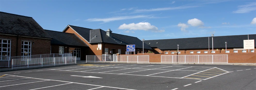
Burry Port, United Kingdom
Burry Port is a town of 8,310 people in Wales, United Kingdom.
Why visit Burry Port
Townapedia lists 1 museum or landmark, 10 parks and trails, 13 places to eat, 2 places to stay and 3 attractions in and around town.
Highlights include Burry Port Lighthouse, Whiteford Lighthouse, Amelia Earhart Monument and Millennium Coastal Park.
Weather in Burry Port
Forecast from MET Norway (CC BY 4.0). Full forecast
About Burry Port
Burry Port (Welsh: Porth Tywyn) is a port town and community in Carmarthenshire, Wales, on the Loughor estuary (Moryd Llwchwr), to the west of Llanelli and south-east of Kidwelly. Its population was recorded at 5,680 in the 2001 census and 6,156 in the 2011 census, and estimated at 5,998 in 2019. The town has a harbour.
From the Wikipedia article Burry Port (this version), under CC BY-SA 4.0.
Travel tips from other travellers: Burry Port on Wikivoyage (CC BY-SA 4.0).
Things to do3

Burry Port Lighthouse
Lighthouse · 0.5 mi
Lighthouse, Grade II listed building in Carmarthenshire, Wales; on the W breakwater of Burry Port harbour

Whiteford Lighthouse
Lighthouse · 2.2 mi
Lighthouse at Whiteford Point, Gower Peninsula, Swansea, Wales, UK

Whiteford Sands
Beach · 3.3 mi
Beach on the northern side of the Gower Peninsula, south Wales
Museums and landmarks1

Parks, trails and playgrounds10


Pembrey Country Park
Park · 2.5 mi
Country park in Carmarthenshire, Wales




Restaurants and cafes13

Pemberton Arms
Bar and pub · 0.4 mi
Colby Road, Burry Port
Mo-Tu 16:00-22:00; We-Th 16:00-23:00; Fr 16:00-00:00; Sa...


Harbour Light Tearoom
Cafe · Sandwich, Regional · 0.4 mi
The Harbour, Burry Port
Mo-Fr 11:00-16:00, Sa-Su 11:00-16:00
Sandhills Bar
Bar and pub
1 Gors Road, Burry Port
Tu-Fr 14:00-23:00; Sa 12:00-24:00; Su 13:00-23:00
1 more on the map.
More about Burry Port
Geography
Burry Port lies 5 miles west of the town of Llanelli. It sits at the mouth of the Loughor estuary, looking south towards the picturesque Gower peninsula. West of the town's shoreline is Pembrey Burrows, a large area of burrow and marshland which historically occupied many square miles of land, much of which has later been reclaimed. To the north of the town is the hill Mynydd Donny, or Pembrey Mountain. Further north lie the Gwendraeth Valleys. The Gwendraeth Fawr runs north easterly from Kidwelly for about twelve miles (19 km). The land around the valley itself contains large amounts of coal as well as limestone. The Gwendraeth Fawr flows the length of the valley, and joins its sister river the Gwendraeth Fach west of Kidwelly before flowing into Carmarthen Bay.
From the Wikipedia article Burry Port, under CC BY-SA 4.0.
Notable people from Burry Port
 Leslie GriffithsBritish minister (born 1942)Photo: Roger Harris, CC BY 3.0
- Gareth JenkinsWelsh rugby union footballer and coach
- John Owen-JonesWelsh musical theatre actor and singer
- John Graysenior British diplomat (1936-2003)
- John Geoffrey JonesBritish judge
- Adam Warrenrugby player
- Darren DanielWelsh rugby union player
- Kirby Myhillrugby player
- Torin MyhillWelsh rugby union player
Born in Burry Port, according to Wikidata (CC0). Each name links to its Wikipedia article.
Where to stay2
Churches and places of worship4
Shopping3
Gas and EV charging2
Schools, colleges and libraries6
Map of Burry Port
44 places. The map loads OpenStreetMap tiles when you open it.
Getting there and nearby towns
Swansea Airport (SWS) is the nearest airport with scheduled flights listed in OpenStreetMap, 9 miles away.
- Llanelli 4 mi east, about 6 min by car
- Kidwelly 4 mi northwest, about 7 min by car
- Pontyberem 7 mi northeast, about 12 min by car
- Gorseinon 9 mi east, about 14 min by car
- Dunvant 10 mi southeast, about 16 min by car
- Cross Hands 10 mi northeast, about 16 min by car
- Carmarthen 12 mi north, about 19 min by car
- Ammanford 13 mi northeast, about 22 min by car
- Swansea 14 mi east, about 22 min by car
- Clydach 15 mi east, about 24 min by car
Drive times are estimates from straight-line distance, not routes.
Towns near Burry Port


Keep exploring
Local news
Headlines from INDB.
Reviews, tips and questions
Loading what members have shared...
Sources and licences
- GeoNames (CC BY 4.0): population, coordinates, regions and time zone
- OpenStreetMap contributors (ODbL 1.0): places, airports, map data
- Wikidata (CC0 1.0): elevation, founding date, time zone, website, landmarks and historic places
- Wikimedia Commons (see each image): photos
- Wikipedia (CC BY-SA 4.0): overview and history text
Photo credits
- Burry Port-panorama, David Lewis, CC BY-SA 2.0
- Pembrey & Burry Port Station 1951619 49bf172b, Ben Brooksbank, CC BY-SA 2.0
- Burry Port Lighthouse, Carmarthenshire, Wales, Vouliagmeni, Public domain
- Whiteford sands view 072006 rb, Rainer Boettchers, Public domain
- Millennium Coastal Path Lla, Wiccasha, Public domain
- Glan-y-mor School Front, Llanelli P at en.wikipedia, Public domain
- Eglwys Pen-bre (Sant Illtyd) Church Pembrey, Sir Gaerfyrddin Carmarthenshire 12, Llywelyn2000, CC BY-SA 3.0
- St Mary's Church, Burry Port, IwanThomas, CC BY-SA 4.0
- Monument to Amelia Earhart on Stepney Road, Burry Port, IwanThomas, CC BY-SA 4.0
- The Whiteford Lighthouse (Unsplash), Alfonso Ninguno alfonso_ninguno, CC0


Page built November 10, 2026. Spotted a mistake? Tell us or suggest a place.