


Carmarthen, United Kingdom
Carmarthen is a town of 15,854 people in Wales, United Kingdom.
Why visit Carmarthen
Townapedia lists 21 museums and landmarks, 9 parks and trails, 78 places to eat, 3 places to stay and 17 attractions in and around town.
Highlights include Carmarthen Bridge, Vue, Carmarthen Castle and Carmarthenshire Museum.
Weather in Carmarthen
Forecast from MET Norway (CC BY 4.0). Full forecast
About Carmarthen
Carmarthen (UK: kər-MAR-dhən, locally kar-; Welsh: Caerfyrddin [kaːɨrˈvərðɪn], 'Merlin's fort' or possibly 'Sea-town fort') is a market town, community, and the county town of Carmarthenshire in Wales, lying on the River Towy 8 miles (13 km) north of its estuary in Carmarthen Bay. At the 2021 census the community had a population of 14,636, and the built up area had a population of 16,455. It stands on the site of a Roman town, and has a claim to be the oldest town in Wales. In the middle ages it comprised twin settlements: Old Carmarthen around Carmarthen Priory and New Carmarthen around Carmarthen Castle.
From the Wikipedia article Carmarthen (this version), under CC BY-SA 4.0.
Travel tips from other travellers: Carmarthen on Wikivoyage (CC BY-SA 4.0).
Things to do17

Carmarthen Bridge
Bridge
Grade II listed bridge in the United Kingdom

Carmarthen Public Rooms
Cinema and theater
Grade II listed building in Carmarthenshire. Building in Carmarthen, Wales

5 more on the map.
Museums and landmarks21

Carmarthen Castle
Monument and historic site
Grade I listed castle in Carmarthen, Wales, UK

Carmarthenshire Museum
Museum · 1.8 mi
Museum in Abergwili, Carmarthen, Wales, United Kingdom


The Picton Monument
Monument and historic site · 0.7 mi
Obelisk in Carmarthen with heritage listing. Situated in island in middle of road at top of Picton Terrace

Moridunum
Monument and historic site · 0.4 mi
Roman settlement at what is now Carmarthen in Wales

Oriel King Street Gallery
Museum
33 King Street, Carmarthen
Mo Off; Tu-Sa 10:00-16:30
Plas Ystrad Mansion
Monument and historic site · 1.1 mi
Former residence of lord John Jons, whilst not in London.
9 more on the map.
Parks, trails and playgrounds9

Cors Goch National Nature Reserve
Park · 3.1 mi
Nature reserve in Carmarthenshire, Wales

Restaurants and cafes78


Dog & Piano
Bar and pub
Former pub, now a cocktail bar
5-6 Water Street, Carmarthen
Mo Off; Tu Off; We Off; Th 16:00-25:00; Fr 16:00-27:00; Sa...
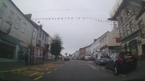
Rose and Crown
Bar and pub
117 Lammas Street, Carmarthen
Mo-Th 09:00-23:00; Fr 09:00-24:00; Sa 09:00-25:00; Su 09:00-22:00


Drovers Arms
Bar and pub
106 Lammas Street, Carmarthen
Mo-Su 11:00-23:00

The Golden Lion
Bar and pub
101 Lammas Street, Carmarthen
Mo-Th 10:00-26:00; Fr-Sa 10:00-26:00; Su 23:00-26:00

The Plume of Feathers
Bar and pub
Saint Mary's Street, Carmarthen
Mo 00:00-01:00,11:00-23:00; Tu-Th 11:00-23:00; Fr 11:00-00:00;...
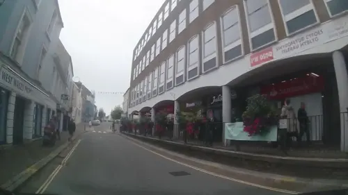
Caffè Nero
Cafe · Coffee Shop
1 Red Street, Carmarthen
Mo-Fr 07:30-18:30; Sa 07:00-18:00; Su 08:00-17:30
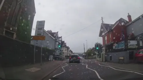
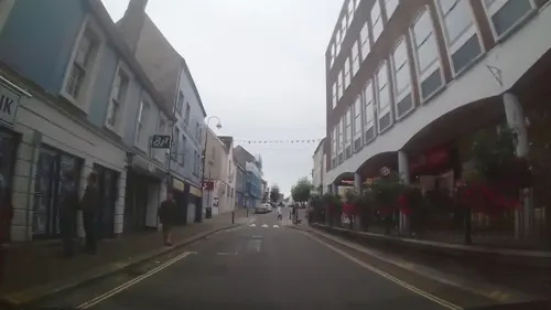


The Coracle Tavern
Bar and pub
1 Cambrian Place, Carmarthen
Mo-Th 12:00-23:00; Fr-Sa 12:00-25:00; Su 12:00-23:30
66 more on the map.
History
When Britannia was a Roman province, Carmarthen was the civitas capital of the Demetae tribe, known as Moridunum ("Sea Fort"). It is possibly the oldest town in Wales, recorded by Ptolemy and in the Antonine Itinerary. The Roman fort is believed to date from about AD 75. A Roman coin hoard was found nearby in 2006. Near the fort is one of seven surviving Roman amphitheatres in Britain and only two in Roman Wales (the other being at Isca Augusta, Roman Caerleon). Excavated in 1968, the Carmarthen fort has an arena of 50 by 30 yards (about 46 by 27 metres); the cavea (seating area) is 100 by 73 yards (92 by 67 metres). Michael Veprauskas (1998) argued for identifying it as the Cair Guorthigirn ("Fort Vortigern") listed by Nennius among the 28 cities of Britain in his History of the Britons. Evidence of the early Roman town has been investigated for several years, revealing urban sites likely to date from the 2nd century.
Read more of the history
During the Middle Ages, the settlement then known as Llanteulyddog ('St Teulyddog's) accounted one of the seven principal sees (Cantrefi) in Dyfed. The strategic importance of Carmarthen caused the Norman William fitz Baldwin to build a castle there, probably about 1094. The current castle site is known to have been occupied since 1105. The castle itself was destroyed by Llywelyn the Great in 1215, but rebuilt in 1223, when permission was given for a town wall and crenellations, making it one of the first medieval walled towns in Wales. In 1405, the town was captured and the castle sacked by Owain Glyndŵr. The Black Book of Carmarthen of about 1250 is associated with the town's Priory of SS John the Evangelist and Teulyddog.
The Black Death of 1347–1349 arrived in Carmarthen with the thriving river trade. It destroyed and devastated villages such as Llanllwch. Local historians cite the plague pit for the mass burial of the dead in the graveyard that adjoins the Maes-yr-Ysgol and Llys Model housing at the rear of St Catherine Street.
In 1110, the ancient Clas church of Llandeulyddog, an independent, pre-Norman religious community, became the Benedictine Priory of St Peter, only to be replaced 15 years later by the Augustinian Priory of St John the Evangelist and St Teulyddog. This stood near the river, at what is now Priory Street (51.8601°N 4.2975°W / 51.8601; -4.2975 (St John's Priory), SN418204). The site is now a scheduled monument.
Franciscan Friars (Grey Friars, or Friars minor) became established in the town in the 13th century, and by 1284 had their own Friary buildings in Lammas Street (51.855794°N 4.309076°W / 51.855794; -4.309076 (Carmarthen Greyfriars)), on a site now holding a shopping centre. The Franciscan emphasis on poverty and simplicity meant the church was smaller (some "70 to 80 feet long and 30 feet broad" – 21/24 by 9 m) and more austere than the older foundations, but this did not prevent an accumulation of treasures, as it became a sought-after location for burial. In 1456 Edmund Tudor, 1st Earl of Richmond died of plague in Carmarthen, three months before the birth of his son, the future King Henry VII. Edmund was buried in a prominent tomb in the centre of the choir of the Grey Friars Church. Other notables buried there were Rhys ap Thomas and Tudur Aled.
The Friary was dissolved in 1538, and many unsuccessful plans were made for the building. Even before the friars had left in 1536, William Barlow campaigned to have the cathedral moved into it from St David's, where the tomb and remains of Edmund Tudor were moved after the Carmarthen buildings were deconsecrated. There were repeated attempts to turn the buildings into a grammar school. Gradually they became ruined, although the church walls were still recognisable in the mid-18th century. By 1900 all the stonework had been stripped off and there were no traces above ground. The site remained undeveloped until the 1980s and 1990s, after extensive archaeological excavations of first the monastic buildings and then the nave and chancel of the church. These confirmed that the former presence of a church, a chapter house and a large cloister, with a smaller cloister and infirmary added later. Over 200 graves were found in the churchyard and 60 around the friars' choir.
Geoffrey of Monmouth, writing in 1188, began the legend that Merlin was born in a cave outside Carmarthen. The town's Welsh name, Caerfyrddin, is widely claimed to mean "Merlin's fort", but a reverse etymology is also suggested: the name Merlin may have originated from the town's name in the anglicised form of Myrddin. (See Merlin § Name). An alternative explanation is that Myrddin is a corruption of the town's Roman name, Moridunum, meaning "sea fort."
Legend also had it that if a certain tree called Merlin's Oak fell, it would bring the downfall of the town. Translated from Welsh, it reads: "When Merlin's Oak comes tumbling down/Down shall fall Carmarthen Town." To obstruct this, the tree was dug up when it died; pieces of it remain in the town museum.
The Black Book of Carmarthen includes poems that refer to Myrddin (Ymddiddan Myrddin a Thaliesin, "Conversation of Merlin and Taliesin") and possibly to Arthur (Pa ŵr yw'r Porthor?, "What man is the porter?"). Interpretation of these is difficult, as the Arthurian legends were known by this time and details of the modern form had been described by Geoffrey of Monmouth before the book was written. Some historians suggest that Vortigern along with his army from Powys may have invaded the Ystrad Tywi in order to gain control of it but had to retreat either due to local rebels fighting back or being defeated by Dyfed, but in the process may have kidnapped a young Merlin from Carmarthen hence why the character is legendary within the town.
One of the earliest recorded Eisteddfodau took place at Carmarthen in about 1451, presided over by Gruffudd ap Nicolas.
From the History section of Carmarthen on Wikipedia, under CC BY-SA 4.0.
Notable people from Carmarthen
 Joe AllenWelsh association football player (born 1990)Photo: Steindy ( talk ) 16:13, 10 November..., CC BY-SA 3.0
 Iwan RheonBritish actor and musicianPhoto: © Ra Boe / Wikipedia, CC BY-SA 3.0 de
 Matthew StevensWelsh snooker playerPhoto: Benutzer:Bill da Flute, CC BY-SA 3.0
 Dave EvansAustralian singerPhoto: Sandra K, CC BY-SA 4.0
 Jessica RobertsBritish cyclistPhoto: Nicola, CC BY-SA 4.0
 Henry Somerset, 1st Duke of BeaufortWelsh politician who sat in the House of Commons (1629-1700)Photo: Attributed to John Riley, Public domain
 Mike PhillipsWelsh rugby union footballerPhoto: Helene Brasseur, CC BY 2.0
 Walter Devereux, 1st Earl of EssexEnglish noble and general (1541-1576)Photo: Unknown artist Unknown artist, Public domain
 Manon LloydBritish cyclistPhoto: Nicola, CC BY-SA 4.0
- Mark DrakefordFirst Minister of Wales from 2018 to 2024
- Dorothea BateWelsh palaeontologist and archaeozoologist (1878-1951)
- Adam PriceWelsh politician (born 1968)
Born in Carmarthen, according to Wikidata (CC0). Each name links to its Wikipedia article.
Where to stay3
Churches and places of worship35
Christ Church
Church · Anglican · 0.4 mi
87 Lammas Street, Carmarthen
Shopping33
Gas and EV charging4
Schools, colleges and libraries16
Healthcare20
Glangwili General Hospital
Hospital · 1.2 mi
Dolgwili Road, Carmarthen
Map of Carmarthen
236 places. The map loads OpenStreetMap tiles when you open it.
Getting there and nearby towns
Swansea Airport (SWS) is the nearest airport with scheduled flights listed in OpenStreetMap, 20 miles away.
- Llanelli 13 mi southeast, about 22 min by car
- Gorseinon 17 mi southeast, about 28 min by car
- Clydach 21 mi southeast, about 34 min by car
- Swansea 22 mi southeast, about 36 min by car
- Ystalyfera 23 mi east, about 37 min by car
- Neath 25 mi southeast, about 41 min by car
- Haverfordwest 29 mi west, about 46 min by car
- Maesteg 33 mi southeast, about 52 min by car
- Milford Haven 33 mi west, about 53 min by car
- Pyle 35 mi southeast, about 56 min by car
Drive times are estimates from straight-line distance, not routes.
Towns near Carmarthen


)_-_Carmarthen_and_the_Afon_Tywi_river;_Wales_12.jpg)


)_-_Carmarthen_and_the_Afon_Tywi_river;_Wales_05.jpg)


Keep exploring
Local news
Headlines from INDB.
Reviews, tips and questions
Loading what members have shared...
Sources and licences
- GeoNames (CC BY 4.0): population, coordinates, regions and time zone
- Mapillary (see each image): photos
- OpenStreetMap contributors (ODbL 1.0): places, airports, map data
- Wikidata (CC0 1.0): elevation, founding date, time zone, website, landmarks and historic places
- Wikimedia Commons (see each image): photos
- Wikipedia (CC BY-SA 4.0): overview and history text
Photo credits
- Caerfyrddin ac Afon Tywi (Ardal Cadwraeth Arbennig Ddynodedig (ACA)) - Carmarthen and the Afon Tywi river; Wales 12, Llywelyn2000, CC BY-SA 4.0
- Carmarthen County Hall close, Rhys Thomas, CC BY 3.0
- Carmarthen Castle Gaol wall, Ken Day, CC BY-SA 4.0
- Carmarthen Castle, walk, Ed Webster, CC BY 2.0
- Carmarthen Castle, Peter Broster, CC BY-SA 4.0
- Caerfyrddin ac Afon Tywi (Ardal Cadwraeth Arbennig Ddynodedig (ACA)) - Carmarthen and the Afon Tywi river; Wales 05, Llywelyn2000, CC BY-SA 4.0
- Prif borth Castell Caerfyrddin 03, Llywelyn2000, CC BY-SA 3.0
- Carmarthenshire Museum (8537), Nilfanion, CC BY-SA 4.0
- Egwys Crist Caerfyrddin Christ Church 09, Llywelyn2000, CC BY-SA 3.0
- Eglwys Saesneg yng Nghaerfyrddin English Church 02, Llywelyn2000, CC BY-SA 3.0
- Entrance gates and rails to Penuel Baptist Chapel, Hywel72, CC BY-SA 3.0
- Gates, piers and railings to Capel Heol Dwr Forecourt, Hywel72, CC BY-SA 3.0
- Carmarthen Cemetery Chapel (front), Sionk, CC BY-SA 4.0
- St David's Church at Carmarthen, Peter Wood, CC BY-SA 2.0
- Carmarthen Market, Hywel72, CC BY-SA 3.0
- The Golden Lion, Hywel72, CC BY-SA 3.0
- The Drovers Arms, Hywel72, CC BY-SA 3.0
- Boar's Head Hotel, Hywel72, CC BY-SA 3.0
- Presbyterian College, Carmarthen, Hywel72, CC BY-SA 3.0
- The Plume of Feathers, Hywel72, CC BY-SA 3.0
- Carmarthen Library (24100803524), Reading Tom from Reading, UK, CC BY 2.0
- The Spilman Hotel, Hywel72, CC BY-SA 3.0
- St Mary's R.C. Primary School, Cwmcafit, CC BY-SA 3.0
- Dog and Piano, Water Street, Carmarthen, Sionk, CC BY-SA 4.0
- Castle Hotel 2, Peter Broster, CC BY-SA 4.0
- Oriel Myrddin (The Old Art School), Hywel72, CC BY-SA 3.0
- Picton Monument, Carmarthen (close-up), Sionk, CC BY-SA 4.0
- Street-level photo, trigpoint, CC BY-SA 4.0
- Street-level photo, trigpoint, CC BY-SA 4.0
- Street-level photo, trigpoint, CC BY-SA 4.0
- Street-level photo, trigpoint, CC BY-SA 4.0
- Street-level photo, trigpoint, CC BY-SA 4.0
- Street-level photo, trigpoint, CC BY-SA 4.0
- Street-level photo, trigpoint, CC BY-SA 4.0
- Street-level photo, trigpoint, CC BY-SA 4.0
- Street-level photo, trigpoint, CC BY-SA 4.0
- Street-level photo, trigpoint, CC BY-SA 4.0
- Street-level photo, trigpoint, CC BY-SA 4.0
- Street-level photo, trigpoint, CC BY-SA 4.0


Page built November 10, 2026. Spotted a mistake? Tell us or suggest a place.