


Why visit Buxted
Townapedia lists 4 museums and landmarks, 23 parks and trails, 52 places to eat, 4 places to stay and 1 attraction in and around town.
Highlights include The Picture House Uckfield, Wilderness Wood, Diane Hutt Gallery and Crowborough Country Park.
Weather in Buxted
Forecast from MET Norway (CC BY 4.0). Full forecast
About Buxted
Buxted is a village and civil parish in the Wealden district of East Sussex in England. The parish is situated on the Weald, north of Uckfield; the settlements of Five Ash Down, Heron's Ghyll and High Hurstwood are included within its boundaries. At one time its importance lay in the Wealden iron industry, and later it became commercially important in the poultry and egg industry.
From the Wikipedia article Buxted (this version), under CC BY-SA 4.0.
Things to do1

The Picture House Uckfield
Cinema and theater · 2.0 mi
High Street, Uckfield
10:00-23:00
Museums and landmarks4
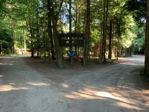


Parks, trails and playgrounds23



Selwyns Wood
Park · 3.7 mi
Nature reserve in East Sussex, England, UK
West Park
Park · 2.6 mi
Nature reserve in Uckfield, East Sussex, England, UK


Luxfords Field
Park · 2.1 mi
Community open space. Available for hire for events.
11 more on the map.
Restaurants and cafes52

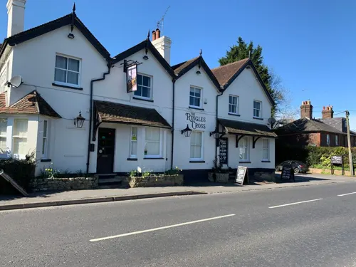

Amira’s Kirchen
Restaurant · Indian · 2.1 mi
Grange Road
We-Fr 15:00-17:00,Sa-Su 14:00-17:00,Su-Th 17:30-22:00,Fr-Sa 17:30-22:30


Craft Coffee And Roastery
Cafe · Coffee Shop · 2.1 mi
144 High Street, Uckfield
Mo-Fr 07:30-16:30; Sa 08:00-17:00; Su 09:00-16:00
40 more on the map.
History
The origin of the name Buxted comes from the Saxon Bochs stede (place of the beeches).
The iron-making industry became a major part of Buxted's early prosperity. The first standard blast furnace was called Queenstock and was built in Buxted parish in about 1491. The cannon-making industry in the Weald started at a furnace on the stream at Hoggets Farm lying to the north between Buxted and Hadlow Down. The first cast-iron cannon made in England was cast in 1543 by Ralf Hogge, an employee of Parson William Levett, a Sussex rector with broad interests, paradoxically enough, in the emerging English armaments industry.
Read more of the history
Levett was removed as Buxted's vicar in 1545 by Thomas Cranmer, Archbishop of Canterbury. But thanks to friends in high places, Levett was quickly reinstated. After regaining his clerical position, Levett died a very wealthy man, thanks to his iron mining and smelting operations, founded by his brother John Levett, one of the founders of the Sussex iron industry and one of the wealthiest men in Sussex, who controlled 20 Sussex manors at his death in 1535. The family is of Norman descent and one of the oldest in Sussex. William and John Levett were the sons of a large landowner in the Hollington area of Hastings, Sussex. In his lengthy will, parson William Levett left large charitable bequests which he directed be supervised by his friend Anthony Browne, 1st Viscount Montagu. Richard Woodman, an ironmaster was born here, but he was burnt as a Protestant martyr in 1557.
The novelist George Alfred Lawrence was born in Buxted in 1827, the eldest son of the Anglican curate at the time, Rev. Alfred Charnley Lawrence.
The manor house, known as Buxted Park, was purchased by the then Prime Minister, Robert Jenkinson, 2nd Earl of Liverpool, in the early part of the 19th century. He set about extending the park surrounding the house, and eventually coerced the villagers to vacate their own houses to enable him to do so. The village (although not the church) was cleared away and the village then took up its present location. By 1836, the entire original village centre was no more, having been relocated to the site it occupies today. Some of the outlying houses pre-date this move, such as Britts, a 17th-century farmhouse, which still stands. The original manor house was built further down the hill next to the railway where Queen Victoria once visited – the house being the Chequers of its day. The original house burnt down in the latter part of the 19th century and was rebuilt in its present location.
From the History section of Buxted on Wikipedia, under CC BY-SA 4.0.
More about Buxted
Geography
The parish of Buxted lies partly within the High Weald Area of Outstanding Natural Beauty, although the village itself is outside it. Tributaries of both the Rivers Rother (flowing eastward) and Cuckmere flow through the parish, and were used by the iron industry for power. It is largely a rural parish, although the original Britts farmland is now largely covered by modern houses along Britts Farm Road, constructed in the 1980s.
The parish contains an area of Site of Special Scientific Interest—Buxted Park, an old deer park which is very important for the conservation of invertebrates. Buxted Park is now a country house hotel, owned by Hand Picked Hotels around which there are some lovely walks.
The wholesale Buxted Chickens had a factory in Buxted as well as one in Five Ash Down. Buxted Chickens was founded by Antony Fisher, who also founded the Institute of Economic Affairs. The Buxted brand, formerly owned by the Grampian Country Foods, is now owned by 2 Sisters Food Group. The Buxted site closed down in the 1980s, and is now owned by the Woodland Trust.
From the Wikipedia article Buxted, under CC BY-SA 4.0.
Where to stay4
Churches and places of worship23
Shopping13
Gas and EV charging5
Schools, colleges and libraries12
Healthcare4
Map of Buxted
141 places. The map loads OpenStreetMap tiles when you open it.
Getting there and nearby towns
London Gatwick Airport (LGW) is the nearest airport with scheduled flights listed in OpenStreetMap, 18 miles away.
- Uckfield 2 mi southwest, about 4 min by car
- Crowborough 5 mi north, about 8 min by car
- Heathfield 6 mi east, about 9 min by car
- Horsted Keynes 8 mi northwest, about 12 min by car
- Groombridge 9 mi north, about 14 min by car
- Lewes 10 mi southwest, about 16 min by car
- Haywards Heath 10 mi west, about 17 min by car
- Hailsham 10 mi southeast, about 17 min by car
- Royal Tunbridge Wells 11 mi northeast, about 18 min by car
- East Grinstead 11 mi northwest, about 18 min by car
Drive times are estimates from straight-line distance, not routes.
Towns near Buxted


Keep exploring
Local news
Headlines from INDB.
Reviews, tips and questions
Loading what members have shared...
Sources and licences
- GeoNames (CC BY 4.0): population, coordinates, regions and time zone
- Mapillary (see each image): photos
- OpenStreetMap contributors (ODbL 1.0): places, airports, map data
- Wikidata (CC0 1.0): elevation, founding date, time zone, website, landmarks and historic places
- Wikimedia Commons (see each image): photos
- Wikipedia (CC BY-SA 4.0): overview and history text
Photo credits
- BuxtedParishHall, MortimerCat, CC BY-SA 3.0
- St Margaret the Queen's Church, Buxted Park, The Voice of Hassocks, Public domain
- Crowborough Country Park (1), Dudley Miles, CC BY-SA 4.0
- Five Ash Down Independent Chapel, The Voice of Hassocks, Public domain
- Former Providence Chapel, Hadlow Down (June 2015) (Datestone), Hassocks5489, CC0
- Rehoboth Strict Baptist Chapel, Jarvis Brook, Crowborough, The Voice of Hassocks, CC0
- Uckfield Baptist Church, The Voice of Hassocks, Public domain
- Hempstead Meadow (3), Dudley Miles, CC BY-SA 4.0
- St John the Evangelist's Church, Heron's Ghyll (IoE Code 295892), The Voice of Hassocks, CC0
- St Bartholomew's Church, Maresfield, The Voice of Hassocks, Public domain
- Buxted Park Hotel, Buxted (NHLE Code 1353483) (October 2010), The Voice of Hassocks, CC BY-SA 3.0
- Holy Cross Church, Church Street, Uckfield (NHLE Code 1028118) (October 2010) (4), Hassocks5489, CC0
- White Hart Inn, Station Road, Buxted (NHLE Code 1293460) (October 2010), User:Hassocks5489, CC0
- Holy Trinity Church, Chillies Lane, High Hurstwood (NHLE Code 1356765) (August 2021) (1), Hassocks5489, CC0
- Street-level photo, EstSsxKt, CC BY-SA 4.0
- Street-level photo, EstSsxKt, CC BY-SA 4.0
- Street-level photo, EstSsxKt, CC BY-SA 4.0
- Street-level photo, EstSsxKt, CC BY-SA 4.0


Page built November 10, 2026. Spotted a mistake? Tell us or suggest a place.