


Heathfield, United Kingdom
Heathfield is a town of 1,001 people in England, United Kingdom.
Why visit Heathfield
Townapedia lists 1 museum or landmark, 4 parks and trails, 21 places to eat and 1 place to stay in and around town.
Highlights include Selwyns Wood.
Weather in Heathfield
Forecast from MET Norway (CC BY 4.0). Full forecast
About Heathfield
Heathfield is a market town and former civil parish, now in the parish of Heathfield and Waldron, in the Wealden District of East Sussex, England. The town had a population of 7,667 in 2021. Locals know it by "Heffle".
From the Wikipedia article Heathfield, East Sussex (this version), under CC BY-SA 4.0.
Travel tips from other travellers: Heathfield on Wikivoyage (CC BY-SA 4.0).
Photos of Heathfield


Museums and landmarks1

Parks, trails and playgrounds4

Selwyns Wood
Park · 2.1 mi
Nature reserve in East Sussex, England, UK

Restaurants and cafes21
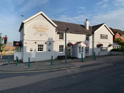




9 more on the map.
Where to stay1

History
Historically, Heathfield lay on an ancient trackway connecting the South Downs with the Weald.
The Manor of Heathfield lies in the parish of the same name. The earliest known record for the manor is a market grant given to Ralph, Bishop of Chichester by Henry III in 1234. The rights to a fair were granted in February 1316 during the reign of Edward II to John, Bishop of Chichester. In 1559, the Government of Elizabeth I passed the Act of Exchange, seizing the possessions of the Bishops of Chichester in return for other payments. Heathfield was one of 73 manors taken by the Crown, which was subsequently granted to Thomas Sackville, the Earl of Dorset. The Manor remained in possession of the Sackville family until the death of the last Duke of Dorset, when it was acquired by the family of the Lords De La Warr through Elizabeth Sackville, Countess of De La Warr, whom married George Sackville-West, the 5th Earl De La Warr. The Manor left the possession of the De La Warr estate in the 1980s. The current Lord of Heathfield is Christopher Repetsky, a physician.
Read more of the history
The Wealden iron brought prosperity to the town during the 16th and the 17th centuries. The coming of the railway (the Cuckoo Line) in 1880 gave it another new lease of life. The latter was not a financial success, and the branch line between Eridge and Polegate closed in 1968. The trackbed is now named the Cuckoo Trail, part of the National Cycle Network.
The original village, Old Heathfield, is now only part of the town, which has expanded over time.
In 1961 the parish had a population of 3244. On 1 April 1990 the parish was abolished and merged with Waldron to form "Heathfield and Waldron".
From the History section of Heathfield, East Sussex on Wikipedia, under CC BY-SA 4.0.
More about Heathfield
Arts and culture
The town holds an annual fair named the Heffle Cuckoo Fair each April, this has not been held since 2019 and the annual Heathfield Agricultural Show takes place each summer. Heathfield is the home of Heathfield Community College, several primary schools in the area and 2 pre-Schools. Opposite the college is a leisure centre, the leisure centre is owned by the school and runs very limited public classes, it does not have open access. There is an Anglo/French market called Le Marché held every year on the August Bank Holiday. There is a fairly large football field, and beside it a playground. At Cross-in-Hand, there is a rugby club for adults and children.
Heathfield has an army cadet force detachment that is part of the Sussex Army Cadet Force group. This detachment is based in the Youth Centre on High Street, and is affiliated to Princess of Wales' Royal Regiment. The Detachment meets on Monday and Wednesday evenings from 19:00 to 21:30 each week.
The Heathfield Silver Band is a silver band headquartered in Heathfield with a history dating back as far as 1880. The band has a large membership, with members spanning the ages of 9 to 80. Although women were not allowed to participate in years past, the band now accepts members regardless of gender.
From the Wikipedia article Heathfield, East Sussex, under CC BY-SA 4.0.
Notable people from Heathfield
 Edwin Russell (artist)English sculptorPhoto: cwi.aida, CC BY-SA 3.0
 Luke HowellBritish footballer (born 1987)Photo: Mattythewhite, CC BY-SA 3.0
- Fred FrithEnglish musician, composer and improvisor (born 1949)
- Ian CoxEnglish cricketer (born 1967)
- Ted Fillarycricketer (born 1944)
Born in Heathfield, according to Wikidata (CC0). Each name links to its Wikipedia article.
Churches and places of worship9
Shopping12
Gas and EV charging2
Schools, colleges and libraries6
All Saints' and St Richard's Church of England Primary School
School · Anglican · 0.9 mi
School Hill, Heathfield
Cross-in-Hand Church of England Primary School
School · Anglican · 0.6 mi
Sheepsetting Lane, Heathfield
Healthcare1
Map of Heathfield
57 places. The map loads OpenStreetMap tiles when you open it.
Getting there and nearby towns
London Gatwick Airport (LGW) is the nearest airport with scheduled flights listed in OpenStreetMap, 23 miles away.
- Uckfield 7 mi west, about 11 min by car
- Hailsham 7 mi south, about 12 min by car
- Crowborough 8 mi northwest, about 12 min by car
- Royal Tunbridge Wells 11 mi north, about 18 min by car
- Bexhill-on-Sea 12 mi southeast, about 20 min by car
- Lewes 13 mi southwest, about 20 min by car
- Eastbourne 14 mi south, about 22 min by car
- Seaford 15 mi southwest, about 24 min by car
- Newhaven 15 mi southwest, about 24 min by car
- Hastings 16 mi southeast, about 26 min by car
Drive times are estimates from straight-line distance, not routes.
Towns near Heathfield


Keep exploring
Local news
Headlines from INDB.
Reviews, tips and questions
Loading what members have shared...
Sources and licences
- GeoNames (CC BY 4.0): population, coordinates, regions and time zone
- Mapillary (see each image): photos
- OpenStreetMap contributors (ODbL 1.0): places, airports, map data
- Wikidata (CC0 1.0): elevation, founding date, time zone, website, landmarks and historic places
- Wikimedia Commons (see each image): photos
- Wikipedia (CC BY-SA 4.0): overview and history text
Photo credits
- High Street, Heathfield, East Sussex, Oast House Archive, CC BY-SA 2.0
- Heathfield banner High Street, Tom Morris, CC BY-SA 3.0
- Ebenezer Strict Baptist Chapel, Broad Oak, near Heathfield, The Voice of Hassocks, CC0
- St Bartholomew's Church, Cross-in-Hand, The Voice of Hassocks, CC0
- St Richard's Church, Upper Station Road, Heathfield (September 2016) (8), Hassocks5489, CC0
- WikiConference UK Bristol 003, Tom Morris, CC BY 3.0
- WikiConference UK Bristol 006, Tom Morris, CC BY 3.0
- WikiConference UK Bristol 005, Tom Morris, CC BY 3.0
- Street-level photo, EstSsxKt, CC BY-SA 4.0
- Street-level photo, EstSsxKt, CC BY-SA 4.0
Page built November 10, 2026. Spotted a mistake? Tell us or suggest a place.