


Royal Tunbridge Wells, United Kingdom
Royal Tunbridge Wells is a town of 68,910 people in England, United Kingdom.
Why visit Royal Tunbridge Wells
Townapedia lists 16 museums and landmarks, 12 parks and trails, 125 places to eat, 9 places to stay and 4 attractions in and around town.
Highlights include Assembly Hall Theatre, Trinity Theatre, The Forum and The Amelia Scott.
Weather in Royal Tunbridge Wells
Forecast from MET Norway (CC BY 4.0). Full forecast
About Royal Tunbridge Wells
Royal Tunbridge Wells (formerly, until 1909, and still commonly Tunbridge Wells) is a town in Kent, England, 30 miles (50 kilometres) southeast of Central London. It lies close to the border with East Sussex on the northern edge of the High Weald, whose sandstone geology is exemplified by the rock formation High Rocks. The town was a spa in the Restoration and a fashionable resort in the mid-1700s under Beau Nash when the Pantiles, and its chalybeate spring, attracted visitors who wished to take the waters. Though its popularity as a spa town waned with the advent of sea bathing, the town still derives much of its income from tourism.
From the Wikipedia article Royal Tunbridge Wells (this version), under CC BY-SA 4.0.
Travel tips from other travellers: Royal Tunbridge Wells on Wikivoyage (CC BY-SA 4.0).
Things to do4

Trinity Theatre
Cinema and theater
Theatre and arts centre, in Tunbridge Wells, Kent, England, in the former Holy Trinity Church
Church Road
Opera House, Royal Tunbridge Wells
Cinema and theater
Former opera house in Royal Tunbridge Wells, now a pub, with the theatre still ocasionally used

Royal Victoria Hall
Cinema and theater · 1.6 mi
Former theatre in Southborough, England
Museums and landmarks16
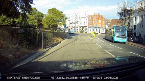
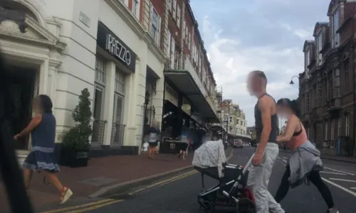


Edward Hoare Memorial
Monument and historic site · 0.4 mi
A large, decorated pillar with statues of the four evangelists, a bust of Canon Hoare and a plaque.
Tunbridge Wells Power Station (Disused)
Monument and historic site · 0.5 mi
The old Tunbridge Wells Powerstation
4 more on the map.
Parks, trails and playgrounds12

Eridge Park
Park · 3.2 mi
Park in Rotherfield, East Sussex, England, UK


Restaurants and cafes125
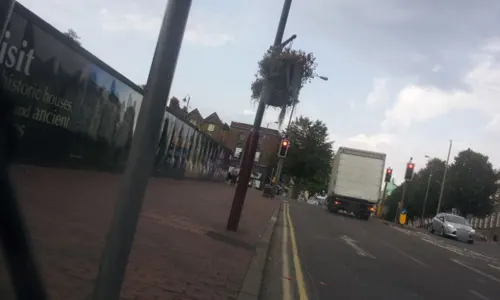
Osteria Pizza
Restaurant · Italian
76 Mount Pleasant Road, Tunbridge Wells
Mo-Su 12:00-21:00; Fr,Sa 12:00-22:00
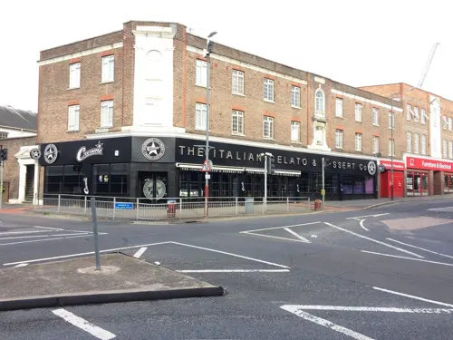
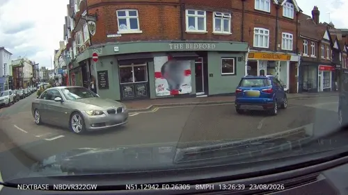
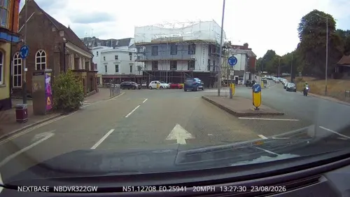
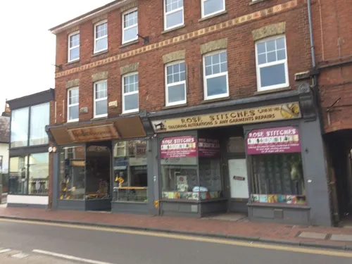
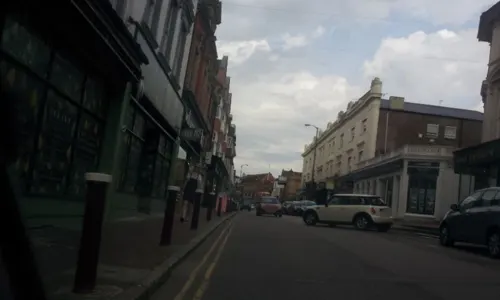

Opera House
Bar and pub
88 Mount Pleasant Road, Royal Tunbridge Wells
Mo-Th 08:00-00:00; Fr-Sa 08:00-01:00; Su 08:00-00:00
113 more on the map.
History
Evidence suggests that Iron Age people farmed the fields and mined the iron-rich rocks in the Tunbridge Wells area, and excavations in 1940 and 1957–61 by James Money at High Rocks uncovered the remains of a defensive hillfort. It is thought that the site was occupied into the era of Roman Britain, and the area continued to be part of the Wealden iron industry until its demise in the late eighteenth century. An iron forge remains in the grounds of Bayham Abbey, in use until 1575 and documented until 1714.
The area which is now Tunbridge Wells was part of the parish of Speldhurst for hundreds of years.
Read more of the history
The origin of the town today came in the seventeenth century. In 1606 Dudley North, 3rd Baron North, a courtier to King James VI and I who was staying at a hunting lodge in Eridge in the hope that the country air might improve his ailing constitution, discovered a chalybeate spring. He drank from the spring and, when his health improved, he became convinced that it had healing properties. He persuaded his rich friends in London to try it, and by the time Queen Henrietta Maria, wife of King Charles I, visited in 1630 it had established itself as a spa retreat. By 1636 it had become so popular that two houses were built next to the spring to cater for the visitors, one for the ladies and one for the gentlemen, and in 1664 Lord Muskerry, Lord of the Manor, enclosed it with a triangular stone wall, and built a hall "to shelter the dippers in wet weather."
Until 1676 little permanent building took place—visitors were obliged either to camp on the downs or to find lodgings at Southborough—, but at this time houses and shops were erected on the walks, and every "convenient situation near the springs" was built upon. Also in 1676 a subscription for a "chapel of ease" was opened, and in 1684 the Church of King Charles the Martyr was duly built and the town began to develop around it. In 1787 the antiquarian Edward Hasted described the new town as consisting of four small districts, "named after the hills on which they stand, Mount Ephraim, Mount Pleasant and Mount Sion; the other is called the Wells..."
In the 1680s there was a building-boom in the town: carefully planned shops were built beside the 175-yard-long (160-metre) Pantiles promenade (then known as the Walks), and the Mount Sion road, on which lodging house keepers were to build, was laid out in small plots. Tradesmen in the town dealt in the luxury goods demanded by their patrons, which would certainly have included Tunbridge ware, a kind of decoratively inlaid woodwork.
"They have made the wells very commodious by the many good building all about it and two or three miles [three or five kilometres] around which are lodgings for the company that drink the waters. All the people buy their own provisions at the market, which is just by the wells and is furnished with great plenty of all sorts of fish and fowl. The walk which is between high trees on the market side which are shops full of all sorts of toys, silver, china, milliners and all sorts of curious wooden ware besides which there are two large coffee houses for tea, chocolate etc. and two rooms for the lottery and hazard board (i.e. for gambling)."—Celia Fiennes, 1697
Following Richard Russell's 1750 treatise advocating sea water as a treatment for diseases of the glands, fashions in leisure changed and sea bathing became more popular than visiting the spas, which resulted in fewer visitors coming to the town. Nevertheless, the advent of turnpike roads gave Tunbridge Wells better communications—on weekdays a public coach made nine return journeys between Tunbridge Wells and London, and postal services operated every morning except Monday and every evening except Saturday. During the eighteenth century the growth of the town continued, as did its patronage by the wealthy leisured classes—it received celebrity cachet from visits by figures such as Caius Gabriel Cibber, Samuel Johnson, David Garrick, Samuel Richardson and the successful bookseller Andrew Millar and his wife—and in 1735 Beau Nash appointed himself as master of ceremonies for all the entertainments that Tunbridge Wells had to offer. He remained in this position until his death in 1762, and under his patronage the town reached the height of its popularity as a fashionable resort.
By the early nineteenth century Tunbridge Wells experienced growth as a place for the well-to-do to visit and make their homes. It became a fashionable resort town again following visits by the Duchess of Kent, Queen Victoria and Prince Albert, and benefited from a new estate on Mount Pleasant and the building of the Trinity church in 1827, and improvements made to the town and the provision of facilities such as gas lighting and a police service meant that by 1837 the town population had swelled to 9,100. In 1842 an omnibus service was set up that ran from Tonbridge to Tunbridge Wells, enabling visitors to arrive from London within two hours, and in 1845 the town was linked to the railway network via a branch from South Eastern Railway's London-Hastings Hastings Line at Tonbridge. During this time Decimus Burton developed John Ward's Calverley Park estate.
In 1889 the town was awarded the status of a Borough, and it entered the 20th century in a prosperous state. 1902 saw the opening of an Opera House, and in 1909 the town received its "Royal" prefix. Due to its position in South East England, during the First World War Tunbridge Wells was made a headquarters for the army, and its hospitals were used to treat soldiers who had been sent home with a "blighty wound"; the town also received 150 Belgian refugees. The Second World War affected Tunbridge Wells in a different way—it became so swollen with refugees from London that accommodation was severely strained. Over 3,800 buildings were damaged by bombing, but only 15 people lost their lives.
Following the war, large-scale housing estates were built at Sherwood and Ramslye to accommodate population growth.
From the History section of Royal Tunbridge Wells on Wikipedia, under CC BY-SA 4.0.
More about Royal Tunbridge Wells
Geography
Tunbridge Wells is on the Kentish border with East Sussex, about 31 miles (50 kilometres) south of London; the original centre of the settlement lies directly on the Kent/East Sussex border, as recalled by the county boundary flagstone that still lies outside the church of King Charles the Martyr.
The town is at the northern edge of the High Weald, a ridge of hard sandstone that runs across southern England from Hampshire along the borders of Surrey, West Sussex, East Sussex and Kent—the town's geology is illustrated by the exposed sandstone outcrops at the Wellington Rocks and High Rocks (a Site of Special Scientific Interest due to its exposed gulls), and the quarries at nearby Langton Green from which sandstone was taken to build houses in Tunbridge Wells. The town is sited at the head of a valley that runs south-east to Groombridge; like the River Teise, which originates in Tunbridge Wells, the stream in the valley is one of the many tributaries of the River Medway, which runs through a much larger valley north of the High Weald. The Tunbridge Wells Sand Formation geological unit takes its name from the town.
Nearby villages have been subsumed into the built-up area of the town, so that now it incorporates High Brooms to the north, Hawkenbury to the south, and Rusthall (whose name resonates with the iron content of the rocks) to the west.
Economy
As of 2002 there were around 50,000 people employed in the borough of Tunbridge Wells. The largest sector of the local economy consists of hotels, restaurants, and retail (the centrally located Royal Victoria Place shopping centre, opened in 1992, covers 29,414 square metres (316,610 sq ft), which accounts for around 30% of all jobs; the finance and business sector makes up just under a quarter of jobs, as does the public administration, education and health sector. Tunbridge Wells is arguably the most important retail centre between London and Hastings. Childrensalon is based in Royal Tunbridge Wells.
The largest single employer in the town used to be the Maidstone and Tunbridge Wells NHS Trust, at the Kent and Sussex and Tunbridge Wells Hospitals, employing around 2500 people; the largest single commercial employer was AXA PPP healthcare, employing around 1,700 in four offices (PPP House, Union House, Phillips House and International House). Tunbridge Wells had a relatively low unemployment rate of around 1.0% in August 2008, compared to a UK national rate of around 5.4%.
Education
Kent County Council is one of fifteen local authorities in the UK that still provides selective education through the eleven plus exam.
Tunbridge Wells does not have a university of its own, but the Salomons Campus of Canterbury Christ Church University is located just outside the town (near Southborough) and provides postgraduate programmes.
From the Wikipedia article Royal Tunbridge Wells, under CC BY-SA 4.0.
Notable people from Royal Tunbridge Wells
 Victor McLaglenBritish-American actor (1886–1959)Photo: Los Angeles Times, CC BY 4.0
 Emma CorrinBritish actor (born 1995)Photo: LucaFazPhoto, CC BY-SA 4.0
 Joe AlwynEnglish actorPhoto: H7ndrx, CC0
 Dominic SherwoodEnglish actorPhoto: Gordon Correll, CC BY-SA 2.0
 Phyllis Johnsonfigure skater (1886-1967)Photo: Unknown author Unknown author, Public domain
 Lady Ottoline MorrellBritish noblewoman and aristocrat (1873-1938)Photo: Unknown author, Public domain
 Hannah BarnesBritish cyclistPhoto: Geof Sheppard, CC BY-SA 4.0
 Charity WakefieldBritish actressPhoto: Helloepilogue, CC BY-SA 4.0
 Elsie BowermanBritish lawyer and suffragettePhoto: Unknown author Unknown author, Public domain
 Clive A. StaceBritish botanistPhoto: Parkywiki, CC BY-SA 4.0
- Arthur WaleyBritish orientalist and sinologist (1889–1966)
- Alec McCowenBritish actor (1925–2017)
Born in Royal Tunbridge Wells, according to Wikidata (CC0). Each name links to its Wikipedia article.
Where to stay9
The Tunbridge Wells Hotel
Motel and hotel · 0.6 mi
58 The Pantiles, Royal Tunbridge Wells
Churches and places of worship32
Church of King Charles the Martyr, Royal Tunbridge Wells
Church · 0.5 mi
Shopping23
SH Hardware and Supermarket
Hardware store · 1.5 mi
140 London Road, Tunbridge Wells
Gas and EV charging5
Schools, colleges and libraries29
Southborough Church of England Primary School
School · Anglican · 1.5 mi
Broomhill Park Road, Tunbridge Wells
St John's Church of England Primary School
School · Anglican · 1.0 mi
Cunningham Road, Tunbridge Wells
St. Augustine's Catholic Primary School
School · Roman Catholic · 1.1 mi
Wilman Road, Tunbridge Wells
St. Peter's Church of England Primary School
School · Anglican · 1.2 mi
Hawkenbury Road, Tunbridge Wells
Healthcare9
Imperial Pharmacy
Clinic and pharmacy · 0.5 mi
4 The Pantiles, Royal Tunbridge Wells
Map of Royal Tunbridge Wells
250 places. The map loads OpenStreetMap tiles when you open it.
Getting there and nearby towns
London Biggin Hill Airport (BQH) is the nearest airport with scheduled flights listed in OpenStreetMap, 17 miles away.
- Tonbridge 4 mi north, about 7 min by car
- Crowborough 7 mi southwest, about 11 min by car
- Sevenoaks 10 mi north, about 16 min by car
- East Grinstead 12 mi west, about 19 min by car
- Uckfield 13 mi southwest, about 22 min by car
- Maidstone 14 mi northeast, about 23 min by car
- Oxted 14 mi northwest, about 23 min by car
- Snodland 16 mi northeast, about 25 min by car
- Biggin Hill 16 mi northwest, about 26 min by car
- Chelsfield 17 mi north, about 27 min by car
Drive times are estimates from straight-line distance, not routes.
Towns near Royal Tunbridge Wells


Keep exploring
Local news
Headlines from INDB.
Reviews, tips and questions
Loading what members have shared...
Sources and licences
- GeoNames (CC BY 4.0): population, coordinates, regions and time zone
- Mapillary (see each image): photos
- OpenStreetMap contributors (ODbL 1.0): places, airports, map data
- Wikidata (CC0 1.0): elevation, founding date, time zone, website, landmarks and historic places
- Wikimedia Commons (see each image): photos
- Wikipedia (CC BY-SA 4.0): overview and history text
Photo credits
- 1223642 II Star TRINITY ARTS CENTRE (FORMERLY HOLY TRINITY CHURCH), CHURCH ROAD Tunbridge Wells 20250825 0004, Tilman2007, CC BY-SA 4.0
- Eridge Park, Andrew Howey, CC BY-SA 2.0
- St Mark's Church, Broadwater Down, Tunbridge Wells, The Voice of Hassocks, CC0
- Former Vale Royal Methodist Church, Vale Road, Tunbridge Wells (August 2021) (7), Hassocks5489, CC0
- King Charles the Martyr's Church, Mount Sion, Tunbridge Wells, The Voice of Hassocks, CC0
- Beechwood, FatClone ( talk ) ( Uploads ), Public domain
- Hotel du Vin Tunbridge Wells 6571128 3a0ff4d6, N Chadwick, CC BY-SA 2.0
- St Barnabas' Church, Stanley Street, Tunbridge Wells, The Voice of Hassocks, CC0
- St John's Church, Amherst Road, Tunbridge Wells (from West), The Voice of Hassocks, CC0
- St James's Church, St James's Road, Ferndale, Tunbridge Wells, The Voice of Hassocks, CC0
- Royal Wells Hotel, Poliphilo, CC0
- Street-level photo, tallguy, CC BY-SA 4.0
- Street-level photo, paulbiv, CC BY-SA 4.0
- Street-level photo, southglos, CC BY-SA 4.0
- Street-level photo, EstSsxKt, CC BY-SA 4.0
- Street-level photo, paulbiv, CC BY-SA 4.0
- Street-level photo, EstSsxKt, CC BY-SA 4.0
- Street-level photo, EstSsxKt, CC BY-SA 4.0
- Street-level photo, EstSsxKt, CC BY-SA 4.0
- Street-level photo, EstSsxKt, CC BY-SA 4.0
- Street-level photo, paulbiv, CC BY-SA 4.0
- Street-level photo, EstSsxKt, CC BY-SA 4.0
- Street-level photo, southglos, CC BY-SA 4.0
- Street-level photo, tallguy, CC BY-SA 4.0
- Street-level photo, EstSsxKt, CC BY-SA 4.0
- Street-level photo, tallguy, CC BY-SA 4.0
- Street-level photo, paulbiv, CC BY-SA 4.0
- Street-level photo, tallguy, CC BY-SA 4.0
- Street-level photo, paulbiv, CC BY-SA 4.0
- Street-level photo, paulbiv, CC BY-SA 4.0
- Street-level photo, southglos, CC BY-SA 4.0
- Street-level photo, tallguy, CC BY-SA 4.0
- Street-level photo, southglos, CC BY-SA 4.0


Page built November 10, 2026. Spotted a mistake? Tell us or suggest a place.